Namibia
Etosha National Park Waterholes
*This summary is now complete but I`m still working on some of the dedicated pages which cover the more productive sites in more detail.*
Introduction
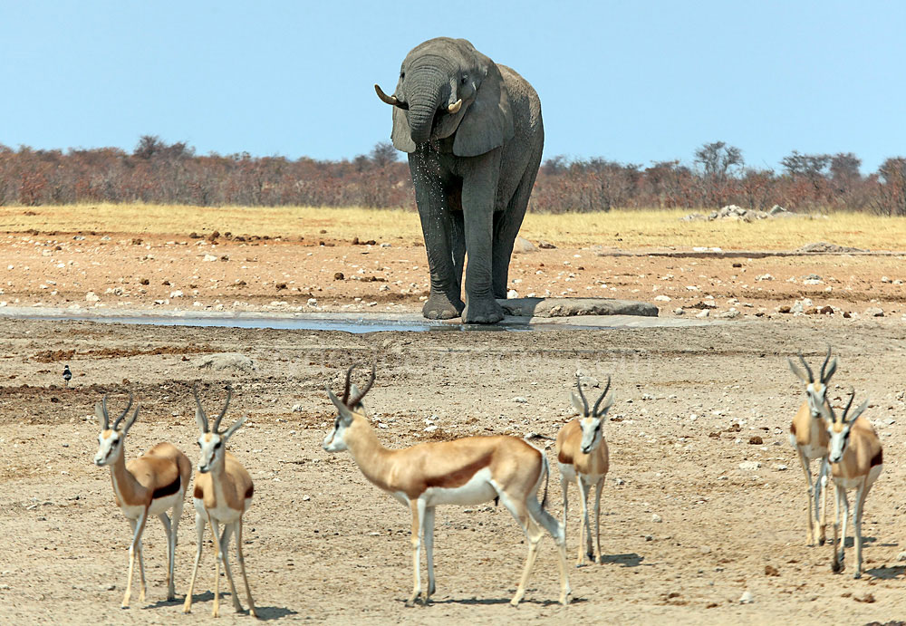
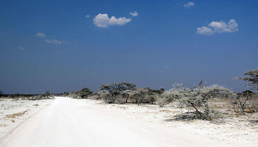
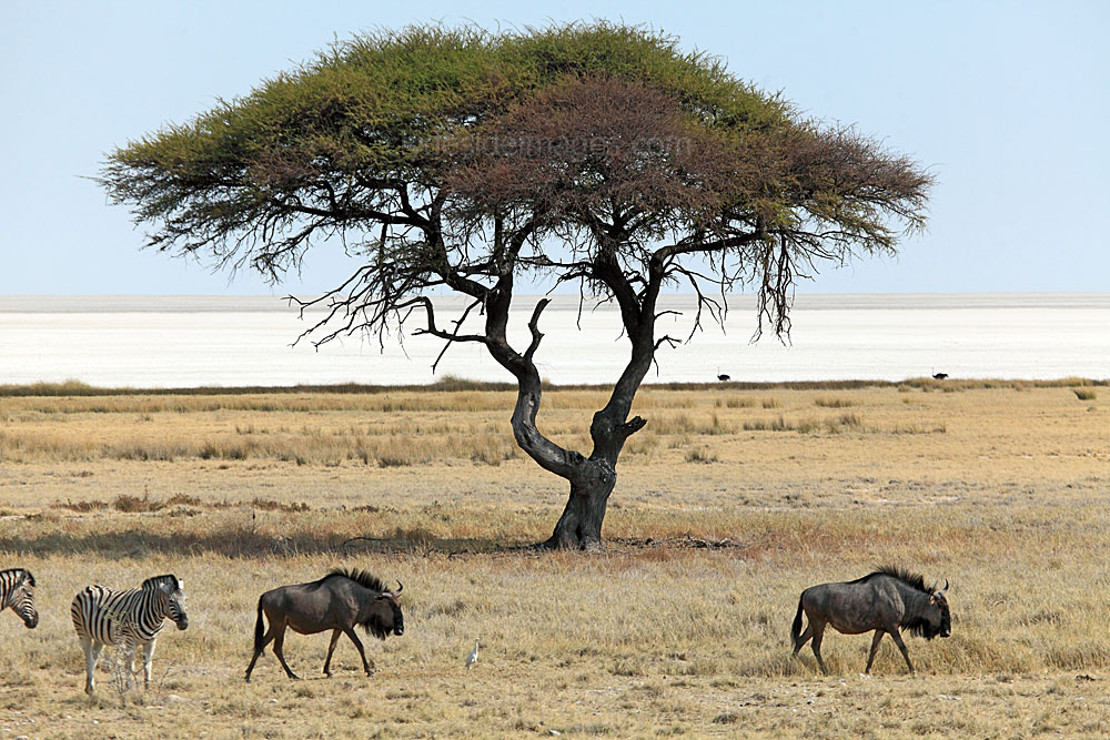
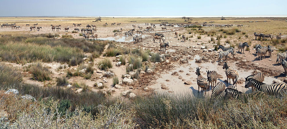
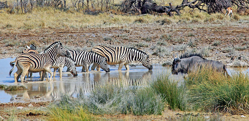
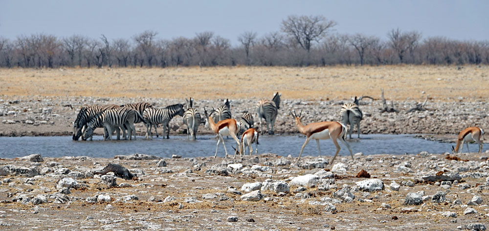
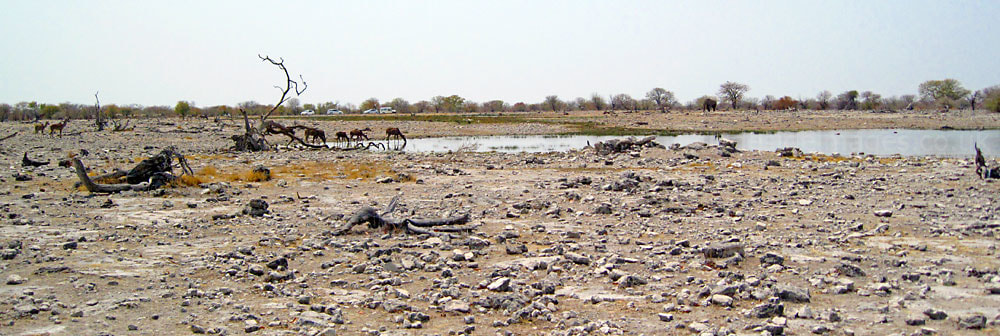
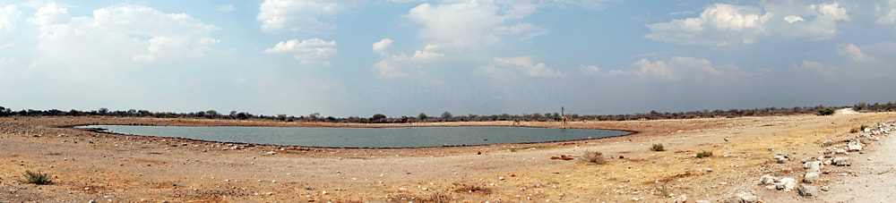
This is a summary of the main waterholes within Etosha National Park with the notes accompanied by sample images which may prove useful to any photographers intending to visit. Much of this information can also be found in the other Etosha sections which contain many more additional shots. The best time to visit the park for game viewing is during Namibia`s winter dry season, between May and October, when you`ll find an abundance of animals at the waterholes as their opportunities for drinking elsewhere during this period are extremely limited. The water sources include natural springs and others fed by man-made boreholes.
|
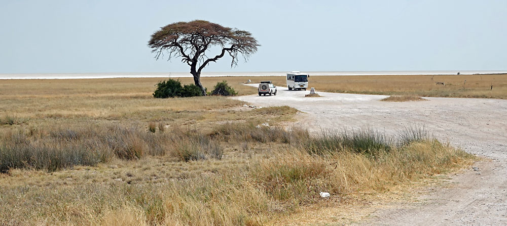
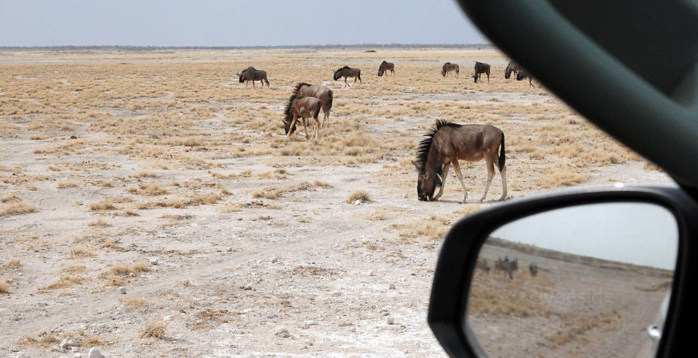
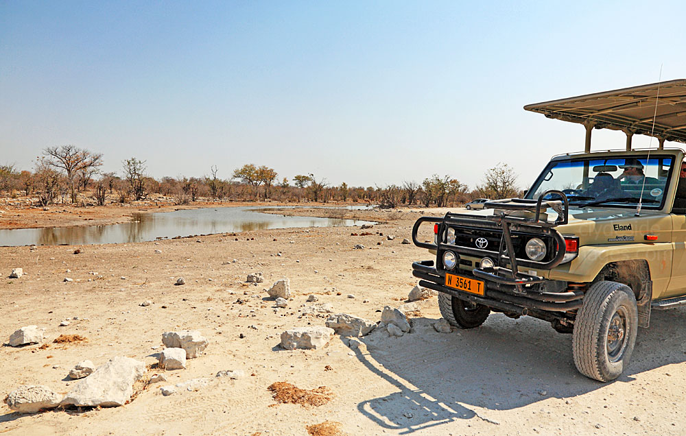
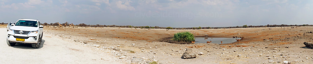
Find a good position, pull up, switch off the engine, and if there`s nothing happening, wait for a little while to see what appears. With a bit of patience and a little luck you can often be rewarded with some spectacular sightings.
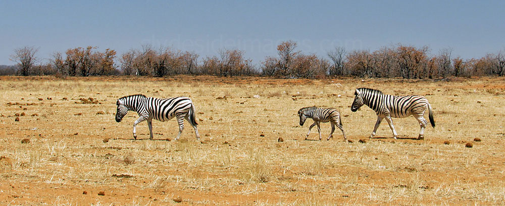
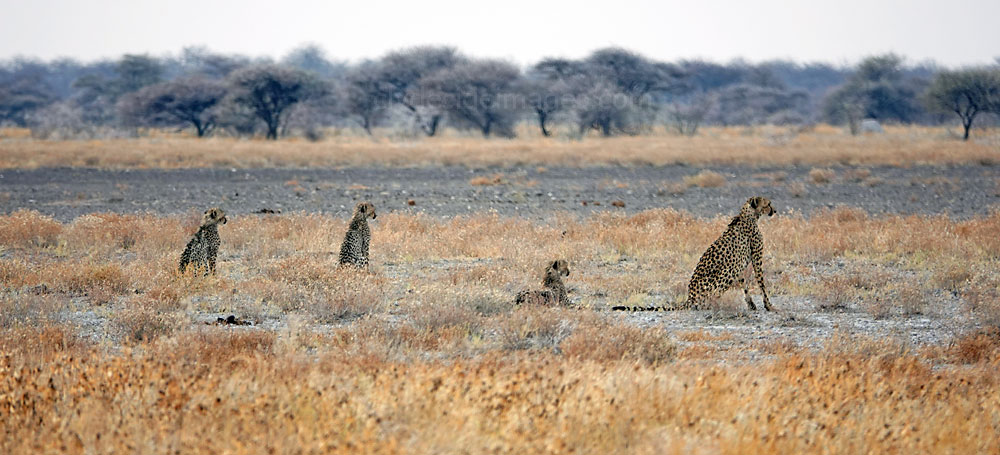
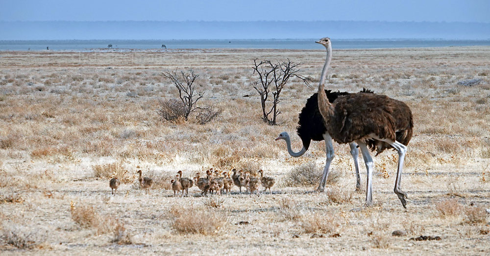
If a waterhole initially seems deserted spend a few minutes checking the surroundings with binoculars. There will usually be some interesting birds around and there`s always the chance that a big cat or other predator has concealed itself, intent on an ambush. Having visited the country throughout September and early October, I think that the latter month offers a bit more variety. This was when we visited Etosha on our most recent holiday and, as well as experiencing some rainfall for the first time, sightings of Lion and Cheetah cubs, young Springbok and Ostrich chicks were an unexpected bonus. |
I`ve listed the waterholes roughly from west to east, beginning with Dolomietpunt at Dolomite Rest Camp and other locations within the remote, least visited western side of the park. Each of the four main Rest Camps has its own waterhole with Okaukuejo usually the busiest and most interesting, however, the others have their moments. Some waterholes have no road access or lie in areas that are currently out of bounds to visitors and are therefore not listed here. The more productive locations will each be covered on a dedicated page which can be accessed from the individual entries below, via a link. Please note that some of the content relating to Etosha may appear on more than one page.
Please bear in mind that all images on this website and my blog are Copyright. They are not free to use and have been embedded with a digital watermark.
|
|

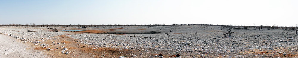
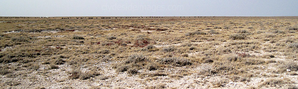
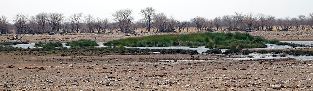
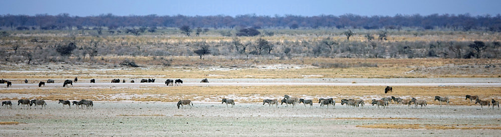
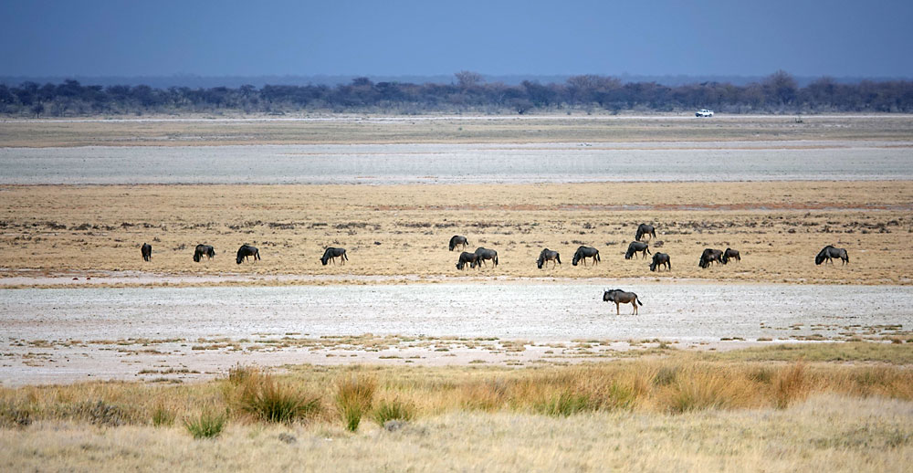
In addition to the park`s waterholes there are also a several viewpoints on the edge of the vast Etosha Pan and a few detour roads which, although they don`t lead to waterholes, enable otherwise inaccessible terrain to be checked. It should be borne in mind that water states and volumes of game can vary drastically depending on various factors, including the season, prevailing weather conditions, human disturbance and even the time of day.
What you see is often just down to luck but some research before you travel can often be beneficial, either checking guide books or online resources for general information and details on specific waterholes. With many locations no longer in use, or seasonal, this saves time physically checking sites that are likely to be unproductive. Also, each restcamp has a sightings book which guests can fill in. These up-to-date entries are often useful as some species may remain at a location for several days or movement patterns can be identified. Lastly, if there are other vehicles already staking out a waterhole with nothing obvious going on, it’s worth asking the occupants if there’s been any activity. Sometimes well-concealed predators are lying in wait, either hoping to make a kill or just checking that it's safe before approaching to drink.
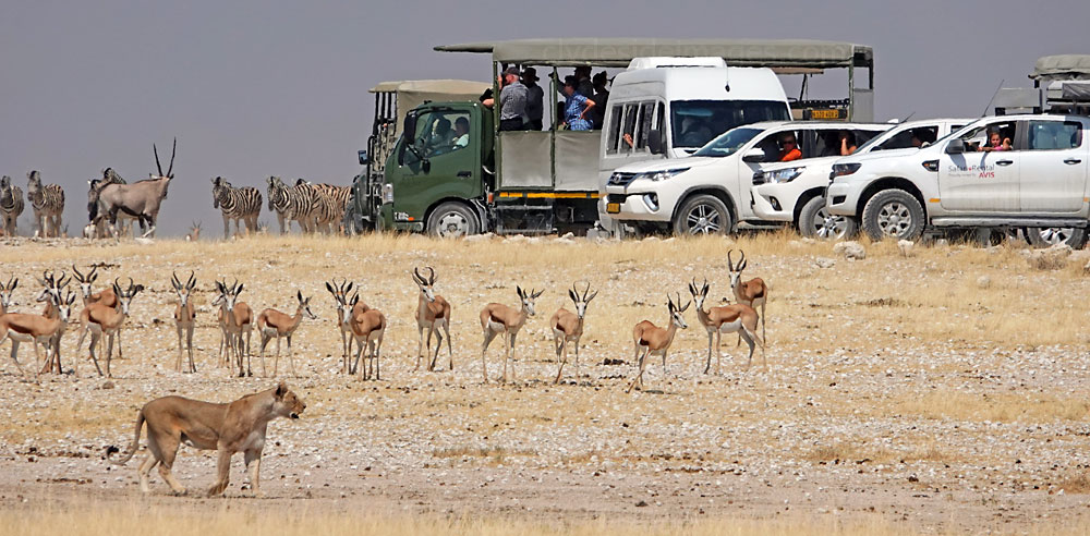
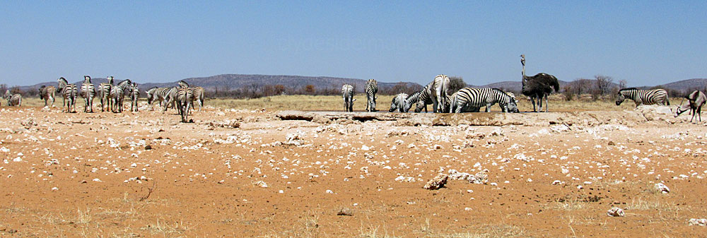
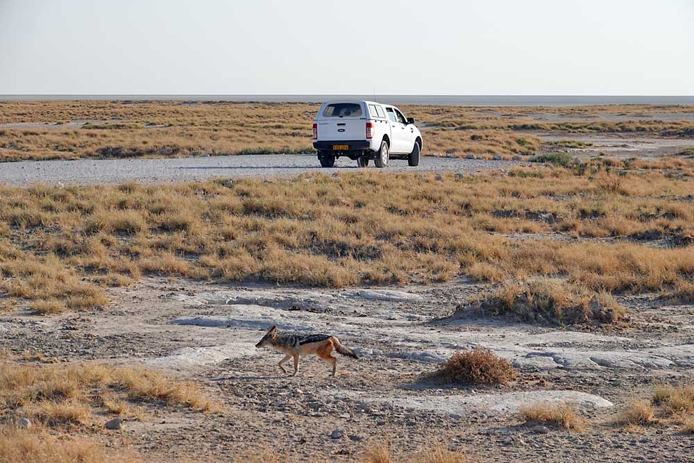
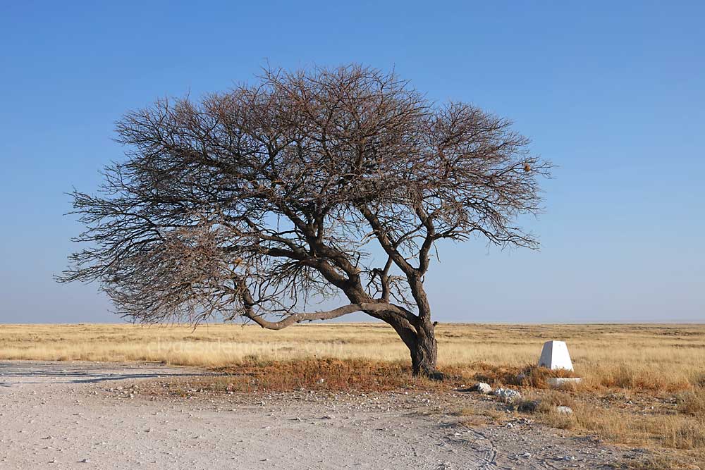
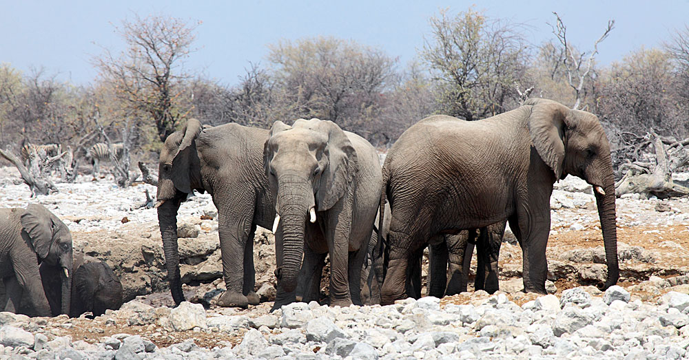
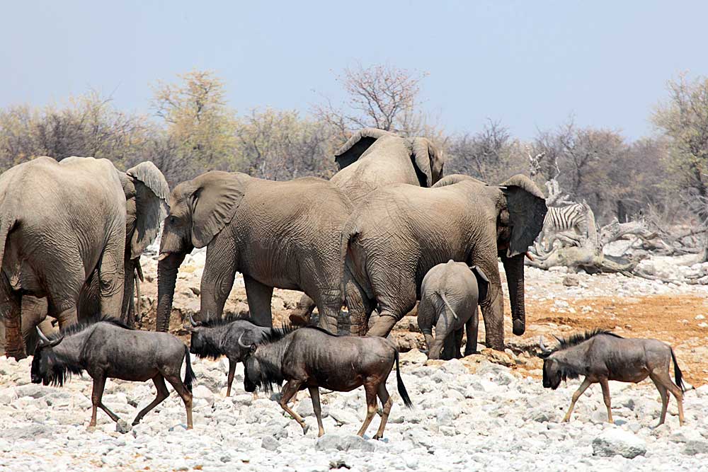
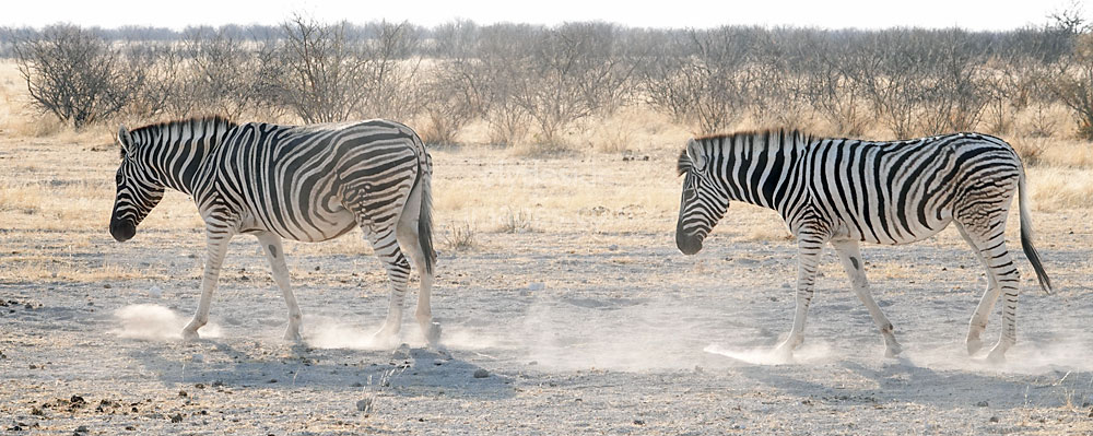
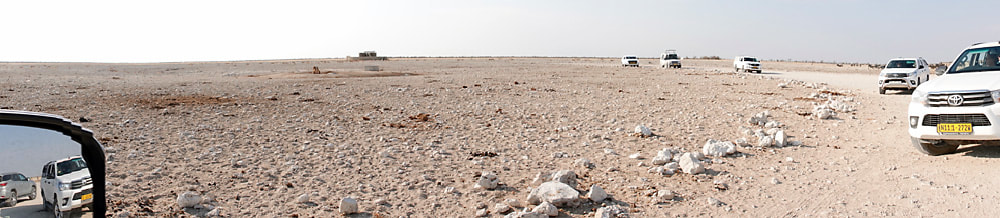
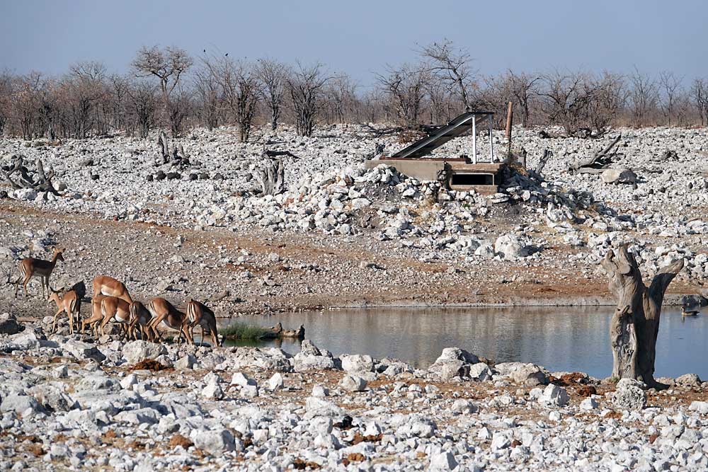
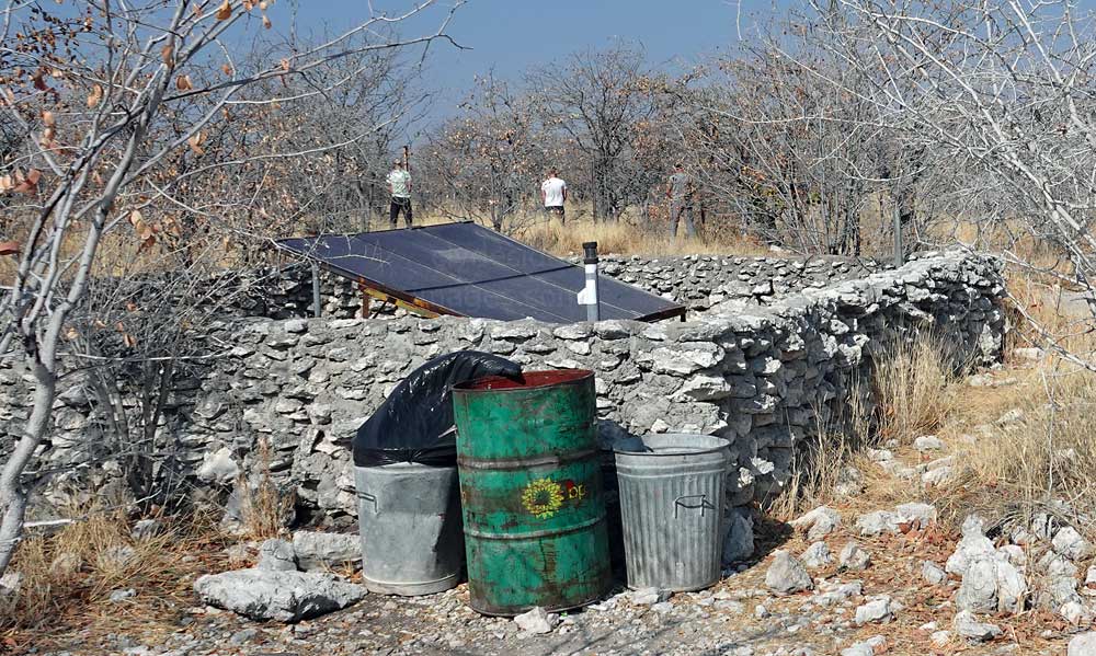
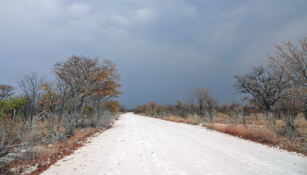
The main disadvantages when visiting during peak season are that some waterholes, particularly those near the Restcamps or entrance gates, can become congested. and tempers may become frayed as vehicles jockey for the best position. During my last holiday, two drivers at Nebrownii (above) near Okaukeujo, began to argue when one refused to reverse to let the other guy out! Also, the dust gets everywhere - the land is parched and often not very photogenic as a result, plus microscopic particles will find their way onto camera sensors and lenses, especially if unprotected. Gusts of wind and passing vehicles throw up huge clouds of the white-stuff, much of which ends-up down your throat or up your nose!
Dolomite Rest Camp & Dolomietpunt Waterhole
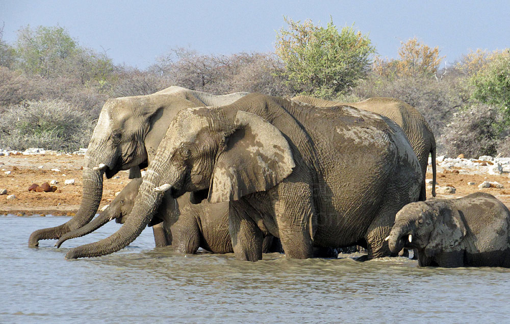
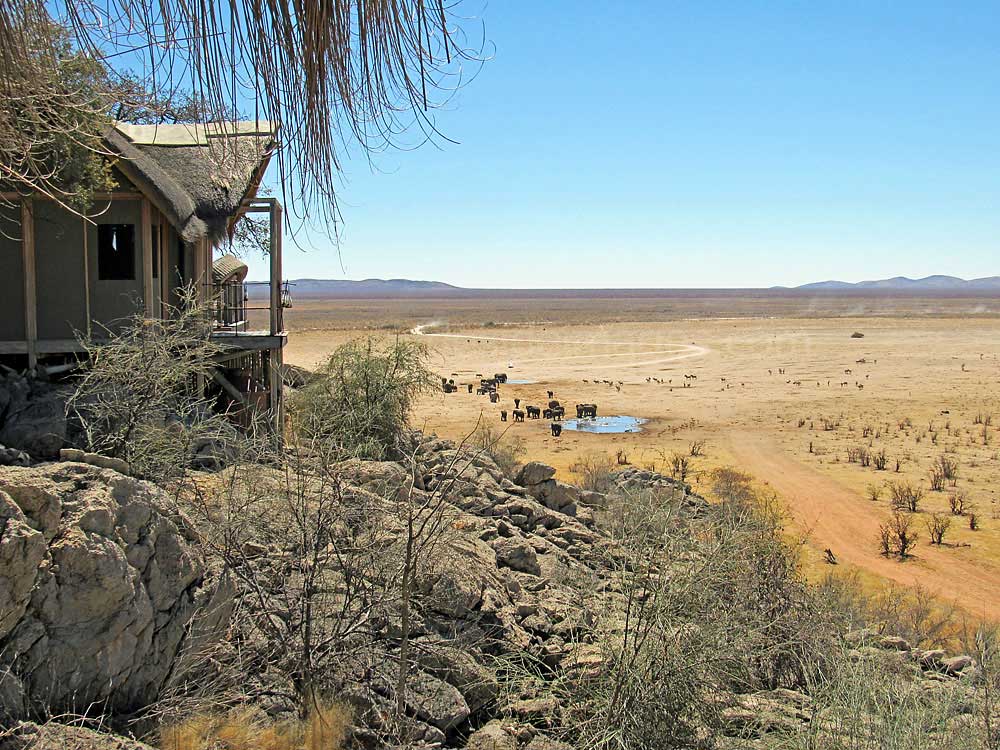
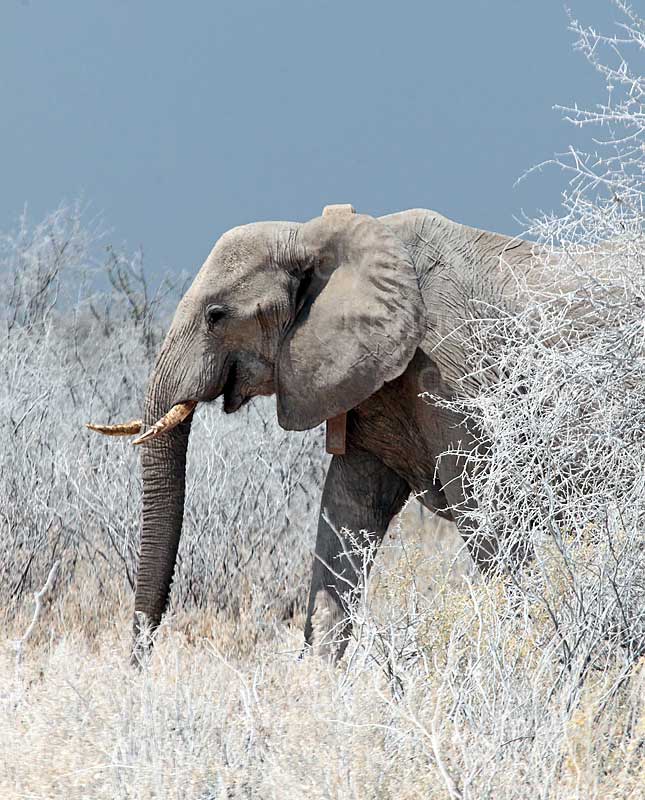
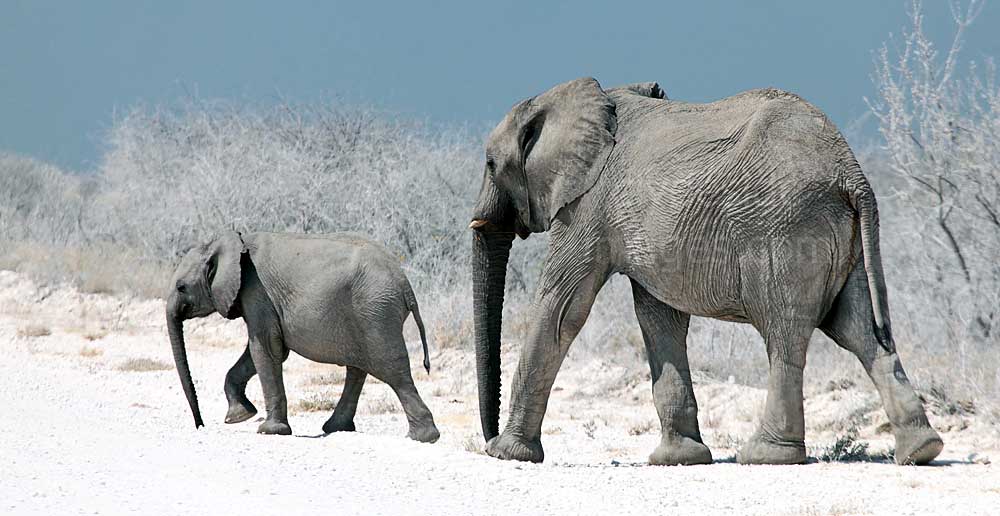
A stay at Dolomite Rest Camp is thoroughly recommended and my wife and I had a fantastic short break there during our second visit to Namibia. Just before the turn-off to camp, the scene that greeted us was magnificent. Various animals, including a herd of elephants, were drinking at the Dolomietpunt Waterhole which lies directly below the ridge and there was just one other car in the large parking area.
|
With low-lying sparsely-vegetated plains in every other direction, you could easily see animals approaching from afar. Baboons are only found in Western Etosha and we watched a big male charge a herd of springbok causing them and several other herbivore species to take flight.
Little did we know that the Baboons much preferred to wind-up human guests staying at the Rest Camp! Out of 20 chalets at Dolomite only two, numbers 13 and 14, have a view of the waterhole and we had been allocated one of them - No.14 - absolutely stunning! Our veranda provided a birds-eye view of herds of elephant, giraffe, zebra and ostrich streaming across the sandy plains to slake their thirst. |
An important consideration when visiting Dolomite Camp is that the nearest filling station is 70 kilometres away so you need to plan carefully, especially if you`re on a self-drive holiday and intend to visit the waterholes independently. The lodge offers guided safaris but they are reputedly not great value as the drivers usually only visit the three nearest waterholes to the camp.

|
|
|
As there was so much going on here, I`ve devoted a separate page to Dolomite Camp and its waterhole: Click Here to view. The location is also covered in more detail in the Western Etosha section.
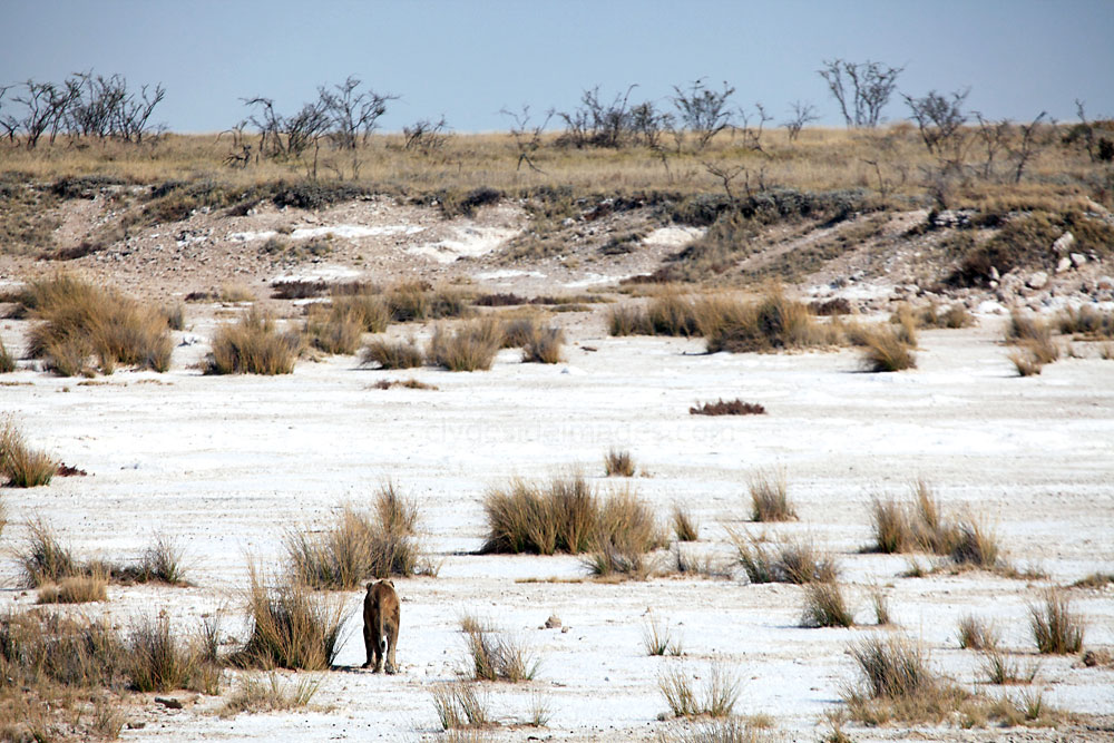
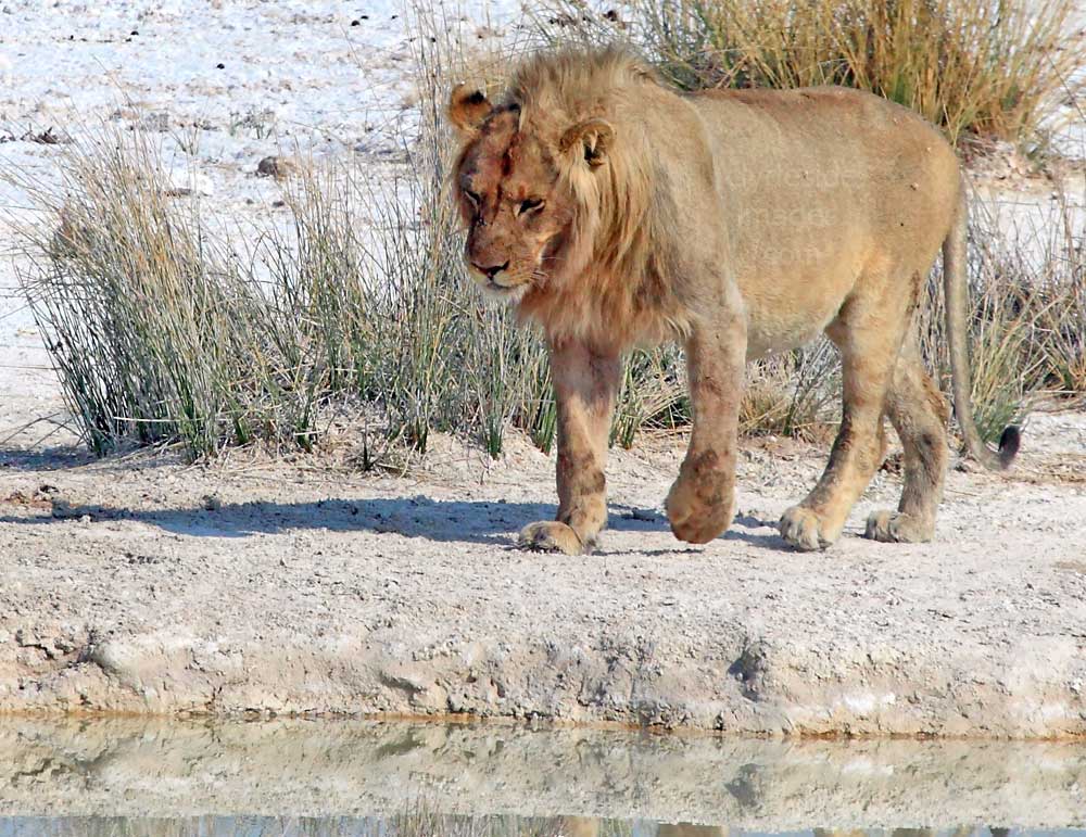
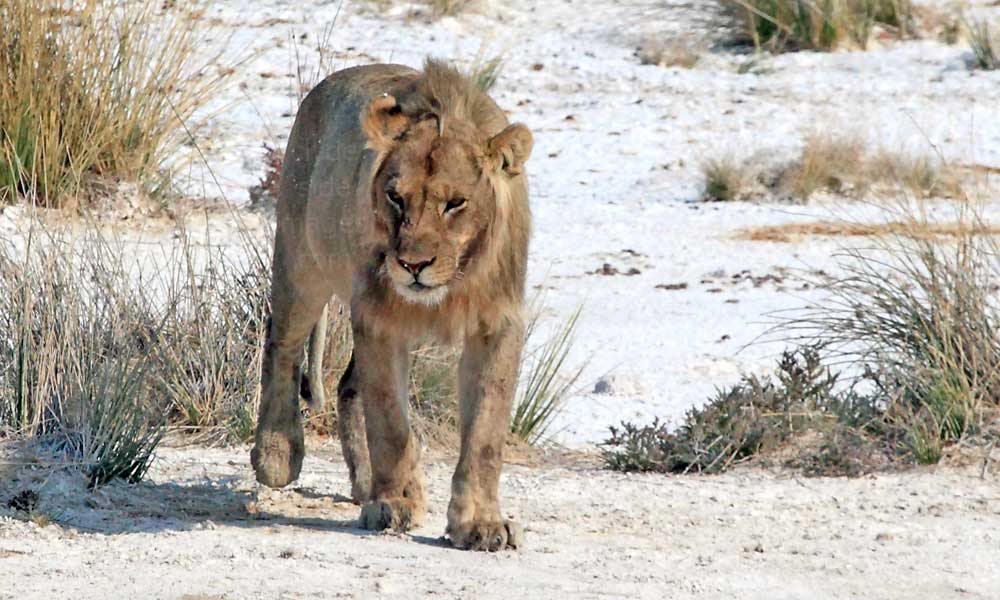
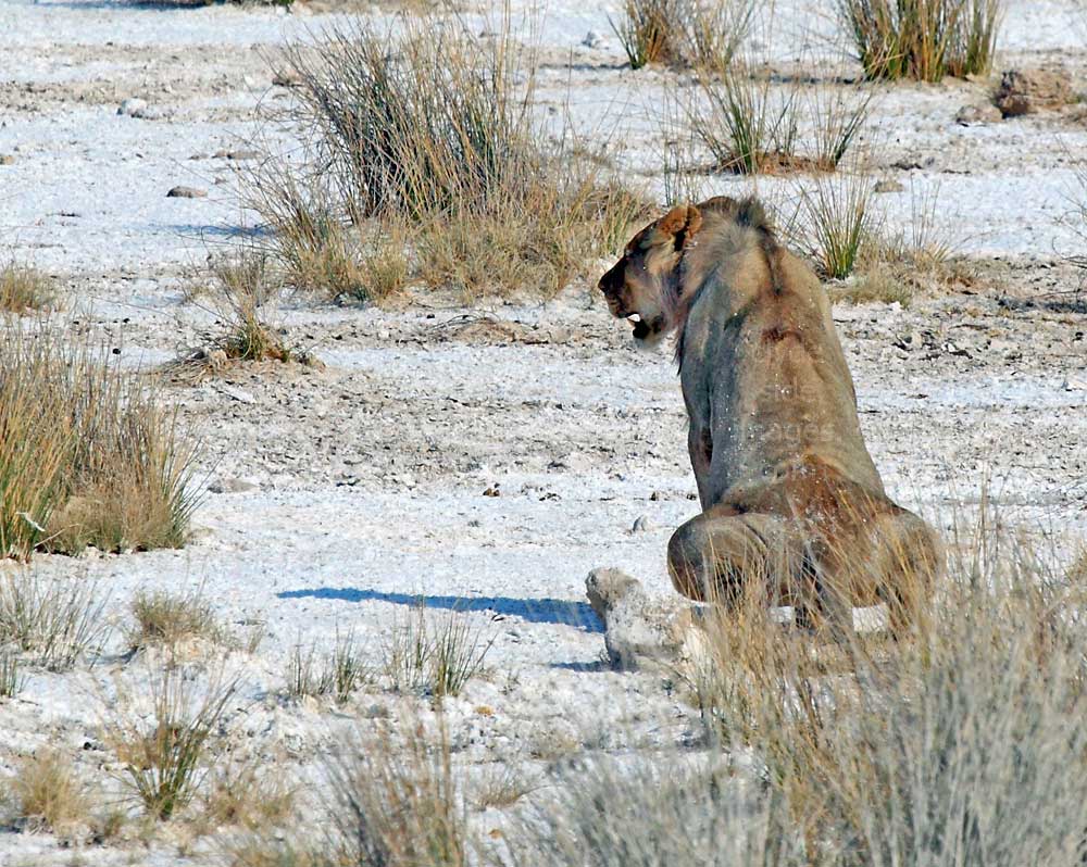
Rateldraf
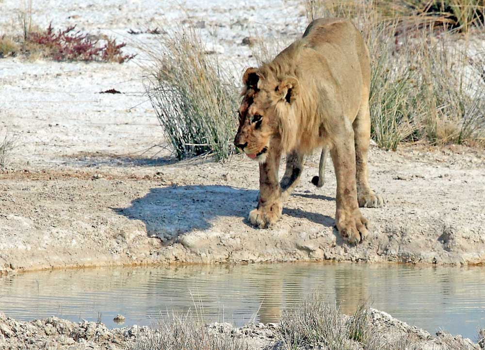
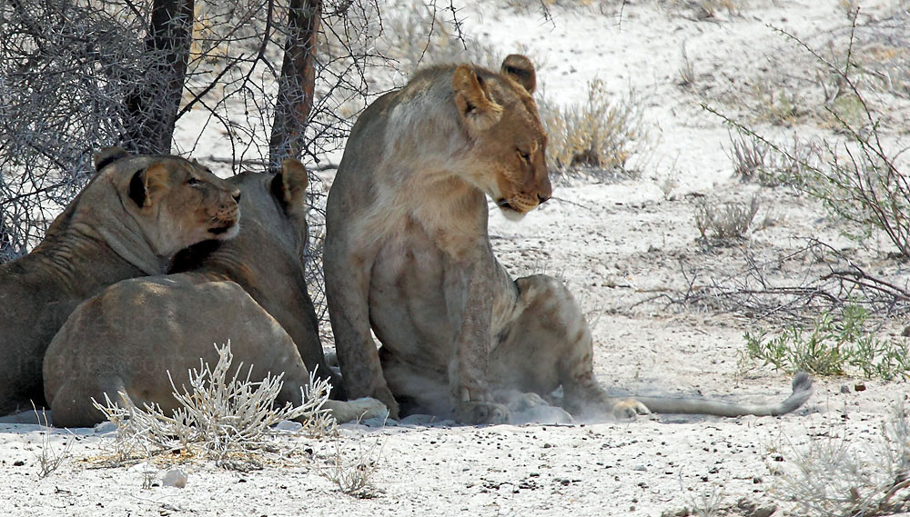
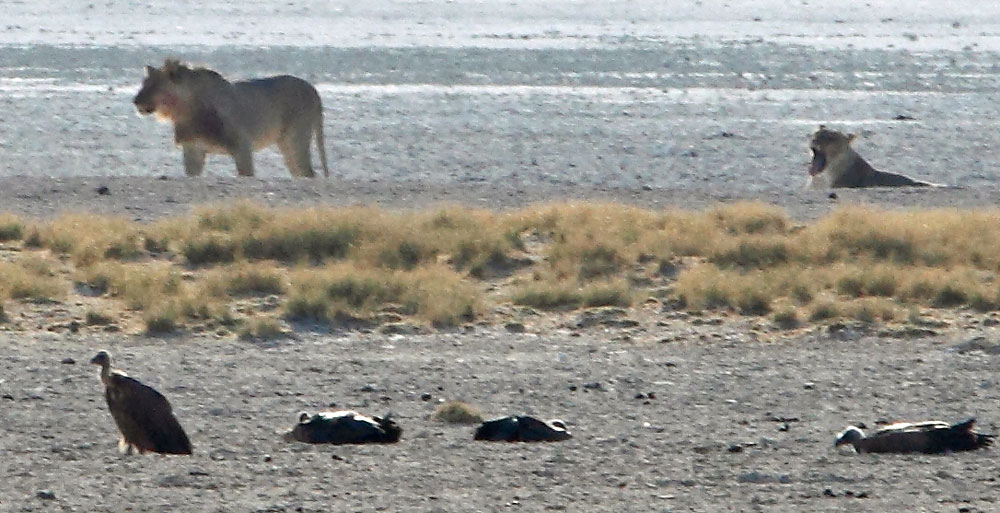
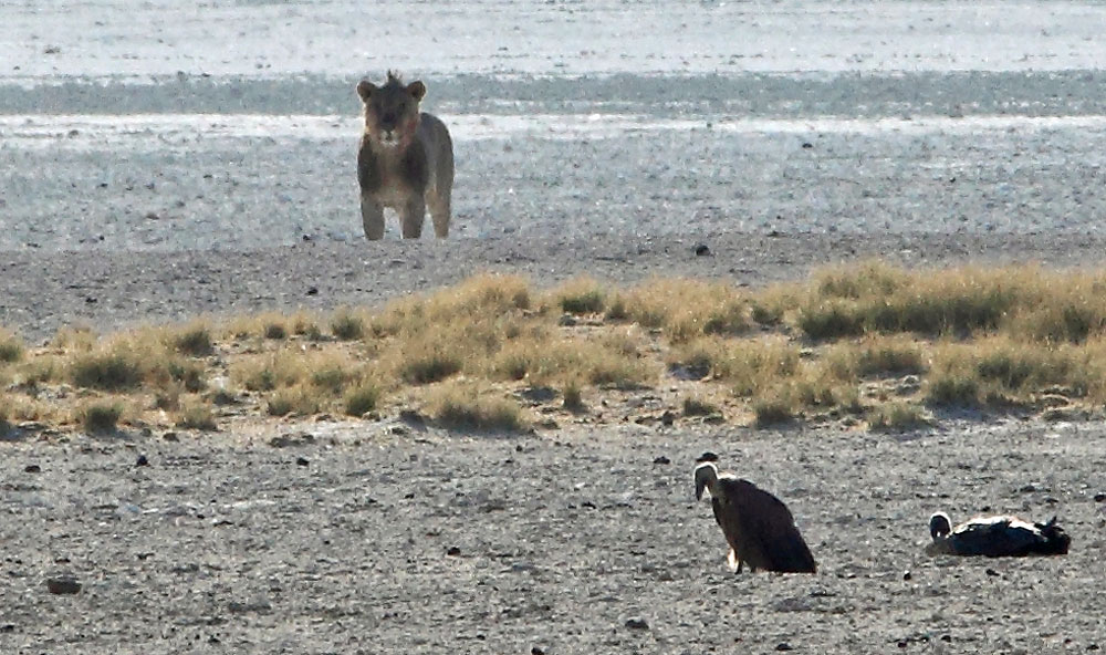
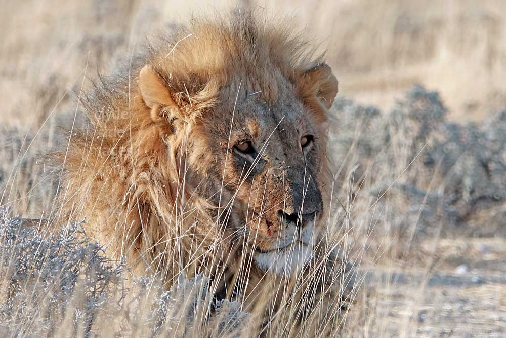
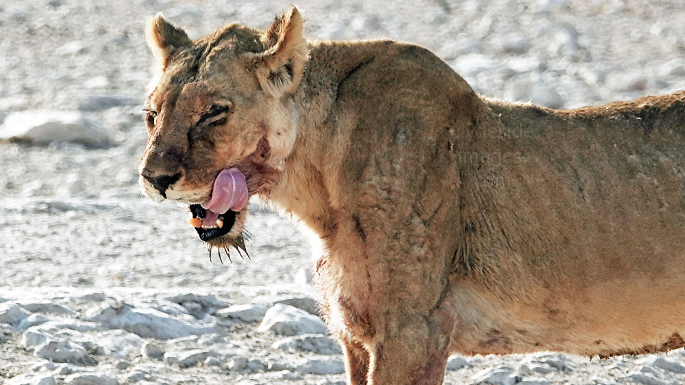
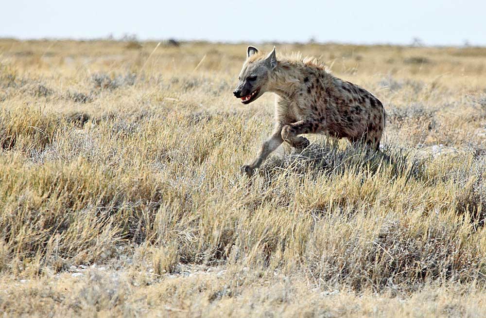
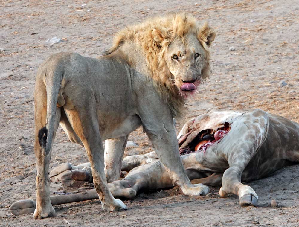
This waterhole comprises a small concrete basin with a mud hole on its left-hand side. The parking area is a bit closer to the source than the one at nearby Klippan but many of the best shots taken here are of animals on approach as they emerge from the distant tree-line. At first glance it looks as though this big male lion is King of the Rateldraf waterhole but he`s actually seriously injured. It was only when he stood up and began walking that I saw he had a very bad limp, possibly as result of a fight with another lion, or sustained during a hunt. Unable to defend himself or struggling to get his next meal, it`s doubtful that he`d survive more than a few days.

Both Rateldraf and Klippan are ideally placed for an early morning foray from Dolomite Camp. Other accommodation options within the National Park, and most of those outside the perimeter, offer an early breakfast so that guests can take advantage of the prime game viewing period around dawn. Possibly due to the fact that there are no gates at Dolomite, the earliest you can breakfast here is 7 a.m. which is just when the sun comes up. Luckily, the three nearest waterholes, Dolomietpunt, Rateldraf and Klippan, are only a 10-20 minute drive away, which allows over 2 hours of wildlife watching before returning to eat. The only disadvantage, as my wife and I discovered, (apart from having to walk all the way down to the parking lot to collect your car with no fences offering protection from any lions or leopards that may be wandering around) was that there probably won`t be much left on the buffet table when you get back!
Klippan
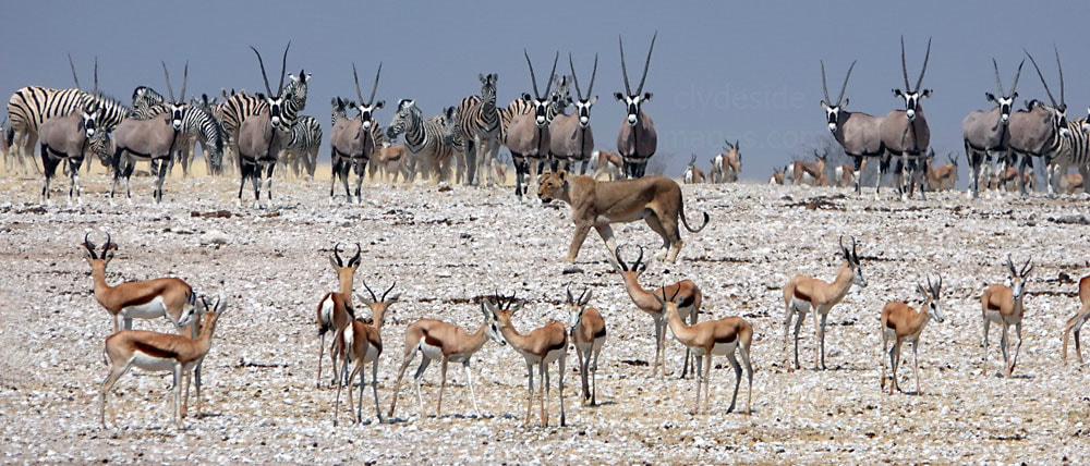
Klippan has the reputation as being one of the most productive sites in the Dolomite area and although we didn`t see much at the waterhole itself during several visits, our early start paid-off one morning, finding this lion and lioness, obviously on a mission, just a few hundred metres along the Klippan turn-off. They crossed and re-crossed the road several times before locking their sights on a mixed herd of Oryx and Wildebeest grazing in the distance. More information on Rateldraf and Klippan waterholes plus additional images taken there, including some from the hunt and its aftermath, can be viewed on the Etosha Waterholes - Rateldraf & Klippan page.

Luiperdskop, Aasvoelbad, Miernes & Dinteri
Although there are around twenty waterholes in the western part of Etosha only half are worth visiting as some have been closed-off, or have run dry naturally. These four, Luiperdskop, Aasvoelbad, Miernes and Dinteri have been closed as they lie too close to the western boundary fence and National Park authorities consider them to be too much of a temptation for poachers.
The names of the first three sites are Afrikaans words for `leopard hill`, `vulture bath` and `ant (termite) nest` respectively and the fourth was named after the well-known German botanist Kurt Dinter (10 June 1868 - 16 December 1945). In the late 19th and early 20th centuries, Dinter explored South West Africa, covering an estimated 40,000 km on foot, by wagon and motor vehicle when cataloguing and collecting specimens, trips which went on to span 38 years. His collection of pressed plants and flowers numbered in excess of 8,400 but vast quantities of living plants and seeds remained unlisted.
The names of the first three sites are Afrikaans words for `leopard hill`, `vulture bath` and `ant (termite) nest` respectively and the fourth was named after the well-known German botanist Kurt Dinter (10 June 1868 - 16 December 1945). In the late 19th and early 20th centuries, Dinter explored South West Africa, covering an estimated 40,000 km on foot, by wagon and motor vehicle when cataloguing and collecting specimens, trips which went on to span 38 years. His collection of pressed plants and flowers numbered in excess of 8,400 but vast quantities of living plants and seeds remained unlisted.
Looking west from the swimming pool at Dolomite Restcamp, beyond Etosha`s western boundary towards distant Kaokoland.
Nowadays unfortunately the animals in Western Etosha seem to be at greatest risk from those who are tasked with protecting them. My wife and I came across a young Black Rhino, lying beside the approach road to Duineveld. It was close to death having been shot and even more sadly, Park wardens were the likeliest suspects - see the entry for Duineveld waterhole below.
Renostervlei
This is a west-facing waterhole therefore light is especially good for photography from early to mid-morning and the parking area is large, enabling drivers to reposition their vehicles with ease to obtain the best angle. The location is quite scenic with some termite mounds in the background but the mud wallow to the right of the concrete water trough and its wind pump are a bit lower, so shooting from higher vehicles is an advantage here. Lions visit often as this is in the heart of the Renostervlei pride`s territory. Cheetah occasionally drink here, as do Black Rhino who also enjoy bathing in the mud.
Jakkalswater
Jackkalswater, supplied by a noisy diesel pump, is situated in the middle of a very open area on the southern part of the loop road from Dolomite. It`s a long way from the restcamp so most people tend to stop here either on the way to, or from Okaukuejo and cover the missed section when they set off on the next stage of their journey. The eastern arm of the loop joins the main Dolomite - Okaukuejo road at Olafantsrus Campground (see below).
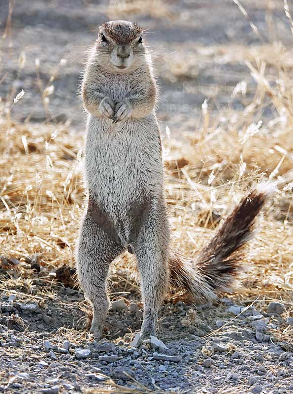
Jackkalswater has a lot of potential and is often visited by large herds of plains game including Burchell`s and Hartmann`s Mountain Zebra, Eland and Red Hartebeest. The borehole was supposedly so-named after a Black-backed Jackal was found drowned in the trough. Large colonies of Ground Squirrel provide additional entertainment here, with some burrows very close to the parking area. This is another location where you have to shoot directly into the sun for most of the morning, but some excellent shots can be had when the sky is overcast, or if you shoot later in the day.

|
Left: This Common Eland (Latin: Taurotragus oryx) was the only individual encountered at Jakkalswater. These animals are the second-largest antelope species in the world after the Giant Eland which is only found in African countries far to the north.
The Common Eland is also commonly referred to as the Southern Eland or Eland Antelope, and prefers savannah, woodland (with the exception of dense forests), and open grassy plains. The species is used by humans as a source of leather, meat, and rich, nutritious milk, and has been domesticated in many areas. Eland obtain most of their water from their food, although they will readily drink water when a supply is available. |

|
|
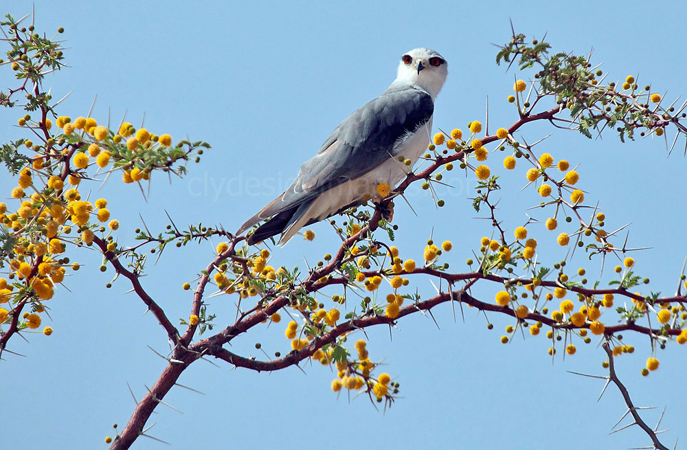
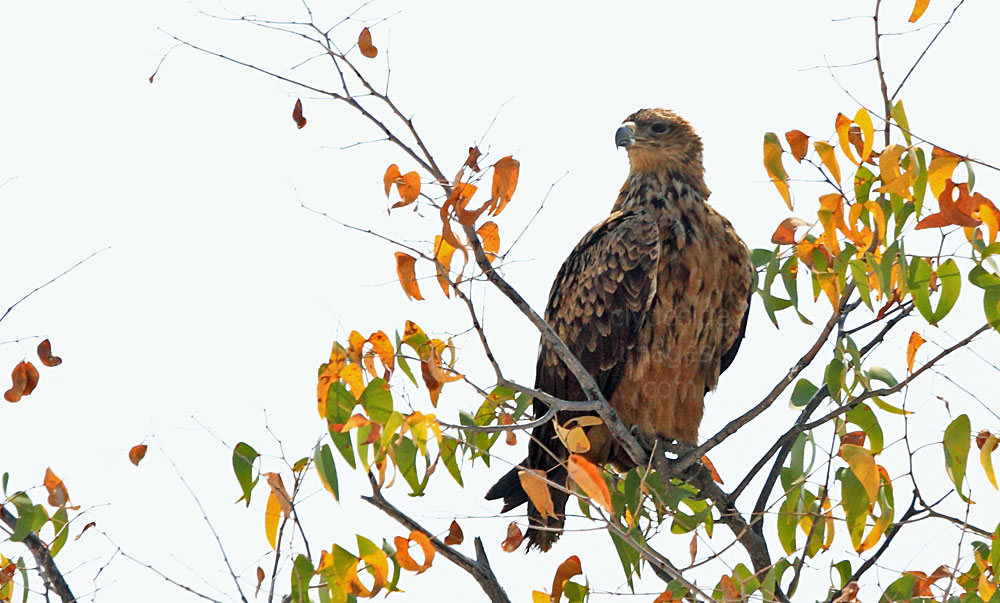
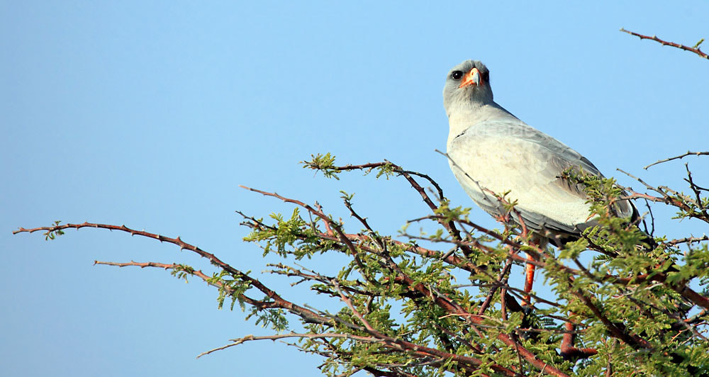
Over 40 birds of prey (almost 70% of all the raptors in Namibia) can be found in Etosha during the rainy season, including Black-shouldered Kite and Pale Chanting Goshawk, examples of which are pictured above. The latter species is one of the Park`s most common year-round residents and they`ll usually pose quite happily on trees or shrubs, often quite close to the roadside. Ornithologists won't be disappointed during the dry season either and I had some great bird sightings on the drive back from Dolomite to Okaukuejo including my first view of the Black-shouldered Kite. The striking bird was perched on a roadside tree just south of the turnoff for Jakkalswater. This small raptor is able to hunt by hovering on upturned wings about 50 meters above the ground. When prey is sighted, the kite glides gracefully straight down into the grass. Black-shouldered Kites are highly nomadic, moving constantly in their search of prey.
Duikerdrink
This waterhole is at the end of a 20 kilometre-long dirt road off the main Dolomite loop, and although I intended to visit during the drive back from Dolomite to Okaukuejo, I about-turned less than halfway along due to the remaining distance, the quaility of the road surface, and no obvious animal activity along the first part of the route. Although it may have been a different story at the site itself, I`ve since heard that this waterhole has been dry for some time. The Duikerdrink road is very rough 4x4 territory and I wouldn`t like to have attempted it in an ordinary car in the dry season, let alone after the rains fall. Back on the loop, follow the road northeast for 21km to the `T` junction, where you can turn left to complete a long circuit from Dolomite Camp, passing Olifantsrus, Nomab and Duineveld waterholes on the way. Alternatively, turn right at the junction to head east, back to Okaukuejo.
Okawao
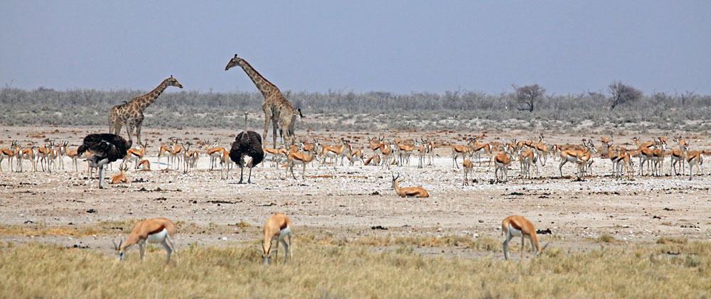
This well-used waterhole is a natural spring situated on the east side of the main loop road from Dolomite Rest Camp, but the source is a fair distance from the parking area. This is another open, scenic location and has a windmill and mud-wallow next to the main pool. It`s regularly visited by large herds of Zebra, Warthog, Ostrich and Springbok. During the morning, if skies are clear, shots must be taken into the sun so an afternoon visit would be better, as long as you leave enough time to get back to your accommodation before sunset. There is a large natural depression about 4km west of this site that sometimes holds water into the dry season following exceptional rains. If this is the case numerous species of waterbirds can be found there including a good variety of duck, egrets and herons.
Olifantsrus
I`ve never visited this location personally but the recently opened Olifantsrus campground, the Park`s first `camping only` experience, comes highly recommended by people who have stayed there. It is far more scenic and has a real wilderness feel, especially when compared with the rather shabby designated campgrounds within Etosha`s main restcamps. The fenced complex consists of just 10 camp sites with a maximum group of 8 people per site. Amenities include an information centre, a kiosk selling drinks and light meals, a communal kitchen and toilets. The main draw though is the superb two-storey hide overlooking a man-made waterhole. Day visitors can pop-in to use the camp`s facilities but this is another location where you need to leave sufficient time for the long drive back to either Dolomite Camp, Okaukuejo, or one of the exit gates and ensure you get there before nightfall.

Image © NWR Etosha National Park
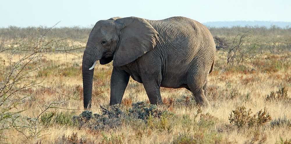
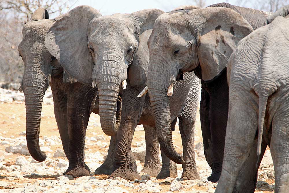
The site has a dark past, however, and the remains of an old elephant culling station which `processed` the animals on a grand scale can still be seen. Huge steel frames used to hoist the dead elephants for butchering, and a few sun-baked skulls, are a haunting reminder of the activities that went on here. The camp`s name translates as `Elephants` Rest` and relates to this practice rather than any comfort or opportunities for relaxation provided by the waterhole. Poaching in Namibia is increasing at an alarming rate but this was not always the case. Back in 1967, during the dry season, the first aerial survey of Etosha counted around 500 elephants within the national park, but in 1973 the number rose to 1,300. By 1983 the amount had swelled to 3,000, the animals taking advantage of the lack of persecution. Many had moved from northwestern Namibia to join resident herds, mainly to avoid South African military operations and widespread poaching in that part of the country.
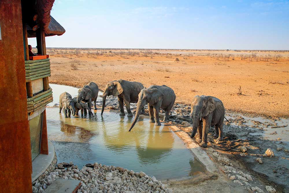
Image © NWR Etosha National Park
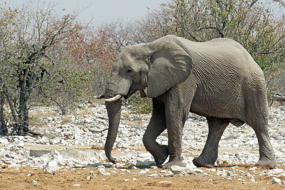
Following a prolonged drought which lasted from 1980 until 1983, large tracts of grass and vegetation throughout southern Africa were in danger of turning to desert, placing not only the elephants` long term future at risk, but also species such as the Black Rhino. As a result the authorities decided to follow the example of Kruger National Park in South Africa and drastically reduce the elephant population. The result was that between 1983 and 1985, 525 elephants were killed in the western section of Etosha and their carcasses were brought by flat-bed truck to Olifantsrus for disposal. The policy was to dispatch entire family units swiftly, supposedly to minimise trauma, and although the meat was used to feed poorer sections of the community, many people find this troubling episode upsetting and refuse to stay here.
Nomab
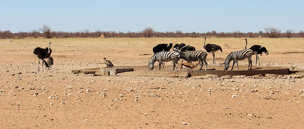
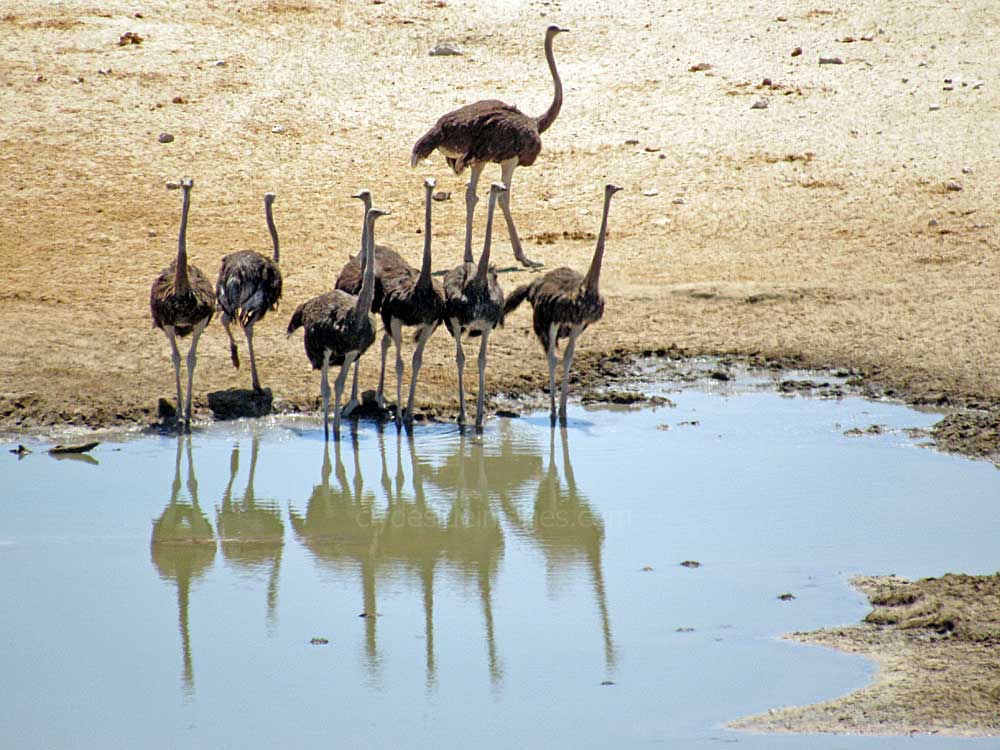
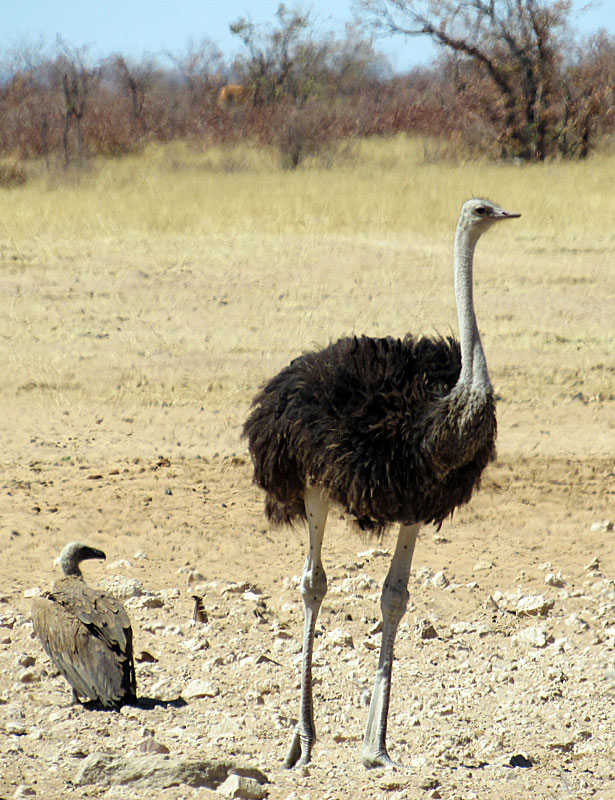
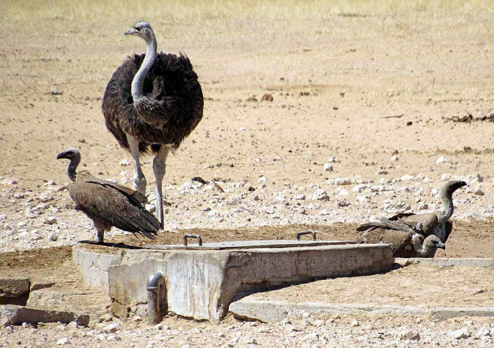
Nomab waterhole sits in the middle of an open grassy area with favourable lighting conditions throughout the day, although mid-morning is reputed to be busiest with regard to animals. This was the scene around noon when the presence of several White-backed Vultures was obviously annoying this female Ostrich and she ran at them a couple of times in a futile attempt to force them to take flight. Lappet-faced Vultures also visit here.
|
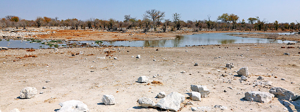
The above shot of the concrete basin here illustrates that many of the actual waterholes aren`t very scenic, particularly those with man-made constructions which would normally be an unwanted addition to any photographs. That said, many lie in picturesque locations and it`s usually easy enough to exclude unwanted detail and catch your subject in a favourable position.
|

|
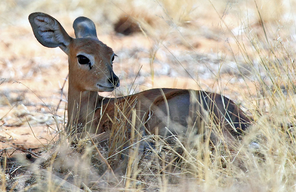
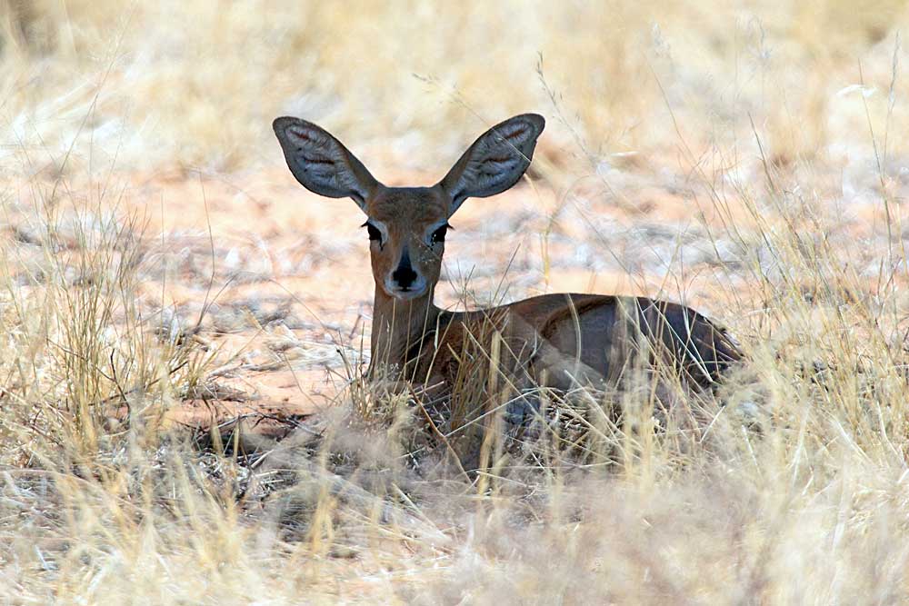
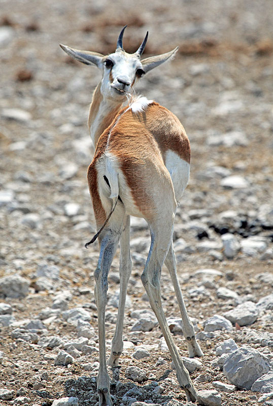
The Steenbok pictured below, sitting under the shade of bush near the Namob waterhole, apparently thought it was well camouflaged and quite hard to spot. It`s amazing to think tiny, frail creatures like this survive day-to-day with so many large predators around. During the dry season, if no standing water is available, Steenbok rake the ground for roots, tubers and bulbs and will even dig down shoulder-deep when they detect a supply. The high moisture content in these nutritious foods alone can sustain these animals for very long periods.
|
|
Only single lambs are born and are concealed for the first three to four months, during which time the mother only makes contact in the early morning and evening to feed and groom the infant. To conceal the youngster`s presence, the mother eats her lamb's faeces and drinks its urine during her visits, which keeps the hiding place relatively odour free, making detection harder for enemies.
Duineveld
In September 2015, during our second holiday in Namibia, we headed for Duineveld after our stop at Nomab, en route to Dolomite Camp. A 4x4 coming in the opposite direction stopped just before the turn-off to Duineveld and the occupants, a Dutch couple who were staying at Olifantsrus campground, asked if we'd spotted anything interesting so we told them about the Honey Badger at Grunewald. We saw a line of elephants in the distance heading for Duineveld and the couple told us that they'd just come from there where, sadly, a young Black Rhino was lying beside the approach road dying.
Sure enough the poor beast was there, lying amongst some bushes and although still breathing, could only raise its head a few inches. By the time we passed-by on the way back after making a brief stop at the waterhole there was no sign of life and a crow had landed on the animal's back, ready to start pecking. Others were waiting nearby. Ivory poachers had no doubt shot, killed and cut the horn from its mother, probably during daylight hours, but the youngster, despite being mortally wounded, had managed to run off only to die a lingering death a short distance away.
On arrival at Dolomite Camp I reported the incident to the reception staff who didn`t appear too surprised and said they'd notify the park authorities. Later, I spoke to two German women who were also staying at Dolomite. They`d discovered the same rhino earlier that morning, clearly struggling but still standing. Photos they took showed what appeared to be several bullet wounds to the rear of its body.
As previously mentioned, in an attempt to make it harder for would-be poachers, the park authorities have closed several waterholes close to the western boundary fence but the sickening illegal practice, already rife throughout Africa, has reached crisis level in Etosha. While officially the number of rhino bodies discovered in 2015 up to September was 54, including 31 found within one week, unofficial local sources have put the figure at 85. Of particular concern is the discovery of five fresh bodies found in the western part of the Park since the launch of a major police investigation. The rhinos were found close to ranger stations and a local source says that evidence found at the scene included bullet casings believed to have come from 9mm Mausers which are the standard issue weapons given to Namibia’s ranger service.
As previously mentioned, in an attempt to make it harder for would-be poachers, the park authorities have closed several waterholes close to the western boundary fence but the sickening illegal practice, already rife throughout Africa, has reached crisis level in Etosha. While officially the number of rhino bodies discovered in 2015 up to September was 54, including 31 found within one week, unofficial local sources have put the figure at 85. Of particular concern is the discovery of five fresh bodies found in the western part of the Park since the launch of a major police investigation. The rhinos were found close to ranger stations and a local source says that evidence found at the scene included bullet casings believed to have come from 9mm Mausers which are the standard issue weapons given to Namibia’s ranger service.
Tobieron & Teespoed
These waterholes lie on either side of the Dolomite - Okaukuejo road, just east of the Jakkalswater and Duikerdrink turn-off. Tobieron, the most westerly, is on the north side with Teespoed on the south. The concrete trough and mud hole at the former sit in an open area with some mopane trees, albeit some distance from the parking area. Light should be favourable for photography throughout the day. The mud wallow at Teespoed is smaller and more suited to photography in the afternoon.
Bitterwater & Duiwelsvuur
Continuing east along the Okaukuejo road, these two waterholes are spaced mid-way between Tobieron & Teespoed and Sonderkop and Arendsnes. A total of three pairs, similarly placed, are located along this route between Olifantstrus and Ozonjuiti M’bari. I made a brief check of several when passing but, either the waterholes weren`t functioning, there was little of interest, or the sun was in the wrong position relative to the location for decent shots. There of course often great opportunities for photographing animals all along this route. The Dolomite - Okaukuejo road is also one of the few places in Etosha where you can frame your subject against a hilly backdrop.
Sonderkop & Arendsnes
As mentioned above, these waterholes also lie on either side of the main route between Dolomite and Okaukuejo. There is just a concrete basin at Sonderkop with no adjacent mud hole. It`s located in an open area but you`ll likely need a reasonably long telephoto lens to best capture the majority of the action. The name Sonderkop is Afrikaans for `headless`, a reference to a windmill here whose top wheel was repeatedly torn off by storm force winds. The other site, Arendsnes, or `eagle`s nest`, is totally dry.
Ozonjuiti M’bari
Often abbreviated to M’Bari, the name of this waterhole is Herero and means ‘two honeybees’. This is a reference to the first initials of the surnames of Messrs H.A. Böttger and L.W. Berman (two `B`s) who provided funds to erect a windmill here.
This waterhole, potentially one of Etosha`s most productive for wildlife viewing, is located on the edge of the Charles Marais Dam which was built to catch water flowing from the farms south of the park. A suspicion arose, however, that this source was increasing the incidence of Anthrax in Etosha and the dam wall was eventually breached as a precaution. During the rainy season, water still accumulates near the site of the dam and flamingos and other water birds congregate here.
|

|
|
Ozonjuiti M’bari, the only waterhole west of Okaukuejo and Okondeka that has water during the dry season, is quite a distance from the restcamp at Okaukuejo, the journey taking well over an hour at a steady pace, and that`s without stops. The drive out is usually worthwhile though. Just make sure you have sufficient time to get back to camp or exit the Park before the sunset curfew.
Many more images and information on Ozonjuiti M’bari can be found on a dedicated page. Click Here to view.
Charl Marais Pan
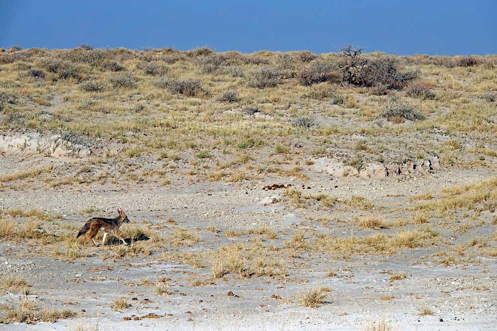
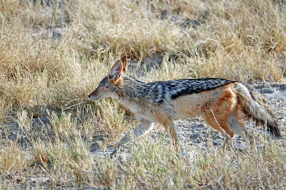
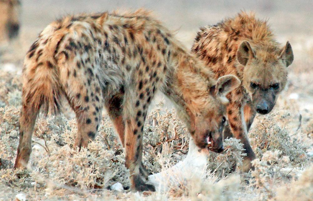
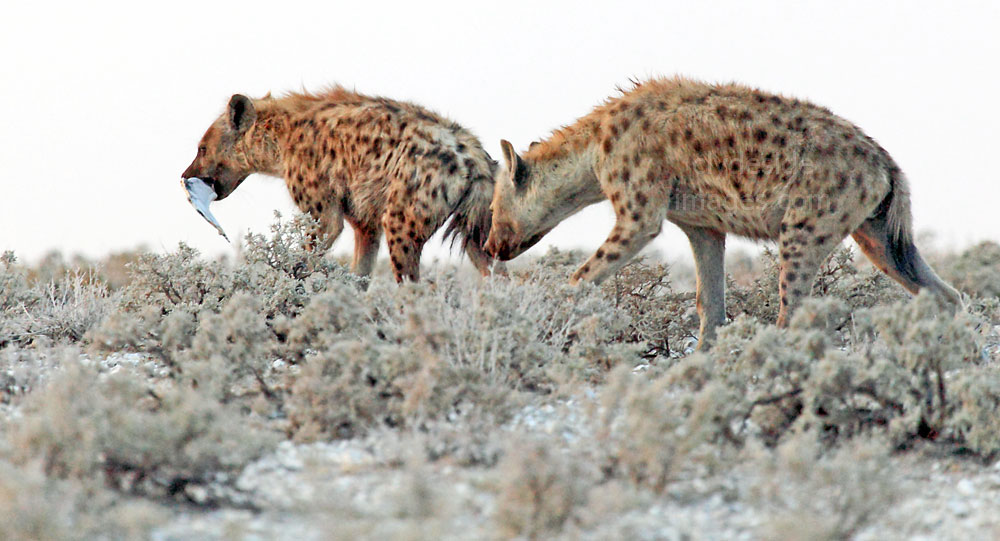
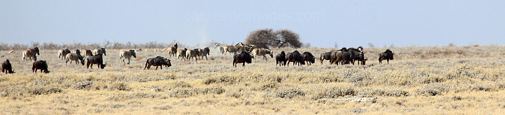
Charl Marais Pan is one of three smaller salt pans located to the west of the main Etosha Pan, the others being the Okahakana Pan and the Natukanaoka Pan. The last pair are a long way from any road and there is no public access. The main route between Dolomite and Okaukuejo is elevated as it cuts across the barren-looking Charl Marais depression and affords good views but I`ve never seen anything out of the ordinary here, just Springbok, Black-backed Jackal, Hyena and various birds.
As previously mentioned, the Charles Marais Dam was built to catch water flowing from the farms south of the park but the wall was breached as a precaution as its waters were thought to be responsible for increasing levels of Anthrax in Etosha. Despite the site no longer functioning as a dam, water still accumulates in the general area during the rainy season, encouraging flamingos and other water birds to visit.
|
|
I`m not sure of the identity of this large raptor, but the other photo shows a Southern Fiscal or Fiscal Shrike (Lanius collaris) which is found throughout most of Sub-Saharan Africa. Due to the species` habit of impaling its prey on acacia thorns to store it for later consumption it`s often referred to as the `butcher bird`. These shrikes usually eat insects but will also take small rodents.
The above shot, taken towards the end of the dry season from the Dolomite - Okaukuejo road, looks northwest across the Charles Marais depression.
|
|
Grünewald

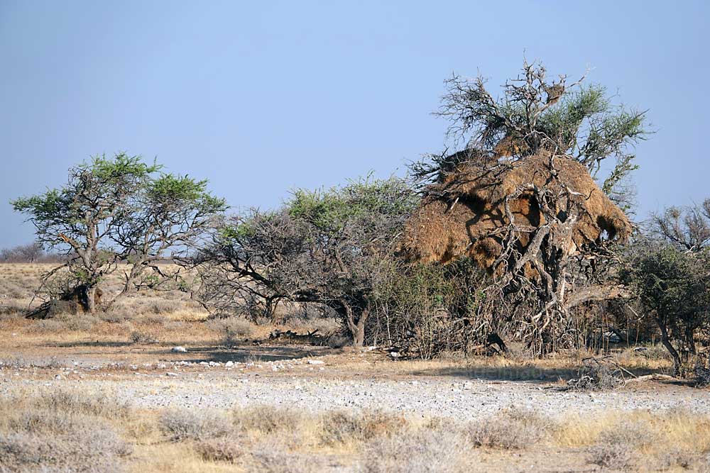
Massive Weaver Bird nests can be found throughout the Park. Many of these small birds are preyed upon by raptors including the Black-shouldered Kite.
|
Most of the waterholes along the eastern part of the route between Okaukuejo and Dolomite are totally dry and haven't held water for decades. Grunewald, only a short diversion from the main road, is one such location. Its name means ‘green wood’ in German and refers to the large mopane trees situated to the east of the waterhole site. Another forest, Sprokieswoud, is located on the road to Grünewald and is of interest due to the large number of Moringa ovalifolia or Phantom Trees.
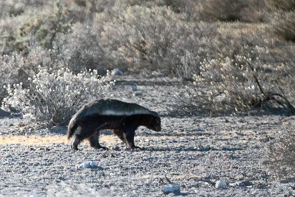
Despite the dry conditions, large tracts of land here were almost like open UK parkland in autumn with lots of well-spaced trees and golden brown leaves. The first time I drove down here the appearance of our 4x4 startled a Honey Badger foraging right beside the track. |
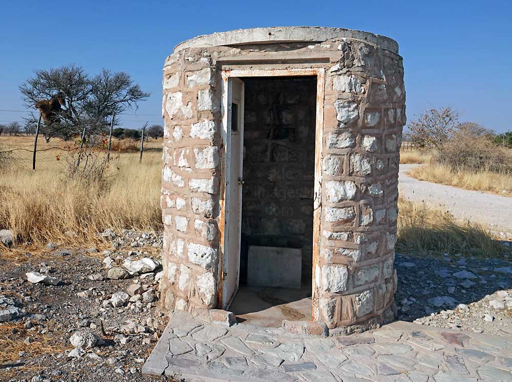
I missed out on a good close-up shot as it quickly toddled off but managed this one for the record. These elusive animals are not usually seen during daylight hours but are a common sight in the Halali Rest Camp after darkness falls when they make frequent dustbin raids for scraps. On rejoining the main Dolomite road after the Honey Badger encounter, a pair of Rhino were spotted grazing in the distance. The toilet pictured below is inside the rest area near to the Grünewald turn off. A Weaver Bird nest has been built on the tree just over the perimeter fence. The other, much larger Weaver`s nest adorns a tree at an unidentified dried-up waterhole nearby, beside the Dolomite - Okaukuejo road.
|
|
Adamax & Natco
|
Adamax and Natco are located close to each other, on a loop road to the west of the main Etosha Pan. Adamax lies on the southern edge of the middle one of three smaller salt pans, the Okahakana, the others being the Natukanaoka Pan to the north and the Charl Marais Pan, previously described, to the southwest.
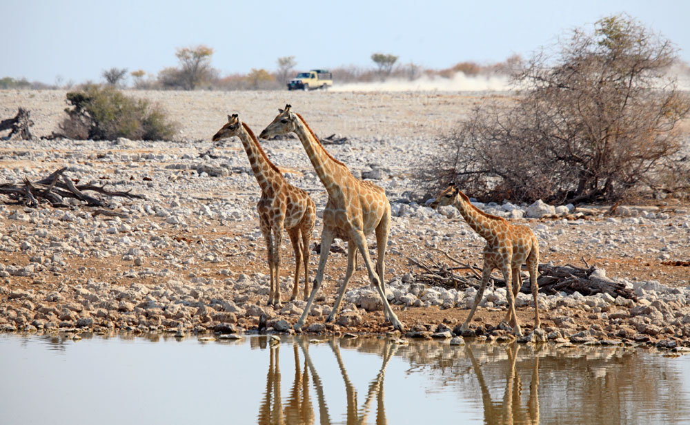
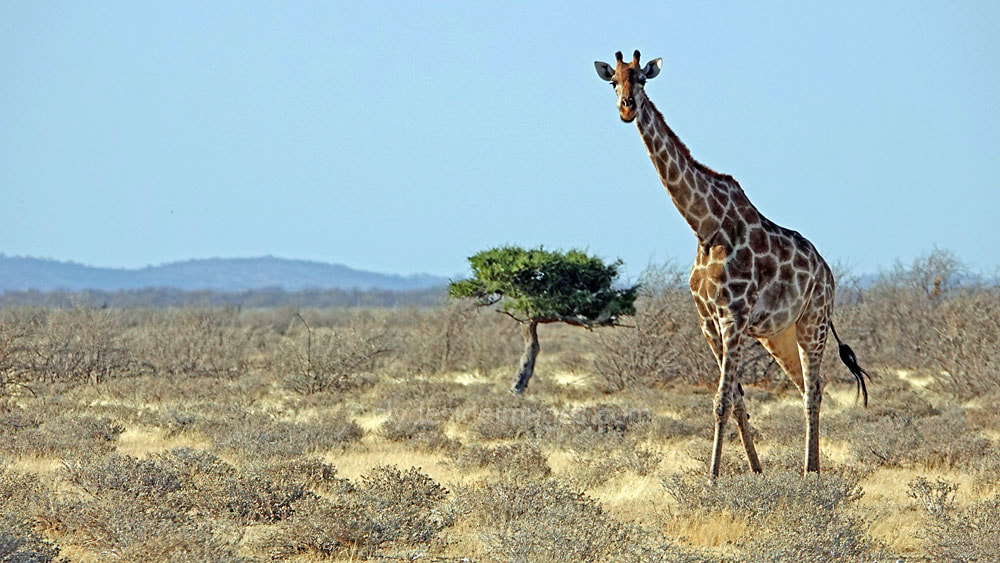
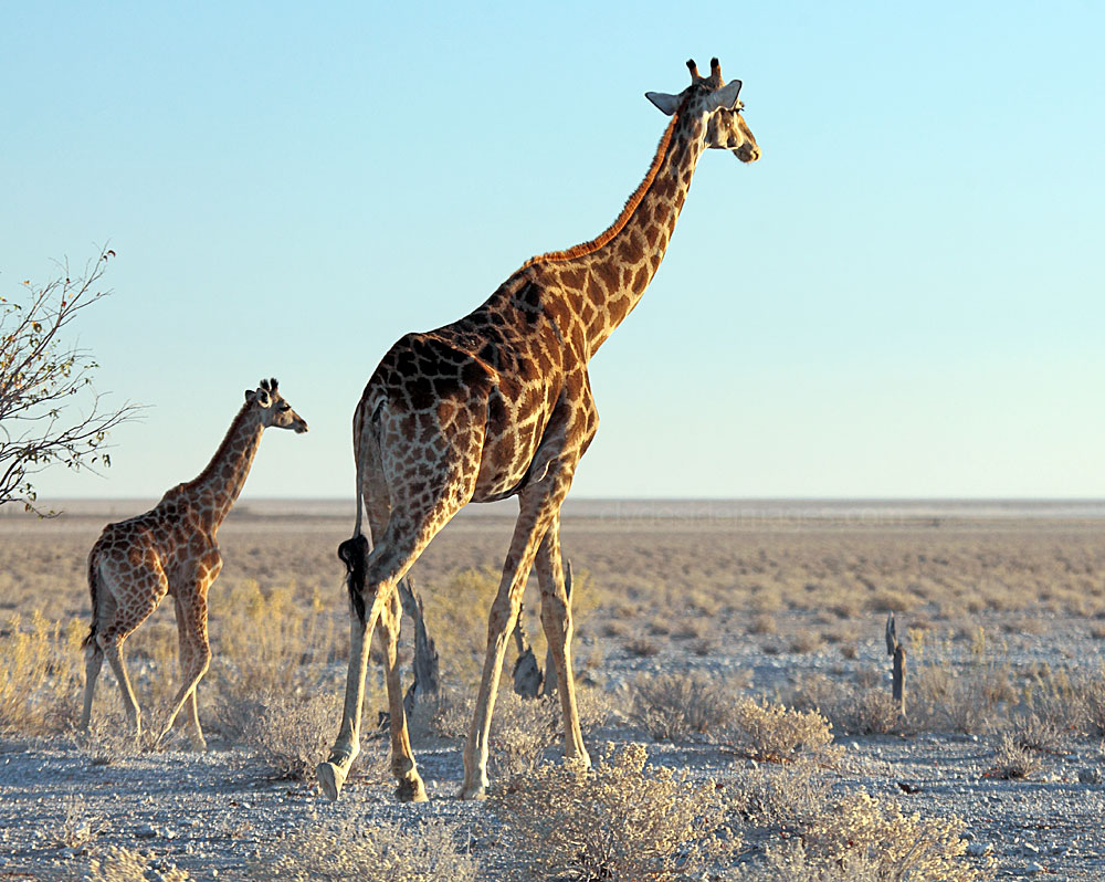
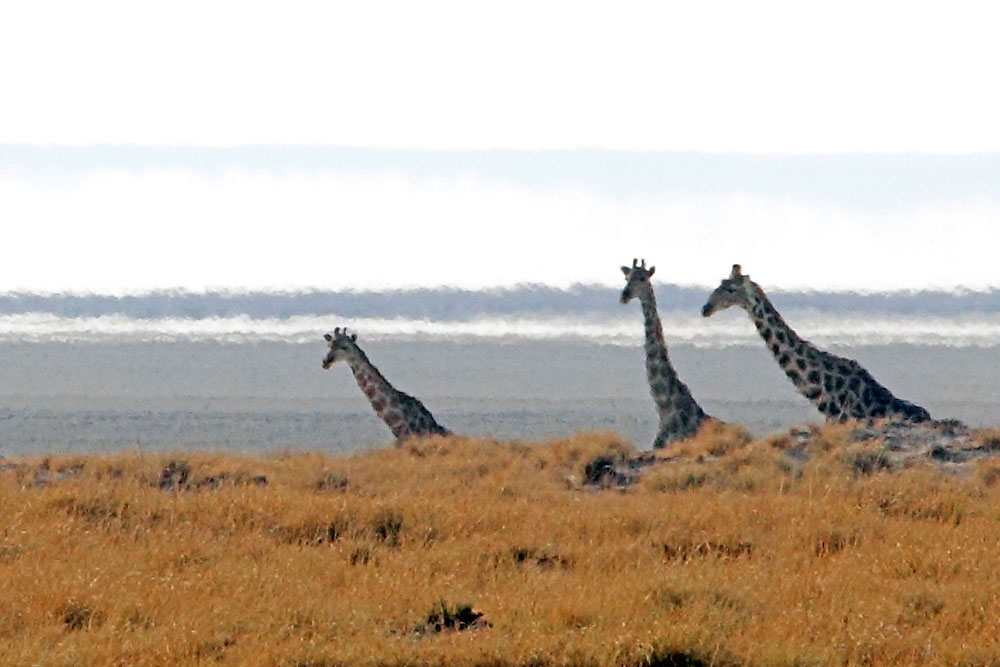
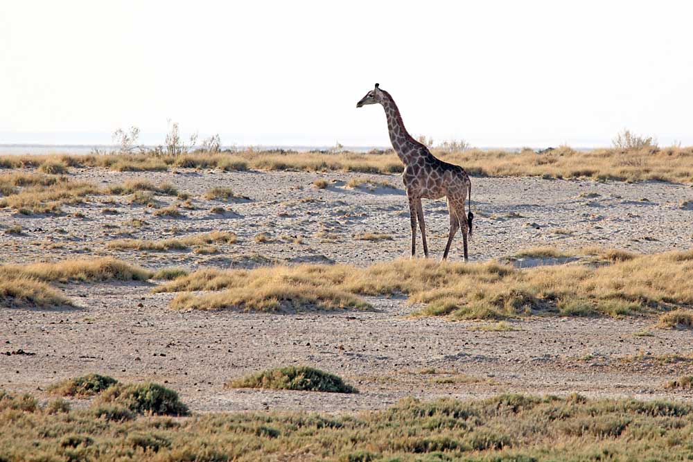
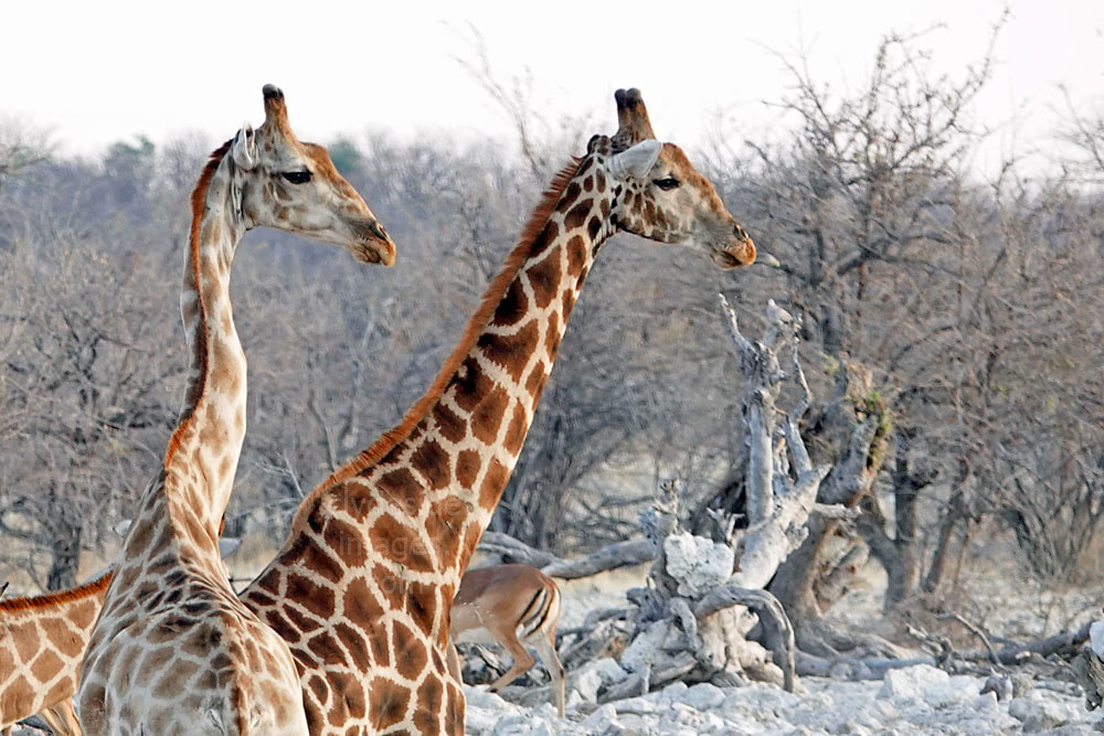
Both of these waterholes are named after those that contributed towards their construction. The name ‘Adamax’ is a combination of the names Ada and Max Kessler, the patrons who paid for the creation of this borehole while ‘Natco’ is an abbreviation of National Trading Company of SWA. Both waterholes were closed in 1974 to avoid further overgrazing on the surrounding grassveldt although there is a large natural depression to the south of the road close to Adamax which holds water after the rains and consequently attracts plains game and associated predators. These Giraffe were photographed near Natco on my second visit to Namibia. |

I checked out these waterholes during my very first full day in Etosha back in 2013, while staying at Okaukuejo Rest Camp. Following a fantastic night-time wildlife viewing session at the camp`s floodlit waterhole when no less than eight Rhinos gathered to drink, two of these magnificent animals were still slaking their thirst when we got up for breakfast. Our vehicle was one of only a few to enter the park when the gates opened at sunrise - and this was in mid-September which is classed as one of the busiest times of the year!
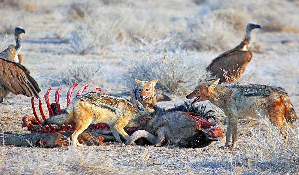
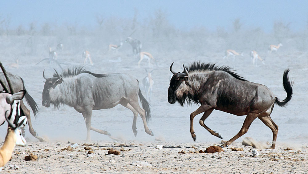
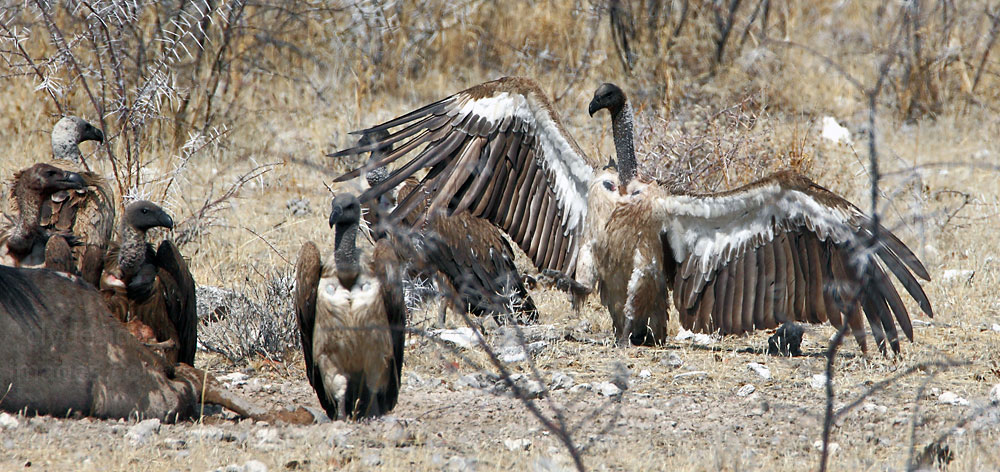
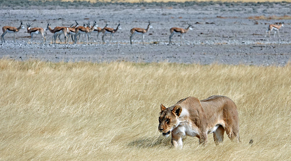
An anti-clockwise circuit starting with Wolfsnes and Okondeka proved fruitless, as did Adamax with only some distant antelope and Ostrich to be seen, however, on the way back, almost midway between Adamax and Natco, we discovered this Wildebeest carcass close to the roadside. The animal had apparently fallen victim to lions during the night and I assumed that the big cats had had their fill as they were nowhere in sight.
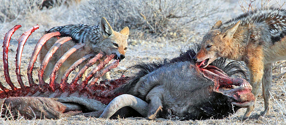
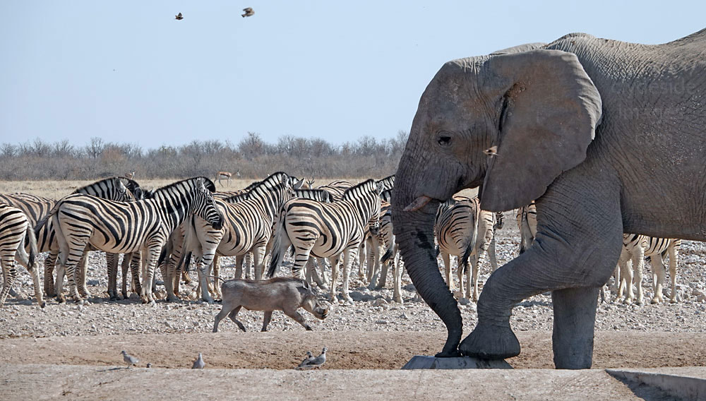
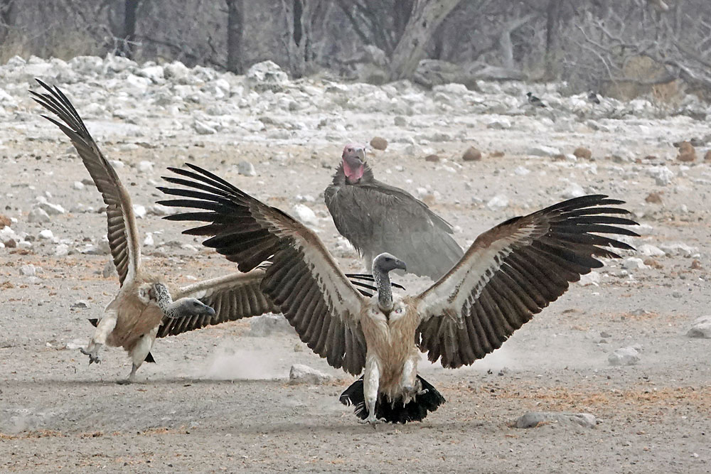
White-backed Vultures impatiently waiting for an opportunity to rush in watched as a pack of Jackals stripped the remaining flesh from the dead animal`s head and rib cage. Despite the gory scene, it was fascinating to watch nature's `clean-up crew` at work and by the time another vehicle appeared about 20 minutes later, most of the scavengers had had their fill. More shots taken here can be found on a separate page: Click here to view.
Okondeka
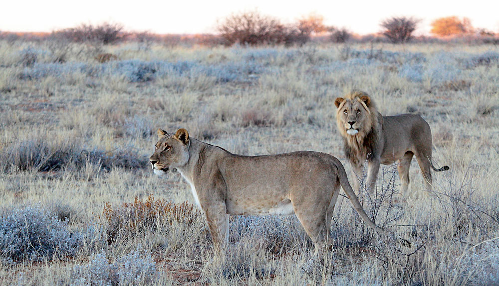
The name of this waterhole is open to interpretation and could be a reference to the prickly salt grass, Odyssea paucinervis, which grows close to the source. The name could also mean any of the following: ‘the place of sedges’, referring to the sedges at the water’s edge, or ‘the place of the small dog’, possibly referring to the African Wild Dog packs which have their dens in the area. Another possibility for the word Okondeka is ‘to encircle or ambush’. The fact that lion frequent the locality, and that the pride used to molest workers returning from farms south of the Park, favours the latter suggestion.

Okondeka is situated to the north of Okaukuejo Rest Camp, just beyond Wolfsnes, with both waterholes located right on the edge of the west side of the vast Etosha Salt Pan. In the above photo, taken in early October 2018, a Black-backed Jackal near the parking area surveys its surroundings on the lookout for carrion. At this time the water source resembled a small stream and birds, mostly doves and Namaqua Sandgrouse were moving in for a drink. In the far distance just right of centre, some vultures are lazing about, hoping that the two lions behind them will make a move and provide some breakfast.
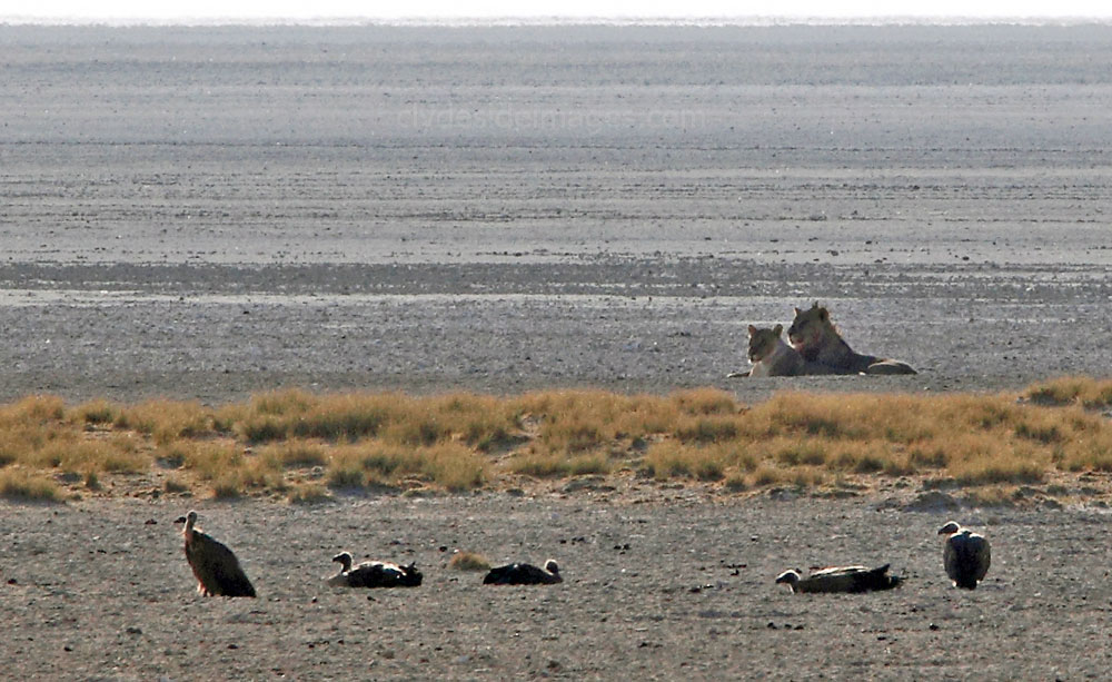
It looked promising for a moment when the male Lion got up and headed in our direction but after just a few steps, he sat down, rolled over and went to sleep! Even though the two big cats were miles away from the spring and relaxing, the herbivores and several giraffes, obviously having walked a considerable distance to get a drink, decided not to approach.
|
|
|
|
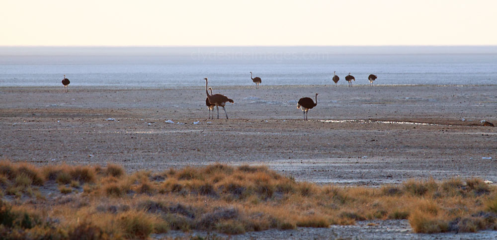
During the rainy season, the main pan sometimes floods but during the dry season Okondeka, a natural spring, is usually the only place north of Okaukuejo and east of Ozonjuiti M’Bari to have water, so thousands of animals will come to drink here at this time.
Okondeka has the reputation as an excellent spot for lion sightings although I`ve never been very lucky here despite having visited the area at least once on three separate holidays. The only lions I`ve ever seen in the area were the ones in 2018, as shown above. The local big cats take advantage of the sand dunes for ambushing their prey but a favourite pastime is lounging under the two trees on the low ridge to the west during the midday heat. |
|

Unfortunately on clear days the view from the parking area out across the shimmering pan looks directly into the the sun for most of the time, making animals and ostriches appear as silhouettes. The optimum light here is mid to late afternoon but the distance from Okaukuejo and the Andersson Gate 18 km beyond that should be borne in mind and photographers will have to leave earlier than they`d like to make sure they get back to the restcamp or exit the Park before the gates close at sundown.

Wolfsnes
The name of this waterhole is Afrikaans for ‘the den of a wolf’ but rather than wolves, this is a reference to the Hyena dens often spotted in this area. Wolfsnes is located on the southwest edge of the main Etosha pan and was one of the first contact springs to dry up during the prolonged drought of the early 1980’s. It remains dry today but the general area may throw up a few surprises and is worth a look. Cape Fox are occasionally spotted when driving the Wolfsnes, Okondeka, Adamax, Natco and Leeubron circuit, especially near the latter waterhole as there are a large amount of rodent colonies, which the foxes target. Secretary birds like to ‘strut their stuff’ here and Lappet-faced and White-backed vultures regularly nest in the low trees just south of the Wolfsnes parking area.
|
|
Leeubron
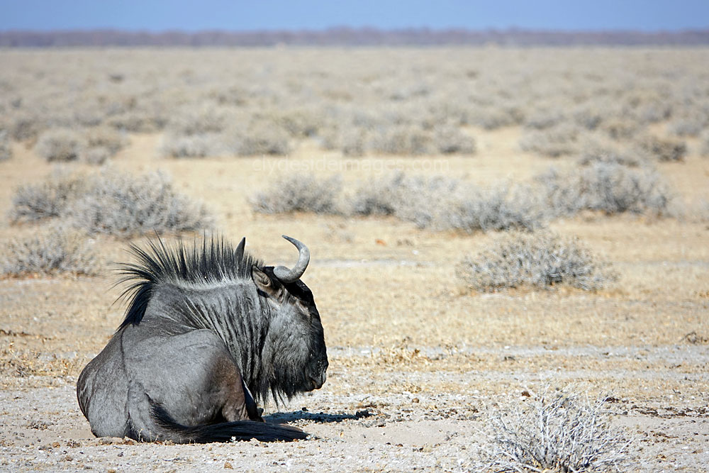
Leeubron is a well, dug by hand during the 1900’s by German soldiers, and its waters subsequently attracted a vast amount of animals. It was closed in 1974, however, to preserve the surrounding short-grass plains from overgrazing by species such as this Blue Wildebeest and it remains dry.
|
It was here in the 1960s that Prof. P. Schoeman, warden of the park at the time, found a starving lioness with five emaciated cubs. Taking pity on them, he began to feed them regularly with plains zebra that he hunted on their behalf.
This daily event became a major tourist attraction where, under the supervision of a nature conservationist, groups were taken to view the ‘lion parties’ at sunset. This involved chaining an animal carcass to a large acacia tree and waiting for the lions to approach, but this practice was short lived as the excitable tourists proved too hard to control and placed themselves at risk. During a wind storm in 2010 this landmark tree fell over and so ended an era. |
|
Okaukuejo Rest Camp & Waterhole
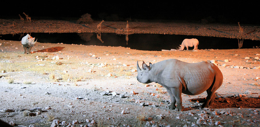
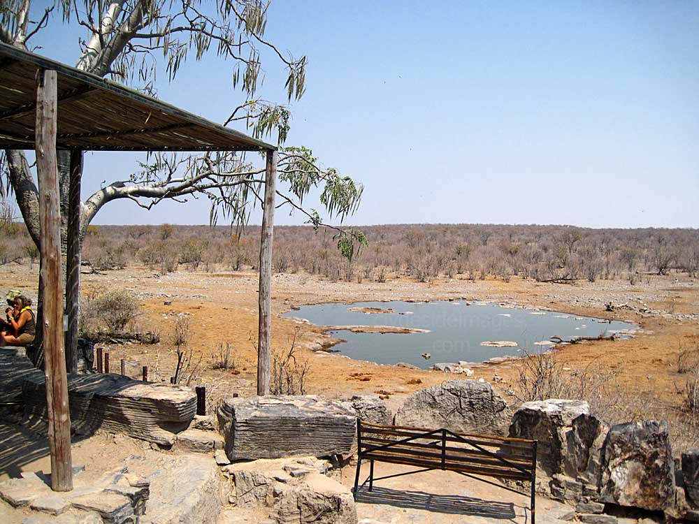
Okaukuejo is an Owambo name that means ‘Place of a Princess Who had a Child Every Year’. It is also called Haiub by the Hai||om, a reference to the plant, Salsola etoshensis, which grows abundantly here. This waterhole, often very busy during the dry season, is located on the edge of the rest camp, with the guests protected by a low stone wall and fencing. Comfortable benches along the camp boundary, which is safely above ground level, enable guests to sit and enjoy watching the wildlife 24 hours a day.

The area is floodlit at night and some spectacular wildlife encounters have been played out here. Although I`ve never seen any, it`s not unusual to witness lions hunting after dark, but on our first visit, my wife and I were privileged to watch a gathering of no less than eight Rhinos. More information and images taken at what is undoubtedly one of the jewels in Etosha`s crown can be found on a separate page. Click Here to view.
|
|
Ombika
Even though the Ombika waterhole lies very close to the Andersson Gate, and is the first such site passed en route to the Okaukuejo Rest Camp, it`s usually worth a look as the location is popular with many species, and supposedly a good place to spot lions although I`ve never seen any here. The name Ombika is a combination of an Owambo prefix, ‘om‘ and the Hai||om word ‘bika‘, which literally means to `force up and give water`. This source was originally used by people walking the old contract labour trail from the farming areas south of Etosha to Owambo in the north. Ombika is also apparently the name of a type of hand-pick which these early travellers utilised to dig down and reach the water.

|
The source is now a contact spring, supplemented during dry periods by a solar powered pump, so water is usually available all year-round. During periods of extreme drought, however, there are times when Ombika fails.
During the winter dry-season, the water level drops considerably and, as the pool is within a deep depression and quite far from the parking area, the animals, particularly the smaller ones, all but disappear from view when they start drinking. |
|
|
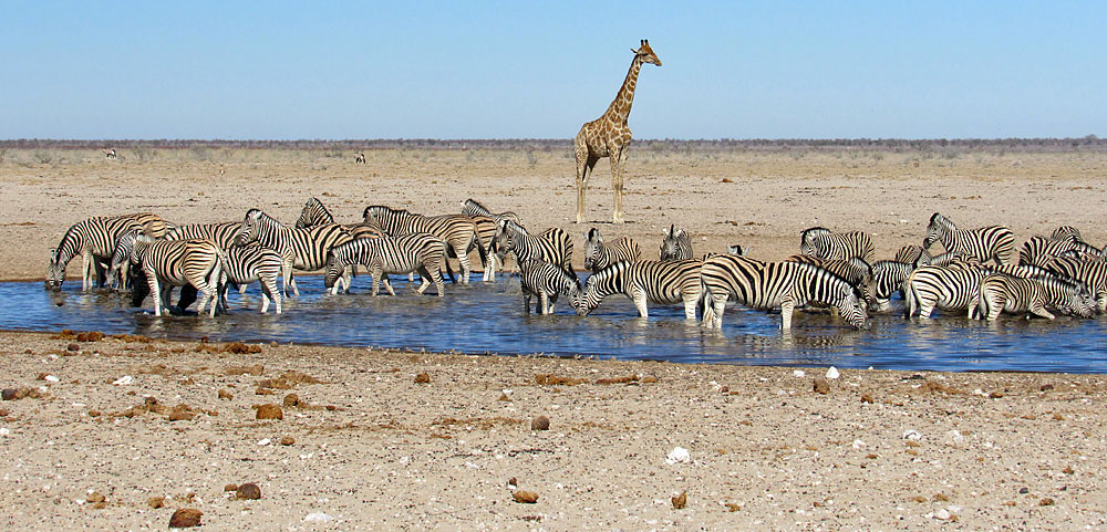
When the rains do come, the pool fills rapidly and overflows almost to the edge of the parking lot. Spring also brings the Catophractes alexandri and Acacia nebrownii into flower, which attracts large numbers of giraffe which feast on these blooms. These spectacular animals seem to favour Ombika whatever the season though and they were present most days when I visited throughout September and into October.
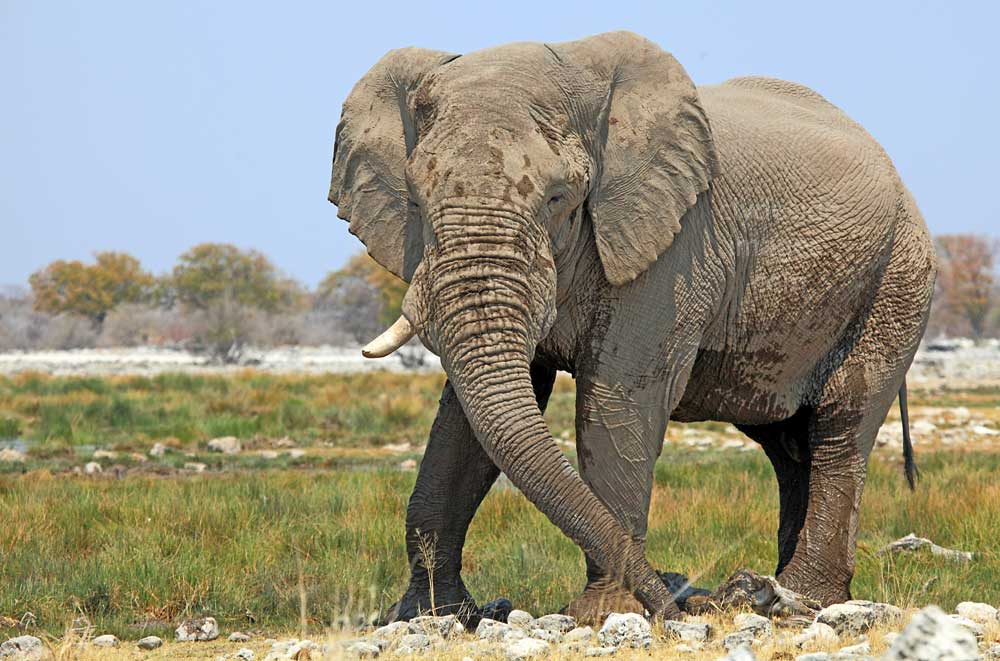
One day, while exploring Etosha on our second holiday, my wife and I had stayed at the Ozonjuitji m`Bari waterhole until midday before driving back to Okaukuejo. After filling up with diesel at the rest camp pumps, we headed for the park exit, intending to spend the rest of the day relaxing at Etosha Safari Lodge. As we passed the turn-off for Ombika, we could see a herd of elephants at the waterhole so we drove in for a look. A couple of the National Park`s safari trucks with clients on board did likewise. It was a very peaceful scene with the animals looking very relaxed as they slaked their thirst.
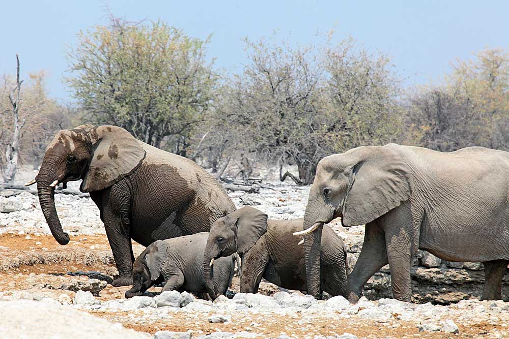
With such a high sidewall, one of the youngsters had to use its trunk for extra leverage when stepping out.
After drinking and splashing around for a bit, the elephants all began to climb out. One of the matriarchs (on the right above) followed the calves, but without warning toppled over and went down like the proverbial `ton of bricks`, trumpeting in terror. To the human spectators and other elephants it initially looked as though she`d been shot, but her left foot had slipped on the muddy rim causing her to fall over. Her leg must have been badly twisted.
The poor beast was obviously shocked and in great pain but the other elephants gathered round and her partner patiently encouraged her to stand and eventually step cautiously out of the hole while he shooed-away unwanted spectators! The injured female managed to put weight on her foot and slowly walked off so it appeared that her leg wasn`t broken. The incident was just another reminder as to how precarious life can be for the animals trying to survive day-to-day here, irrespective of how large and powerful they are. Some addition images taken at the Ombika waterhole can be viewed here.

|
|
Gaseb
It is thought that the name Gaseb refers to the ear, sense of hearing, thirst, or the name of a Hai||om individual scooping water from a hole. This artificial waterhole was closed many years ago due to overgrazing and all that remains to be seen is an overgrown water trough. Even so, it is still thought to be a good place to see Rhino.
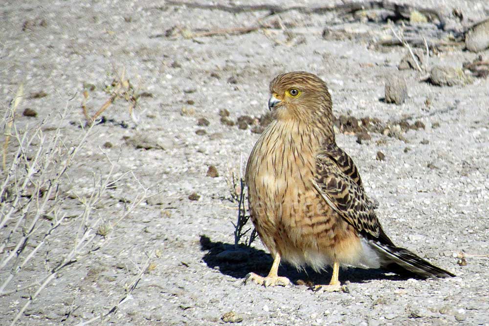
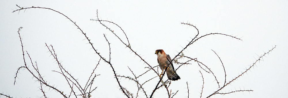
On our second holiday in Namibia, a drive to nearby Gemsbokvlakte proved fruitless, just a few Springbok, so we took the Gaseb loop back to the Okaukuejo rest camp. Close to the dried-up waterhole, three Hyena, were making their way through the forest, our first sighting of these predators that trip. There were some good close-ups of birds here too including Crowned Lapwing and this Greater Kestrel, on the ground just a few feet from the car with a very full tum!
|
|
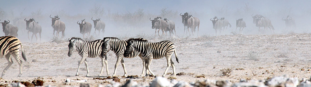
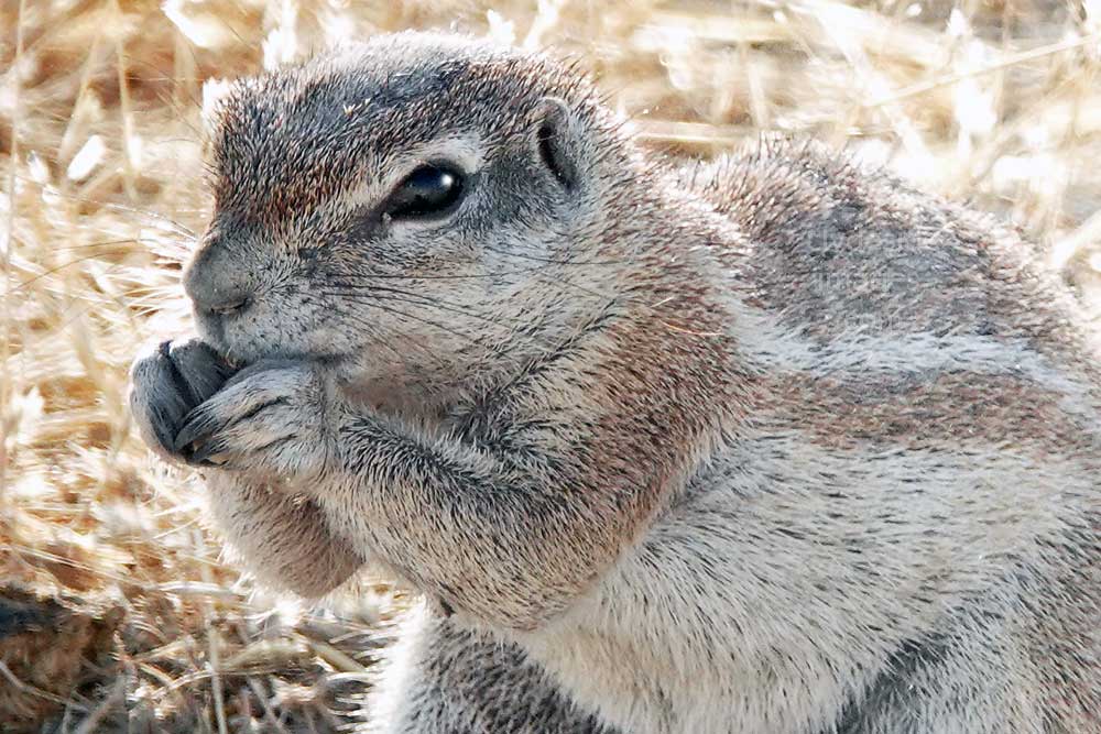
On the last visit to Etosha entertainment here was provided by a colony of Ground Squirrels at the roadside. It was fun watching these wee animals as they dug for beetles, preened and squabbled among themselves momentarily before jumping into the air and darting off. In the background, a procession of Zebra could be seen heading to Gemsbokvlakte, the animals’ hooves kicking up clouds of dust as they plodded along.
The Ground Squirrel (Xerus inauris), like its close relative the Mountain Ground Squirrel, has no tree-dwelling tendencies and is entirely a ground living species, using its long-haired tail as a sunshade as and when required. Full of character, these small creatures have a preference for open terrain with sparse bush cover and will avoid areas of loose sand which makes warren construction difficult. Colonies usually number around 30 individuals who are constantly engaged in tunnel repairs and the building of new multi-entrance burrows.
Ground squirrels only emerge from their burrows in the morning, well after dawn and retire before the sun sets. They are common throughout Namibia, except in the extreme north-west, north east and coastal areas. Although ground squirrels are predominantly vegetarian, they will eat certain insects. Their diet mainly consists of leaves and stems of grasses and plants, seeds, bulbs, and roots.
Ground squirrels only emerge from their burrows in the morning, well after dawn and retire before the sun sets. They are common throughout Namibia, except in the extreme north-west, north east and coastal areas. Although ground squirrels are predominantly vegetarian, they will eat certain insects. Their diet mainly consists of leaves and stems of grasses and plants, seeds, bulbs, and roots.
|
|
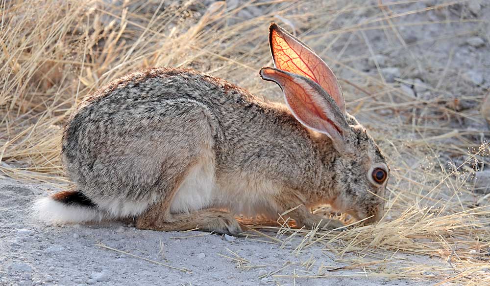
The Scrub Hare (Lepus saxatilis) pictured above was feeding nonchalantly beside the Gaseb loop road, close to the Ground Squirrel colony. These hares are more common in agricultural areas but also occur in savannah woodland. They are mainly nocturnal but usually emerge to feed towards sundown, being more evident on warm rather than cold evenings and will lie-up during periods of rainfall. They feed on the leaves, stems and rhizomes (a thick underground stem that produces a new plant) and dry as well as green grass, with a preference for the latter.
Nebrownii
Nebrownii is named after the water-thorn acacia, Acacia nebrownii, which grows in thickets immediately west of the site. The waterhole here opened in 1992, primarily to relieve grazing pressure around Okaukuejo, and a solar pump was added in 1997 to increase the borehole`s efficiency. The supply, which should be available all year round, attracts a wealth of animals and the wide open spaces, elevated parking area and it's proximity to Etosha’s busiest restcamp, make it an extremely popular venue with human visitors.
The surrounding terrain consists of white calcrete dust, which becomes white mud at the edge as the water overflows from the dam and seeps into the earth. The elephant and rhino which frequent this area enjoy rolling about in this mud and there are many reports of ‘old’ white elephants logged in the rest camp game sightings books.
Even if there aren`t many animals in view, there are usually plenty of birds, either coming to the waterhole to drink, or in the case of the smaller species such as Sabota and Red-capped Larks, hopping between the stones and piles of elephant dung in their search for beetles and other insects. At the other end of the scale, Ostrich and Bustards are frequent visitors.
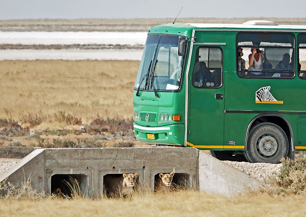
The culverts on the main road just north of Nebrownii are favoured as ready-made dens by lions and hyenas which comes as a surprise to most visitors.
I`ve had some great sightings here and a dedicated page covers the action at Nebrownii in more detail: Click here to view.
|
|
Above: A wide-angle view of the Nebrownii waterhole and its designated parking area seen from the main road immediately east of the culverts. This is a good position to take up when the parking area gets busy, especially if the lions emerge and go on the hunt. A 400-600mm lens or greater may be required and heat haze will likely prove problematical in distant shots taken late in the day.

|
|
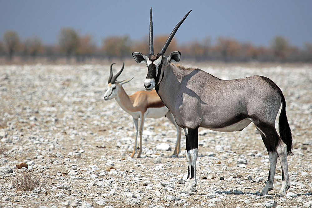
Gemsbokvlakte
The name Gemsbokvlakte is an Afrikaans name, and simply means `the plain of the Gemsbok` (Oryx). During the dry season, many animals gather here and it can quickly become fairly hectic. The source is a borehole assisted by a solar pump. The sunken sheep dip-style trough often overflows to form a small pool but the waterhole itself is situated in a depression so, as the animals pile in to slake their thirst, only their upper parts are visible.
The location is popular with photographers, especially during afternoons when the lighting is more favourable. Springbok, Zebra and Oryx were the main species noted here but Gemsbokvlakte is frequently visited by the Nebrownii lion pride although the big cats are more likely to be found early in the morning.
On my last visit a small herd of elephants, including this heavily pregnant female, was slowly making its way across the plains to Gemsbokvlakte.
|


|
Pictured below, surveying the scene at Gemsbokvlakte, is one of several Martial Eagles spotted over several days in the park but they were all quite far off. This distinctive raptor is Africa`s largest species of eagle and reputedly capable of knocking an adult man off his feet. The adult birds weigh in at almost 14 pounds (6.5 Kg.) with a wingspan of approximately 6 feet 4 inches. Other birds feature heavily in the Martial Eagles` diet and they have been known to have preyed on species as large as the European Stork although guineafowl, francolins, bustards, and poultry are more commonly targeted. Mammals are also eaten from hyrax up to small antelope and monkeys, plus occasionally snakes and large lizards.
|
|
Pictured above right is the animal that gives this waterhole its name. The Gemsbok, or Oryx, is one of the characteristic animals of the arid areas of Southern Africa, adapted to living in deserts where there is no water to drink. It`s at home in vast open spaces under a fiery sun, even deserts with no shade whatsoever, although arid open grasslands are its preferred habitat. When deprived of drinking water the Gemsbok uses several measures to minimise its hydration requirements, notably allowing its body temperature to rise from a normal 35.7°C to 45°C (113F) then it cools itself by nasal panting and sweating. It also concentrates its urine and absorbs all possible moisture.
More shots taken at Gemsbokvlakte can be found on a dedicated page: Click here to view.
Olifantsbad
The name of this waterhole is an Afrikaans word that means ‘elephant’s bath’. It is a natural spring, augmented by a borehole and solar pump, which lies amongst attractive Mopane woodland between Gemsbokvlakte and Aus. Although I’ve never witnessed anything out of the ordinary here, the site has a reputation for being busy with a good variety of species. Light is best from mid-morning onwards but the concrete pumphouse is unsightly and best excluded from shots.
|
|
On my last visit to this waterhole, which was mid-afternoon, we had to stop on the approach road to let a herd of elephants cross right in front of us.
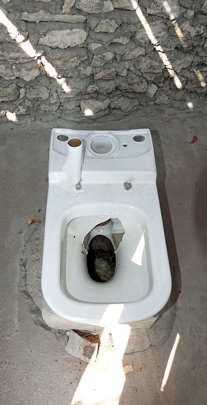
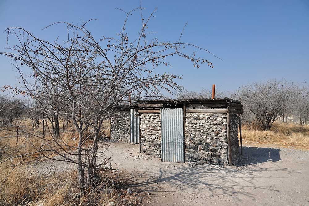
The adjacent rest area complete with picnic tables and toilets opened in 2000 and although it's still a busy place, the toilets are a mess now and most people wouldn’t fancy having an emergency `sit down` here, let alone a picnic! Like the vast majority of these rest areas (as opposed to Restcamps like Okaukeujo, Halali etc) the one at Olifantsbad has fallen into disrepair and the Park authority has insufficient capital to improve the situation. At least the perimeter fence at the Olifantsbad rest area seems to be intact which can’t be said for most of the others in Etosha.

|

|
Above: The rest area car park and the trail up to the picnic area and toilets.
As illustrated, many people can`t be bothered walking uphill to the WCs (below) and just `go` right next to the parking area, either against the wall surrounding the solar panels, or in the trees - not the best place place to enjoy your sandwiches! The cracked loo on the left was the best of the bunch - by far!
|
|
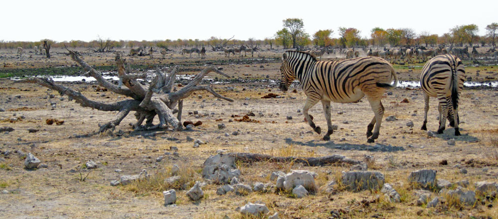
Aus
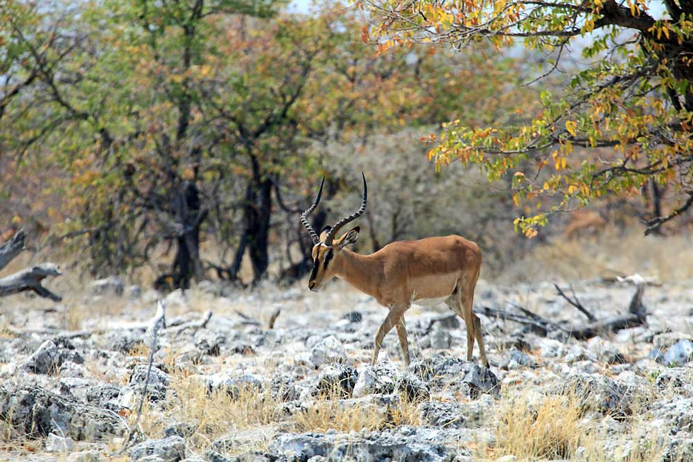
The name of this waterhole is derived either from the Nama word meaning ‘bitter-tasting bush’, or the Hai||om word meaning ‘spring’ or ‘salt water’. Like nearby Olifantsbad, the source here is a natural spring augmented by a solar pump which provides a year-round supply. The location is best known for the large herds of Black-faced Impala that come to drink, or congregate on the road between Aus and the neighbouring waterholes, providing excellent opportunities for observing these antelope at close quarters. Kudu are pictured below.
|
|
Ondongab
The name Ondongab probably comes from the Hai||om word ‘/andommie’, which means ‘the place where two valleys or rivers come together’. Even though the source, a contact spring which is active only during or just after the rains, tends to dry out quickly, the surrounding area often retains sufficient moisture to provide good grazing. During the rainy season the majority of animals tend to avoid the main waterholes, preferring to move into the interior of the park to avoid human disturbance, however, large numbers of herbivores can be spotted at Ondongab during this time.
Kapupuhedi
Kapupuhedi, like Ondongab to the east, is only active during and immediately after the rains, drying out totally in winter, so again, it`s the plains that attract animals rather than the waterhole itself. Zebra in particular, travel for many kilometres to reach this grass. With the shimmering white pan immediately north of the site, Kapupuhedi is another favourite spot with photographers. Its name can mean either ‘small earthworm mounds’ or ‘soft mud’.

Homob & Gonob
Homob, a water-table spring within a large depression, is situated close to the edge of the main pan. Its name is a Hai||om word meaning ‘a place without swarms of locusts’. Well worn animal trails cross the road leading to this waterhole enabling tourists to view passing game at close quarters. Lions sometimes rest in the shade provided by the site’s tall trees.

|

|
Homob is a very scenic location but I`ve never seen much activity here, just lots of Helmeted-Guineafowl and some smaller birds.
I believe that Homob waterhole`s neighbour Gonob has been dry for many years and public access to the site has been blocked. During the dry season dust thrown up by the wind and passing vehicles coats roadside trees and shrubs turning them white, almost giving the impression that you`re driving through a winter landscape.
This elephant family emerged from the scrub and crossed the road right in front of our car. One of the adults had been fitted with a radio tracking collar.
|

|
Sueda
|
Sueda waterhole takes its name from the ink bush, Sueda articulata, which grows in the vicinity. This waterhole is situated in a depression, overlooked by the road which connects with nearby Salvadora. Each site has a large parking area with plenty of potential pull-over spots when travelling between them.
The southern edge of the pan looks more like a sandy beach along this barren stretch, however, the source at Sueda is a natural, seasonal contact spring but with a very high saline content. Because of this, most animals prefer to drink at Salvadora, apart from the local lions who seem to like it here. 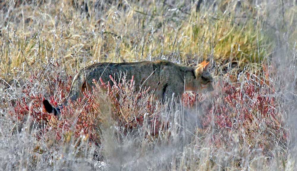
In September 2013, on my first visit to Namibia, I was just moments away from the parking area at Suedo but had to stop as a couple of cars had halted beside one another, effectively blocking the road. The occupants would have no doubt had a terrific, unobstructed view of this African Wildcat as it strolled past.
These elusive predators are most often spotted at waterholes, where they will lie in ambush, waiting to pounce on birds such as doves and sand grouse when they come to drink. Other prey species taken are rodents, insects and even very small antelope. Regrettably, these were the best shots I could manage. |
|
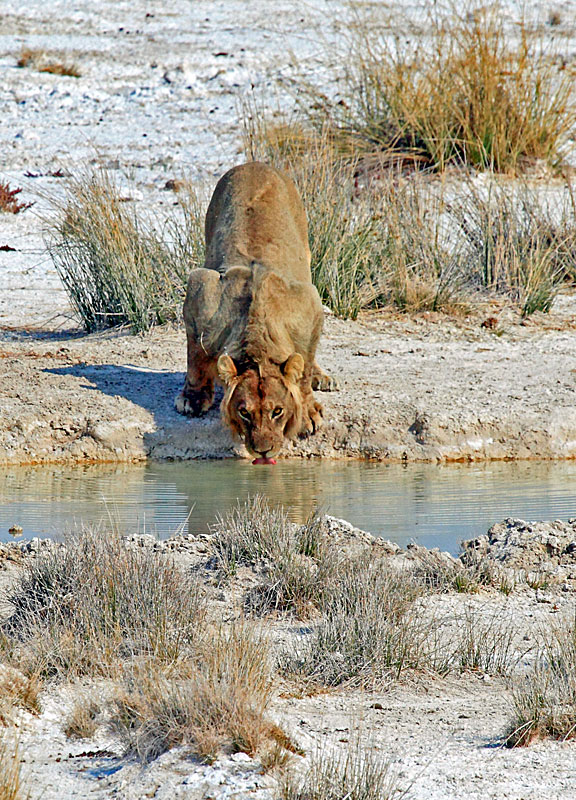
At first glance it looks as if the Suedo waterhole would make an ideal picnic spot, however, at least three lions are resting here, all concealed behind large tufts of grass towards the left side of the above image. The occupants of several stationary vehicles had their attention focused on the area so we sat tight. Our patience was eventually rewarded when the first lion, a female stretched out, breaking cover. Eventually she stood up and wandered over for a long drink.
|
|
It looked as though this lioness was fascinated by her reflection. After slaking her thirst she headed over the salt flats to seek out a spot with more shade.
|
|
Another two lions, tremendously well hidden, soon popped into view. Both were male with one `caught short`, possibly as a result of a dodgy Zebra curry the night before! After the trio had settled back down together, and as they were quite far off, we decided to move on and try our luck at Salvadora. More shots can be found on a dedicated Suedo waterhole page. Click here to view.
|
|
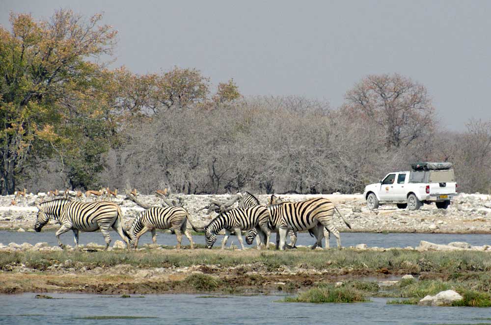
Salvadora
Salvadora, one of Etosha`s most picturesque locations, lies just a few kilometres east along the Pan`s southern edge from Sueda. The site is best known for its evergreen mustard tree, Salvadora persica, which gives this waterhole its name and makes a fine backdrop to proceedings. The parking area is elevated with a steep drop-off, providing panoramic views out towards the Pan, and an almost birds-eye view of any animals directly below, sometimes only a few metres away.

Overall, this is one of the park`s most popular spots with photographers and on my first visit, long lines of antelope and Zebra stretched into the distance, wandering over the grasslands on their way to or from the waterhole creating a classic African scene. Although I`ve never encountered any predators here, Salvadora is a well-known lion hotspot and the big cats regularly ambush their prey after lying in wait among the bushes and reeds. Cheetah also make frequent appearances.

|

|
Bird-wise, irrespective of the season, there is usually something of interest with Ostrich seen shimmering in the far distance and Blue Cranes among the species at the water`s edge. Pied Crows from Charitsaub visit the parking area to beg for treats and even though feeding any animal or bird within the park is prohibited, they obviously have a good deal of success.
On my last visit, in October 2018, my wife and I were driving from the east side of the Park to Okaukuejo and we stopped here around midday to discover an impressive gathering of Zebra revelling in newly formed pools created by early overnight rainfall. Soon, Springbok and long lines of Wildebeest began to move in and we could have sat for ages watching the interaction and niggles between the animals, especially as they were so close at hand. More information and shots take at Salvadora can be found here.
Charitsaub

The name ‘Charitsaub’ comes from the Hai||om word Geikoitsaub, which means ‘small well’. After decent rains this artesian spring irrigates the surrounding plains which in turn attracts thousands of springbok, Oryx (Gemsbok) and Zebra. Crows, Greater Kestrels and Rock Kestrels often nest in the large Acacia tree beside the access road, just north of the waterhole. Red-necked and Lanner Falcons regularly prey on the smaller birds frequenting the area.
|

|
The designated parking spot is raised affording excellent views of the source itself and anything on approach, plus the light is good for photography throughout the day. Although this site has lots of potential I`ve never seen much here despite several, albeit brief visits. These shots were taken in early October 2018 when the only animals present were a handful of Springbok and a Black-backed Jackal. The pool usually dries up towards the end of the month but there was still an ample supply thanks to some overnight rain.
Halali Plains Seeps

|
|
|
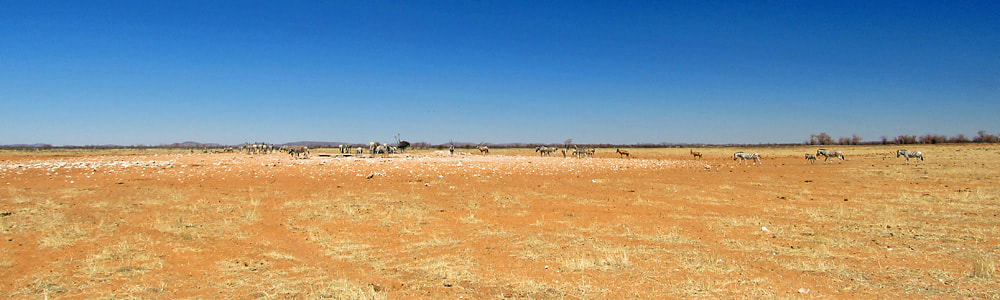
The main Okaukuejo-Namutoni road cuts through the extensive Halali Plains where long lines of animals can often be seen making their way across the flat landscape on their journey to or from one of the water sources located within.
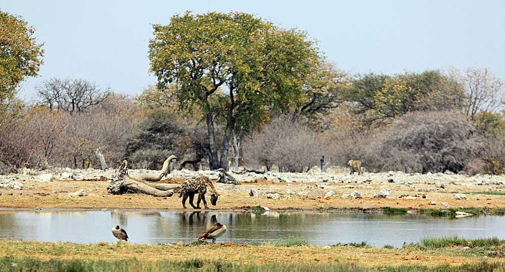
The Halali Plains Seeps are located between the Salvadora waterhole and the causeway road to the Etosha Lookout Point. Although there are numerous small contact springs in the immediate area, none are marked or clearly visible from the road, except for the Halali Plains seep. The best sighting here was a group or`cackle` of Hyenas on our first Namibian holiday. |
|
Rietfontein & the Detour Road
In 1876, the Dorsland Trekkers, Boers from South Africa seeking a new place to settle, named this artesian spring Rietfontein (Afrikaans for ‘reed spring’) after the Phragmites australis reeds that used to grow here. The grave of Johanna Alberts, one of the trekkers who died that year is located nearby. Elephants have long since made short work of the original reeds and the waterhole is now home to the hardier Typha species.

|
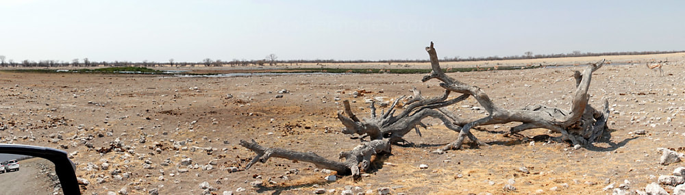
Rietfontein waterhole lies on the south side of the main Namutoni - Okaukeujo road, west of the Halali Restcamp turnoff. It’s an open, relatively scenic location with a large parking area overlooking the site which has two main parts. Photography here is best in the afternoon, and an immediately recognisable dead tree trunk, reminiscent of driftwood, in the foreground is often included in shots.
The eastern end of the site (on the left when viewed from the parking area) has a reed-covered islet and plenty of greenery around the fringes but holds mostly dark and sticky mud. This makes it popular with elephants, although I’ve never encountered any here. |
|
The other end of the pool is shallower with clearer water and this is where most of the other animals prefer to drink from. Lions visit occasionally and are usually found just after first light. Leopard patrol the mopane woodland but are rarely seen.
By mid-morning, however, it's the large volume of plains game that’s the main draw here. Given the right conditions and timing you can sit and watch seemingly endless herds of herbivores emerge from the distant tree-line then wander over to slake their thirst. |
|
Rietfontein holds the reputation as being one of the best waterholes in the entire park for waterbirds of all species. On my last visit in early October 2018, a white Cattle Egret was standing on the islet, ready to pounce on anything it considered edible. Be warned that the Pied Crows aren’t shy here. It is understandably forbidden to feed the animals and birds within the National Park, and anyone caught doing so faces a hefty fine, but it’s obvious that these cheeky feathered residents of Rietfontein successfully manage to persuade more than a few visitors to throw them some tasty titbits.
|
|
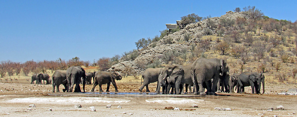
Halali Rest Camp (Moringa Waterhole)
Halali, lies roughly midway between Okaukuejo and Namutoni and many people travelling across the park use Halali as a convenient lunch stop. It`s the smallest, usually least busy of Etosha`s three main rest camps and occupies a picturesque woodland setting at the base of a dolomite hill, or Koppie. The Moringa ovalifolia, better known as the phantom tree, or fairy-tale tree, which grows on the slopes, lends its name to this camp’s waterhole. The original mopane trees that surrounded the waterhole reached up to 15m high but elephants have long since bulldozed and destroyed them.
Halali`s Moringa is far quieter than its counterpart at Okaukuejo but lies in a more natural setting. The lighting is best in the mornings although most animals tend to appear later in the day. Elephant, Hyena and Rhino are regular visitors and there’s a good chance of seeing a Leopard coming to drink after dark when the location is floodlit. Honey Badgers are often present, not only at the waterhole but foraging around within the camp`s perimeter during the night.
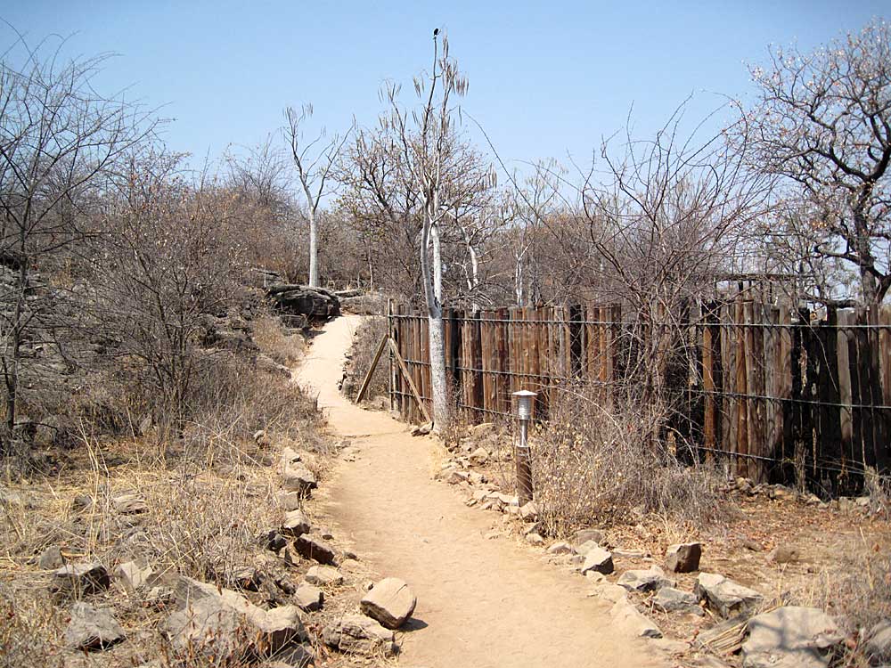
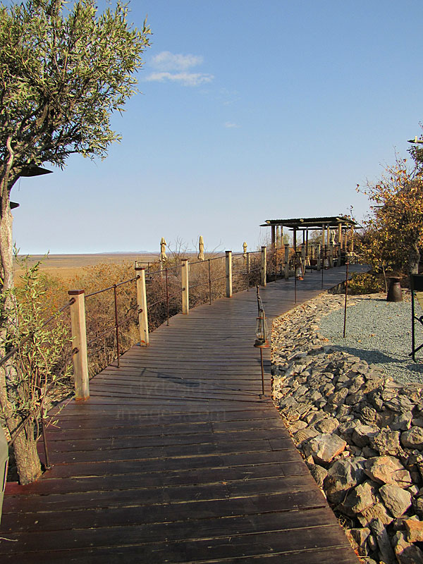
The covered seating area at Moringo is elevated but quite small so it`s best to dine early and secure a space before the floodlights come on. There is additional standing room along the walkway itself which some photographers may prefer as this puts them a bit closer to the action. A short trail from the camping area leads past the waterhole viewing area and climbs the dolomite kopje to a viewpoint near the summit - supposedly a great spot for watching the sun rise or set over the surrounding countryside.

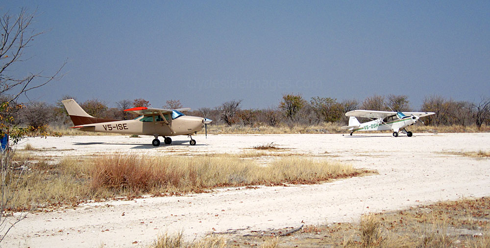
|
The three main restcamps each have a small airstrip but the one at Halali seems to be the most active, during the dry season at least. I’ve never seen any planes at Namutoni and only a single-engined Cessna at Okaukeujo, but there were several aircraft at Halali when I looked in during my first visit to Etosha, the most interesting being this military-looking MD OH-6A helicopter, V5-HUG of Expedite Aviation. Piper Cub V5-DSH and Cessna V5-ISE (above) were among the handful of fixed-wing lights.
I believe that no privately-owned aircraft are permitted to fly over the National Park without special permission, so I assume most of these planes will be used by researchers or the park authorities for game surveys and anti-poaching patrols. |
Helio
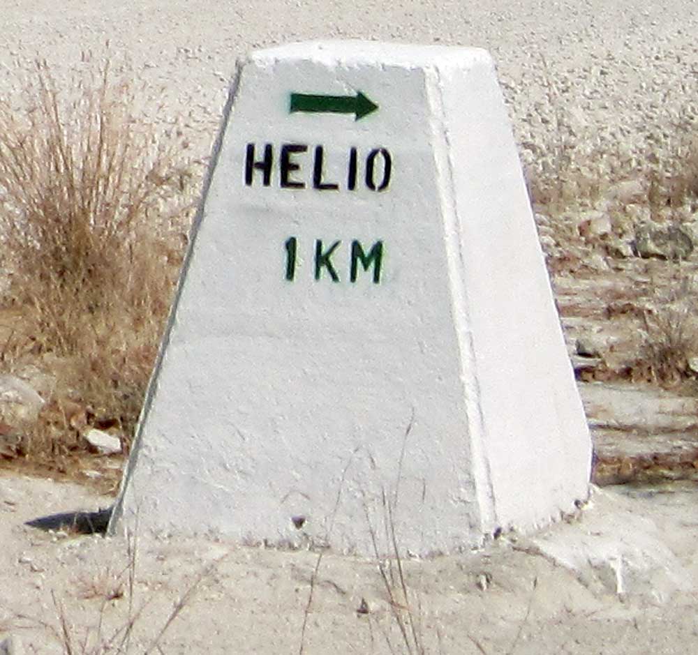
Helio at the end of a rough track through scrub land close to the Halali Rest Camp, is an artificial waterhole but it has been dry for many years. The location takes its name from the fact that in the 1890’s, German Schutztruppe sent heliograph signals from nearby koppies to Fort Namutoni.
|
|
Up until 1992, Helio was supplied with water via a pump but the site was closed to encourage animals to concentrate on the Moringa waterhole at Halali. All that remains today is the concrete water trough and an alternate view of Helio koppie.

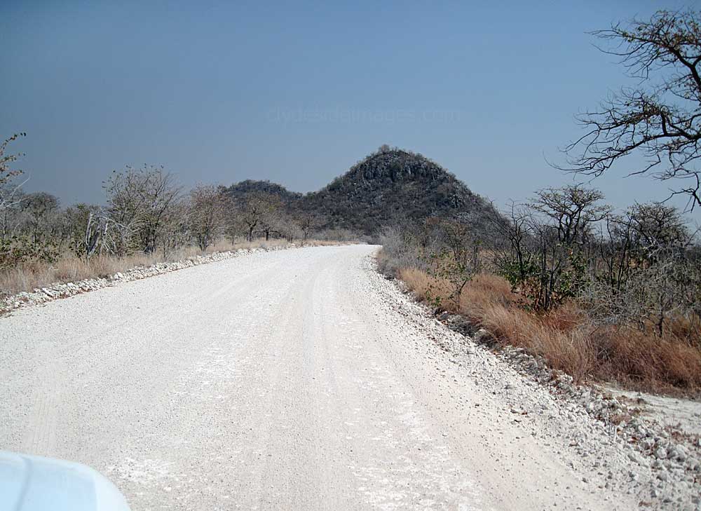
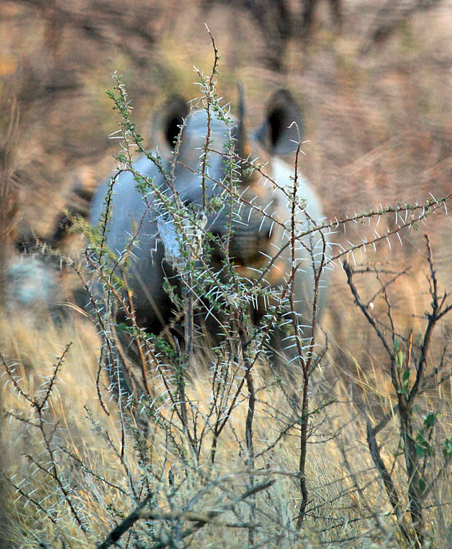
When my wife and I first visited the park, we were unaware that the site was dry and drove down the dusty, tree-lined track off the north side of the main road to the loop at the end to check it out, seeing nothing at all on the way. Slightly disappointed to discover that the waterhole was no longer in use, I about turned and retraced our route. We came round a bend and startled a rhino in the woods, right beside the road - it was a toss-up as to who got the biggest fright!

|
|
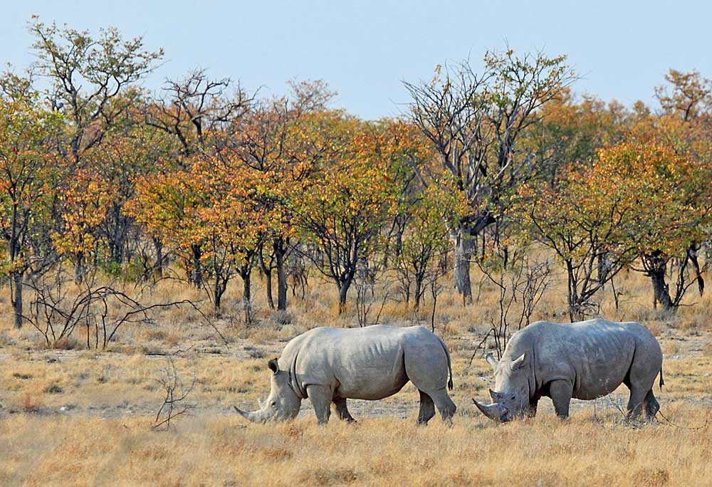
Although we hadn't been travelling fast, the animal took off in a panic, initially running parallel with our 4x4. Black Rhinos are notoriously unpredictable and luckily it veered away rather than into the side of the car - but then it came to a halt. I stopped, grabbed the camera and started snapping away. Almost immediately, before I could focus properly, the huge animal turned, stared us out and began to snort and shake its head - with only a thin, prickly shrub separating us from, at the very least, a severe dent in the hired Toyota Hilux (on my wife`s side!) - She agreed that it was definitely time to go! About 15 minutes later, we spotted this pair of Rhino grazing contentedly fairly close to the main road but at a much safer distance...
Rhino Drive & Eland Drive
These two routes are basically long detour roads that run east to west through the Halali area, south of the restcamp. They roughly parallel the southern edge of the distant Etosha Pan with Eland Drive being the easternmost of the two and closer to Namutoni. I`ve driven these routes, both of which are very bumpy with many deep potholes, but never had much success with regard to wildlife sightings on either. My last attempt was in October 2018 when we were relocating from the east side of the park to the west and took in Rhino Drive en route. Again, there wasn`t much to see, certainly no Rhinos, although they are resident in the general area.

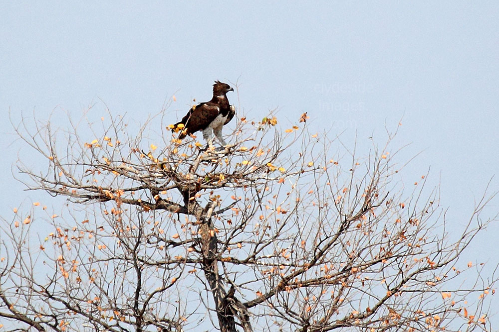
The section to the southeast of Halali is about the only place in the entire park where a road undulates considerably and opens up views, although places to stop are very limited. Apart from a few Giraffe, the only subject worth photographing was this eagle on its nest. A check on the internet revealed that apart from an occasional interesting sighting, most people don`t have much luck on either of theses routes, so time`s probably better spent staying close to the waterholes.
Nuamses
Situated close to the main Etosha Pan, adjacent to the south side of the main Okaukujo - Namutoni road, this waterhole is very scenic, especially in the late afternoon when the sun glistens off the vast sand-like backdrop. The Etosha Lookout is nearby, enabling visitors to scan the pan for birds which congregate in huge numbers if the rains have been good.

Nuamses is a Hai||om word meaning ‘black water’, a reference to the dark, deep sinkhole at this location which features a small reed bed, but the spring has failed over the past few years and remained dry throughout the winter months. Goas, is definitely more productive and is the area`s main draw for both animals and human visitors.
Goas
Although short, this name is a Hai||om word meaning: ‘The hooves of the game knock against the many stones in the area and then the animals come to drink‘. This extensive site is particularly scenic and has the potential of being one of the most productive wildlife viewing locations in the Park, especially during the winter months. The water supply from two artesian springs is maintained throughout the year and the level in the upper pool is constant regardless of the season. It overflows into the lower pool during the rains and the latter usually only runs out of water towards the end of October.

Herbivores often congregate here in large numbers, attracting birds of prey and predators including Leopard and Lion. It`s also a good place for water birds. An added bonus is that the access road winds round the two separate water sources, enabling alternative angles on the animals drinking at, or moving to and from the location, so it's possible to get decent shots here throughout the day.
|
The first time my wife and I visited Goas we arrived around midday when the light wasn`t particularly favourable, but this large Elephant was performing only a few metres away from the parking area at the top pool.
The following wide-angle shot of the bottom pool was taken from close to where the 4x4 is parked in these views, and looks back towards the elephant which is barely visible between the two tall trees right of centre. As can be seen, the light was poor from this position due to the time of day but during the dry season it improves at the bottom pool towards late afternoon. |
|
|

|

My attention was focused on this Hyena approaching the waterhole and it was only when I returned home and processed the Goas images on the computer that I noticed the lioness walking off in the background in the following shot. Click here for some additional images taken at Goas.
Noniams
Noniams takes its name from the Hai||om word for the shepherd’s bush, Boscia foetida, which grows nearby. This source here is a contact spring that only appears during the rainy season but as most animals prefer nearby Goas, which lies to the north, time is probably better spent there. Large herds of Black-faced Impala can often be seen in the area en route to Eland Drive or Rhino Drive and there`s always a chance of a close encounter with an elephant or giraffe. The shot below shows the Noniams site just a few weeks before the rainy season begins.
Ngobib
Ngobib is a Hai||om word that means `water diminishes` which is appropriate as the water availability here is unpredictable and usually disappears quickly after rains. The artesian spring is surrounded by Leadwood trees which keep their leaves for most of the year thanks to retention of underground moisture, making the site popular with giraffe although most of the plains game prefer to drink at Kalkheuwel, just 2 km away.
During our first visit to Etosha, we`d heard that a Leopard had been sighted the day before on the Ngobib loop trail and decided to make the detour just in case, even though we knew the chances of a repeated sighting were slim. Unsurprisingly, the leopard was nowhere to be seen, just this Hyena heading towards a few grazing Zebra while a Springbok kept a wary eye.
|
|
This area is very scenic and there were good views of various birds at the roadside including a Red-crested Korhaan and Crowned Lapwing.
|
|
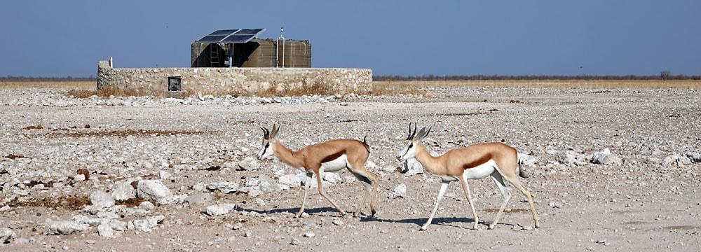
Springbokfontein
This waterhole’s name means `springbok fountain` in Afrikaans, a reference to the large herds of Springbok that often congregate here. The site is on the edge of an extensive tract of grassland, right next to the main road. The supply from two separate contact springs is good all year round and when the rains come this area tends to be one of the first to be transformed into lush pasture. The water level recedes considerably towards the end of the dry season when game has to wade through dark sticky mud to drink.
Pale Chanting Goshawks (above) are common throughout Namibia and are usually seen perched atop telegraph poles or solitary high trees. The birds eat a variety of prey including small mammals and birds, lizards and large insects. They sometimes hunt in social groups to maximise their chance of success.
Batia
|
Batia waterhole, which lies 2 km from the southern edge of the main salt pan, is named after Bernabe de la Bat, a biologist at the Park who, in the early 1950s, also served as Etosha`s first Chief Game Warden. The source here is a small natural seep which has been dammed to form a small pool, but this tends to dry up soon after the end of the rainy season.
The surrounding ground retains plenty of moisture though and this supports a large growth of juncus sedges which in turn attracts a good variety of animals. The Red Hartebeest pictured above were grazing on the grassland near the turn-off for the waterhole. |
|
The main Namutoni - Halali road looking west. The turn-off to Batia is on the left. Like most stone location markers within the Park this one instructs visitors to`STAY IN YOUR CAR` but the writing on many has faded, often due to animals rubbing themselves against the sides.
The edge of the main pan here often holds large numbers of herbivores, especially Wildebeest and Zebra.
I`ve checked out this location several times over the years but still haven`t seen any predators, just this Hyena on my last visit.
Okerfontein
‘Okerfontein’ is an Afrikaans name that means `ochre fountain`, a reference to the colour of the water at this site which lies on the edge of the main pan. This is the only waterhole between Springbokfontein and Kalkheuwel and is therefore well used. During the rainy season, the parking area at Okerfontein is a good place from which to view vast numbers of flamingo when the pan fills with water.
Kalkheuwel
The name Kalkheuwel means ‘limestone hill’ in Afrikaans. This is an artesian well, meaning a well that doesn’t require a pump as natural pressure forces the water to the surface. This one, however, has been augmented with a man-made borehole and solar pump.
Kalkheuwel is one of the best waterholes in the entire park for photographing wildlife as its twin pools lie very close to the parking area, the light is good throughout the day, and a Mopane forest makes a colourful backdrop. Plus, the location is within comfortable reach of both Namutoni and Halali restcamps.


Despite spending a few hours at Kalkheuwel on each of my visits to Etosha, it never lived up to its reputation with regard to predators (the site is often visited by lions and leopard) but I’ve often watched elephant herds and a good variety of bird and antelope species here.
In the panoramic shot below, taken in October 2018, the site appears totally dry although there was an ample supply at the top of the slope. The other two photos were taken in September 2013 when the pools held water but nowhere near their maximum. More images taken at Kalkheuwel can be found here.


The Chudop Triangle

This relatively compact area at the east end of the National Park comprises three of Etosha’s most productive waterholes, all of which can be comfortably reached during a drive from the Von Lindequist Gate or Namutoni. They are Kleine Namutoni, Koinachas and Chudop. This is prime Cheetah territory so even the plains very close to the restcamp can turn up a few gems, especially early morning.
In Africa some 7,500 Cheetah still live in the wild today and of these Namibia has the largest population. A conservative estimate puts the figure at around 3,000 of which 95% live outside protected areas, mainly on farmland. It's thought that less than 50 Cheetah live in Etosha with this total declining every year. They`re unable to compete with lions for prey and are particularly prone to the naturally occurring disease anthrax which is mainly contracted by eating infected prey.
Chudop

With a small reed bed at its centre Chudop waterhole, one of several within the territory of the large Namutoni Lion Pride, is particularly photogenic and it`s definitely worth checking if you`re in the eastern side of the park. As this waterhole is so close to Namutoni Rest Camp, some visitors like to spend the whole day there arriving just after sunrise and only leaving to reach their accommodation before the sun sets.
The word Chudob is Hai||om referring to the black mud found around the waterhole. The source is a natural spring within a large depression and although the water level is gradually receding availability is still good. Photographers can find the island of reeds in the centre a nuisance, partially because it may screen animals when they bend down to drink, particularly when the water level is low. As the parking area can get fairly congested, depending on where the subject is relative to available spaces, you may not be able to manoeuvre to get shots from the best angle.
Having said that, the surrounding area is clear of vegetation and wide open with views towards the distant tree-line which means you get plenty of warning if anything interesting is on approach. It's worth checking behind you regularly too as animals, including lions, often wander across the parking area, usually when your attention is elsewhere - not the place to have an arm dangling out of the car window!
|
|
Please bear in mind that all my images are subject to copyright. They are not free to use and have been embedded with a digital watermark.
Further information on Namibia and additional images taken there can be found on Clydeside Images.com. Utilise the blog`s search box or the `Overseas-Namibia` fly-out label on the right-hand side of the blog page. Please bear in mind that my Stock Photography Archive has even more shots taken in Namibia. If you wish to purchase any image(s) please email using the Contact Form and I will respond at the earliest opportunity.

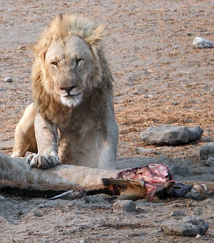
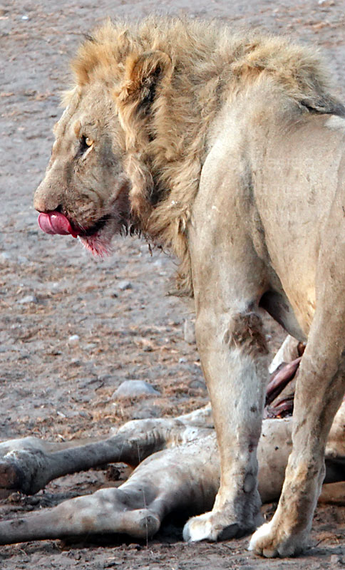
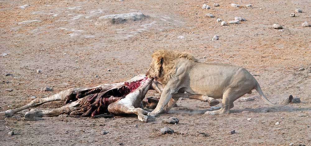
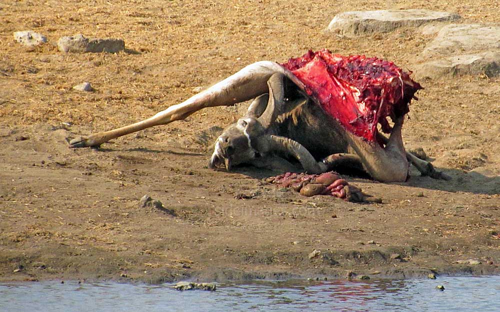
One morning my wife and I arrived at the car park to find two male Lions relaxing on the far side of the waterhole after a hearty breakfast, while at the same time effectively blocking access for the other animals that were desperate for a drink. The grisly remains of their prey, a large Kudu with its eyes staring vacantly into space and its viscera lying alongside, was a testament to not only the lions` power, but also their appetite. Leopard also visit Chudop. More notes on this location and images taken over several visits can be viewed here.
|

|
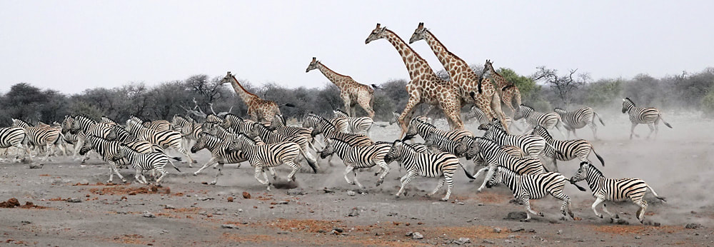
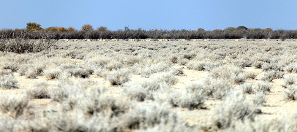
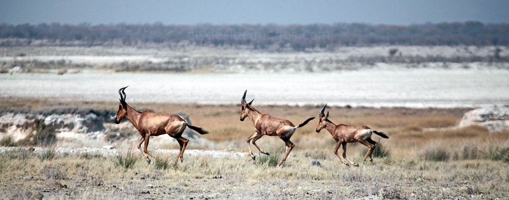
The impressive stampede turned out to be the result of a false alarm!
|
|
Klein Namutoni
This waterhole`s name is Afrikaans for ‘small Namutoni’, a comparison between this site and the larger King Nehale waterhole at nearby Namutoni Restcamp. The artesian spring here forms a large vegetation-free lake which is very popular with the local animal population, particularly elephants and giraffe, and being so close to the Park’s Von Lindequist Gate, it can get busy with human visitors too. It is often the first stop with people on their way in, or briefly checked when en route to exit the park before the gate closes at sundown. Many more shots taken here during numerous visits and additional background information can be found here.
Dik-Dik Drive
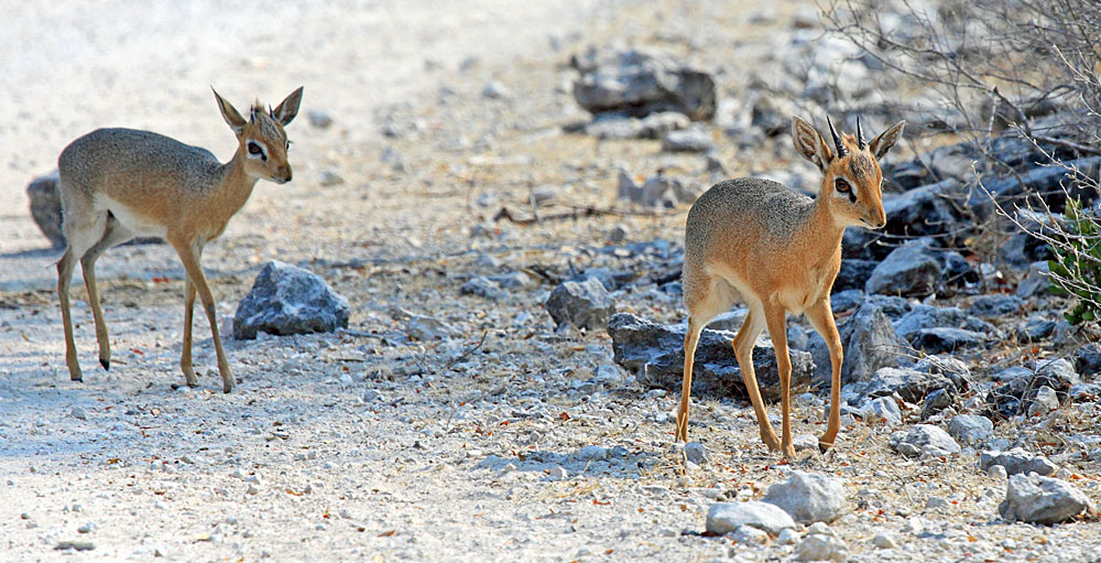
The aptly named Dik-Dik Drive, accessed from the Klein Namutoni waterhole, is one of the best places in the park to see the diminutive Damara Dik-Dik, Namibia`s smallest antelope species. These beautiful little animals are common in Etosha and so frail looking that it`s a wonder that they can survive at all in such a predator-rich environment. They favour habitats that provide cover such as mixed scrub and grassland, primarily relying on camouflage for protection, however, they will quite happily pose for a photo or wander past cars that have pulled in at the roadside.
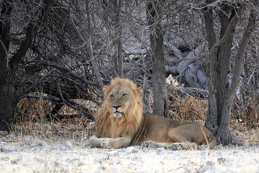
|
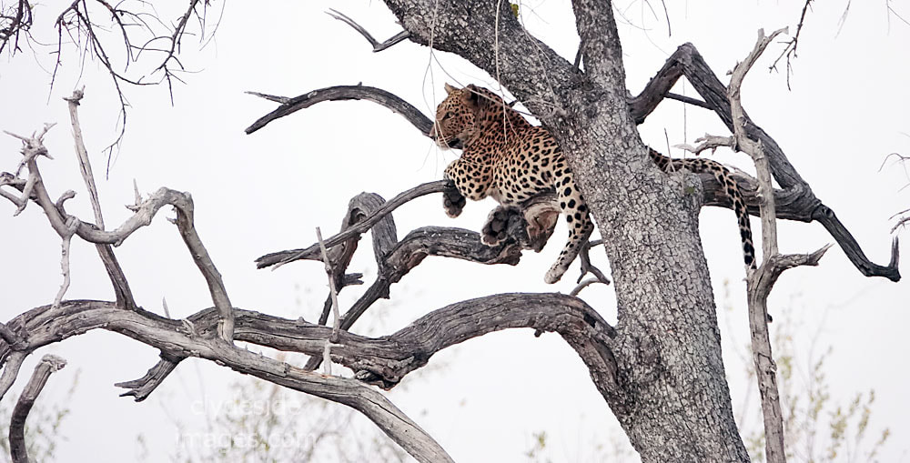
|
Two of the local residents chill-out between meals.
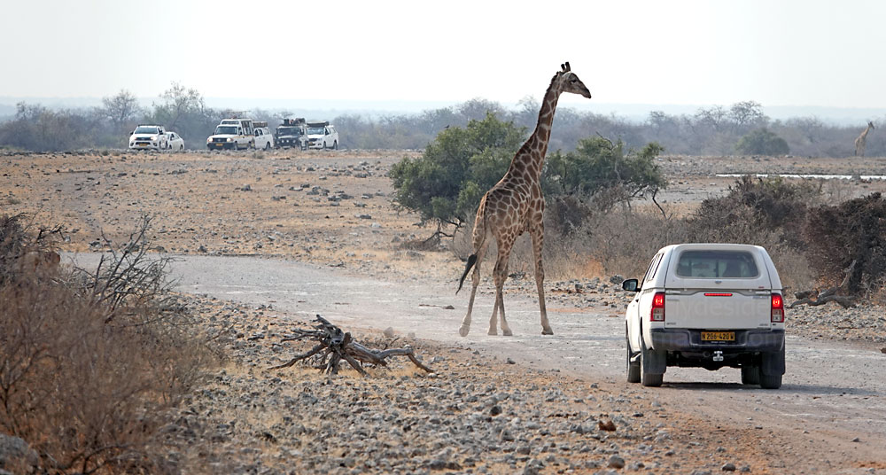
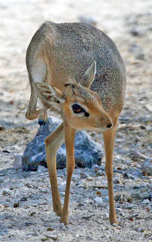
|
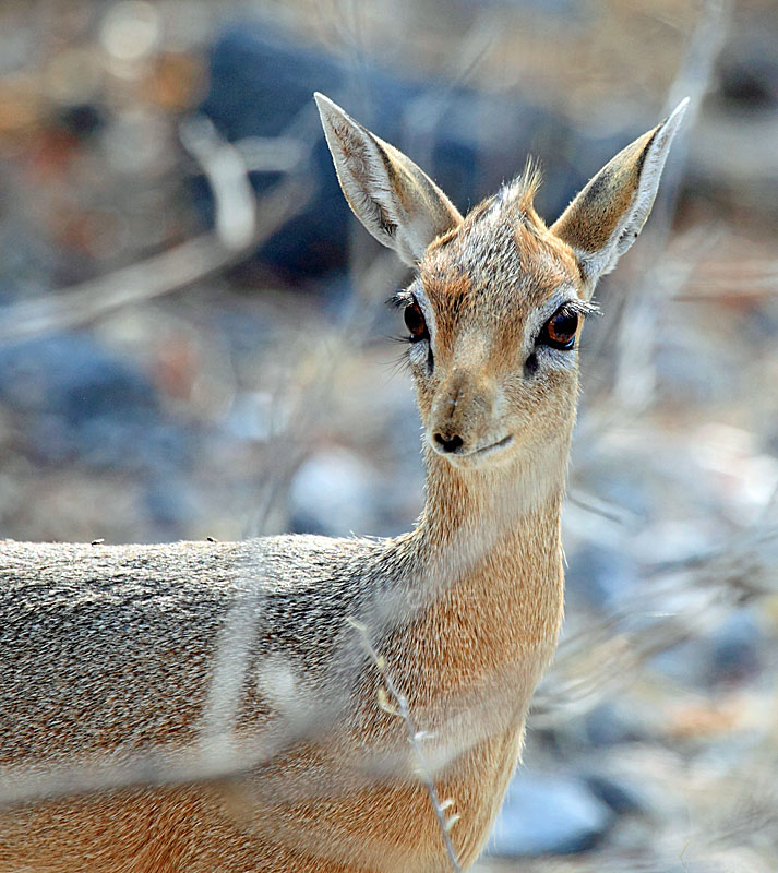
|
Koinachas
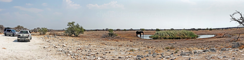
Koinachas is a Hai||om word meaning ‘strong bulrushes’, a reference to the extensive clump of rushes (Typha capensis) forming an islet in the middle of this artesian spring. The local game seem to favour this site over the King Nehale waterhole at nearby Namutoni Restcamp, especially during the hours of darkness, probably due to the lack of human disturbance.
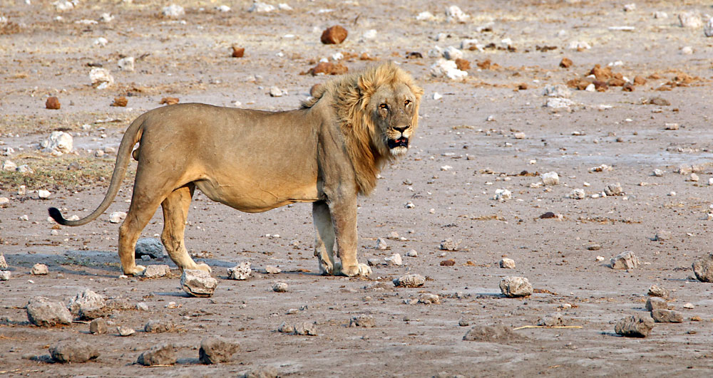
|
My most memorable encounter here was in October 2018 when a pride of lions, including six cubs, had settled down for the day.
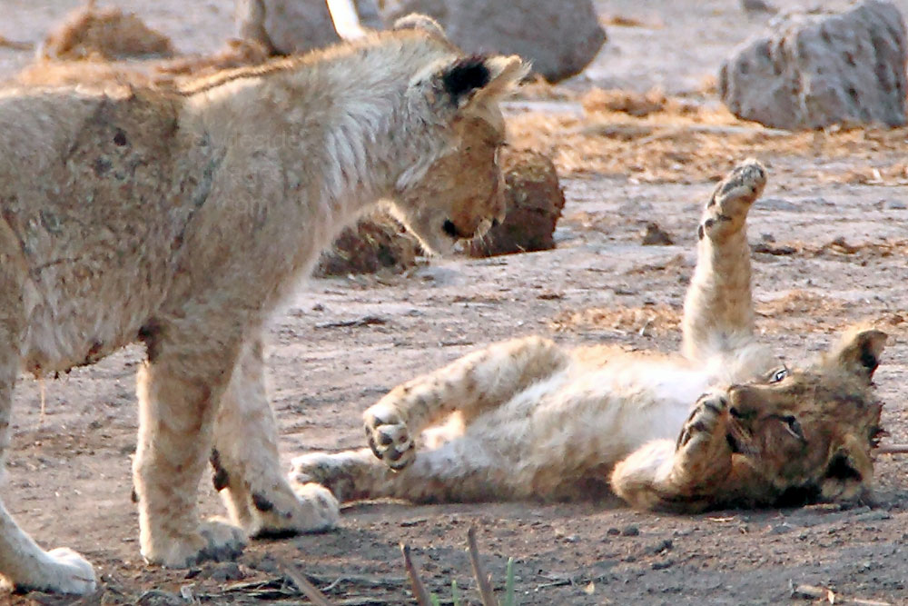
More shots and further details on Koinachas waterhole can be found on a separate page: Click here to view.
|
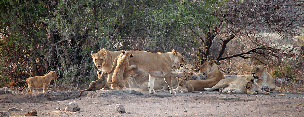
Namutoni Rest Camp (King Nehale Waterhole)
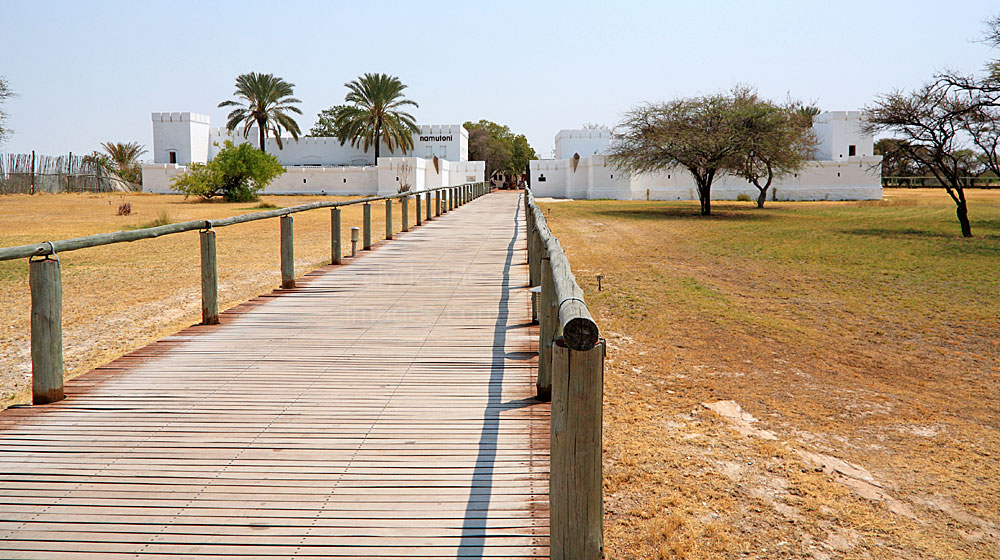
|
Namutoni is an Oshindonga word meaning ‘elevated place’ and the restcamp, with its striking ‘Beau Geste‘ style whitewashed fort, is situated between the southeast corner of the main Etosha salt pan and the southwestern end of the much smaller Fischer`s Pan. Approximately 10 km to the east of the rest camp is the Von Lindequist Gate, one of the Park’s main access points.
The King Nehale waterhole, located within Namutoni restcamp, is named after the leader of the 500 Ndonga warriors that attacked the outpost in 1904. The first German army garrison here was established in the 1890’s because of the copious water supply and open views that were possible across vast tracts of terrain. The original German fort fell into disrepair in the 1930s and during the 1950s new accommodation was built at Namutoni to resemble the original complex. |
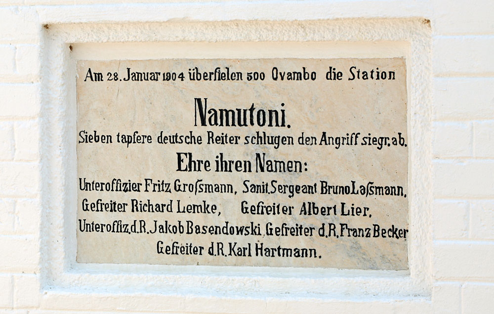
|
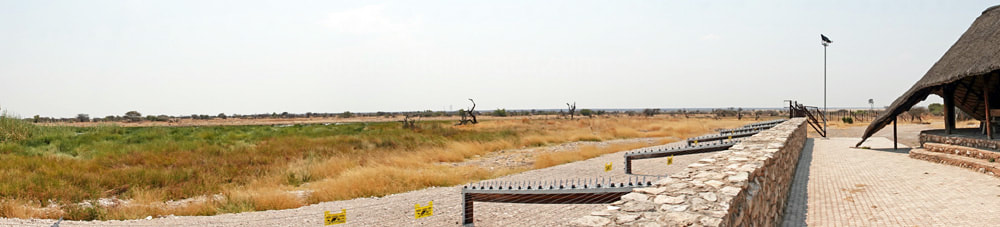
Thanks to the fort, Namutoni is the most scenic of the National Park’s restcamps, but the onsite waterhole is poorly sited and offers only limited photographic opportunities. It`s overlooked by a thatched open-air viewing area with several rows of banked seating, but the deck’s modest height means that smaller subjects are often screened by the extensive reed bed, and in any case the source, an artesian spring, is almost 200 metres away. The site isn’t particularly popular with animals either as most seem to prefer drinking at Kleine Namutoni, Koinachas or Chudop, which are all fairly close by.
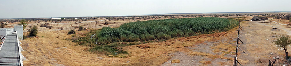
The best time to shoot from the viewing deck is early morning when the sun is directly behind you, otherwise you’re looking straight into the light. Currently there`s no public access to the fort’s ramparts and there hasn't been for many years, but visitors can climb to the top of one of the towers for an elevated view of the location, especially worth doing around sunset. Some interesting silhouettes can also be had from the viewing area around this time, especially if Giraffe or Elephants are present, or even huge flocks of Red-billed Quelias.
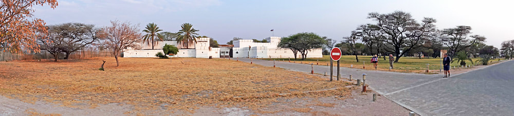
Although Namutoni Restcamp’s waterhole doesn`t have a great reputation for animal sightings, anyone staying there could direct their attention towards the resident bird species or the Banded-Mongeese that live under the swimming pool decking and roam the camp by day. During the hours of darkness, owls are active here, although difficult to photograph, but the fort itself makes an ideal subject for night photography.
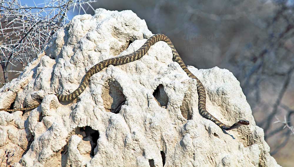
Namutoni is reputedly an excellent place for snakes, with African Rock Python sometimes targeting the doves and smaller birds when they land to take a sip. I never saw any snakes at Namutoni during several brief visits, but this guy, which I`m pretty sure is a Western Barred Spitting Cobra (a.k.a. Zebra Cobra) was basking on a roadside termite mound very close to the rest camp. These reptiles which actively hunt for for prey including rodents, birds, lizards and other snakes, are mainly nocturnal. When provoked they will spread a dark hood and spit their venom. Zebra snakes have a potent cytotoxic (cell tissue destroying) venom which causes intense pain, swelling and necrosis. Tissue destruction starts taking place as soon as the venom is injected, and because of the long distances in Namibia, the victim will probably arrive too late for the antivenom to be of any use.
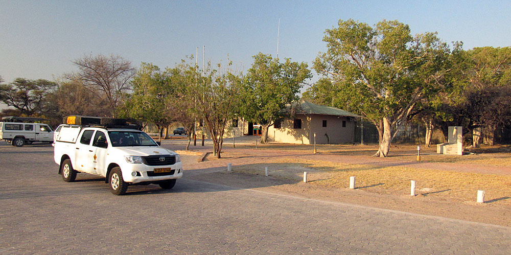
|
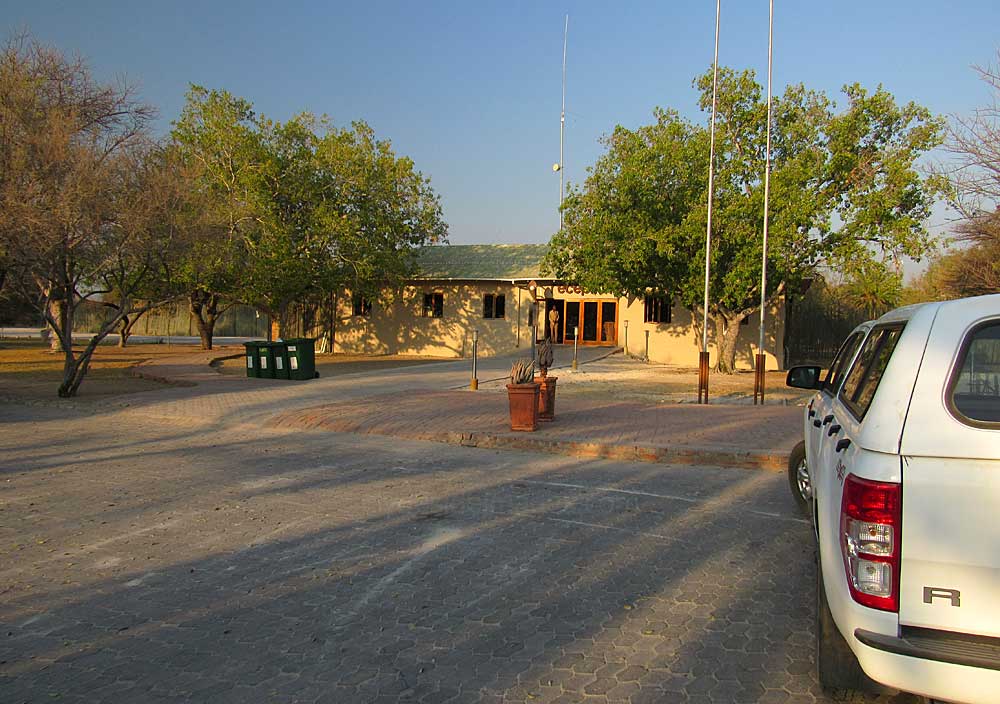
|
The Admin block at Namutoni is where you purchase your permit. More shots of the camp and its waterhole can be found here.
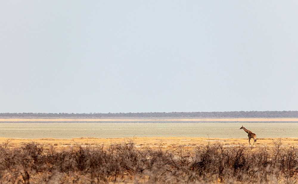
The main road, roughly following the south edge of the Etosha Pan, heads west from Namutoni to Okaukuejo, with Halali situated roughly midway between the two making a convenient lunch stop. A causeway close to Namutoni initially carries the Andoni road northwards to the Nehale Lya Mpingana Gate at the National Park`s northeast corner. This is also the route taken to reach the exclusive Onkoshi Rest Camp which only guests who have pre-booked accommodation can visit.
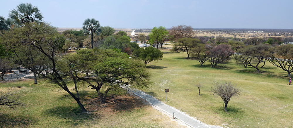
Above: This view looks eastwards from the top of the Namutoni Fort. The road that runs round Fischer`s Pan can be seen disappearing into the distance in the centre of the photograph. The section visible is on the south side of the pan and if an anti-clockwise circuit is made it initially leads to Twee Palms Waterhole (see below).
Fischer`s Pan
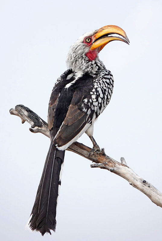
|
Although not a waterhole, Fischer`s Pan, separated from the Etosha Pan by a causeway, becomes one of the park`s prime birdwatching locations as soon as the rains come. This pan is named after Lieutenant Adolf Fischer who was stationed at Namutoni during the 1880’s.
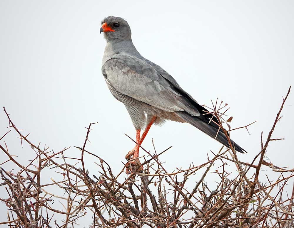
The dry lake bed completely fills in exceptionally good years, acting as a magnet for vast numbers of flamingos and other wetland species. Although there`s far less avian activity here during the dry season, (usually May-November) it`s worth taking the road that runs very close to the pan`s edge to try and spot game. This route takes in the Aroe and Twee Palms waterholes, prime cheetah territory, but much of this circuit is only suitable for 4-wheel drive vehicles.
|
Twee Palms
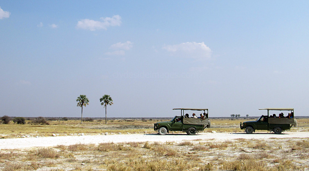
`Twee Palms` is an Afrikaans name that means `Two Palms`and here is a reference to the two Makalani Fan palms growing beside the waterhole which is situated on Fischer Pan's south side. Even on those relatively rare occasions when the pan is full of water, a good variety of animals visit. This is a very scenic location, especially in the rainy season when the vegetation is lush and landscape comparatively dust-free. Landscape shots taken late in the day as the sun begins to set can be spectacular.

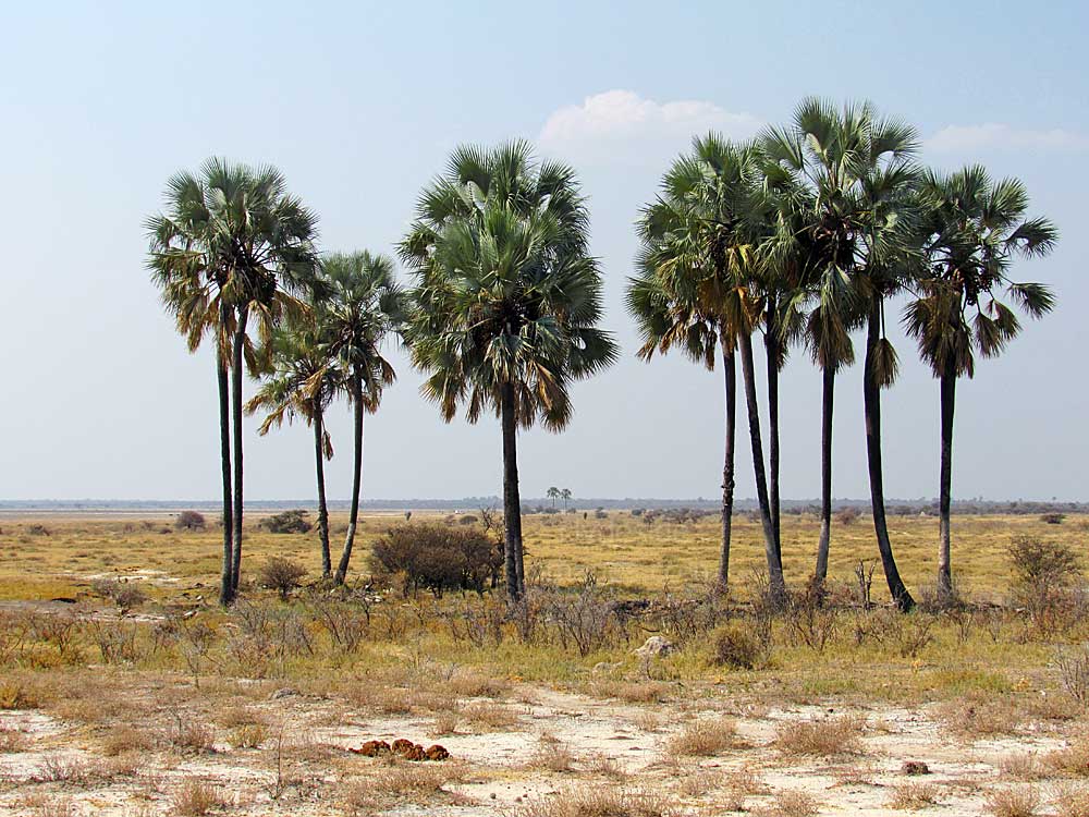
|
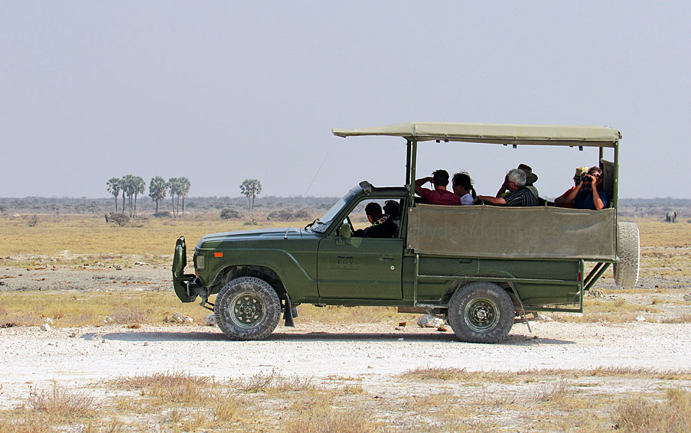
|
The first time my wife and I drove into the parking area here the occupants of a couple safari trucks and their guides were scanning the terrain through binoculars. We had a quick squint, but seeing nothing obvious, continued along the route. Later, back at our accommodation, we discovered that everyone had actually been watching a Cheetah sheltering in the shade of the trees - it pays to ask people already staking-out a location if they've spotted anything of interest. Often the animals are so well camouflaged that it's only when they move or someone points them out that you realise that they're there.
The following morning, we made an early start, setting off from Mushara Outpost around dawn for the 145km drive to Okaukuejo, our base for the next two nights. Following advice from the guide at Mushara we drove straight to Twee Palms to find a couple of cars already there, snapping away at a female Cheetah tucking-in to an animal that she had just brought down quite close to the road.
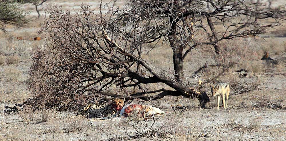
It wasn't long before the jackals homed in but they wisely kept a safe distance.
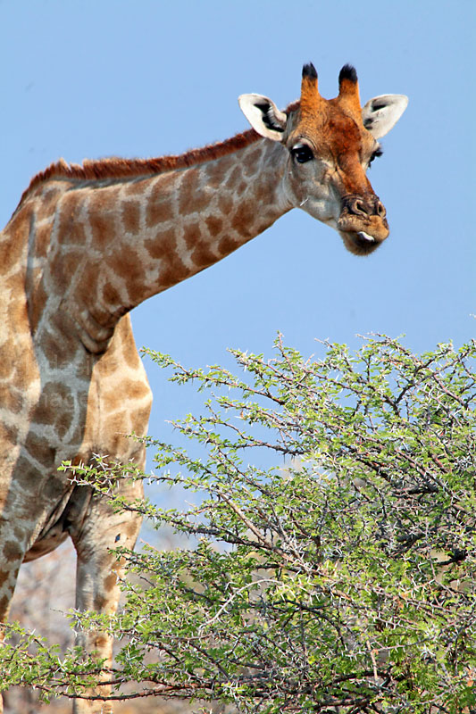
|
|
|
Aroe
|
Aroe is the Hai||om word for the Worm-cure bush (albizia anthelmintica), a shrub of the mimosa sub-family that occurs in the vicinity. It`s often used by African sheep or cattle farmers to treat livestock against internal parasites.
The waterhole at Aroe, on the edge of Fischer’s Pan, was originally a natural dry meandering watercourse that filled during the rainy season but it has since been supplemented by a solar pump to make it available all-year round. It is popular with elephant that cannot find water in the sandy country to the north. I never saw much here last time I drove past but the circuit round Fischer`s Pan is worth taking for the panoramic views and there`s always a chance of coming across something of interest including. |
|
Even in the dry season, birds such as this Kori Bustard are possible - I snapped this guy beside the road close to Aroe. The male of the species is the world's heaviest bird capable of flight and although they are reluctant to take to the air unless threatened, we did see a couple fly.
A Pale-chanting Goshawk perched on a dry shrub near the causeway surveys its domain.
Soon after leaving the causeway behind as you head north from Namutoni on the Andoni road, you reach the first pair of waterholes - Kleine and Groot Okevi, both of which lie very close to the main road. Just south of the first one, Kleine Okevi, there is a turnoff for a detour loop road (above) which is well-worth taking. I`ve had some excellent game sightings here and a close encounter with a large herd of elephants that appeared from the trees and crossed on either side of our stationary car. It`s supposed to be a good place for Leopard but I didn`t see any, or for that matter any other big cats in the vicinity.
Kleine Okevi & Groot Okevi
These two waterholes lie very close to one another to the west of the Namutoni - King Nehale Gate road. This main road is also the way to the exclusive Onkoshi Rest Camp which only guests who have pre-booked accommodation can visit. Almost immediately after leaving the fort at Namutoni, the route north becomes a causeway across the point where the mouth of Fischer`s Pan joins the east side of the main Etosha Pan. A detour road on the edge of the latter circles the area containing the Okevi waterholes and offers panoramic views of the seemingly endless wastes. Leopards are sometimes seen along this stretch and individual animals may be seen occasionally slaking their thirst at either water source.
Okevi is an Oshindonga word that means `from under the rocks`while ‘Klein’ and `Groot` are Afrikaans for ‘small’ and `large.` I don`t have any shots of Kleine Okevi, which is nearest Namutoni. Supposedly many of the animals grazing around Fischer’s Pan, including Elephant, visit Kleine Okevi to drink so I may have just been unlucky with my timing. These giants often approach the water through the parking area which makes for some hair raising encounters as they come alarmingly close to vehicles! There have also been sightings of the elusive Honey Badger and African Wildcat here. During the rainy season, vegetation grows right up to the water’s edge and the source quadruples in size.
Okevi is an Oshindonga word that means `from under the rocks`while ‘Klein’ and `Groot` are Afrikaans for ‘small’ and `large.` I don`t have any shots of Kleine Okevi, which is nearest Namutoni. Supposedly many of the animals grazing around Fischer’s Pan, including Elephant, visit Kleine Okevi to drink so I may have just been unlucky with my timing. These giants often approach the water through the parking area which makes for some hair raising encounters as they come alarmingly close to vehicles! There have also been sightings of the elusive Honey Badger and African Wildcat here. During the rainy season, vegetation grows right up to the water’s edge and the source quadruples in size.

Although Groot Okevi (above), lies in a scenic woodland setting, I never saw any animals here during two separate visits although there were plenty in the area. On the way to this waterhole, you will pass a stand of trumpet thorn, Catophractes alexandri, an interesting blue-grey bush which has white tubular flowers and seed pods that make a rattling noise. This is far quieter than its smaller cousin with Kudu and Giraffe being the most likely species. There are usually a few birds around though and if you stay for long enough you should be able to spot Black-cheecked waxbills, Red-headed Finch and Green-winged Pytilia. This is also a good area for rollers and bee-eaters in the wet season.
|

|
|
Giraffes feed on shrubs, grass and fruit and obtain calcium and protein from twigs and small tree branches. An adult will eat around 34 kg (75 lb) of foliage each day. Although Giraffes are herbivores they will sometimes visit carcasses of dead animals and chew or lick the bones to extract minerals. This guy, photographed near Klein Okevi, apparently didn`t think much of this bone`s taste and decided to stick to a more traditional, readily accessible lunchtime snack!
Tsumcor
Tsumcor waterhole is named after the Tsumeb Corporation, a company that donated the original windmill for this borehole, which consists of a large trough supplied by a solar pump. The sandy terrain here means the location is unable to retain water during the rainy season, so the man-made source is well-used year round. The woodland surrounding the waterhole has been slowly thinned and opened up by elephants as they browse, making Tsumcor popular with photographers. Light can prove problematic, however, when the sun is shining, depending on the time of day.
On our first visit to Etosha, a detour was made to the Tsumcor waterhole one afternoon when we learnt from a guide that lions had been spotted there. These two lionesses sat for a while before joining a third lazing in the tree-line. Various species of animal wisely kept a respectable distance - apart from this Giraffe!
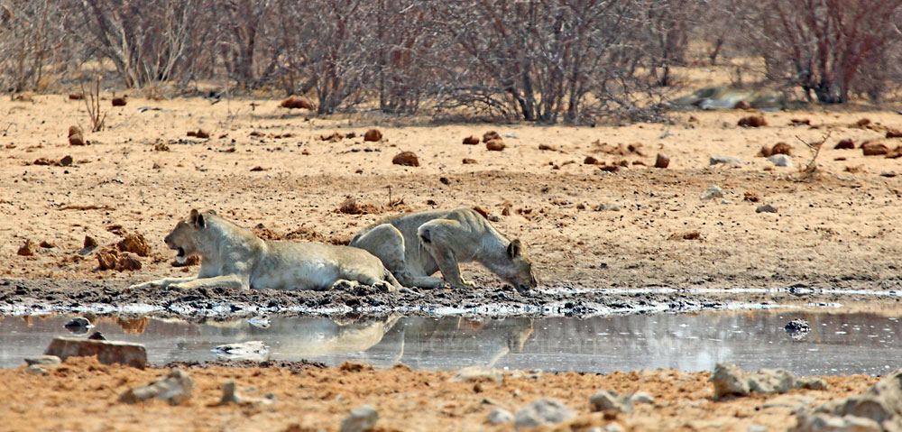
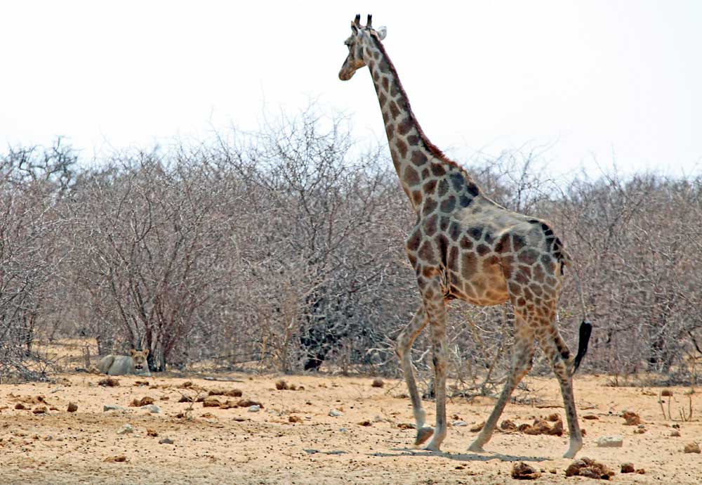
|
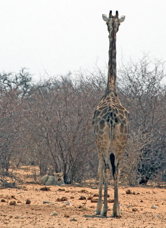
|
Although she didn`t approach the waterhole, she wandered right over to the lioness relaxing in the shade and stood, staring at it for a while, apparently totally unaware of the risk she was taking. The lioness, well within pouncing range, licked her lips a few times but didn`t make a move. Either she`d already eaten, or it was just too hot. Either way, curiosity didn`t kill the Giraffe on this occasion.
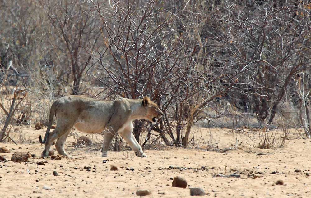
Once the pair of lionesses had vacated the water`s edge, Eland, Oryx, Zebra and a Kori Bustard all considered it safe enough to approach for a drink.

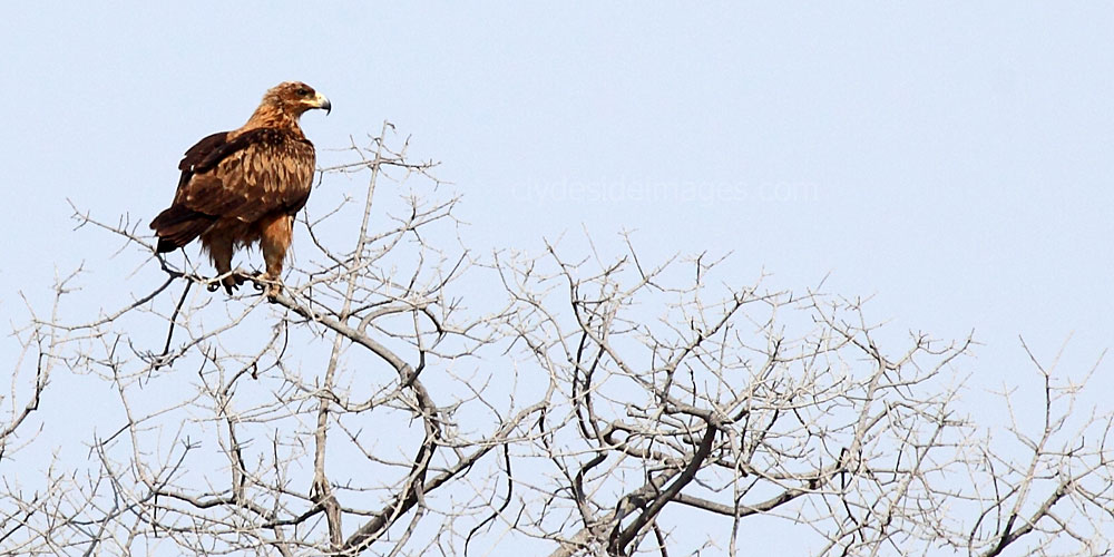
|
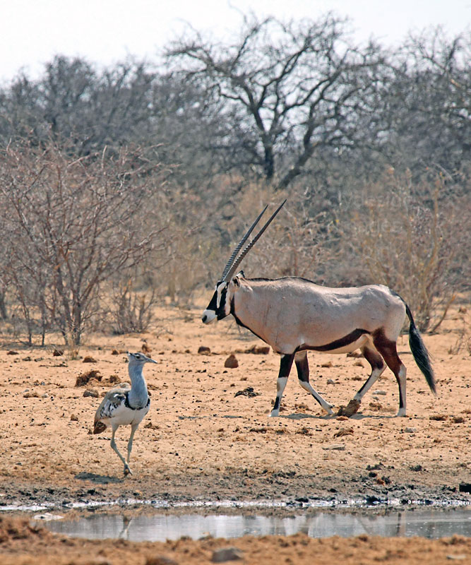
|
This powerful looking raptor, which I think is a Wahlberg`s Eagle, was surveying the scene. When my wife and I returned to Tsumcor on our next holiday two years later, there wasn`t much activity, just some Zebra and antelope, so I never took any shots, which would have been straight into the sun anyway. This was the last time I visited this waterhole, electing not to make the detour on my last trip in October 2018.
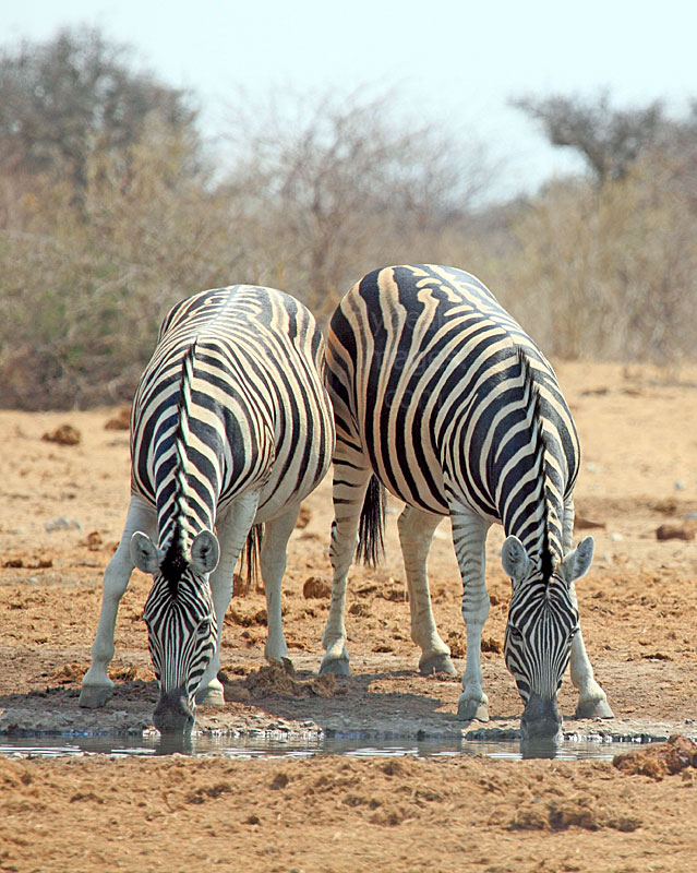
|
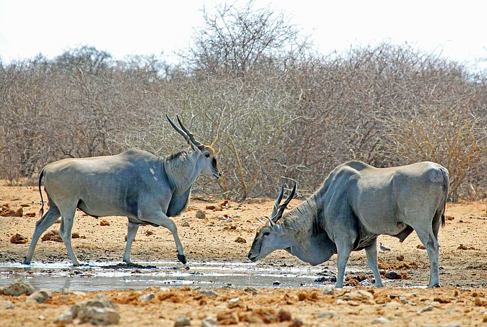
|
Stinkwater
The last two waterholes are situated at the north eastern corner of the National Park and can be accessed directly via the Nehale Lya Mpingana Gate, or from Namutoni Rest Camp to the south. I`ve only ventured as far as Tsumcor so haven`t any images and from what I can remember, the southern section of the main road was badly potholed.
“Stinkwater” , surprise, surprise, is an Afrikaans name that means `stink water` and this source does indeed have a whiffy odour, due to its high sulphur content. This waterhole comprises a series of mud hole seeps which only appear during the rainy season, and being on the edge of the main Pan and next to the road, game viewing can be excellent. Elephant and warthog often take their mud baths in the seeps and various antelope species, especially Gemsbok, and Zebra enjoy grazing on the surrounding grassland.
“Stinkwater” , surprise, surprise, is an Afrikaans name that means `stink water` and this source does indeed have a whiffy odour, due to its high sulphur content. This waterhole comprises a series of mud hole seeps which only appear during the rainy season, and being on the edge of the main Pan and next to the road, game viewing can be excellent. Elephant and warthog often take their mud baths in the seeps and various antelope species, especially Gemsbok, and Zebra enjoy grazing on the surrounding grassland.
Andoni
This waterhole, situated just inside the Nehale Lya Mpingana Gate, is named after the surrounding Andoni Plains, which in turn is thought to be an Owambo corruption of the family name Anton. The source is an artificial borehole created by a mining company while searching for minerals in 1923 but it was subsequently found to be an endemic source of Anthrax and was welded shut in the 1970’s. Over time the high pressure and saline water has caused the casing to corrode and the water once again flows freely all year-round. Blue Cranes are often seen in this area and it`s one of the few places in the park where they can be spotted during the dry season.