Erskine, Bishopton and Inchinnan Community Website
Walks
This is the first in what will hopefully be a series of suggested walks illustrating what Erskine, Inchinnan and Bishopton have to offer for anyone seeking some local outdoor action, irrespective of their age, interests and physical ability. This page has been compiled and hosted on www.clydesideimages.co.uk specifically for the EBI Community Website. Please note that all images belong to the Photographer Brian Moyes unless otherwise stated and all are subject to copyright. They have been embedded with a digital watermark.
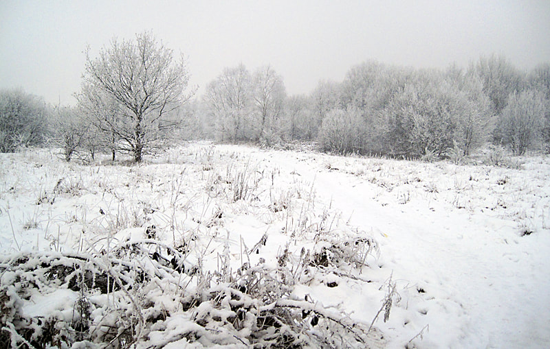
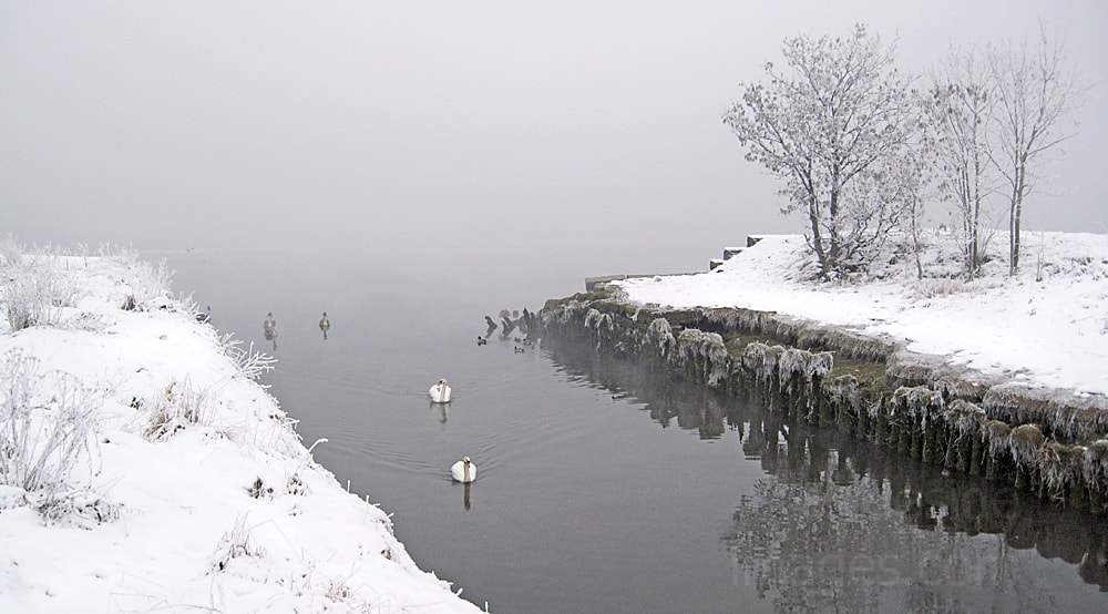
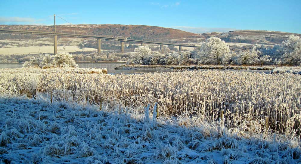
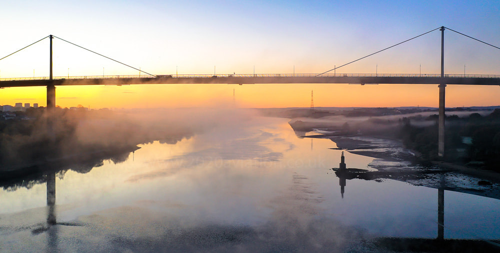
The Renfrewshire communities of Erskine, Inchinnan and Bishopton lie within superb countryside which creates endless opportunities for a diverse range of outdoor activities. Seasonal transformations can often be dramatic, especially after a heavy fall of snow, which admittedly is becoming rarer these days, or if you venture onto the nearby hills above a sea of mist, only to find clear blue skies above. Whether your interests lie in local history, wildlife or watching the ships sailing up and down the river, all can be combined with enjoying our outdoor spaces. An added advantage is that with the Erskine Bridge within easy reach of all three communities, they also make ideal starting points for exploring the north side of the Clyde, whether on foot or by bike.
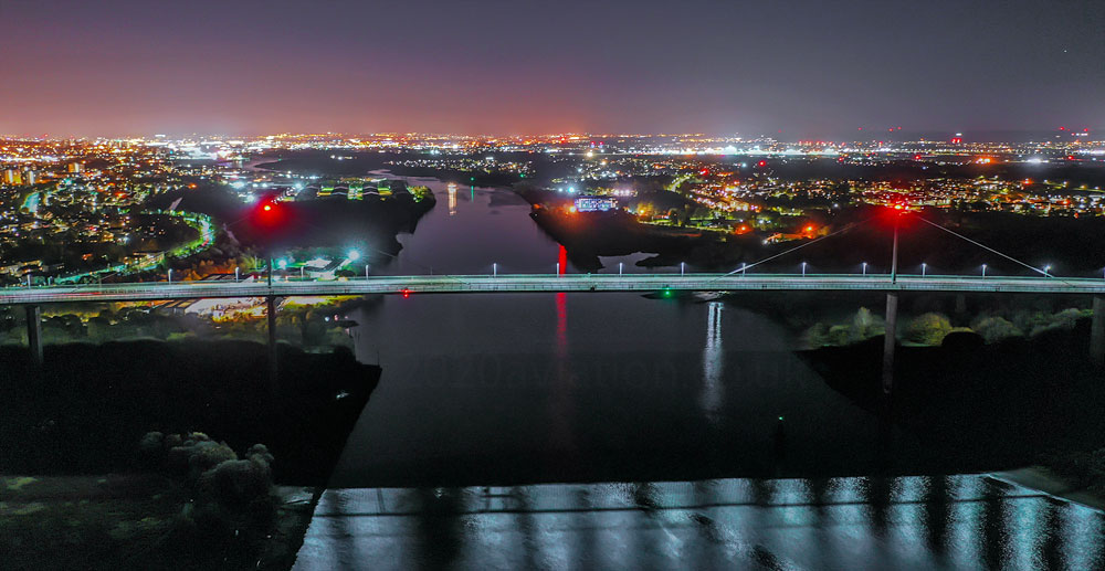
Steve Moyes of © 2020 aviation has kindly supplied a number of images for use in this feature including this spectacular view of the Erskine Bridge at night. Local photographer John McSporran has also contributed by providing the ebi.scot header image. Check out their respective websites via the foregoing links to see more of their superb photography.
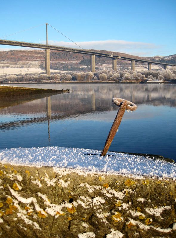
A Walk along the Banks of the Clyde at Erskine
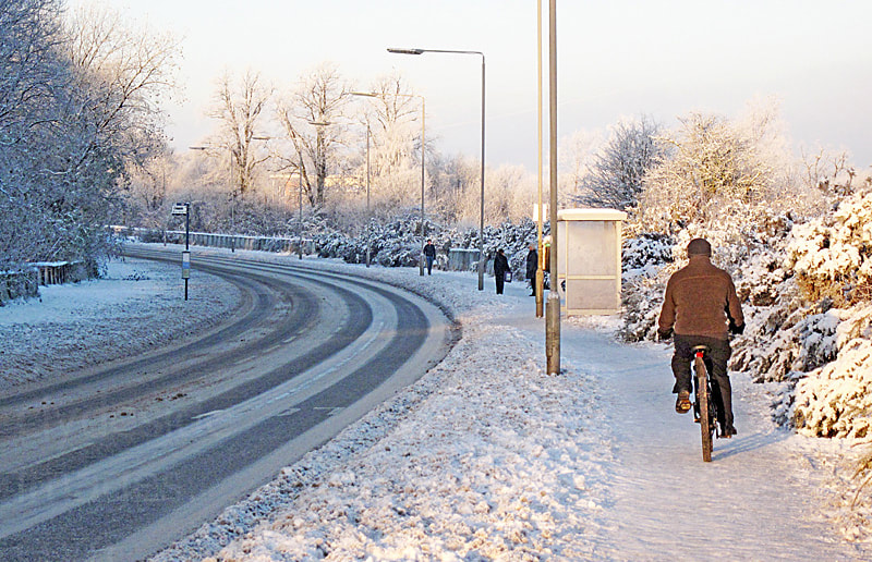
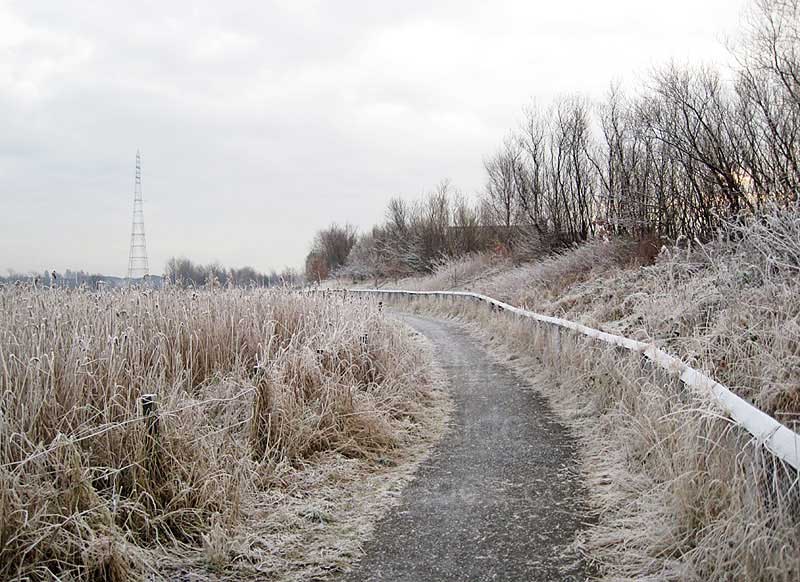
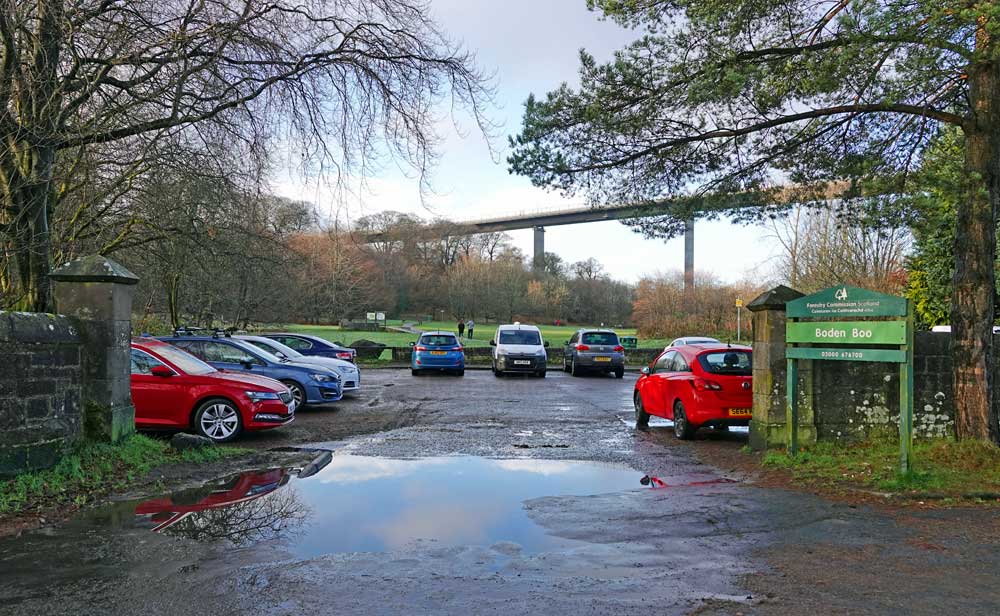
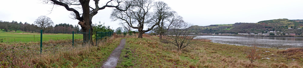
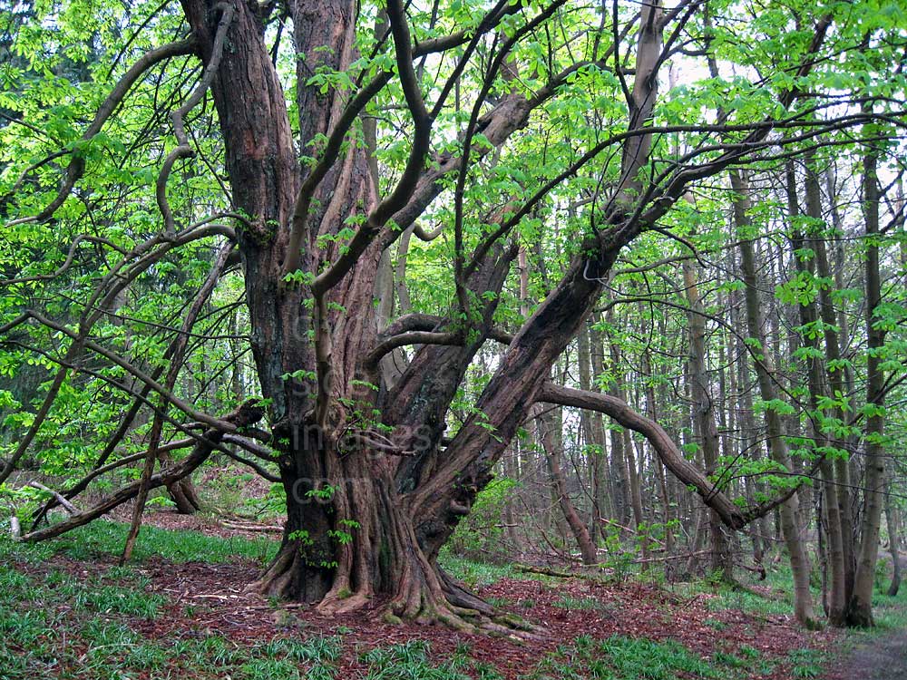
A fabulous way to get a bit of exercise whatever the time of year is to take a stroll along Erskine`s Riverside Walkway between the Newshot Island Local Nature Reserve and the Boden Boo Community Woodland. The walk can easily be extended to explore the wider area which has a wealth of natural, scenic and historical points of interest.
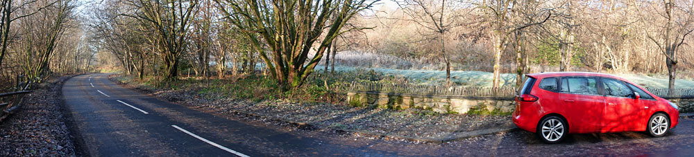
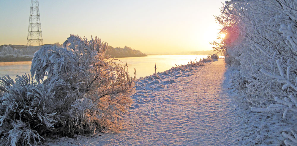
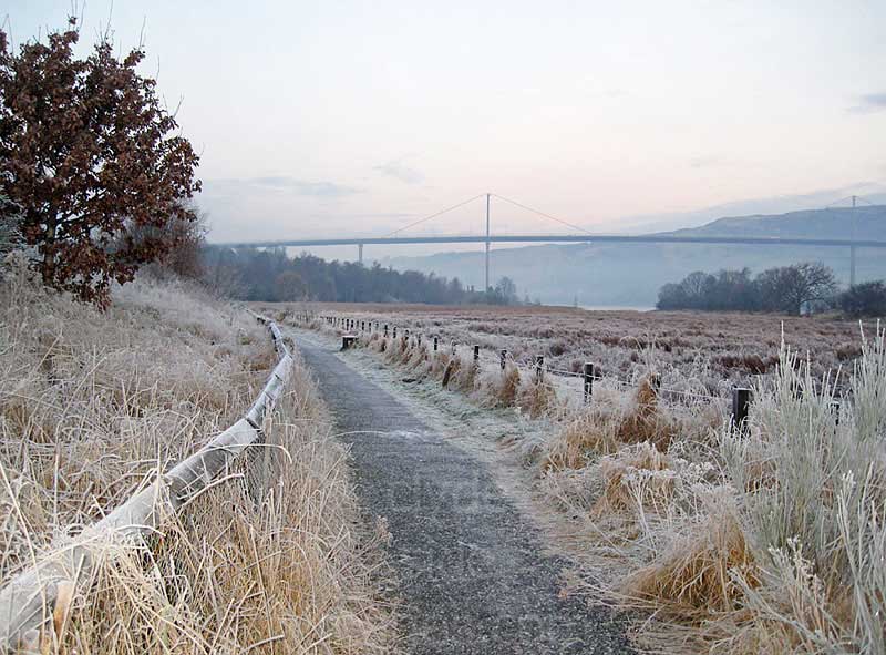
The area covered here is described as an elongated circular walk, taken from east to west, but it is of course, just as enjoyable if tackled in the opposite direction. The Riverside Walkway at Erskine is a valuable asset for locals and visitors alike, and is consequently extremely popular. Rather than walk this stretch of riverbank in its entirety, many people are content to settle on enjoying a short stroll, often with their dogs in tow (or being towed by their dogs!). The route is very easy to access and for anyone driving here there are several purpose built car parks, while more spaces can be found nearby at the Bridgewater and Bargarran shopping centres. There is also plenty of on-street parking available. The Riverside Walkway links with the Clyde Coastal Path (CCP), a delightful mixture of seascapes, town, farmland, and open moorland, at the Erskine Bridge. This 35 mile-long (56 km) route runs between the Kelly Burn near Wemyss Bay and Milngavie, the official starting point for the world famous West Highland Way, Scotland's first officially designated Long Distance Walking Route. The `Way, which opened in 1980, leads north from Milngavie through some spectacular terrain to reach Fort William on Scotland`s west coast, 96 miles (154 km) later.
Newshot Island
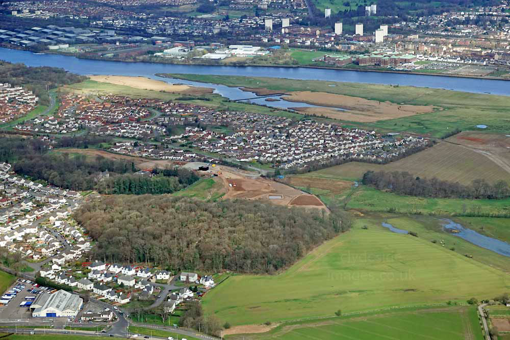
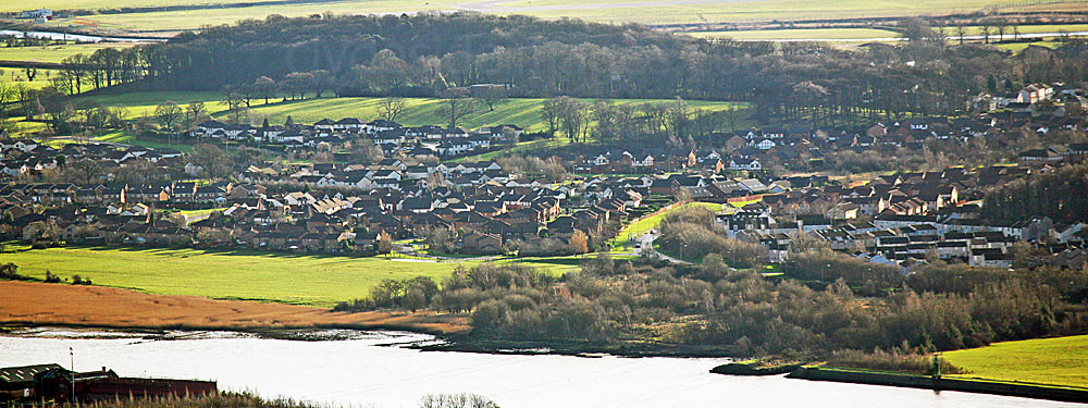
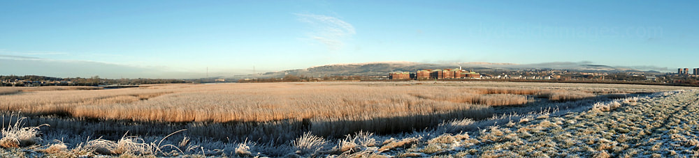
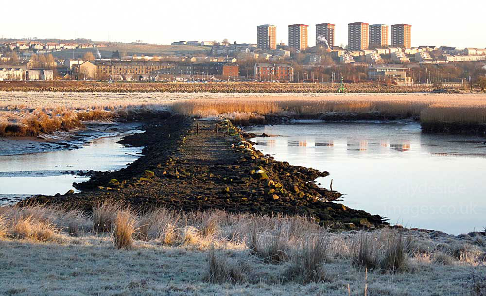
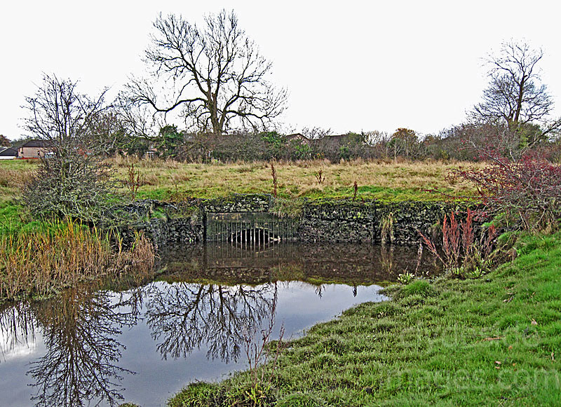
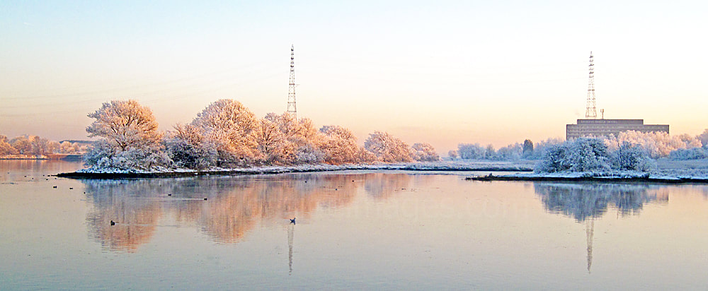
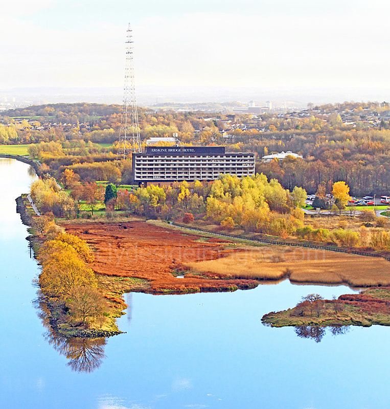
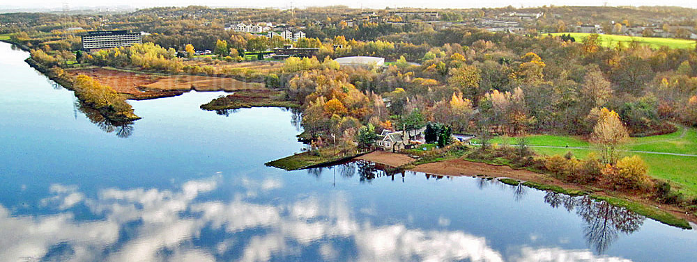
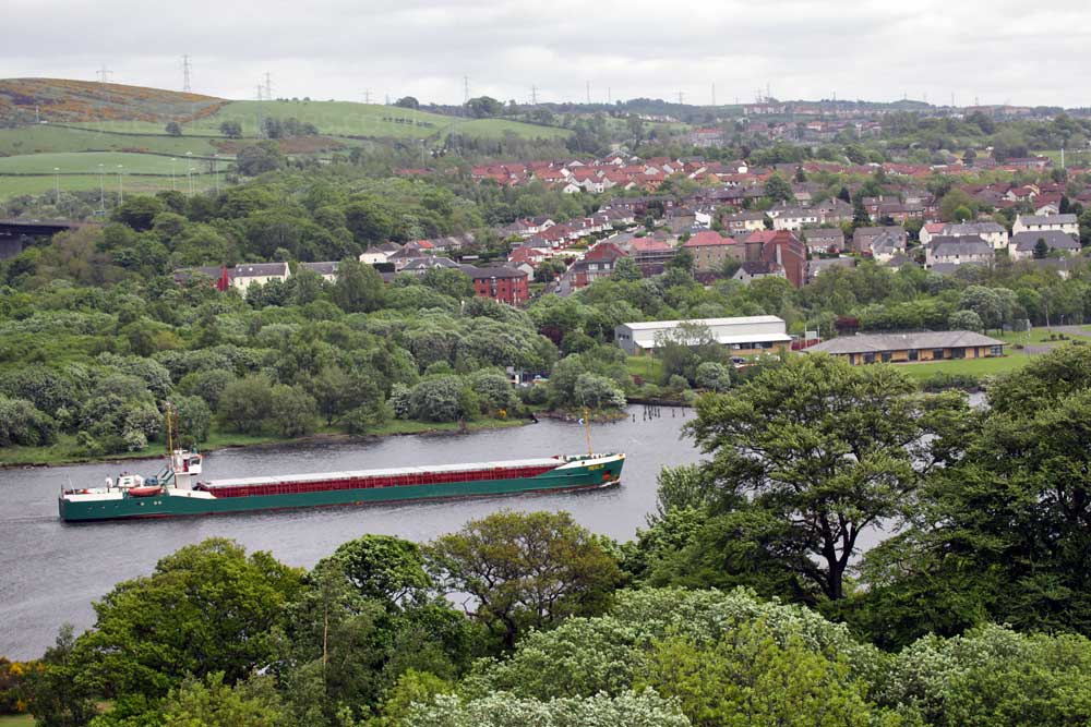
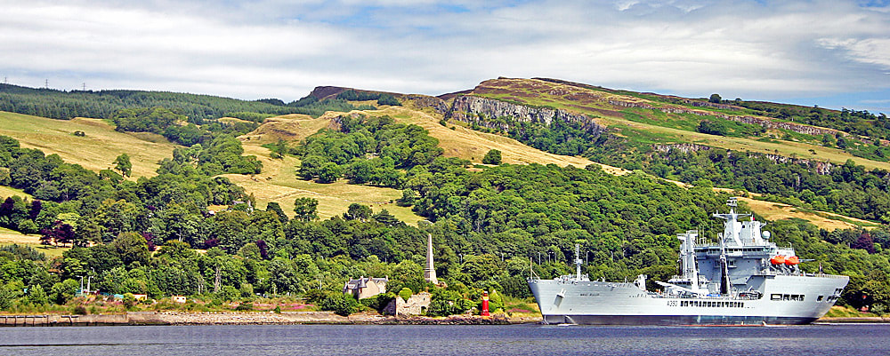
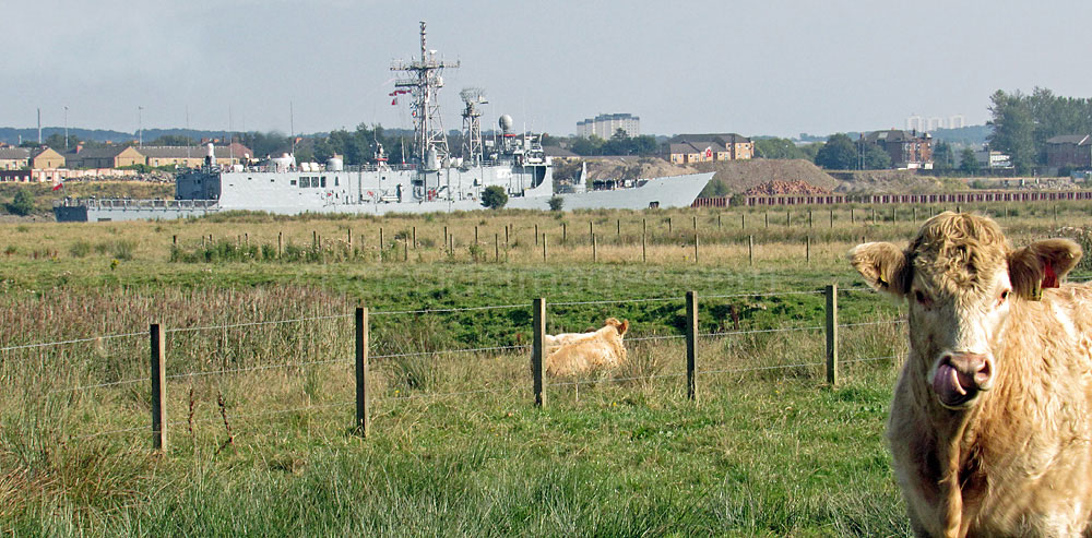
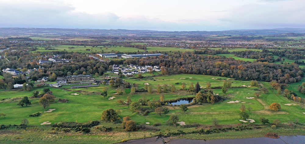
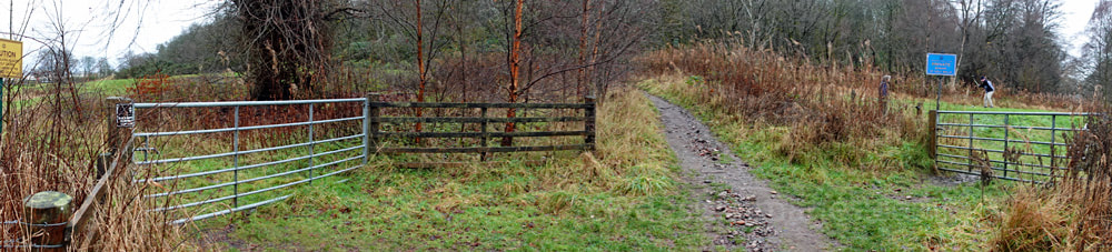
Included in the above view are part of Inchinnan village with McGill`s bus garage, bottom left, and the Garnieland area of Erskine in the centre with Newshot Island beyond. The weir forming a lagoon at the east end of the reed bed is clearly visible. The wooded Newshot Island Local Nature Reserve (LNR) is top left. Access to Newshot Island itself, which has no recognisable trails, is discouraged (see below) so this walk begins at Newshot Drive beside the reserve entrance. From there the route is continuous and easy going all the way past the Mar Hall Hotel then through mature woodland, joining with the B815 Ferry Road, just outside Bishopton.
Erskine`s Garnieland estate features in these shots and many of the houses along its northern aspect look out across Newshot Island to the Clyde.
|
|
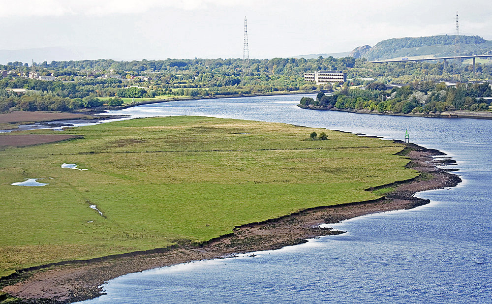
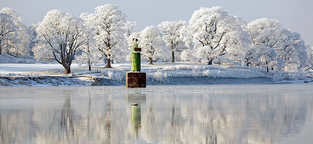
Parts of the extensive Newshot Island salt marsh can also be seen. In the right hand photo above, the woods of the nature reserve, along with the dark green navigation aid at Park Quay, an instantly recognisable local landmark, are also visible. Known as the Rashielee Light, the beacon stands on a cast iron cylinder. It was originally oil fuelled, but later converted to compressed gas and is now solar powered.
Newshot Island hasn`t been an actual island for many, many decades, having been gradually transformed into a peninsula by the weather and tidal action.
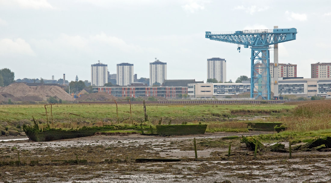
In years gone by, when shipping on the Clyde was at its peak, there was a constant battle to keep the riverbed free of silt and sand and the area around Newshot was particularly troublesome. The left hand photo below was taken from the top of the Titan Crane on the site of the old John Brown`s Clydebank shipyard.
|
|
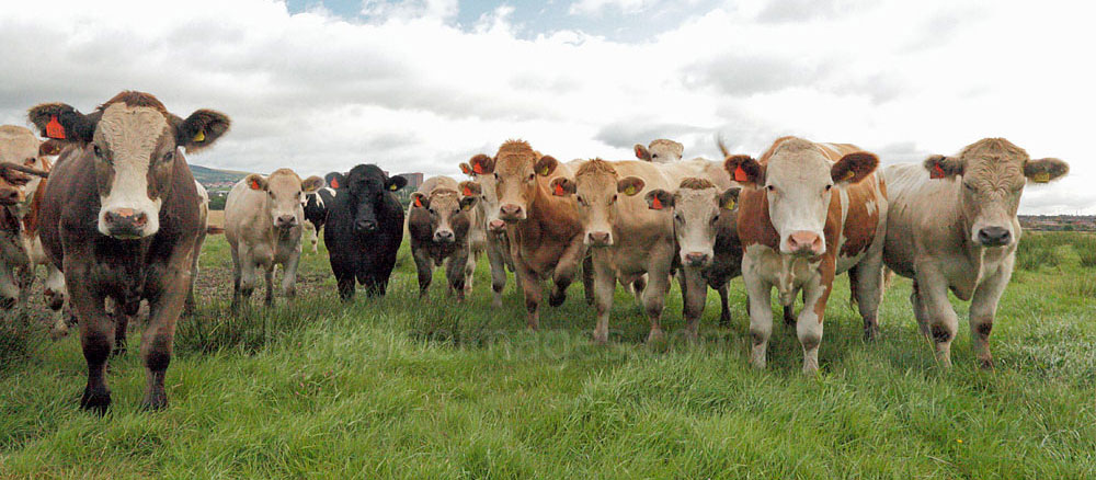
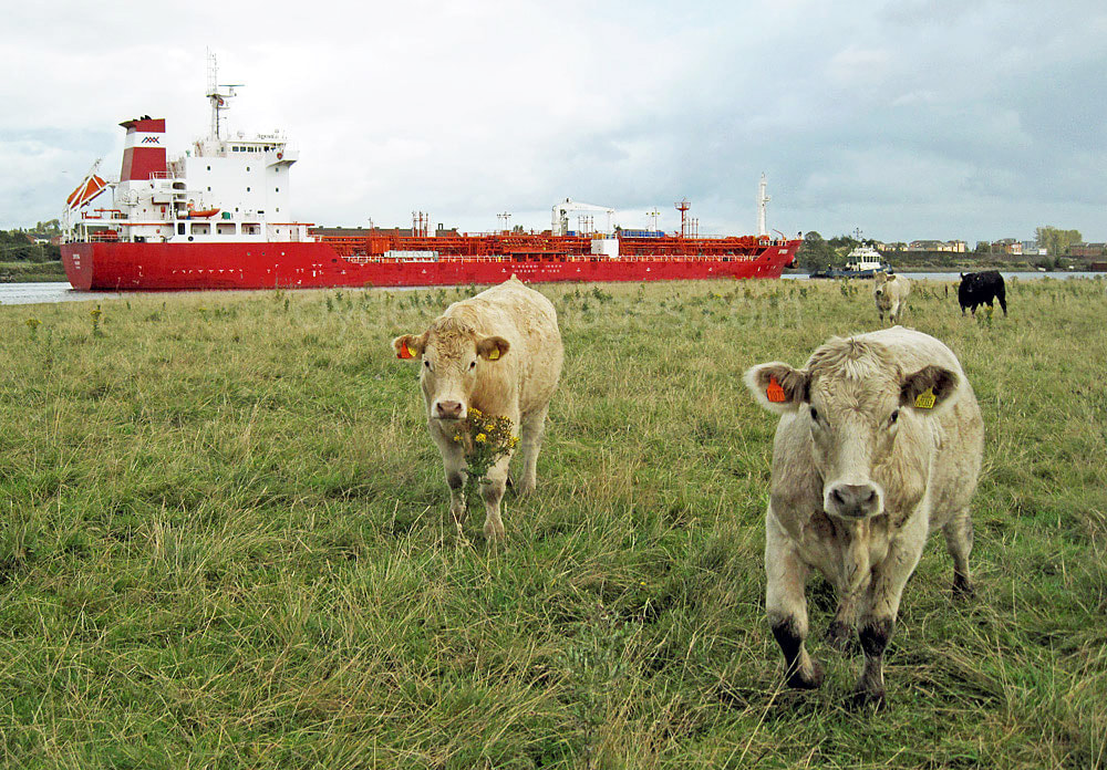
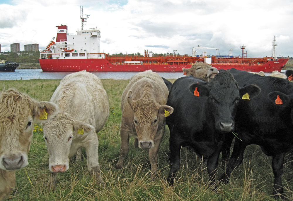
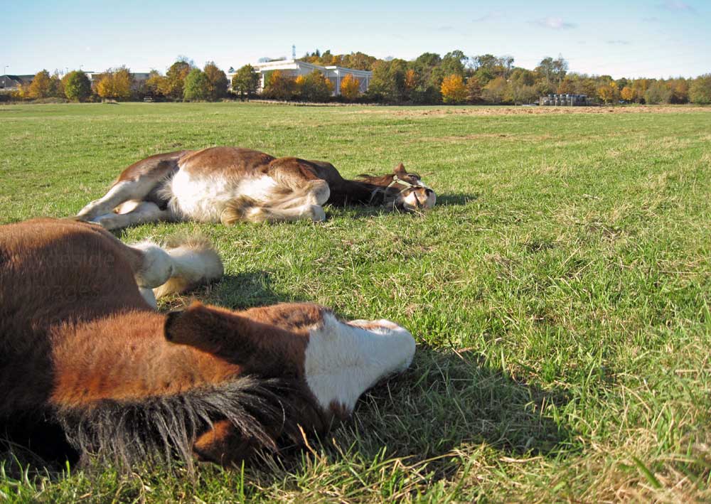
Bear in mind that the resident herd of cattle may have something to say if you venture onto the fields without their permission!
|
|
Also, if you do get ambushed, there`s more chance of you being in the photo rather than taking it!
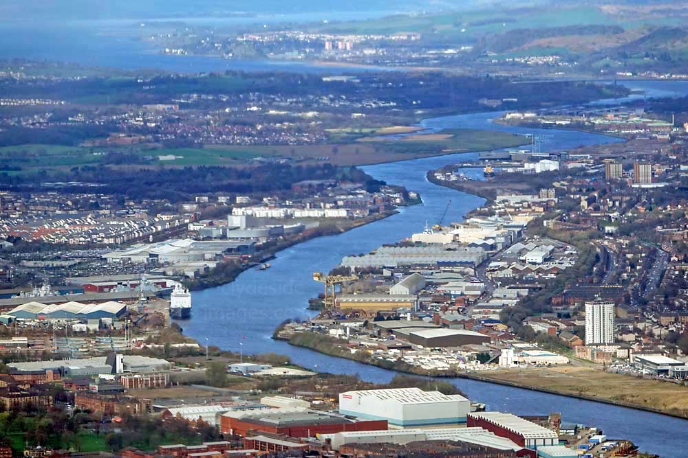
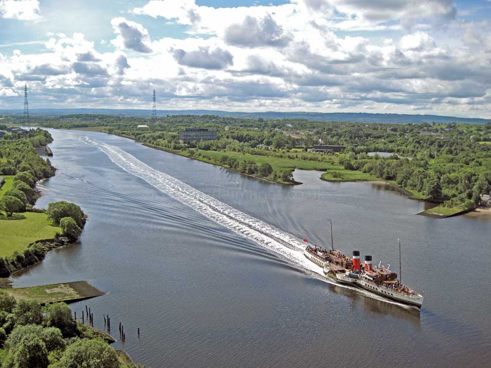
This aerial view looks down the Clyde from Glasgow and includes BAE Systems Govan and Scotstoun shipyards, the King George V Dock, Braehead Shopping Centre and the Clydebank Oil Terminal at Rothesay Dock. Newshot Island is central in the middle distance. The shot clearly shows that the river has several S- bends between the city and Bishopton where it starts to widen.
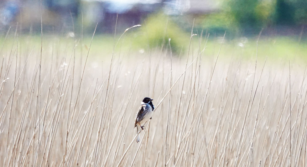
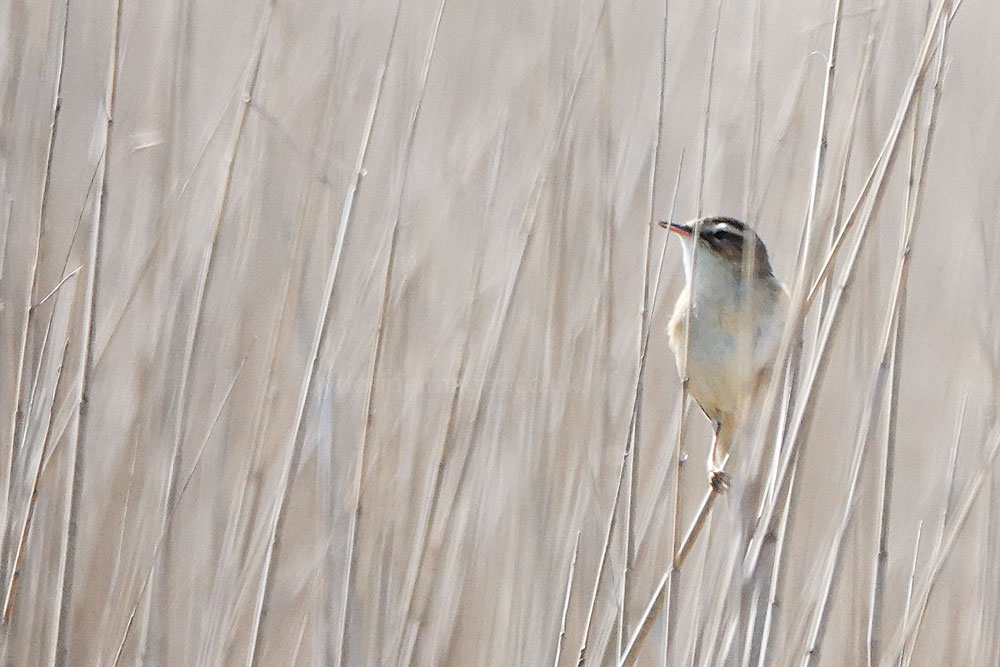
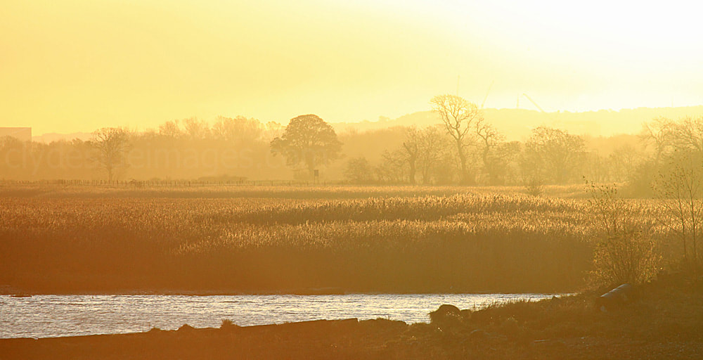
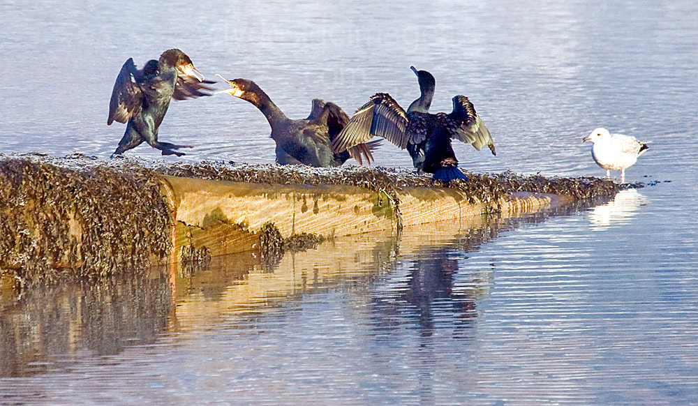
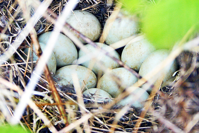
The salt marsh from the east on a crisp, clear morning, complete with resident Reed Bunting and Sedge Warbler.
|
|
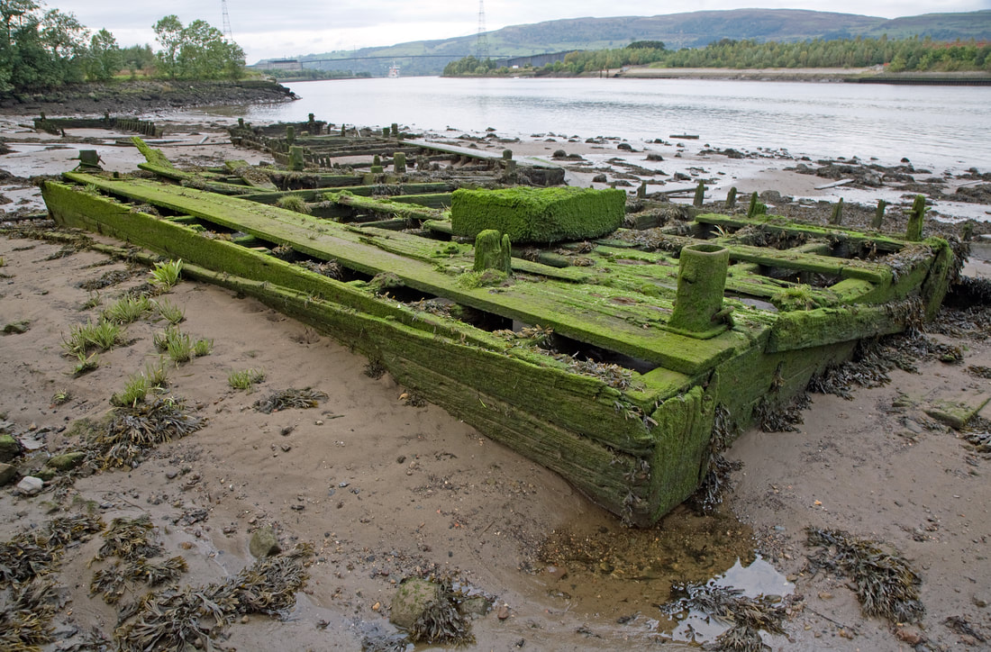
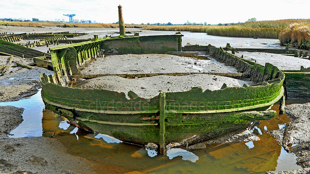
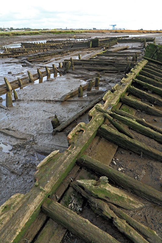
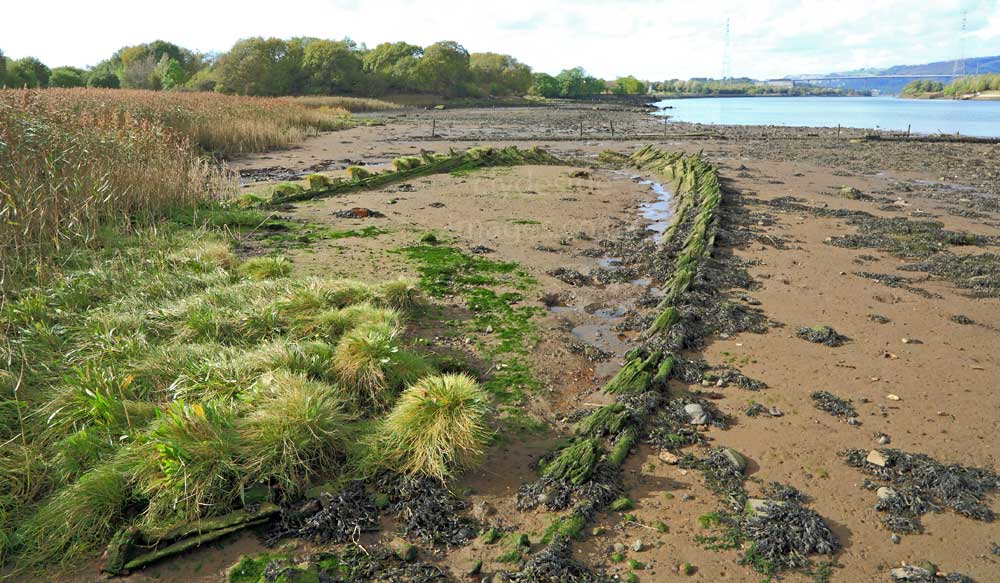
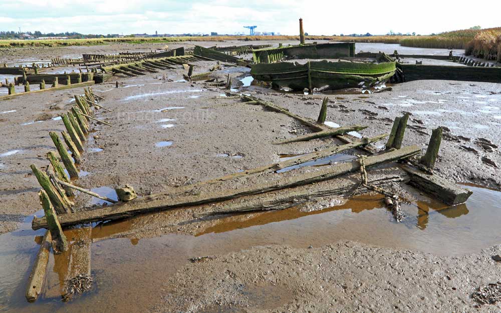
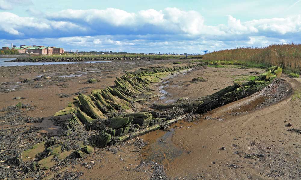
During dredging operations between Newshot Island and Glasgow, numerous wooden mud punts were filled with spoil then towed here for dumping. Many were abandoned and can still be found, scattered along the muddy stretch of riverbank at Newshot alongside several wrecked wooden schooners which were towed here and abandoned after they were damaged in a serious fire at Glasgow`s Kingston Dock in 1914.
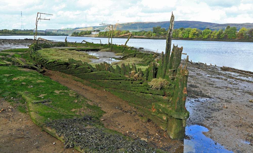
The punts, along with the larger vessels, are occasionally fully exposed at low tide.
|
|
In addition to the schooners, there`s this steel-hulled craft (below) which experts believe dates from the 1850s and could possibly be the world`s first purpose-built diving-bell boat. The pillar at the stern supported a crane which lowered and raised the specialist equipment. The diving bell is one of the earliest types of equipment for underwater work and exploration, its use first described by Aristotle in the 4th century BC. The bell used on this boat would have been lowered into the water having been ballasted so as to remain upright and would sink even when full of air. Hoses would provide the workers inside with air as they chiselled and hammered away at the riverbed with picks and shovels. It must have been a cold, dangerous and physically demanding job.
|
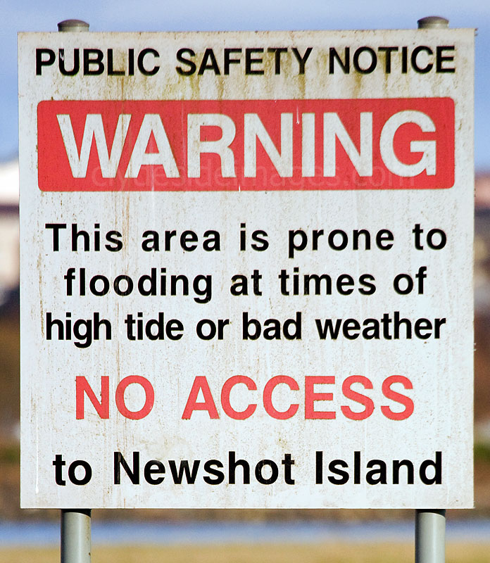
This location can only be accessed several times a year when the water is exceptionally low, but it can be extremely hazardous underfoot with hidden channels, very soft sand and deep mud. Even in fine weather it would be easy to become stuck. Warning signs discourage exploration and this whole stretch should be avoided during storms or flood conditions, especially around high tide. The only safe way to examine the wrecked schooners and diving bell boat at Newshot Island is at a distance with binoculars from the lookout platform at the edge of the nature reserve.
|
|
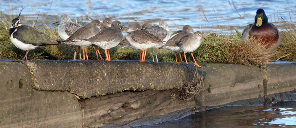
The stone causeway is a popular wader and duck roost.

|
|
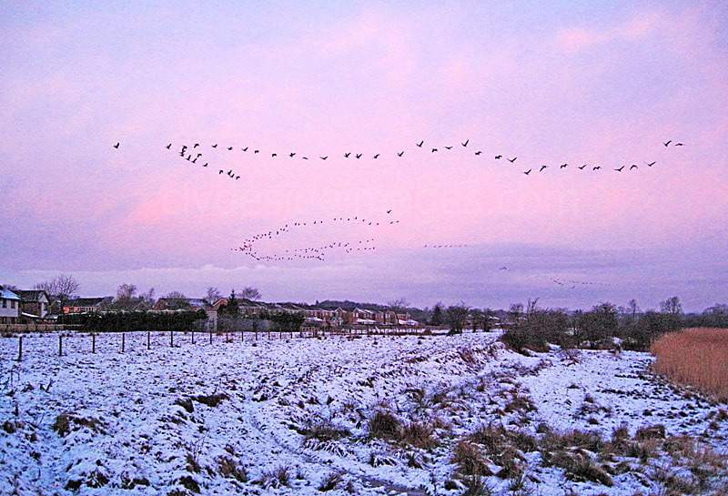
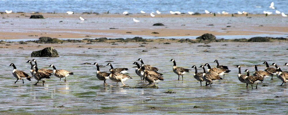
Even though access to Newshot Island is discouraged, it`s worth getting into position at the fence near the edge of the reed bed just before dawn on a clear, crisp winter`s morning to watch the geese taking off for their feeding grounds against the rising sun. With care, this point may be accessed via a gate near a small electricity sub-station at the end of Hawthorn Avenue. Fieldfares and various tit species may be feeding on the berry-laden trees. Skylarks are common during the spring and summer months and it`s not unusual to inadvertently flush a Snipe or two from cover. Godwits and Greenshank appear on passage and there`s often the added bonus of various species of wader feeding on the exposed riverbed. At least one Osprey has been seen hunting here in years gone by.
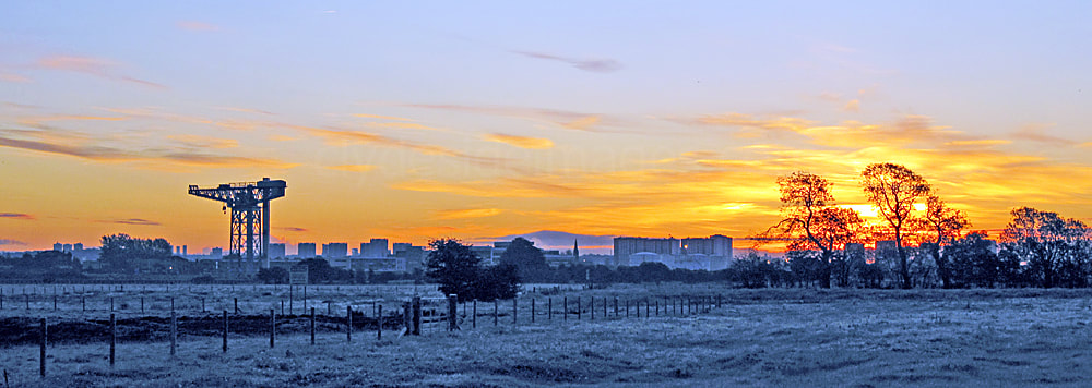
The Titan Crane at Clydebank was built in 1907 by Sir William Arrol`s Dalmarnock based engineering company having taken almost two years to assemble. It stands on the site of the world-famous John Brown & Co shipyard which was, at the time of the crane`s construction, the largest shipbuilding group in the world.

Following the yard`s closure the crane lay neglected for years and would likely have been dismantled for scrap, however, following a £3 million pound restoration project, the crane opened to the public in time for its 100th birthday in 2007. It was a popular tourist attraction offering not only great views but also an insight into the shipbuilding industry, however, it has been closed in recent years and will likely remain so for the foreseeable future as a result of the Coronavirus pandemic.
|
|
The Clydebank Titan stands 46 metres (150ft) high and it was put in place to lift heavy components, such as engines, boilers and gun-mountings, during the fitting-out of battleships and many of the world`s most famous ocean liners. Although the control cab of the crane would often be freezing cold, one unrivaled perk enjoyed by the crane operator would be the superb 360 degree panorama over the Clyde and surrounding area. Following the removal of the Titan crane at Govan, only four of these giant cantilever structures, including the one at Clydebank remain on the Clyde. The others are the Finnieston Crane near Glasgow City centre, one at Scotstoun and one at Greenock`s James Watt Dock.
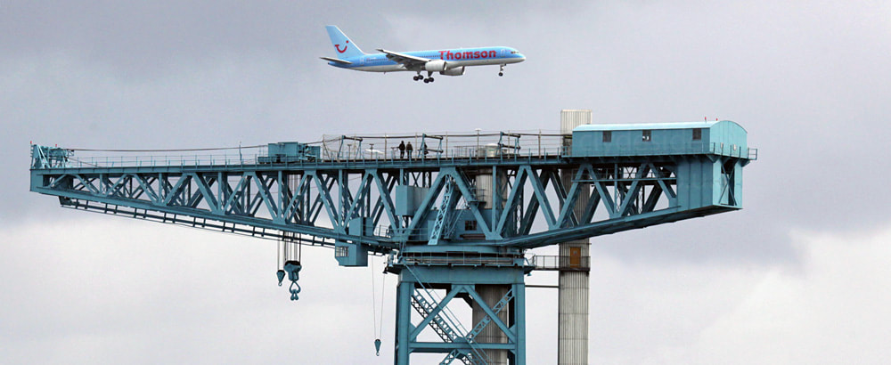
When the Clydebank Titan Crane eventually reopens, it`s well worth a visit. In addition to the great views, you can wave to the pilots and passengers of the planes as they come in to land at Glasgow Airport. More information on the structure and any updates can be found on the official website: www.titanclydebank.com.
Above: An early morning view of the Newshot Island salt marsh from the nature reserve lookout.
|
|
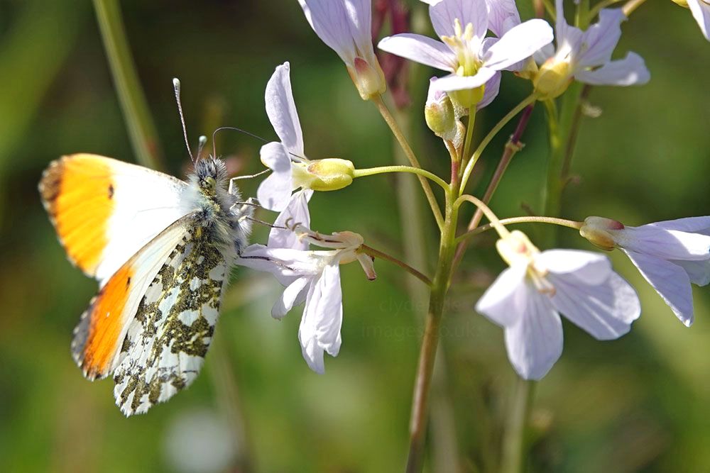
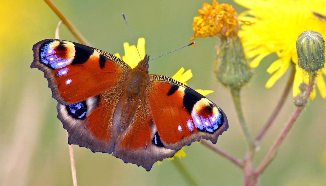
Newshot Island can be a colourful place when wildflowers carpet the fields and butterflies flit about in spring and summer.
|
|
|

|
The main entrance to the wooded nature reserve is hidden behind the bus shelter in the following photo of Newshot Drive. This view looks west toward the Bridgewater Shopping Centre. The adjacent shot shows the path immediately on entering the site from this location. Sadly many of these trees had to be felled to accommodate an essential underground pipeline project but it`s hoped that replanting will take place soon, now that the ground has had sufficient time to settle.
|
|
Bird species can be fairly limited here over the winter months until the migrants start to arrive for breeding but there`s always the chance of a surprise visitor. This Ring-necked Parakeet was snapped mid-December a few years ago, although it wasn`t actually on the nature reserve itself, but in a nearby garden. A serious agricultural pest in Africa and southern Asia, the species` colonisation of Western Europe has been aided by warm winters and abundant bird-table food. They are well-established in some areas of Southern England, making the British birds the most northerly breeding parrot populations in the world. It now seems that some individuals aren`t content living down south as most years there are reports of these colourful birds coming to feeders in Bishopton and Erskine. Glasgow`s west end, including Victoria Park in Scotstoun, is another favoured location.
|

|
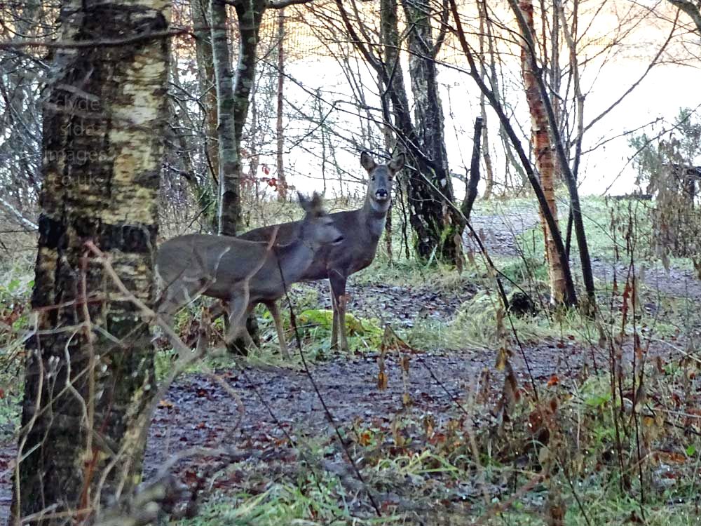
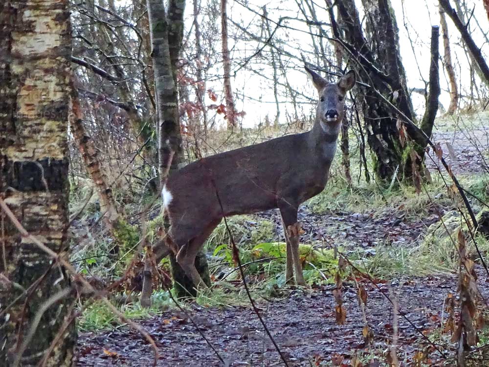
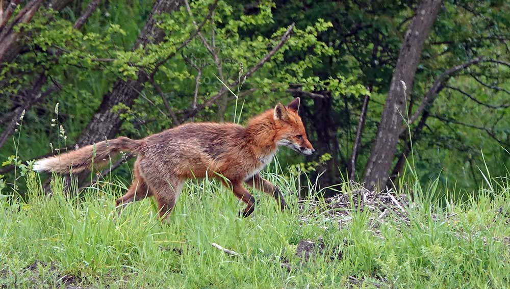
Roe Deer often visit the Newshot Island reserve and provided there are no dogs about and the wind direction is favourable, they may not bound off immediately. The above shots were taken with a compact camera. Roe encounters are increasing locally as their habitat continues to diminish, much of it churned up for housing and other developments. The coat of the Roe varies in colour throughout the year, being most distinguishable in summer when it`s bright rusty red. In winter coats turn a dull, slate grey colour. Both sexes are easily identifiable by their prominent white rump but no tail, although females (does) do have a small tuft of hair similar to a tail at the base of their rump patch in winter.

|
|
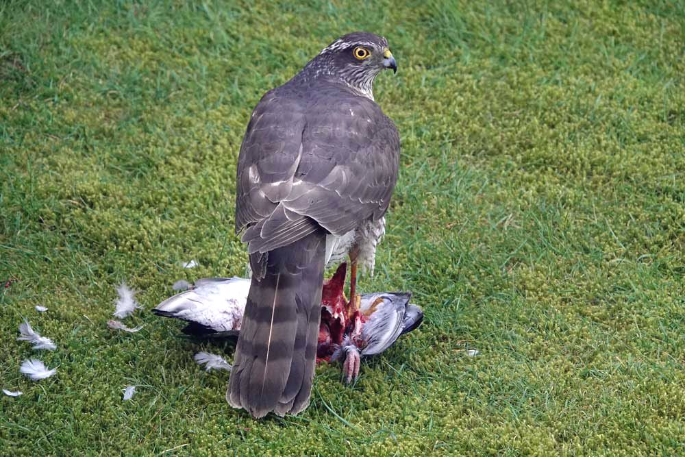
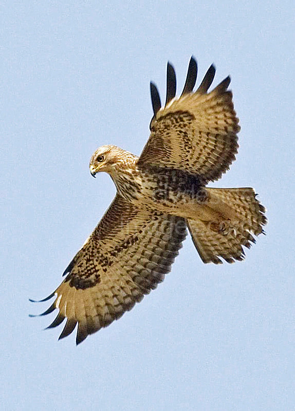
Raptor-wise, Kestrels are often spotted hunting in the woods of the Newshot reserve or out on the island itself and Buzzards are occasionally seen soaring high above. These may be local birds, or fly over from the Clydebank / Old Kilpatrick side when thermals are favourable. Sparrowhawks are fairly common in the general area but probably the best chance of an encounter is when they pounce on an unsuspecting tit, finch or pigeon at a garden feeder.
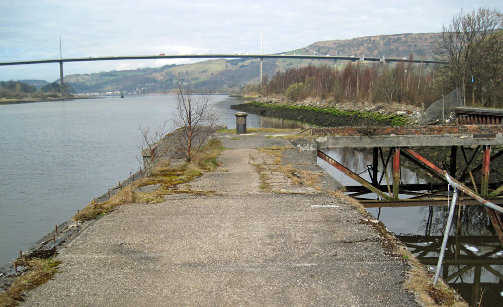
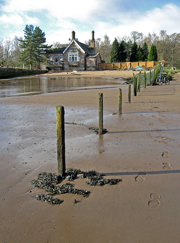
Park Quay to Erskine Harbour
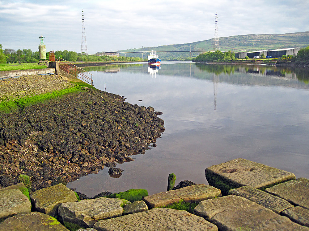
Originally named Fulton`s Quay but nowadays known as Park Quay, this disused private quay and jetty stands close to the site of the old Park House estate. The quay, a mix of stone and wood construction, is thought to have been built between 1789 and 1801 by the Fultons who made their fortune manufacturing silk in Paisley. One of the quay`s later owners was William Todd Lithgow (1854–1908) who, along with two others, founded the famous shipbuilding company of the same name in 1874. The small quay and loading bay pictured below can be be found to the east, on the southern edge of Newshot Island and may have been connected with Lithgow, or the dredging operations.
|
|
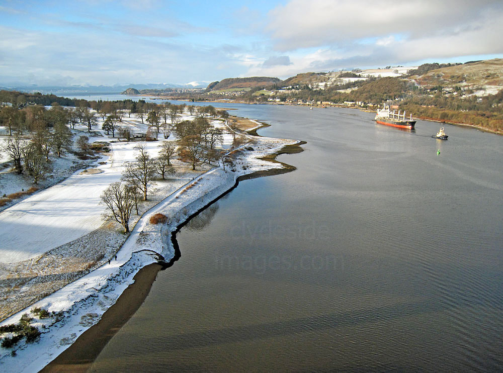
Park Quay (below) was used up until the mid 1950s, albeit rather infrequently by the time of its closure. Nowadays it marks the north-western boundary of the nature reserve. After leaving the wooded area, the Riverside Walkway is gained and followed toward the distant Erskine Bridge.
|
|
|
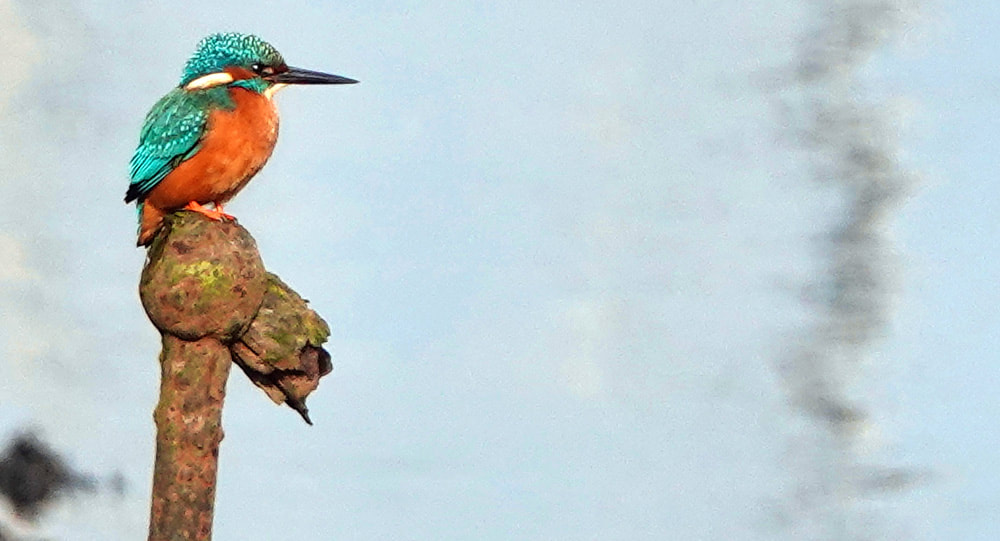
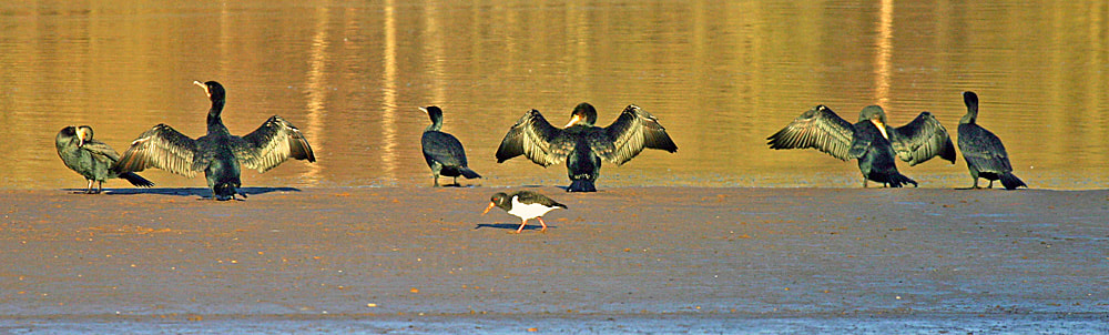
If you want to watch the sun come up on this stretch of the Clyde, Park Quay is a good choice. Cormorants and waders frequently fly past, often just above the surface of the water. Kingfishers are occasionally spotted, perched on one of the stone blocks or wooden pilings as they scan the water for prey, but the wee birds are quite nervous and usually dart off before camera lenses can be brought to bear.
Occasionally seals will make an appearance here too if the tides are right and they`ve been known to haul out on the old Erskine Ferry slipway on more than one occasion. |
|
|
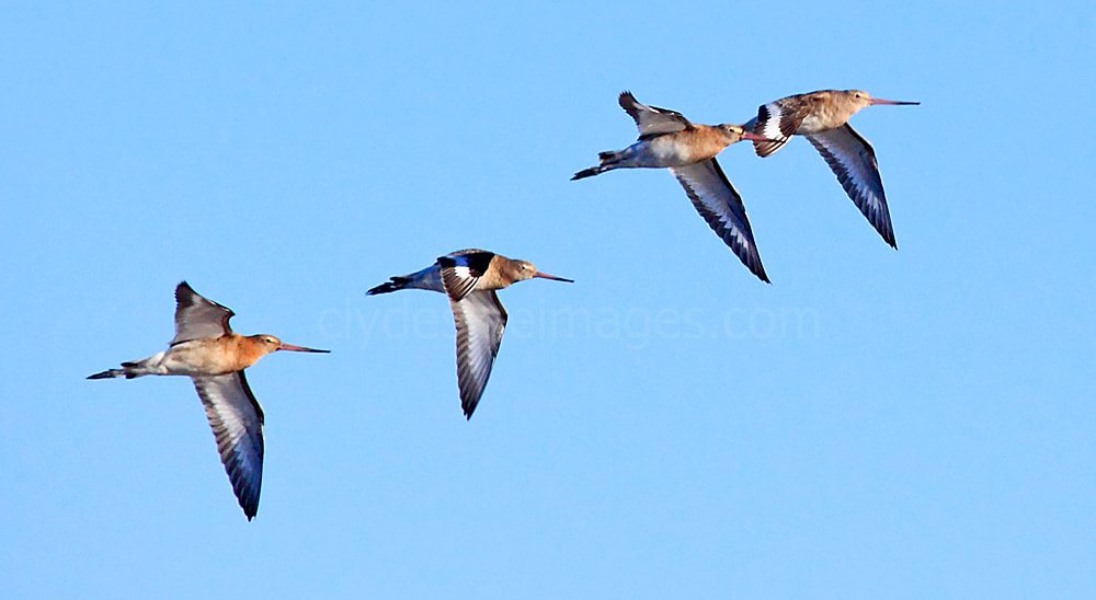
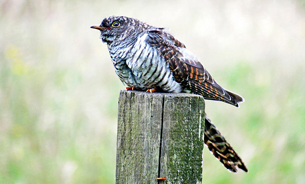
Black-tailed Godwits and a recently fledged Cuckoo chick resting after early attempts to get airborne.
|
|
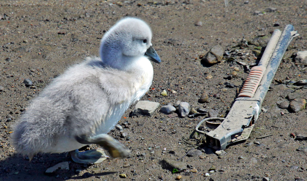
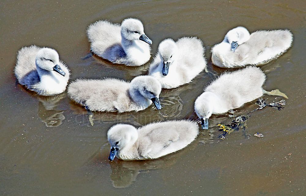
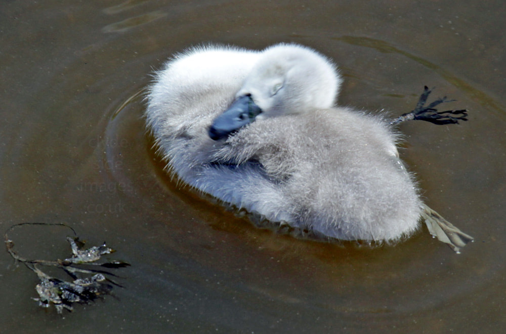
"Woke up this morning." Some of the Park Quay cygnets are tough cookies! This wee guy doesn`t stand for any hassle from marauding gulls, cats or foxes - he just settles matters `Soprano-style`with his sawed-off pump-action shotgun! Brothers and sisters, meanwhile, can relax in the knowledge that they are in safe hands - they don`t realise it`s just a discarded plastic toy stuck on the riverbed and exposed at low tide.
|
|
Jogging along the walkway on a fine afternoon.
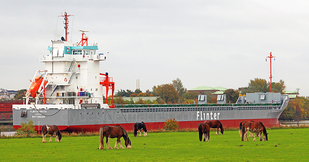
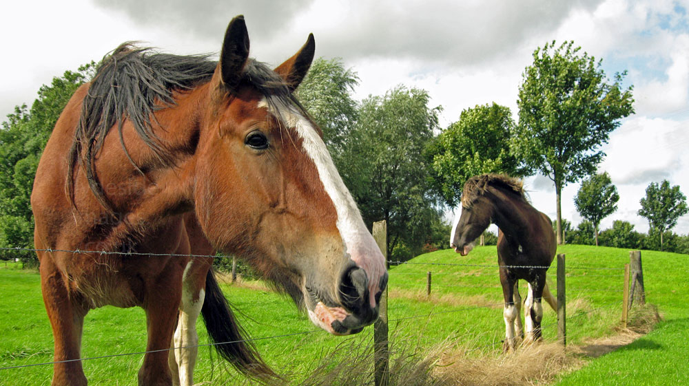
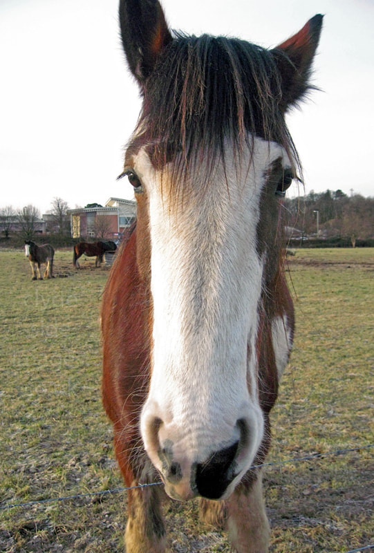
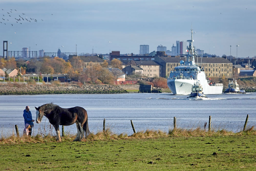
The heavy horses that graze in the fields for several months each year are much loved by locals and visitors alike.
They`re supposed to keep the grass short, but they were doing so well with tastier treats that their owner put up a sign asking people not to feed them.
|
|
Sometimes all that munching just gets a bit too much!
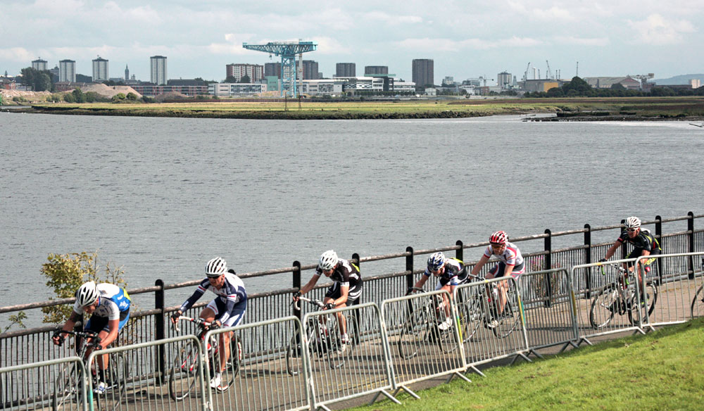
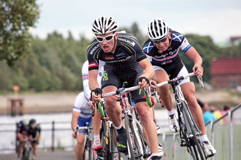
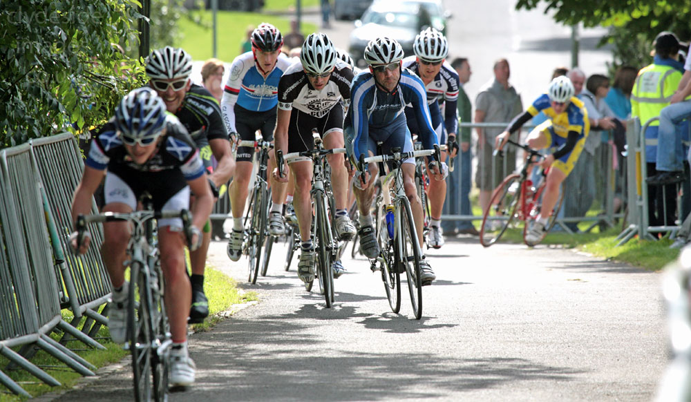
The Erskine waterfront can get fairly busy, especially if the weather`s fine, but it rarely gets congested, however, various events have attracted large crowds over the years. Back in August 2010 for instance, the Scottish Cycle Race took place here. It proved so popular and drew so many spectators that the organisers decided to relocate to Paisley for future competitions.
|
|
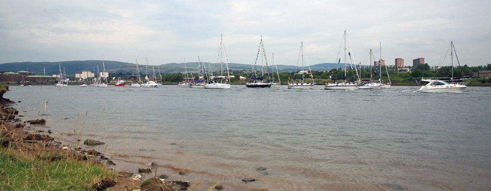
Four years later, the Commonwealth Games came to Glasgow and as part of the celebrations a flotilla of assorted vessels sailed upriver to the city centre...
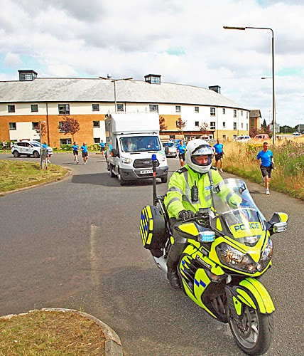
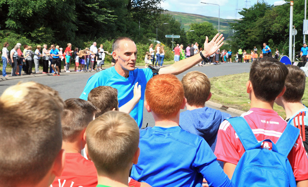
On 17th July 2014, with the Opening Ceremony less than a week away, the Queen`s Baton Relay made its way across Renfrewshire and passed through Erskine in the afternoon. This was the scene at Park Mains High School where a large crowd had turned out to welcome the runners...
|
|
Renfrewshire’s Provost Anne Hall made a guest appearance to welcome the runners and posed with the Games` mascot for publicity photos...

|

|
"Gonae move ower a bit Clyde - ye`r staunin` oan ma taes!"
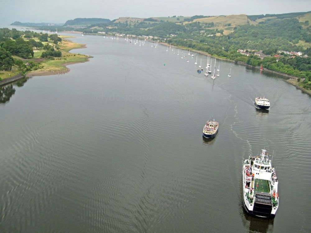
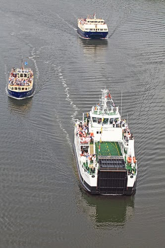
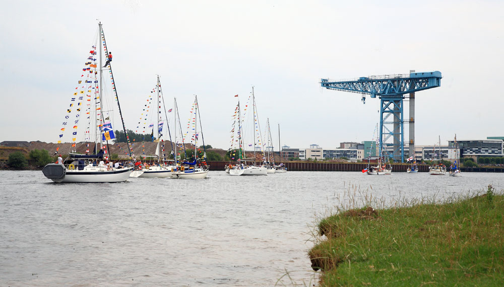
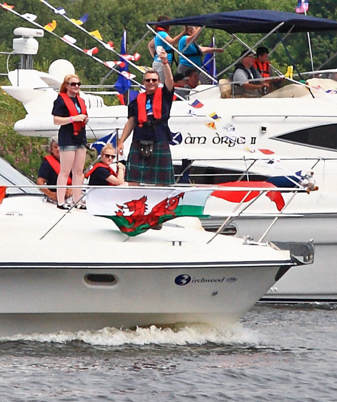
On Saturday 26th July 2014, around 250 small ships, yachts, motor launches and workboats sailed up the River Clyde from Greenock to Glasgow. The flotilla, the largest assembly of vessels ever seen on the Clyde, was organised by the Royal Yachting Association (RYA) Scotland. People lined most of the accessible stretches of riverbank along the route and cheered on the crews as they headed, very slowly, towards the city. Police Scotland said it would mount its biggest-ever operation in Glasgow over the weekend to help the city cope with the expected masses. An estimated 280,000 people visited the city on Saturday alone with sporting events taking place at eight different venues.
|
|
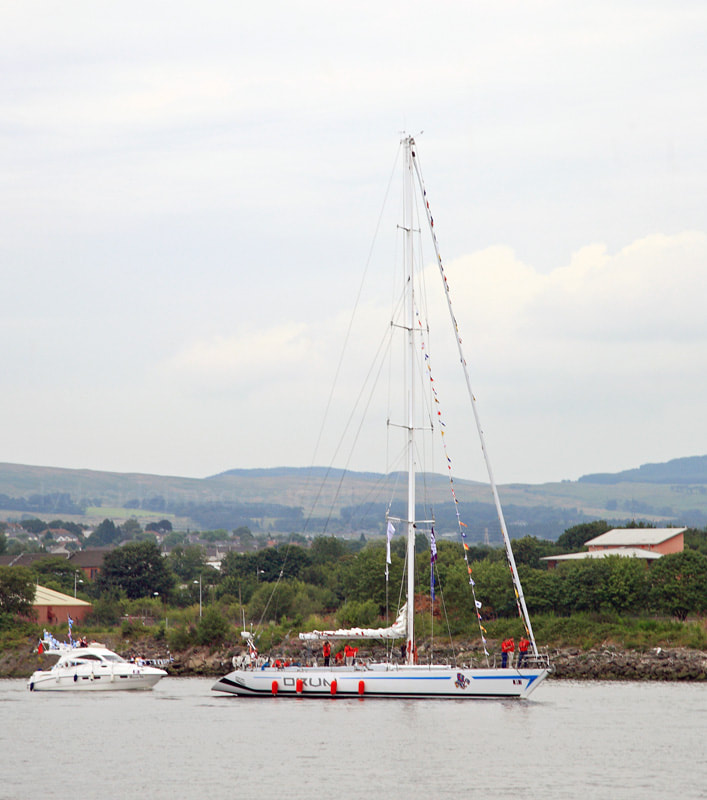
Surprisingly, (and a major disappointment for many) the iconic paddle steamer Waverley didn`t accompany the yachts upriver. Cal Mac`s ferry Lochinvar, Clyde Clipper and Cruiser, the largest of the participating vessels, were at the head of the flotilla. Many historic or otherwise noteworthy craft took part and there was a terrific atmosphere, both along the river and in the city for the duration of the games. Drum, pictured below right, is one of the most famous yachts in the world. Formerly co-owned by lead singer of Duran Duran, Simon le Bon, she was designed and built by Ireland-based boat-builder Ron Holland specifically to compete in the Whitbread Round the World Yacht Race.
|
|
In 1985, Drum competed in the Fastnet Race and was one of the favourites to win, however, due to a design failure, she lost her keel and capsized off Falmouth which sparked world-wide media attention. Before being rescued, Le Bon and the other crew members were trapped underwater, inside the hull, for forty minutes. They were subsequently picked up by a Royal Navy helicopter, earning the Rescue Diver involved a George Medal. Despite the accident, Le Bon and Drum went on to participate in the 1985-1986 Whitbread Round the World Race, coming in third overall. In 1988 Drum was in the news again when she was involved in a collision with a Royal Navy submarine. Le Bon and his partners eventually sold the yacht and Scottish businessman Sir Arnold Clark became an owner for a time.
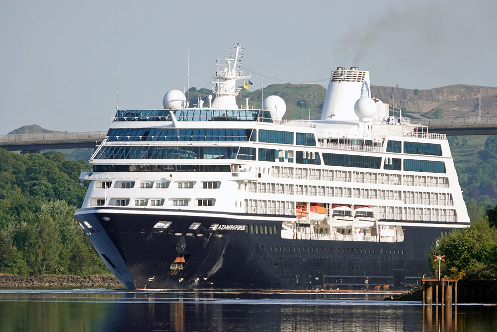
The next occasion when the crowds were out in force along the Erskine waterfront was in the summer of 2020 when three cruise ships of the Azamara line made their way upriver to Glasgow`s King George V Dock for layup following the downturn in the leisure industry caused by the Coronavirus pandemic. First to arrive was Azamara Pursuit, which made her way upriver to the KGV Dock on Monday 1 June. She had sailed all the way from Miami.
|
|
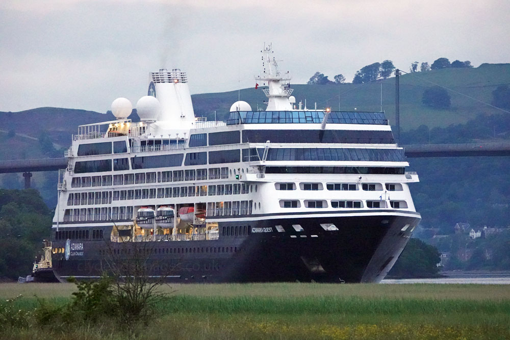
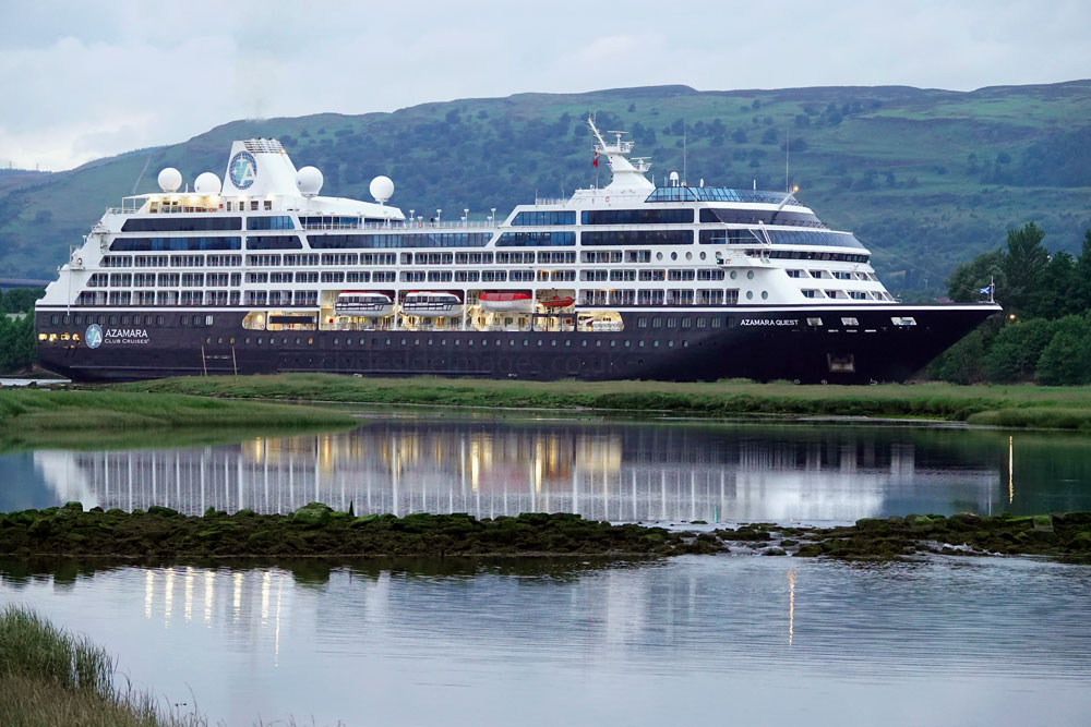
By the time Azamara Quest (above) was inbound on the second high tide of Friday 19 June, the cruise line`s dilemma had been well publicised on social media and her arrival was a welcome diversion during lockdown for many. Unfortunately, she passed Erskine around sundown, which wouldn`t necessarily have been a problem on one of the longest days of the year but overcast skies made it a dull affair. It didn`t deter photographers though. Newshot Island, where these shots were taken, was almost deserted unlike some of the packed vantage points further west, although most of the residents in the Garnieland estate whose houses look onto the river, were out in their back gardens snapping away.
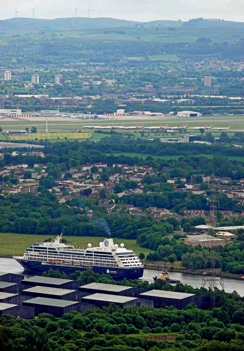
The forthcoming arrival of the last of the trio, Azamara Journey, even made the Scottish national news and combined with fine weather the event became a major attraction. Most of the publicly accessible viewpoints were well attended once again, the most popular soon becoming very busy, with some people seemingly paying scant attention to social distancing. The following shot of the cruise ship passing the Erskine Community Sports Centre, en route for lay-up with her sisters at the KGV, plus a Virgin widebody airliner and numerous BA Airbuses in long term storage at nearby Glasgow Airport, act as a small reminder of the catastrophic impact that the pandemic has had on the travel / leisure industry worldwide.
Erskine Harbour
|
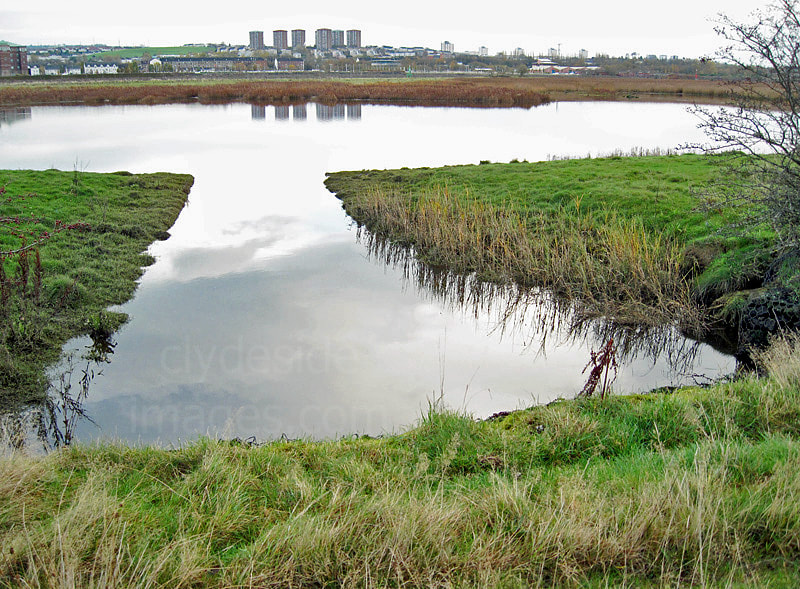
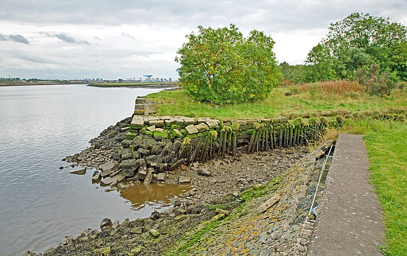
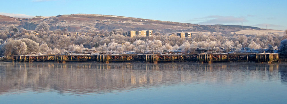
This location, referred to locally as Erskine Harbour, lies immediately east of the old Erskine Ferry slip. Most of the sheltered area inside the outer wall has silted up over the years and is now almost totally overgrown with reeds. The salt marsh attracts waders and waterfowl. Reed Buntings and Sedge Warblers can often be heard singing or spotted clinging precariously to one of the wavering stalks. Despite appearances, there is no trace of a harbour ever being at this location on old maps and the wall was built to narrow and deepen the Clyde just like the Lang Dyke further west (see below).
|
The area mistakenly identified as the inner harbour, was actually the site of Bodinbo Island, a bow-shaped piece of land, and its title was obviously the reason for the Boden Boo woodland being so named. The name may be Scots as both 'Bod' and 'Bo' in place-names mean a sunken rock or as a term for small low-lying rocks on the shoreline. The training dyke was built around 1857 after which the south side of Bodinbo gradually silted-up, just like Newshot Island to the east.
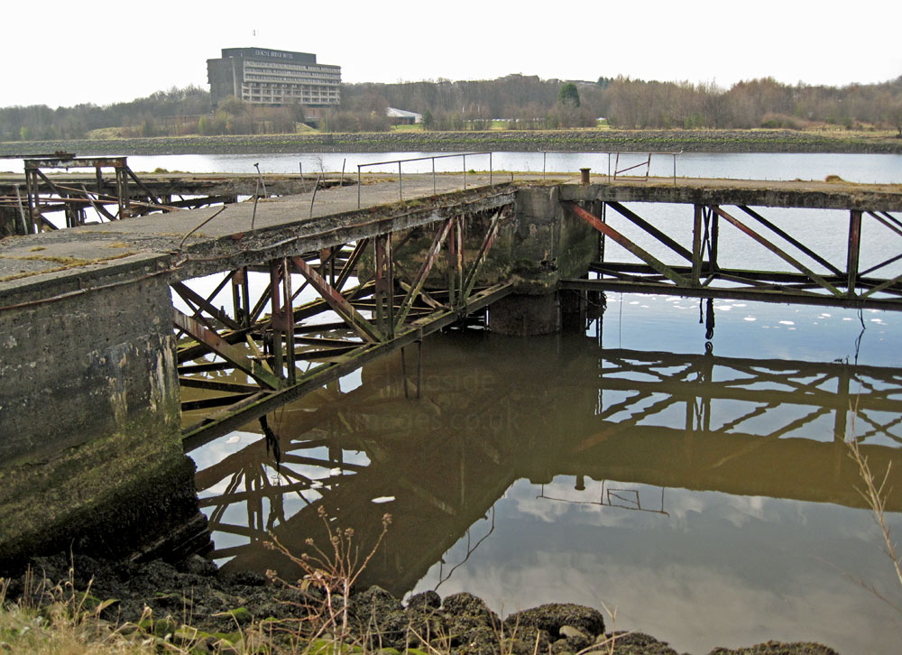
Rashielee Quay, which was also situated somewhere along this stretch, was built to provide loading facilities for ships and punts collecting locally-quarried stone for use along the course of the River Clyde. In 1857 a track ran from the nearby quarries towards the quayside, dividing into several sidings and ending where a crane was located. The quay, which had several berths, was marked by a navigation beacon. (See below for more information on a tunnel that was built between the quarries and the riverfront loading area).
|
|
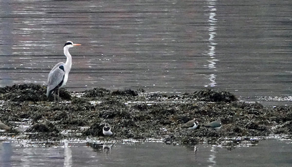
The wall used to be favoured as a Heron roost but the birds haven`t been seen here in numbers for many years, possibly due to increased human traffic along the path. Otters are resident in this area but are very shy so encounters are rare. Sightings of Water Rail are also possible when the water has drained.
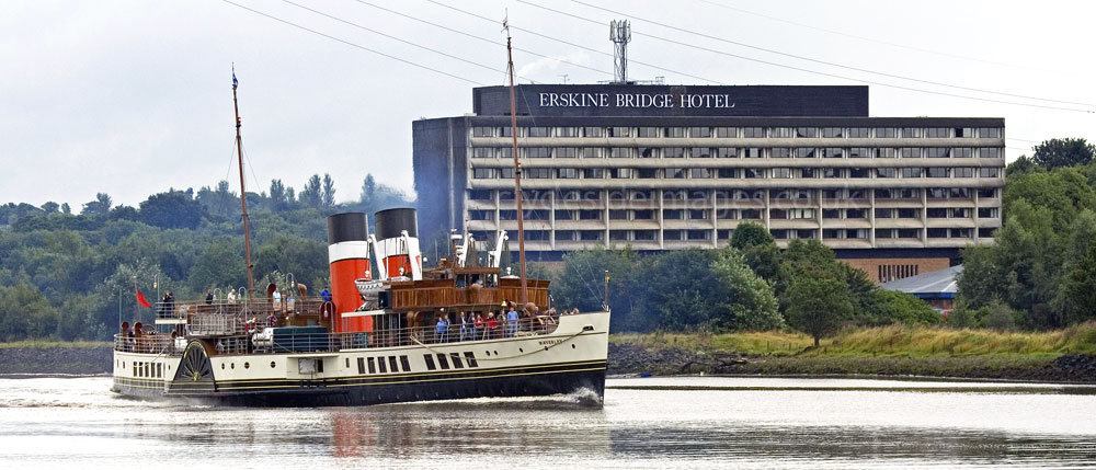
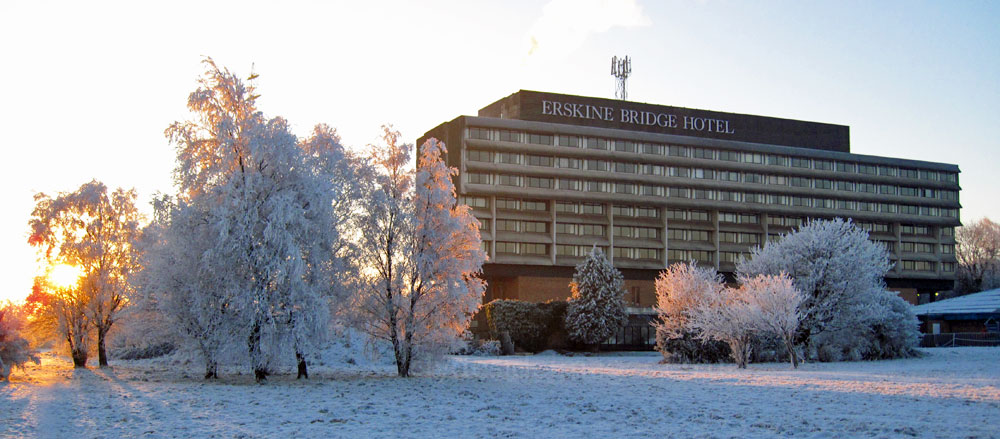
Below right: The line of trees on the left atop the training wall illustrate that without it, the Clyde would have been quite wide at this point and the depth in the central channel, like the river at Longhaugh Point further west, would likely have been too shallow for larger vessels to negotiate unless tides were particularly high. The present-day Erskine Bridge Hotel is now know as Muthu Glasgow River Hotel following a recent takeover.
|
|
The hotel, which opened in 1971 at a cost of £1 Million, was first owned by the Esso oil company. The original nine hole pitch and putt golf course in the grounds was converted into a car park many years ago. The following shot, taken from a light aircraft in October 1976, shows not only how much Erskine has changed since, but also Dalmuir and Clydebank on the opposite side of the river. The site for Bridgewater, Erskine`s main shopping centre, is in the process of being cleared but construction hasn`t actually begun. There is very little housing compared with today and the only major buildings visible are the hotel and AA (Automobile Association) offices.
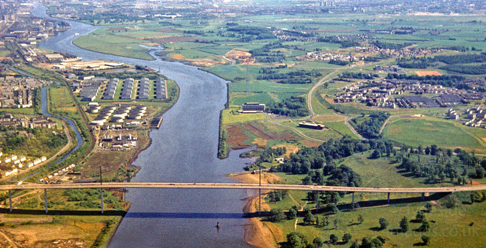
Over on the north bank of the river, the MOD oil terminal at Mountblow has long since been demolished and its circular tanks removed although the sheds at the Chivas Regal Whisky Bond remain. Just beyond, is the site of William Beardmore & Co at Dalmuir, which was by that time acting as a shipbreakers. The ground has been substantially cleared prior to sale for the construction of the HCI Hospital. A fairly large merchant vessel is tied up at the Beardmore quayside.
The Mountblow fuel depot was established by the Admiralty during the Second World War, primarily to supply Royal Navy vessels. The main tank farm serving the facility lay to the north between the Forth and Clyde Canal and the A82 Glasgow to Fort William road. Further west, towards Dumbarton at Milton, numerous storage tanks were built into the hillside and in 1942 the Americans connected these tanks with the new deep-water jetty they were constructing at Finnart on Loch Long. There was also a spur line which ran to Rosneath on the Gare Loch to supply ships operating from the Royal Navy`s naval base at Faslane. After the war the Mountblow facility remained operational but closed in the 1960s.
|
|
The Germans were well aware of the strategic importance of the Mountblow fuel farm, particularly as it lay so close to the upper Clyde shipyards and associated heavy industry. During the Clydebank Blitz of 13 and 14 March 1941, Luftwaffe bombers succeeded in completely destroying eleven of Mountblow`s storage tanks and their valuable contents, while many others were badly damaged. Millions of gallons of fuel were lost and the resultant fire burned for almost two weeks before being extinguished. When the site was finally cleared, no less than 96 bomb craters were reported.
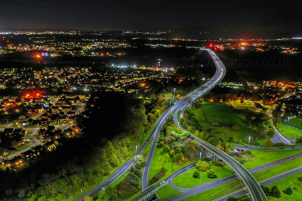
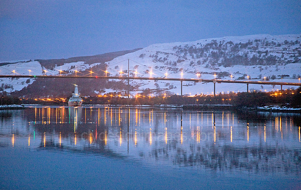
This night time shot shows the Erskine Bridge from the north. The derelict Mountblow facility is in darkness toward the left hand edge of the frame.
(Image © Steve Moyes 2020 aviation)
(Image © Steve Moyes 2020 aviation)
|
|
Continuing our walk on the Erskine side of the river, there`s a choice of routes once you reach the end of the salt marsh.
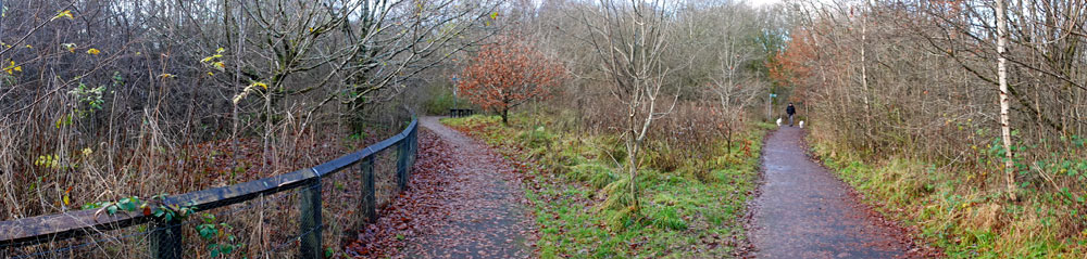
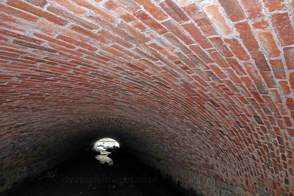
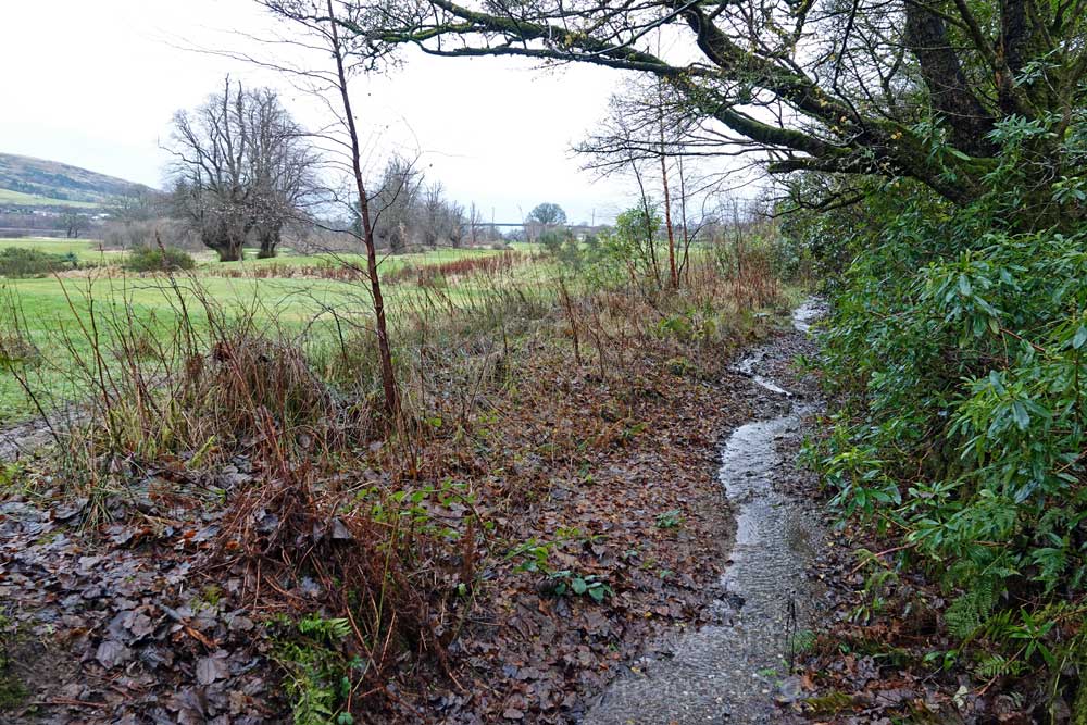
A right turn follows the riverbank, while a left turn leads through a small wood known as Barhill Plantation to meet Ferry Road south of the old slipway, close to the lesser of the two Boden Boo car parks. There`s a burn with a little waterfall, often just a trickle, in the plantation and two brick tunnel sections which are easily overlooked in summer when they`re partially obscured by thick vegetation. In winter, however, the constructions can be easily examined.
|
|
Old maps show that the house at the slipway once operated as the Ferry Inn and a mansion known as Bodenboo Lodge stood on the west side of Ferry Road. There was also a curling pond close to the river.
It seems that in 1899 there were no industrial facilities nearby but a map dated 1914 shows that three quarries were crammed into this relatively small area, one on the west side of Ferry Road and two on the east, where the best preserved section of tunnel can be found today. According to the map it headed in a northeasterly direction from the easternmost quarry before cutting left towards the Clyde. |
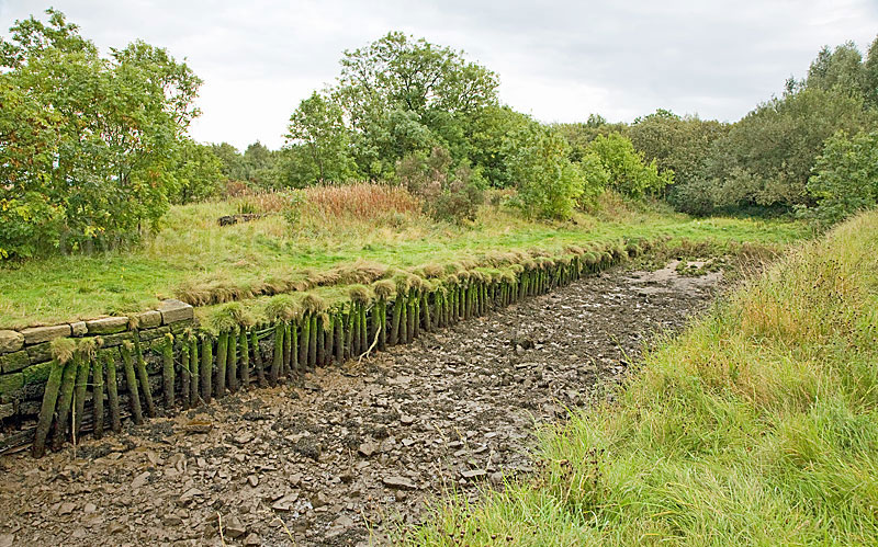
It`s likely that the Barhill tunnel was connected with a larger ongoing operation at the Rashielee Quarries which lay further inland, dotted around the base of Craigend Hill. There`s a suggestion that the tunnel protected the whinstone when it was floated down the burn to the Clyde on barges for loading. This traditional, dark coloured rock has properties similar to Granite and the name 'whin' derives from the sound it makes when struck with a hammer. It`s often used for dry stone walls, but it`s not easy to work with so nowadays it`s mainly used in the laying of pavements, patios and driveways. Its hard wearing characteristics also makes whinstone ideal for building jetties and it was put to good use in the construction of the Lang Dyke, a wall created by the innovative 18th century engineer John Golborne, to increase the depth of the Clyde and enable vessels to unload their cargoes at the Broomielaw in the centre of Glasgow rather than at Greenock and Port Glasgow. Over the centuries, the Clyde had widened considerably between Dumbarton and Langbank and unless the tides were particularly high it was too shallow for larger merchant ships to negotiate safely, thus restricting trade.
|
Golborne had the riverbed dredged and built various structures including his 800 metre-long wall to restrict the main flow and thus create a passage of deep water. An added bonus was that the river`s tidal action scoured the riverbed and dislodged some of the loose stones and gravel that had gathered there.
Construction of this training wall started in 1773 and the material had to be floated down to the site on barges at the slack tide and placed underwater. Around 1810, a westward extension to the dyke was built, again using whinstone from the Rashielee Quarries. The rock from these quarries is from the same lava flows that formed the Renfrewshire Hills. Parish records show that the quarries had been abandoned by 1881 and the local population dropped considerably due to workers seeking employment elsewhere. |
|
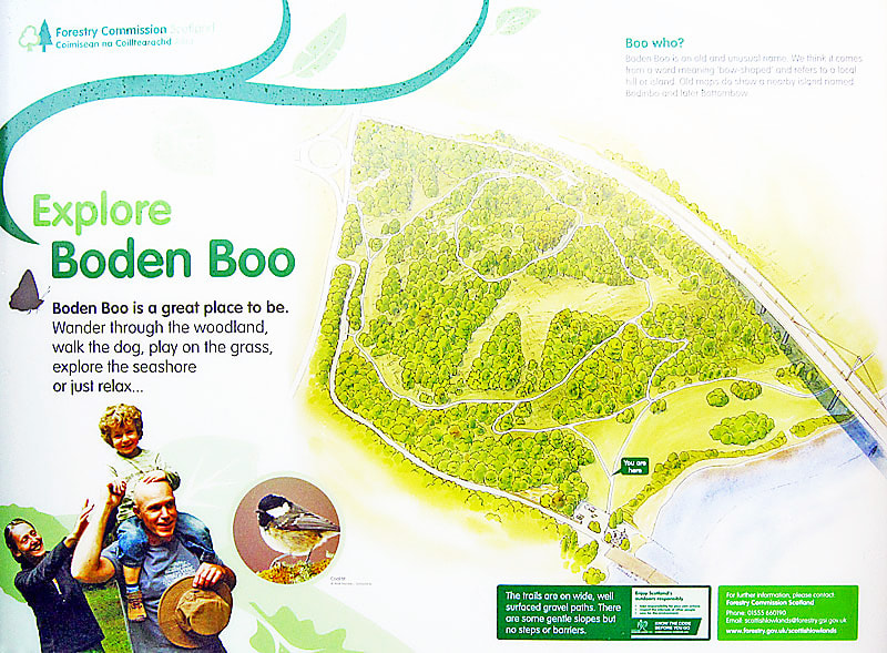
Boden Boo Community Woodland
Boden Boo at Erskine is one of fourteen Commonwealth Woods, designated as part of the legacy of the Commonwealth Games held in Glasgow in 2014. These spaces all provide natural land where visitors can enjoy free events and activities, watch wildlife or just to go for a stroll in the fresh air. The network of green spaces in and around the city includes a mix of well-established and newly-planted woods, and a new riverside park created out of derelict land opposite the Commonwealth Games Athletes’ Village in the East End of Glasgow.
|
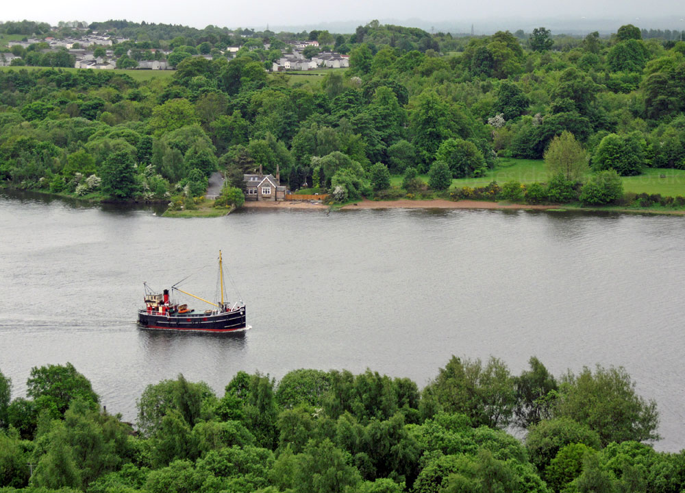
Left: Vital Spark sails past the old Erskine ferry slipway on her way out sea. The main Boden Boo car park, screened by trees, lies just behind the lodge. This wee vessel is the latest to carry the name of the world famous fictional Puffer, immortalised in the Para Handy Tales by Neil Munro (1863–1930) and the BBC Scotland television series starring Roddy McMillan, John Grieve, Duncan MacCrae and Angus Lennie. Built in 1944, by Brown’s Shipyard, Hull, she was originally known as Vic 72, then the Elseda followed by Eilean Eisdeal. The VICs (Victualling Inshore Craft) were designed to act as supply ships for the Royal Navy and transported various goods and munitions to provision the fleet during WW2. Over 100 such vessels were built between 1941 and 1946 with the majority being steam powered and only a few equipped with diesel propulsion.
|
Neil Munro was born at Inveraray at the head of Loch Fyne and his shore-front cottage still stands, close to the old jail house. In addition to working as a journalist for various newspapers Munro published other novels, many set in the Highlands. The New Road (1914), an adventure story set around the time of the 1715 and 1745 Jacobite rebellions, is considered by many to be his best work of historical fiction.
|
|
Erskine`s Boden Boo Community Woodland is now under the care of the Forestry Commission which has carried out a lot of work since taking over, improving paths, rebuilding the boundary wall, removing and cutting back trees and overgrown shrubs to improve the various habitats for people and wildlife alike.
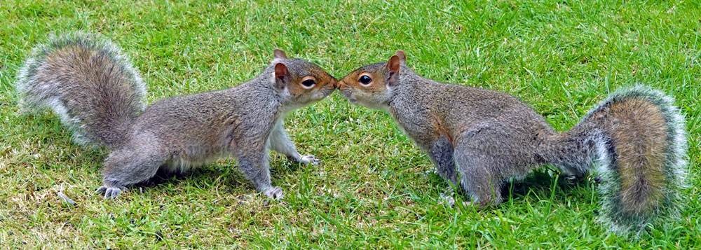
The local squirrels certainly seem happy with the result!
|
|
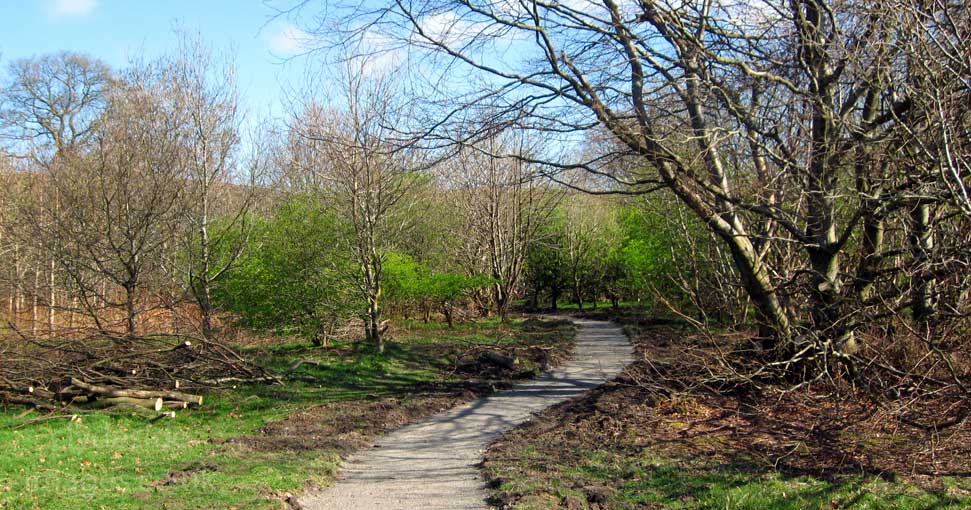
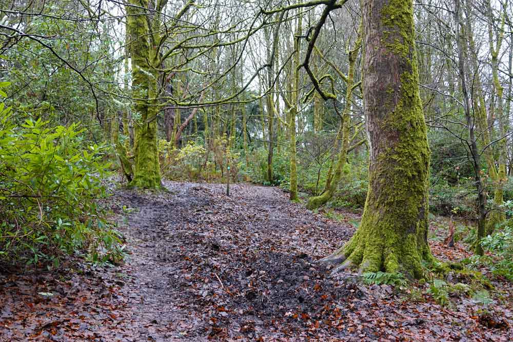
The small beach is popular, especially when the sun comes out, and the network of informal trails, about 2 miles in total, makes for easy walking and cycling, plus they`re wide and smooth enough for buggies.
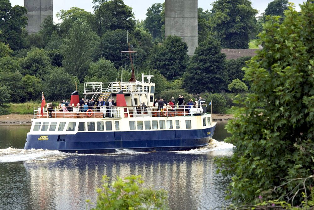
Numerous companies have operated cruises from Glasgow over the years. On offer up until recently were high-speed city waterfront river excursions on RIBs, all the way to sedate trips `Doon the Watter` to Greenock and beyond on larger vessels such as Cruiser, seen here about to pass under the Erskine Bridge with a deck full of happy passengers.
|
|
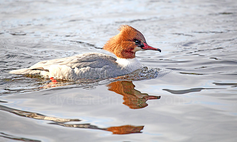
There`s no public access to the old ferry slipway and without human disturbance, several species such as Cormorants, Oystercatcher, Lapwing, Wigeon and Redshank favour it as a roost. And as previously mentioned, you may be lucky enough to spot a chilled-out seal. A Red-breasted Merganser is pictured below.
|
|
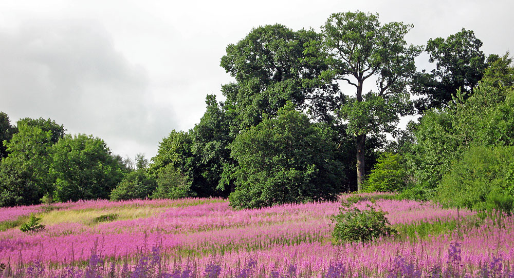
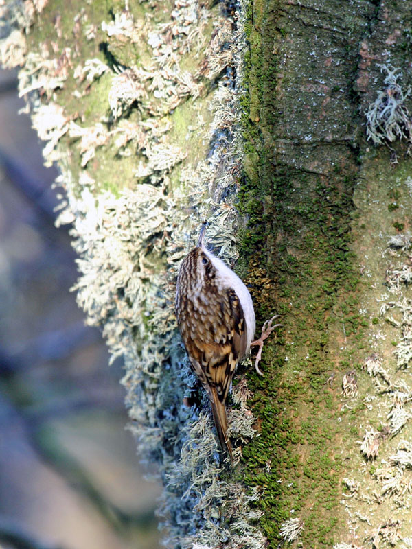
The open slopes are a blaze of colour in high summer and Great Spotted Woodpeckers can sometimes be found hammering away on the taller trees.
|
|
|
|
|
|
|
|
|
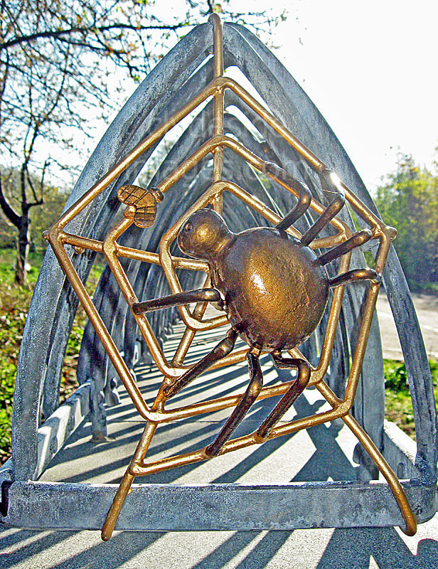
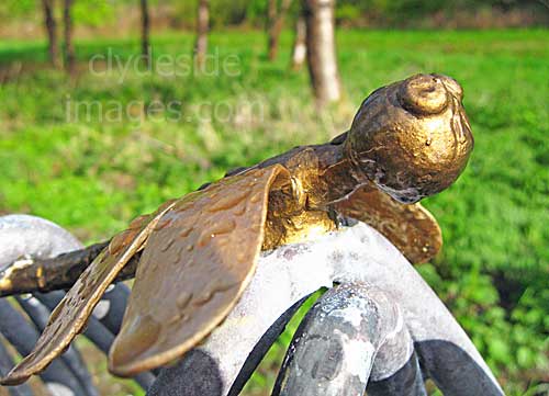
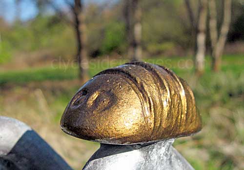
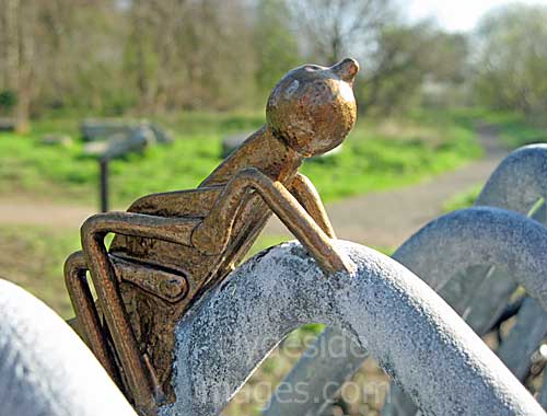
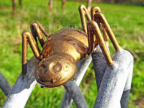
A decorative wildlife dry-stone wall, covered with comical cartoon-like insects, has been built at each of the two Boden Boo car parks. It means that whatever the weather or time of year, visitors are guaranteed to spot dragonflies, spiders, beetles and other assorted creepy crawlies.
|
|
River Traffic
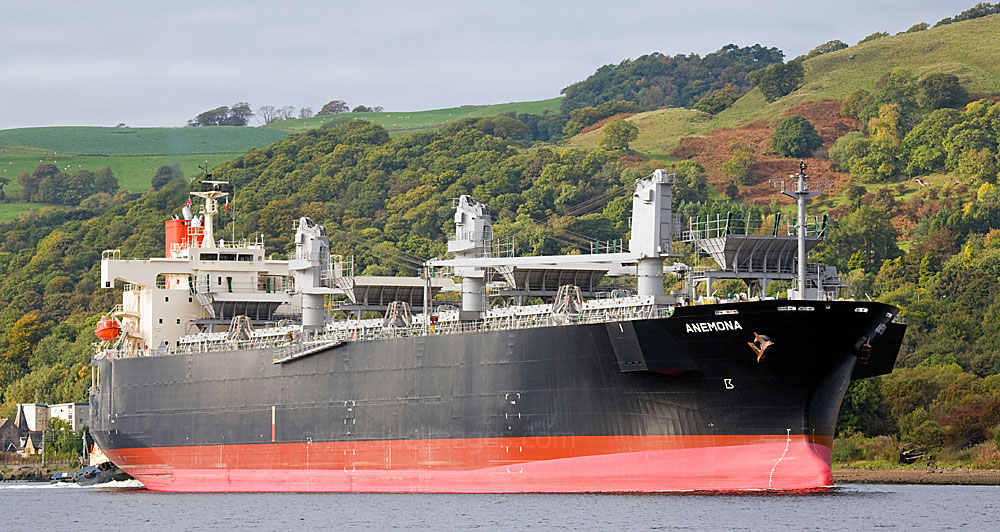
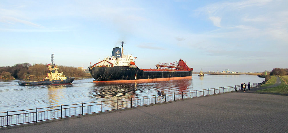
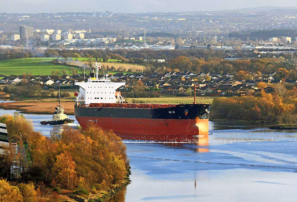
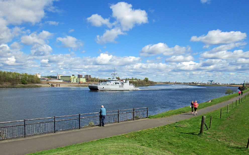
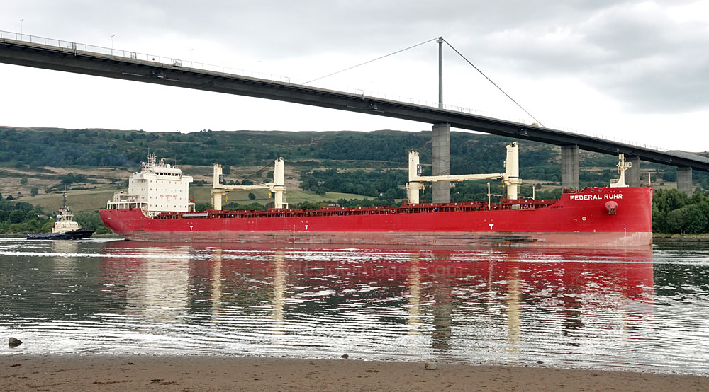
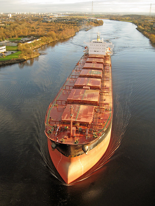
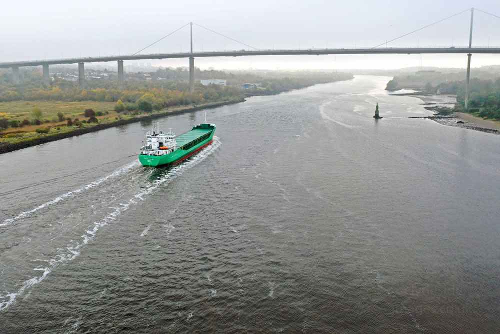
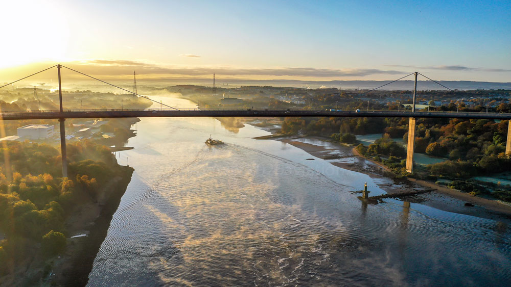
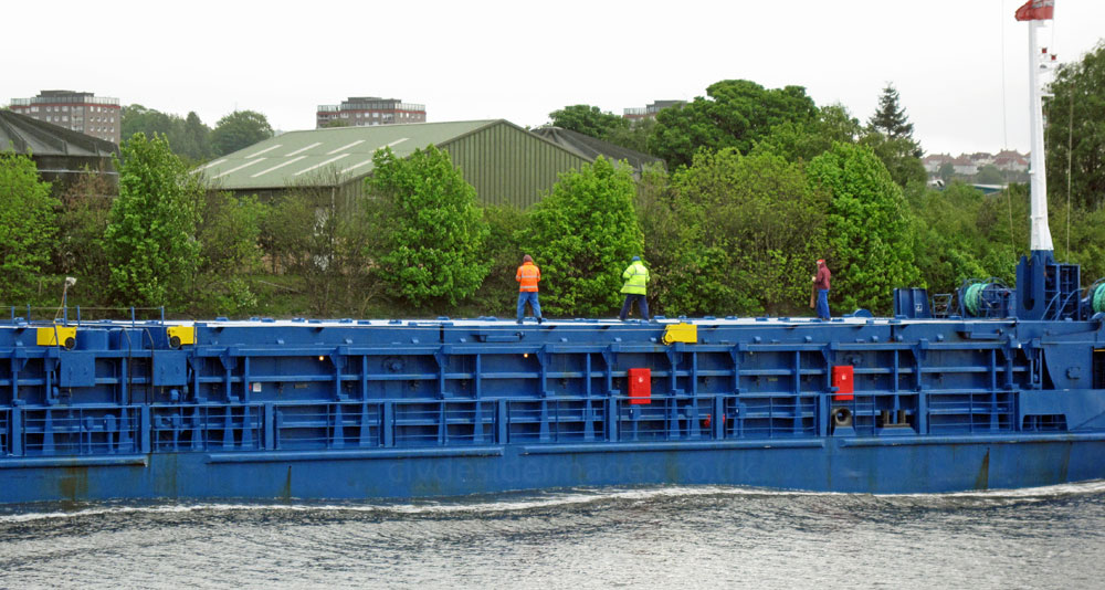
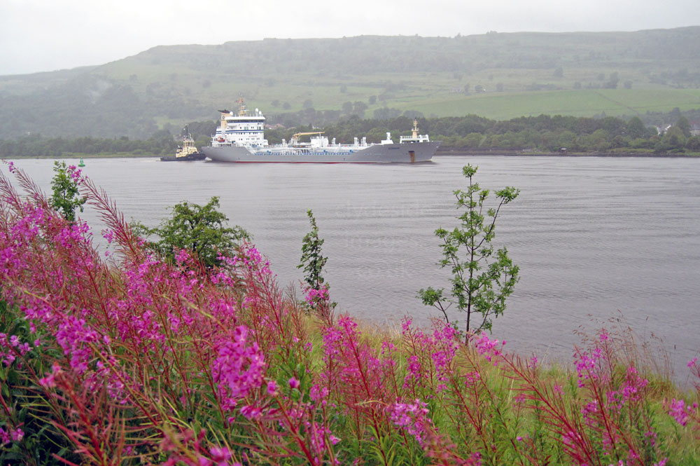
Nowadays the largest merchant ships to sail upriver to Glasgow are the bulk carriers, some of which are 225 metres long and weigh almost 40,000 gross tons. They usually bring animal feed or other agricultural products to the city to help feed Scotland`s cattle. For anyone interested in watching and / or photographing waterborne activity, Marine Traffic.com, a free resource, shows real time tracking which makes it easy to get into the best position in plenty of time.
|
|
|
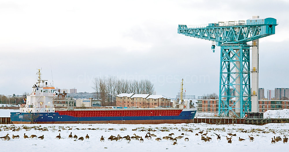
The workhorses on the upper Clyde are the small coasters like Arklow Raven (below) which discharge and / or collect a diverse range of cargoes, including scrap metals, minerals, road salt and cement. (Following image courtesy of Steve Moyes © 2020 aviation).
|
|
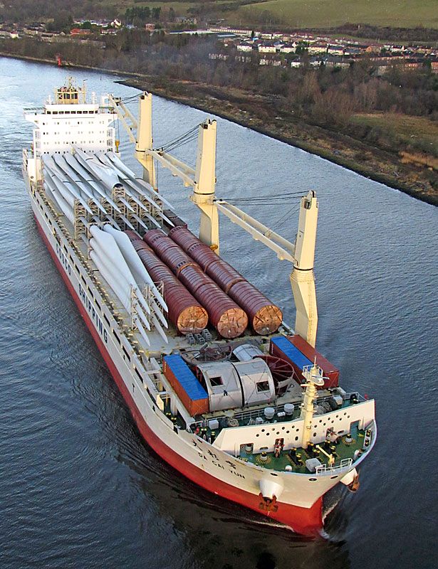
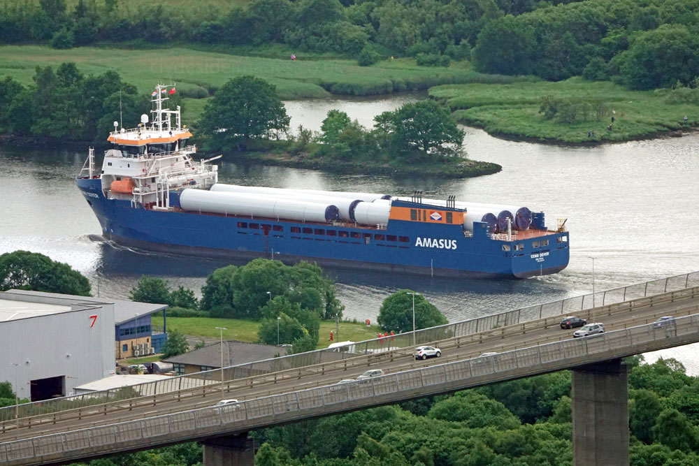
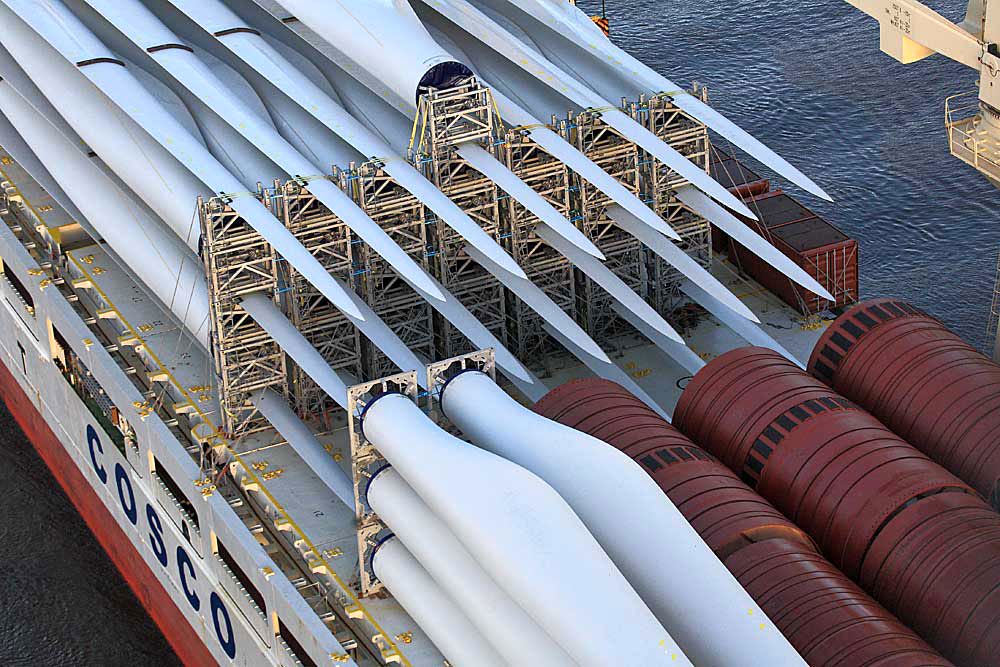
With the switch to renewable energy becoming an increasing priority to combat global climate change, wind turbine components for Scotland`s wind farms are delivered to the city multiple times each year. These vessels are always unloaded at the King George V Dock with the parts transferred to their final destination by road.
Tankers also make frequent visits to the Clydebank Oil Terminal at Rothesay Dock.
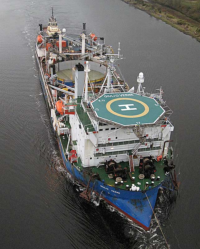
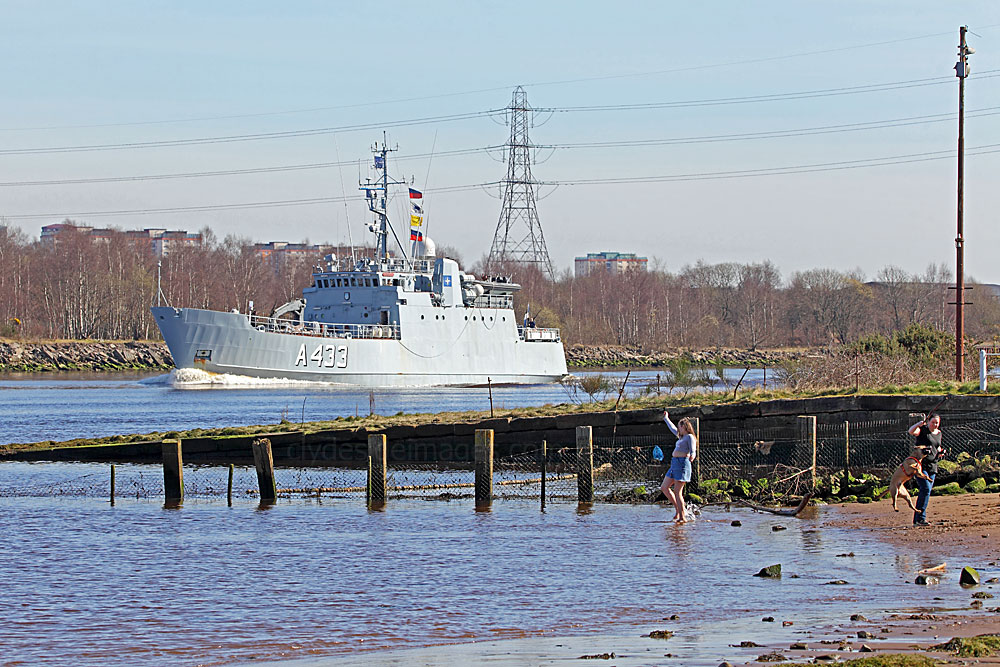
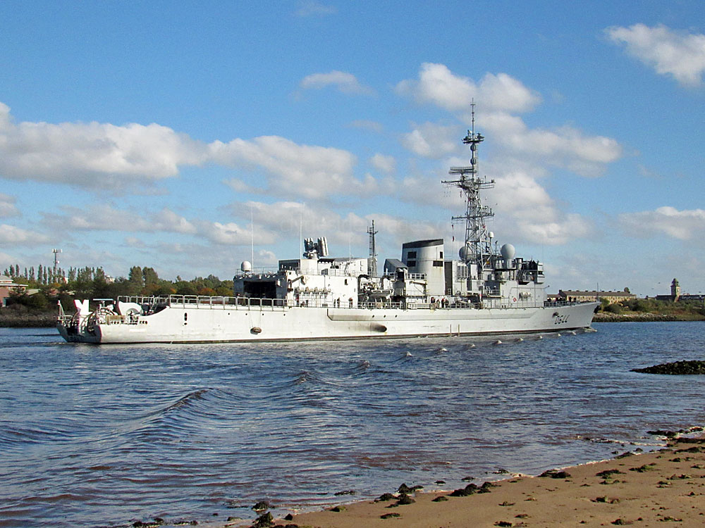
Other vessels passing the Erskine waterfront in recent years have included survey and scientific research ships, massive pipe-layers, dredgers, live fish carriers and craft belonging to government bodies such as Border Force, Scottish Environment Protection Agency (SEPA) and the Scottish Fisheries Protection Agency (SFPA), as well as luxury private motor yachts including Cayman Islands-flagged Lady Sandals.
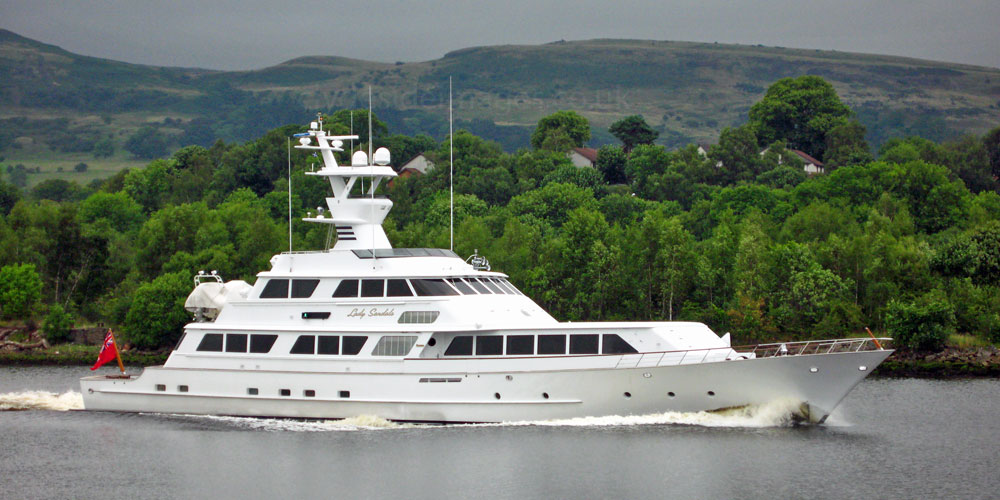
Originally named Gallant Lady, this super yacht dates from 2007. It measures 51.21 metres (168.0 ft) in length, has a crew of twelve and can accommodate ten guests. Unfortunately she didn`t bring any Caribbean sunshine with her when she visited the Clyde back in the summer of 2013.
|
|
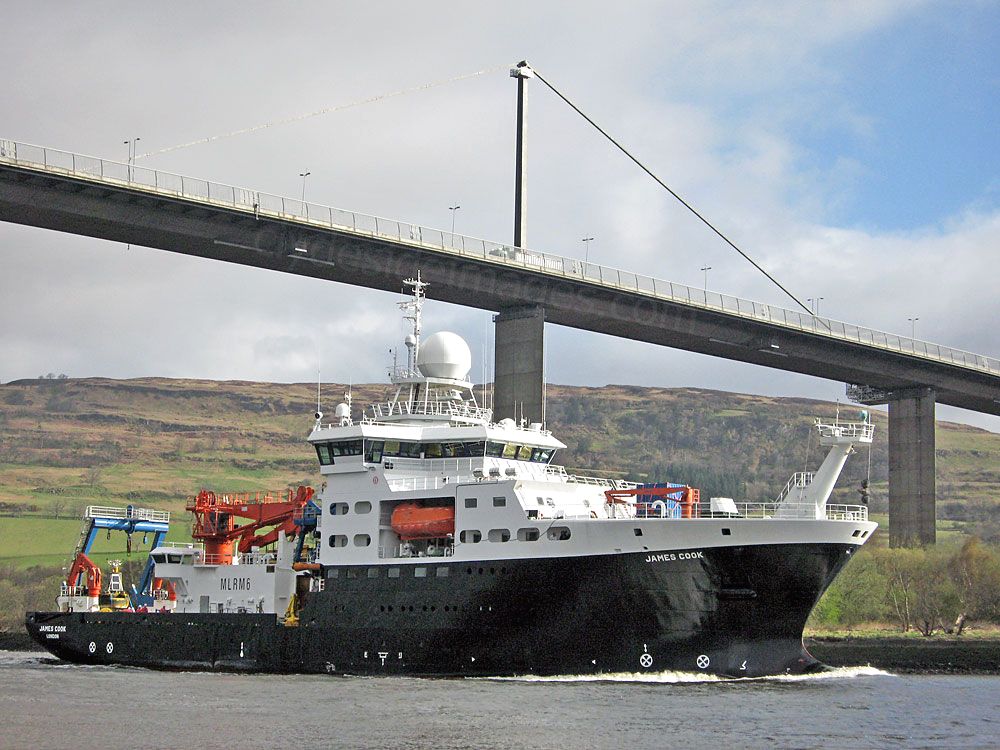
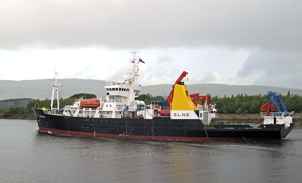
Operated by the Natural Environment Research Council (NERC), RRS Discovery and RRS James Cook carry out oceanographic and marine biology research in the Earth’s most challenging environments, from tropical oceans to the edge of ice sheets. Both have called in at Glasgow several times over the past decade for post-survey maintenance.
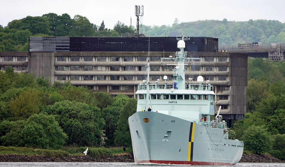
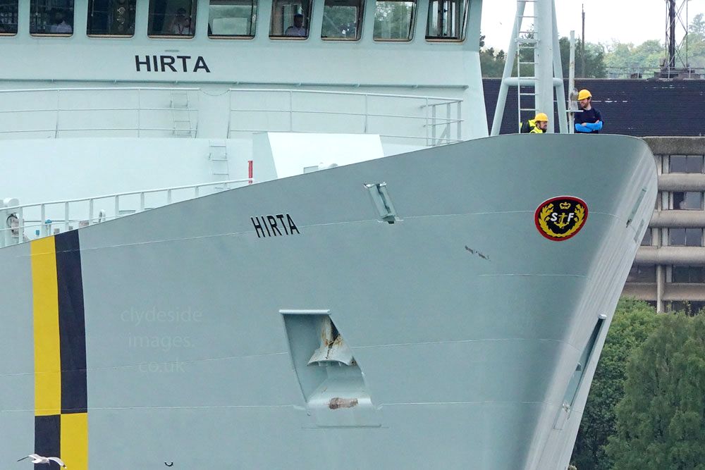
This is FPV Hirta of Marine Scotland en route to the King George V Dock at Glasgow.
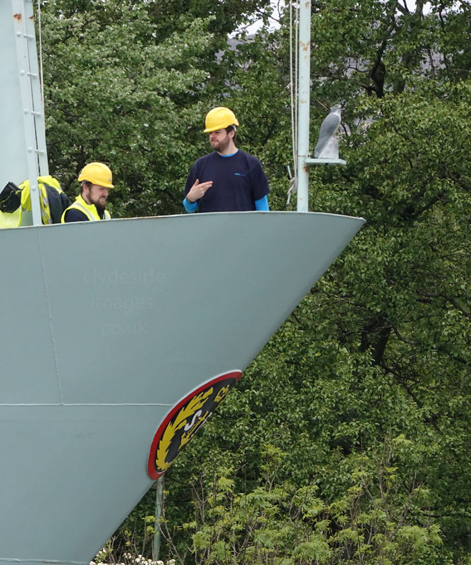
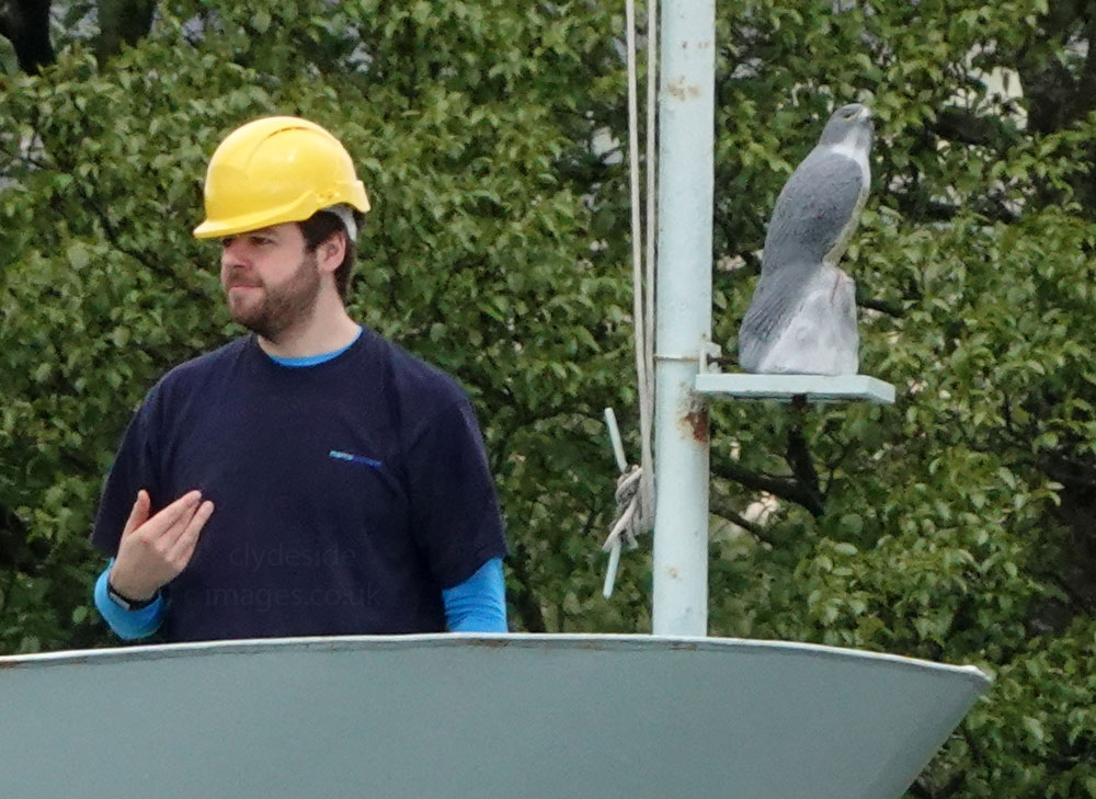
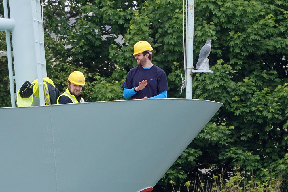
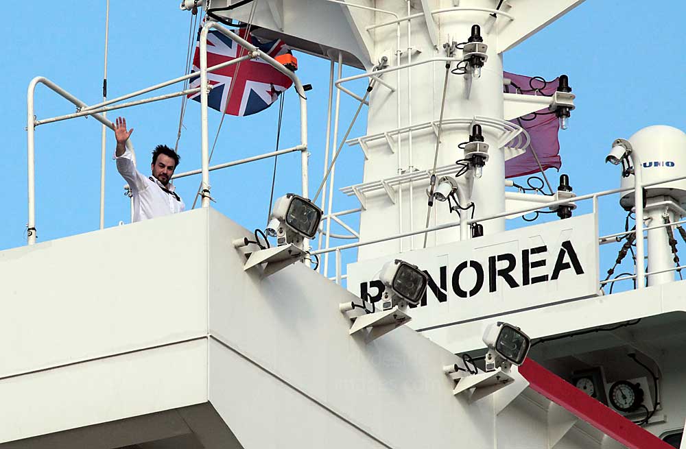
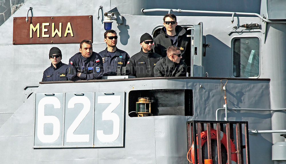
Sometimes the ships pass close enough for onlookers at Erskine to overhear what`s being said by the crew on deck.
|
|
"Ah ken ah should huv insisted oan a Macaw, but the guy in the pet shoap said this wan wiz a stoatin` talker!"
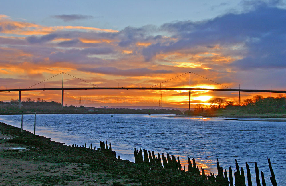
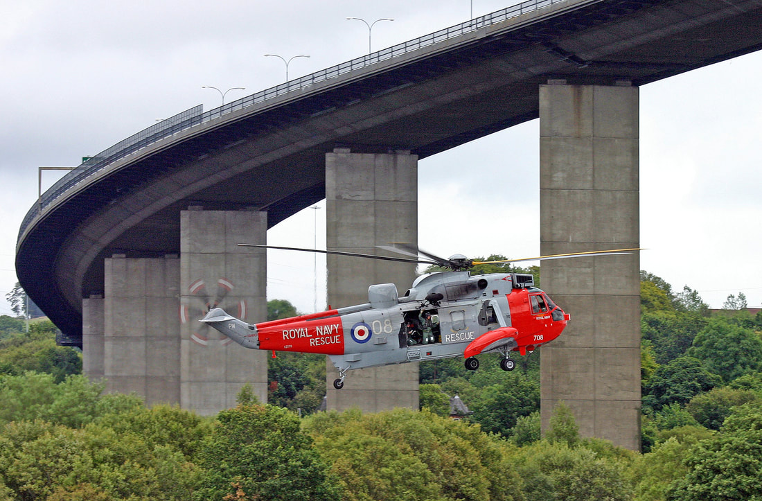
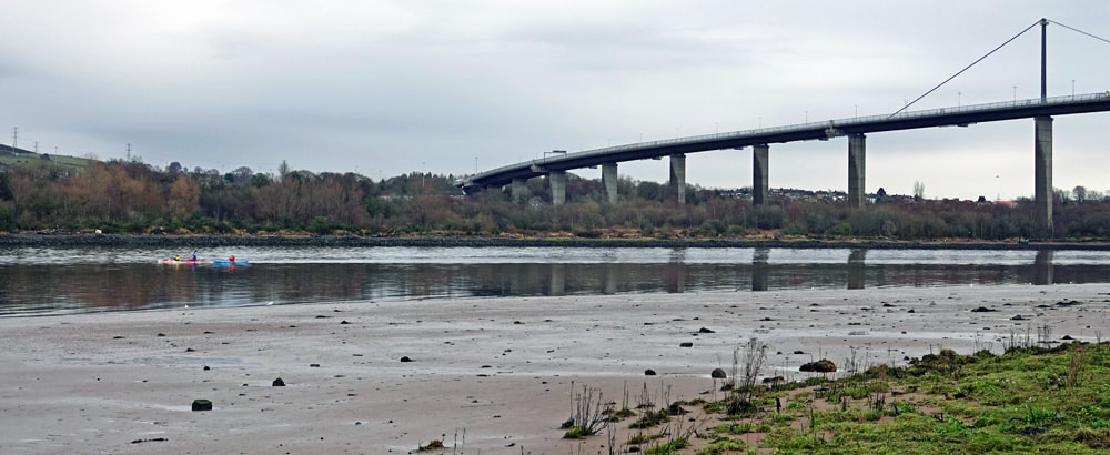
And don`t forget that the Erskine Bridge is a unique vantage point on the Clyde, whether it`s for checking out the scenery, or photographing passing ships. Plus, there`s always a chance of an unusual sight! Up until 2015, when the Royal Navy was responsible for Air Sea Rescue in the UK, Fleet Air Arm crews based at HMS Gannet, Prestwick, would occasionally practice their low level flying by transiting under, rather than over the bridge. HM Coastguard took over the service, operating AgustaWestland and Sikorsky helicopters in place of the navy`s ageing Sea Kings.
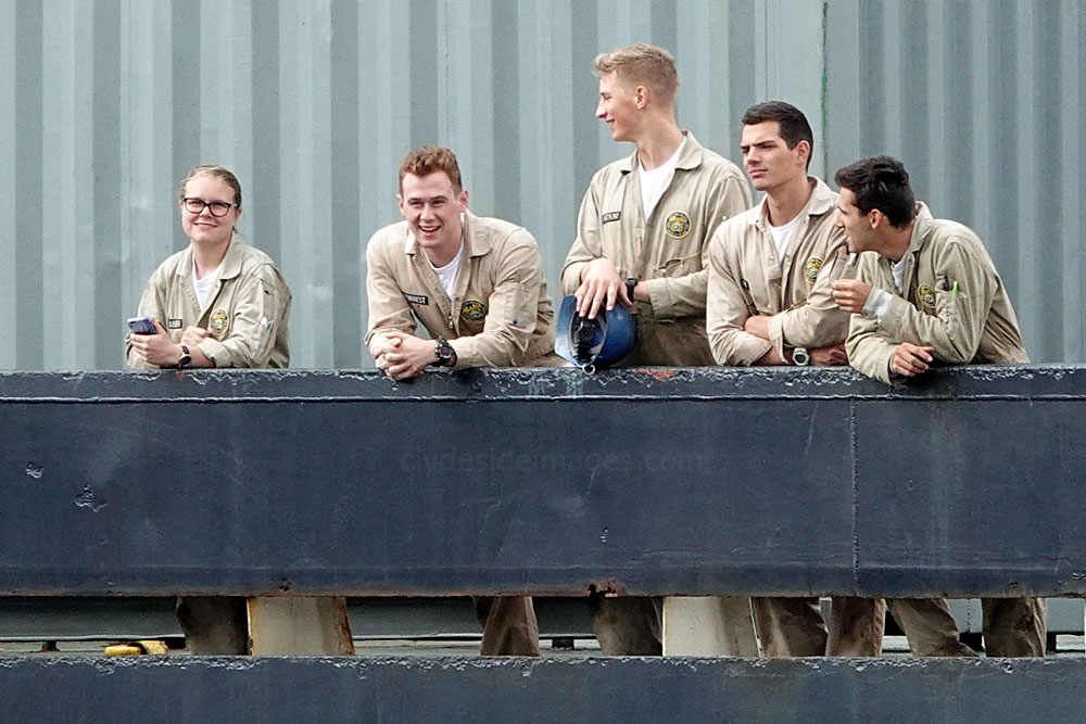
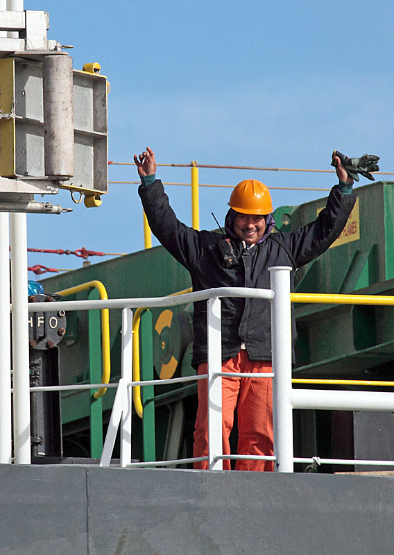
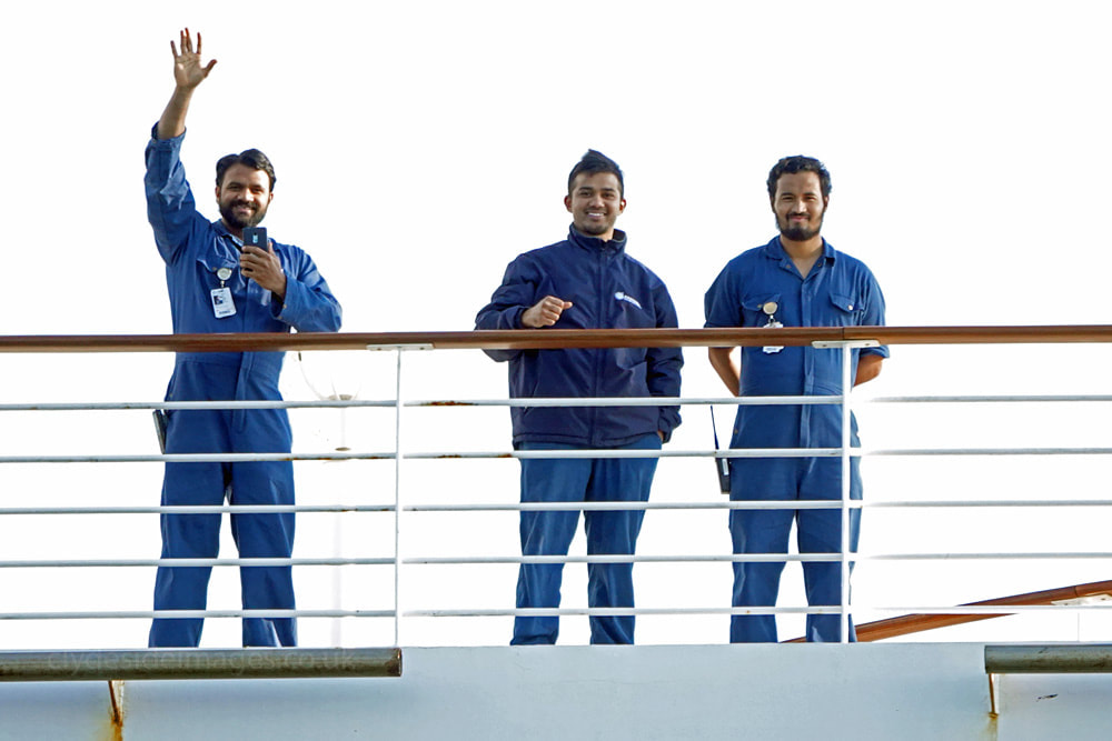
Many sailors from all over the world are delighted with the friendly reception they get when they sail past Erskine...
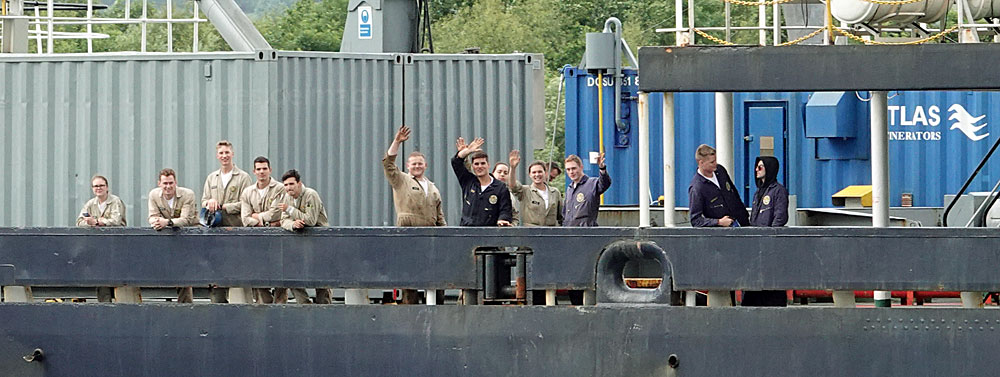
Smiles and waves are often the order of the day.
|
|
|
Below: This crew was the exception though, taking time out to practice their Full Monty routine...
Shipbuilding and Naval Activity on the Upper Clyde
|

|
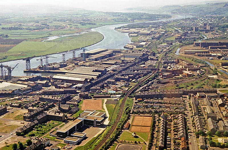
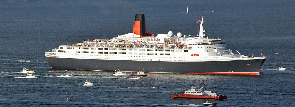
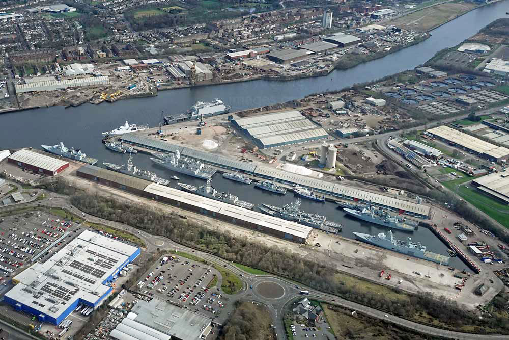
The River Clyde has been a centre for shipbuilding for hundreds of years, with boats being produced in the area possibly as early as the 15th century. By the early 1900s, the Clyde yards were turning out around a fifth of all the world`s ships. Two of the most famous companies were located just across the water from Erskine, namely William Beardmore & Co at Dalmuir, and John Brown`s at Clydebank, both of which can be seen in the aerial view above. Of the numerous iconic vessels that the latter yard produced, the most recent was the QE2, pictured below when she made her last visit to the Clyde in October 2008.
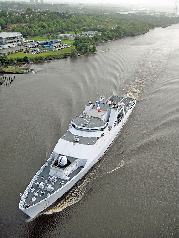
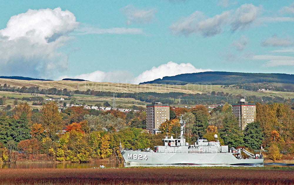
Now, all that remains is Ferguson Marine at Port Glasgow and BAE Systems on the upper Clyde, the latter specialising in naval vessels. They have two sites, one at Govan, where the ships are assembled, and another downriver at Scotstoun where fitting out takes place. At the time of writing, the run of five Batch 2 River-class Offshore Patrol Vessels is nearing completion. Four are already in service with the last, HMS Spey due to be commissioned sometime in 2021. The proud tradition of warship construction on the Clyde continues with BAE having been awarded the contract to build the next generation Type 26 Global Combat Ship. Work is already well underway on HMS Glasgow and HMS Cardiff at Govan. This comes two years after steel was cut on the lead vessel,
|
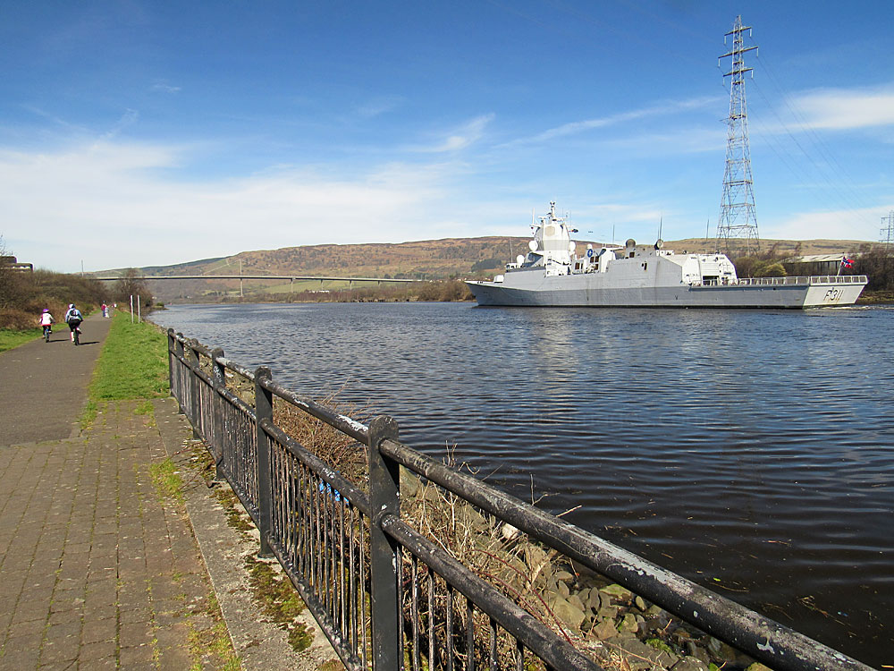
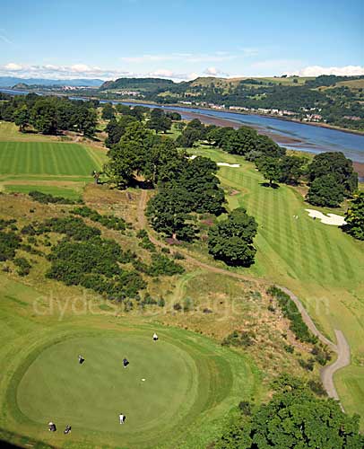
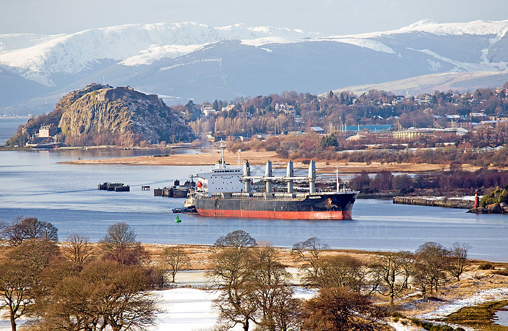
The waterfront between Erskine and Longhaugh Point near Bishopton offers a variety of backdrops for photographs of new naval vessels as they head out for, or return from sea trials in the outer Firth. This shot of Wave Ruler, a Wave Knight-class Fast Fleet Tanker was taken on a sunny day back in August 2005 from the shore just west of the Erskine Golf Club. Dunglass Castle on the opposite side of the river is currently in a dangerous condition and access is not permitted.
|
|
Security fences and trees more or less screen the ruins from the road, therefore the south bank of the river is the best place to come for a view. The earliest part of the castle, which was once the main power base of the Colquhoun Clan, dates from the 14th century but very little of the original structure remains. In 1735 a large section was dismantled to provide a source of stone to repair the adjacent quay. Charles Rennie Mackintosh and his wife Margaret MacDonald later re-designed the castle`s interior for its wealthy owner and it`s thought that Mackintosh's efforts here led to him being awarded the contract for the Hill House in Helensburgh. The obelisk in the castle grounds, erected in 1838, is a monument to Henry Bell who designed the paddle-steamer Comet, which became the Clyde`s first regular steamship service following her launch at Port Glasgow in 1812.
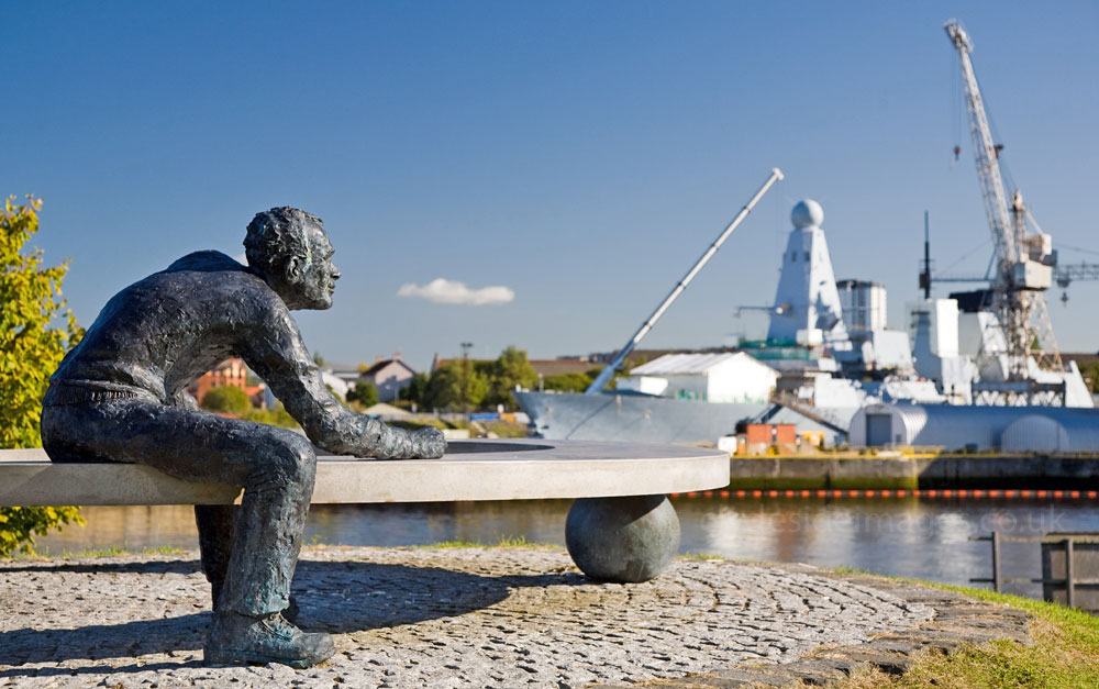
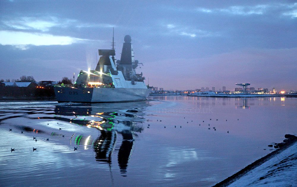
The upper Clyde`s shipbuilding heritage is celebrated in Clyde View Park, Renfrew, with this statue of a naval architect. The last major construction project for BAE before the Batch 2 River-class OPVs was six Type 45 Daring-class guided missile destroyers for the Royal Navy. The lead ship, HMS Daring, was launched on 1 February 2006 and commissioned on 23 July 2009 with the last, Duncan, entering service in September 2013. One of these vessels, HMS Dragon is pictured below returning from sea trials just before first light on a cold December morning.
|
|
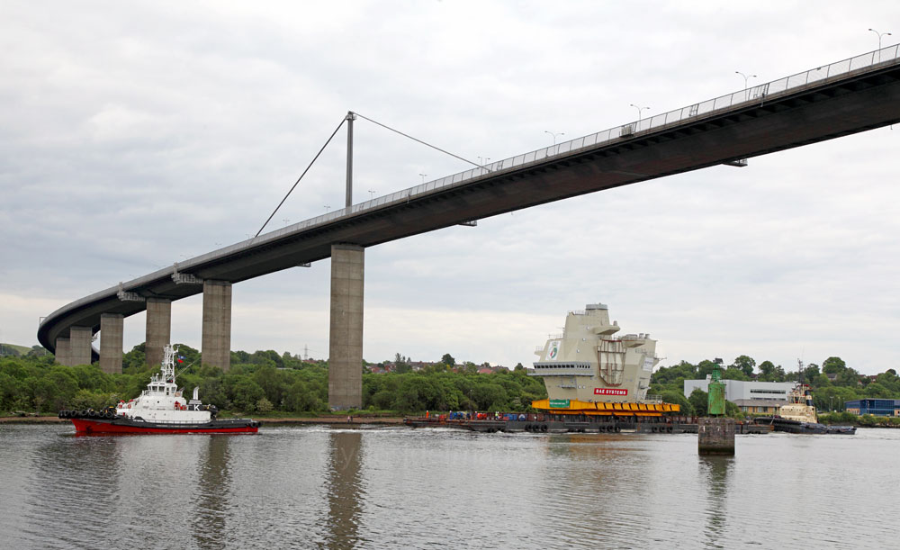
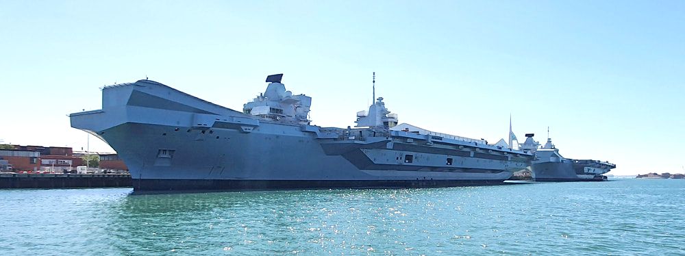
The largest construction project ever undertaken by BAE Systems was when it produced sections for the new Queen Elizabeth-class aircraft carriers. Various yards around the UK were involved and once complete the prefabricated blocks were loaded onto a barge and towed to Rosyth on the Forth for assembly. Adverse weather meant that at least one of the blocks from the Clyde had to go the long way round, taking a less exposed southern route before running up the east coast, rather than sailing round the top of Scotland.
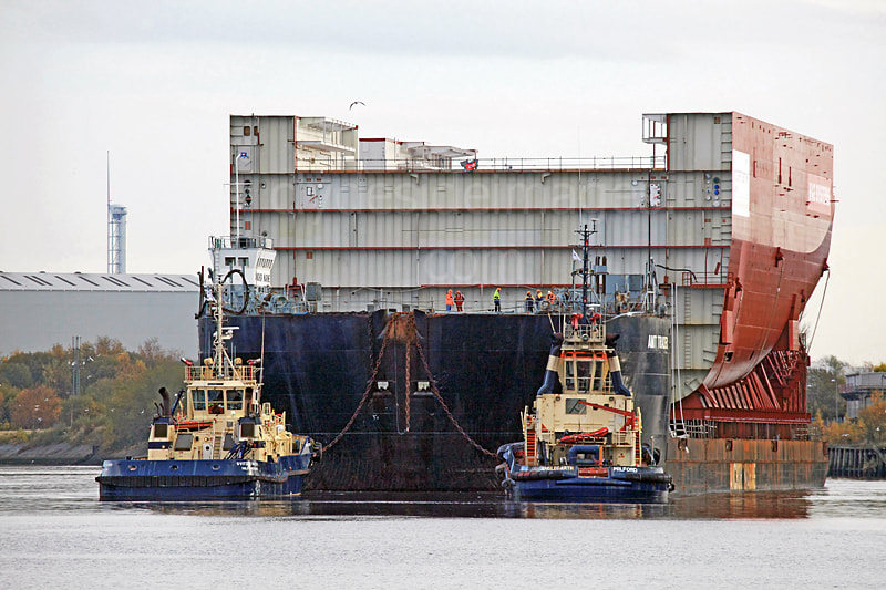
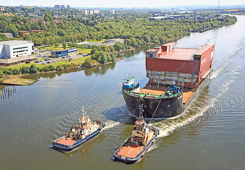
|
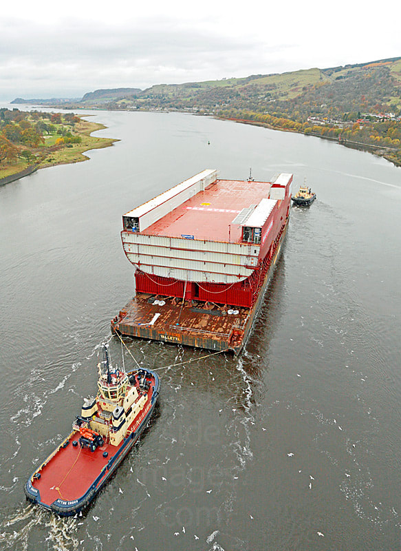
|
Both HMS Queen Elizabeth and her sister HMS Prince of Wales, pictured below at Portsmouth, are now in service and training continues with the state-of-the-art F-35 Lightning 2 fighter jets. Neither of the new carriers have visited the Clyde yet, but once the Northern Ammunition Jetty at Glen Mallan on Loch Long has been upgraded the huge vessels will have to appear at some point. The refurbishment is well underway and when complete the huge ships will be able to load up with ammunition and other essential supplies.
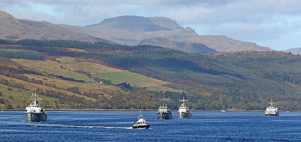
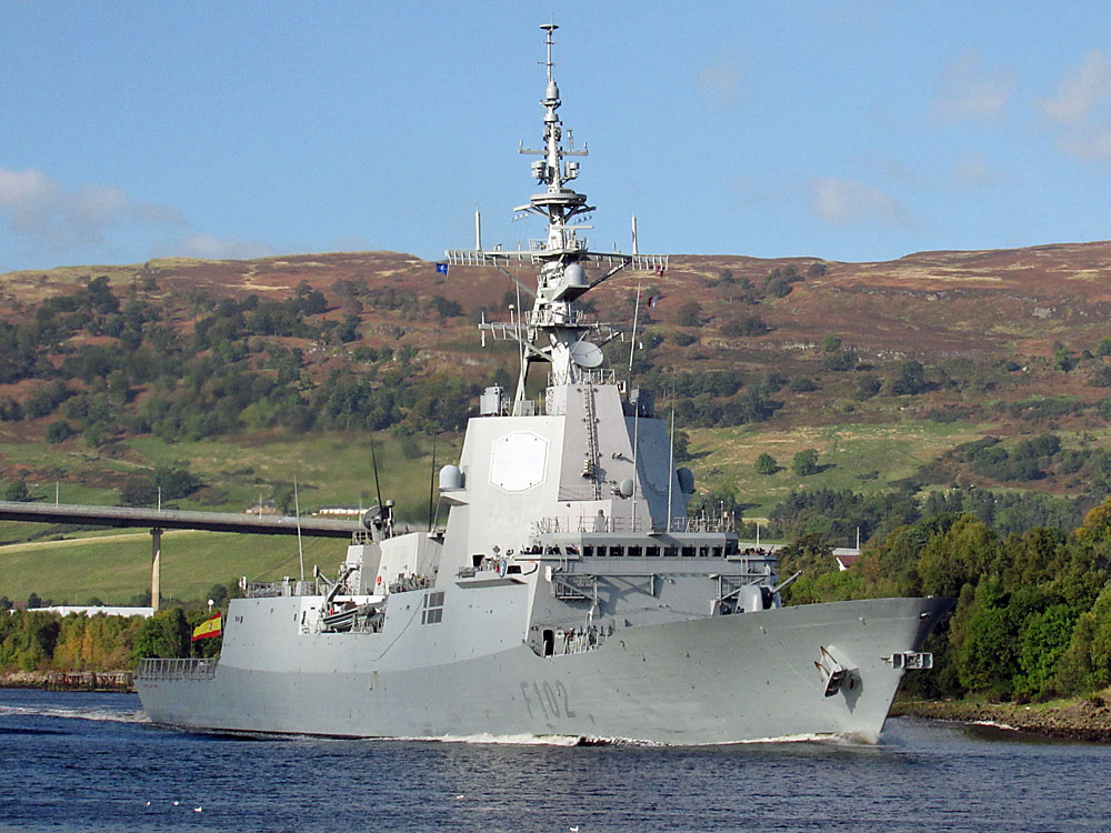
Twice a year, in spring and autumn, the UK hosts Exercise Joint Warrior which is designed to enable the armed forces of participating countries to practice procedures and operate as a multi-national coalition. The event incorporates a wide variety of training scenarios, and each one may include small boat attacks, boarding operations, large-scale amphibious assaults, air defence and anti-submarine warfare. The participating naval vessels traditionally gather on the Clyde for a briefing prior to the commencement of each exercise.
|
Most of the warships tie-up at either Faslane or Glasgow’s KGV Dock to give their crews some shore time before the hard work begins and Sunday has become the main departure day when most vessels head out to sea to take up station.
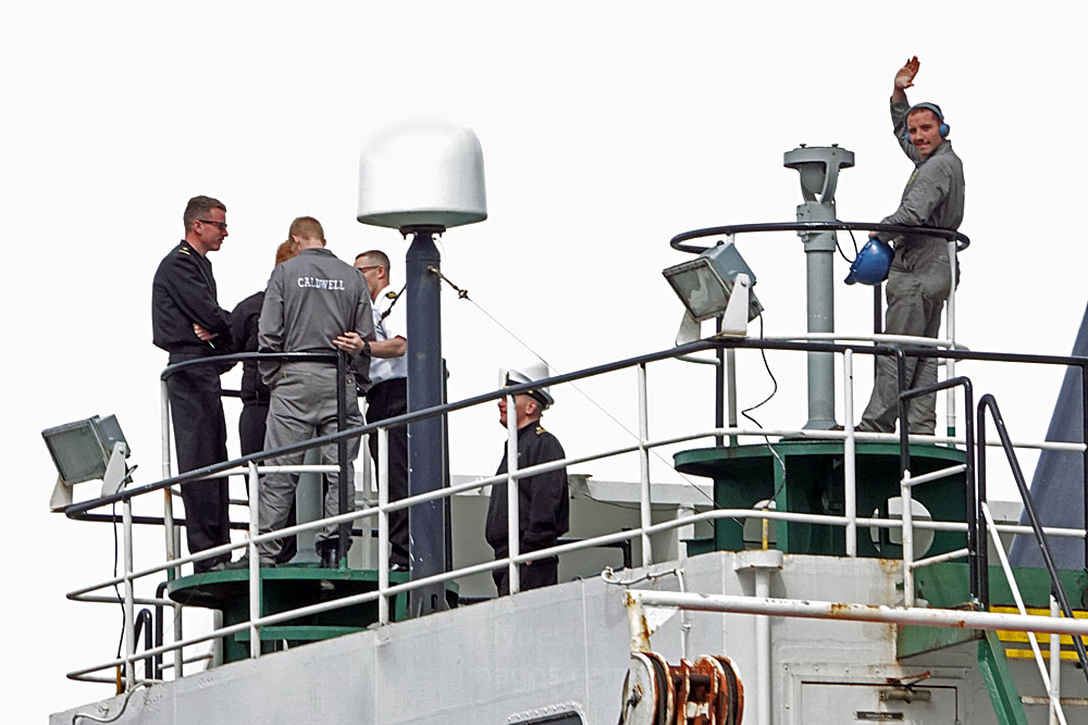
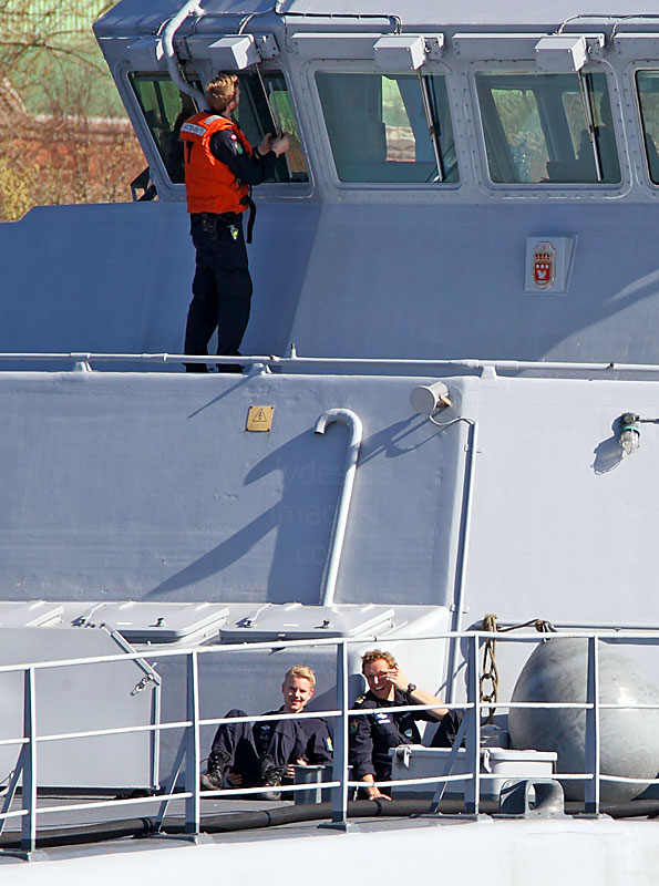
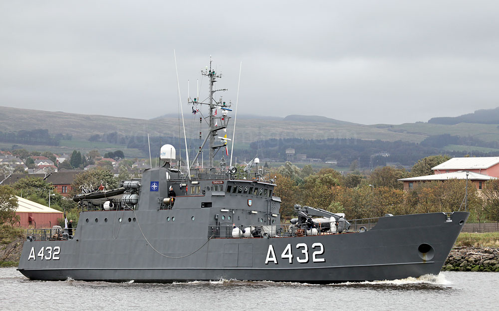
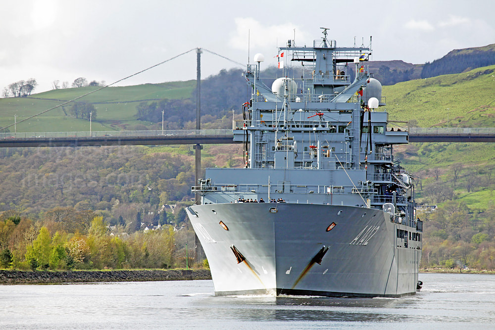
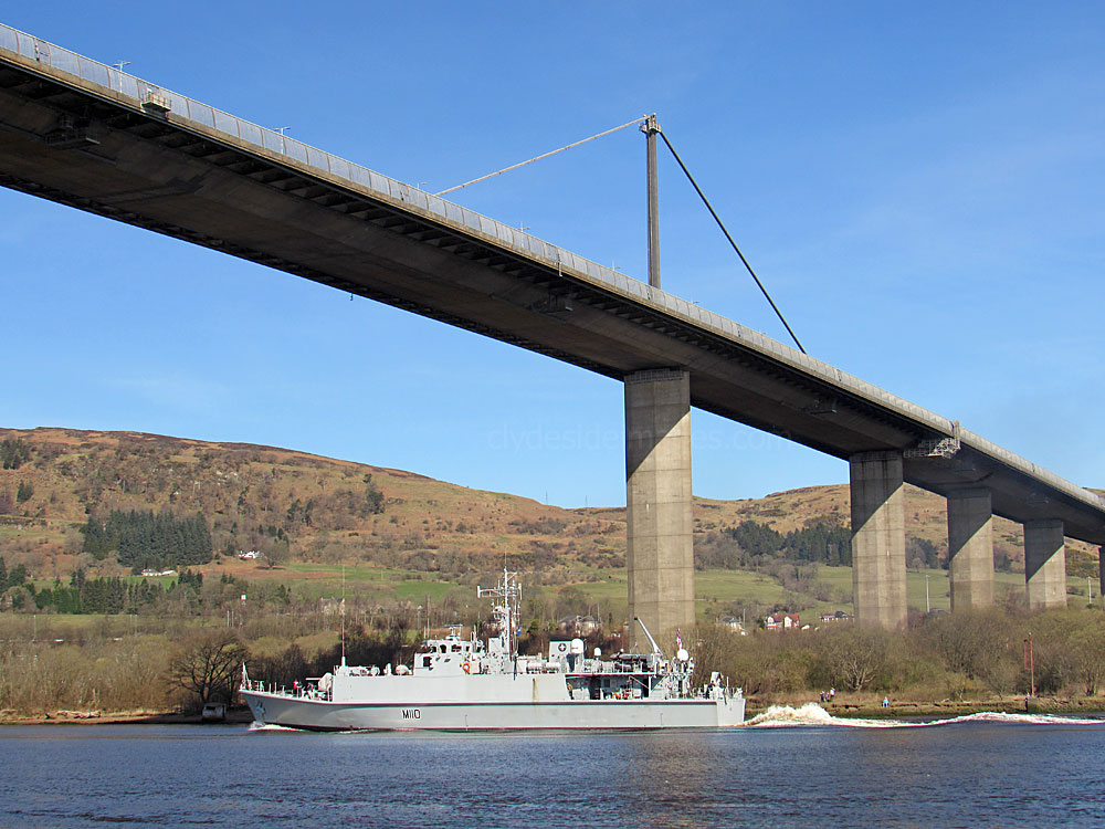
Right: This was the scene at the KGV in March 2019 when no less than 17 naval vessels berthed there. This gathering was the largest-ever number of Joint Warrior participants in the city. The following slideshow features just some of the Joint Warrior vessels that have transited the upper Clyde in recent years. |
|
|
|
The Joint Warrior slideshow and following gallery only feature shots taken around the Erskine waterfront. The scenery becomes even more spectacular as you head west for the outer Firth of Clyde, with the high mountains of Arran and mainland hills to the north often forming a dramatic backdrop to the ships. This is just a small selection from the hundreds of individual vessels from NATO and allied nations that have visited the Clyde in connection with the exercise over the years.
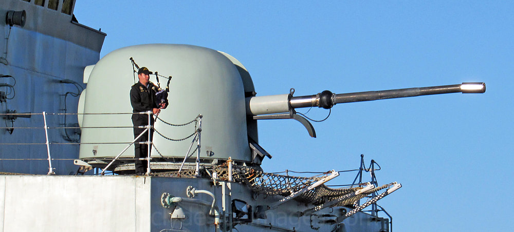
This guy serving on Canadian destroyer HMCS Athabaskan obviously has Scottish heritage and always blasted out a tune or two on the pipes as he sailed past Erskine. On this occasion he was entertaining onlookers with a rendition of `Scotland the Brave`.


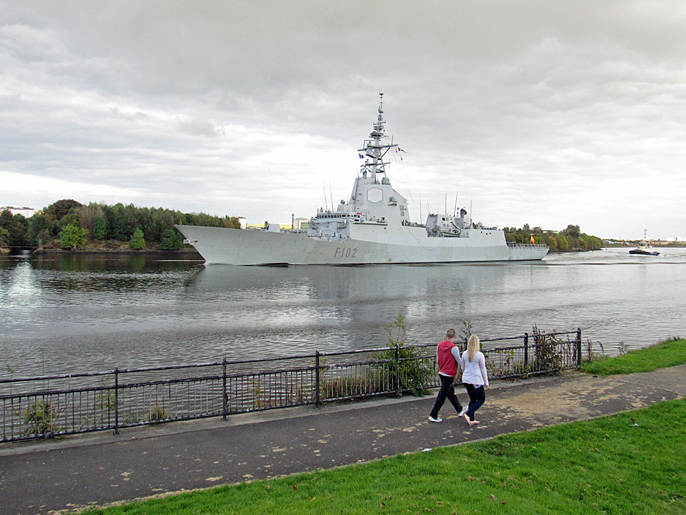
Below: One of the Newshot Island cows enjoys a light lunch as a Polish Navy frigate heads for the KGV...
Heading West beyond the Bridge

|

|

|
The entire stretch of the riverbank between Park Quay and Erskine Golf Course is understandably extremely popular with dog owners and indeed, their dogs but the increased activity, usually inadvertently, can result in the disturbance of roosting birds.
Years ago, for example, Shelduck used to nest in the ground between Mar Hall and Longhaugh Point at Bishopton, but they are seldom seen this far upriver nowadays. This sign, beside the path underneath the bridge, reminds visitors with dogs that they should take extra care along the foreshore, and consider keeping their pets on a lead, especially in winter and during the bird nesting season.
|
|
The whole area is steeped in history ranging from prehistoric times, through the Roman occupation, to the First and Second World Wars and beyond. Although the entrance to the inner Firth of Clyde was protected during WWI and WW2 by an anti-submarine boom which stretched from Cloch Point to Dunoon, seaborne mines laid by German warships, submarines or parachute versions dropped by aircraft, could easily be carried upstream on an incoming tide to cause serious disruption or catastrophic damage to naval and merchant vessels, all of which were vital to the war effort.
|
In an effort to protect the huge number of ships transiting the Clyde, mine-watcher`s lookout posts were built along both banks of the river between Greenock and Glasgow. Most have since been demolished while others have collapsed and slid into the water as a result of bank erosion but several examples remain. The shelters are made of brick with a concrete roof and have a foot-high horizontal observation slit facing the river. The rear entrances were often protected by a defensive wall. One post still survives on a promontory at the eastern end of the Greenock Ocean Terminal, and can be seen from the walkway at the back of the town's swimming pool while another intact example lies at Port Glasgow, near the lighthouse. The tilted one pictured here lies opposite the Mar Hall golf course, just west of the Erskine Bridge. The spacing of these surviving examples suggests that there may have been several more in operation along the river during wartime.
|
|
|
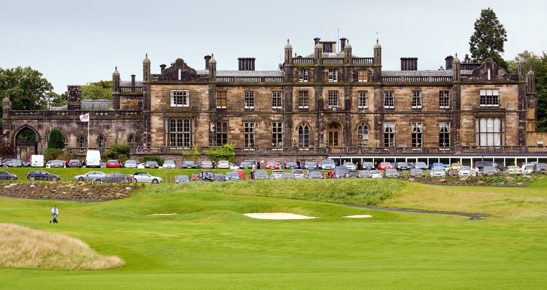
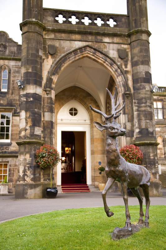
This building, currently operating as the Mar Hall Hotel, opened in 2004, but from 1916, when the Great war was at its height, until the commercial takeover, this was Erskine Hospital, now simply known as Erskine, which continues to provide nursing and medical care for members of the UK`s Armed Forces, helping them to rebuild their lives, usually after suffering horrendous physical injuries or mental illness as a result of their service.
|
|
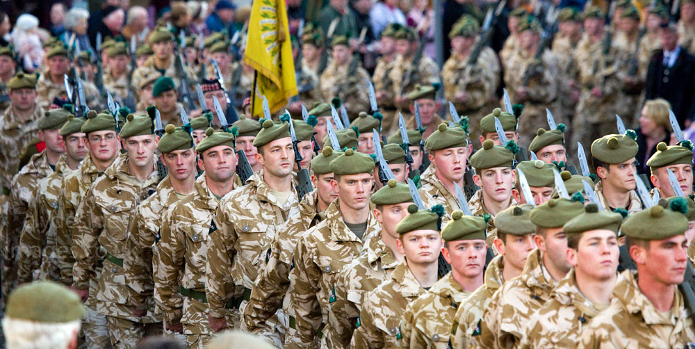
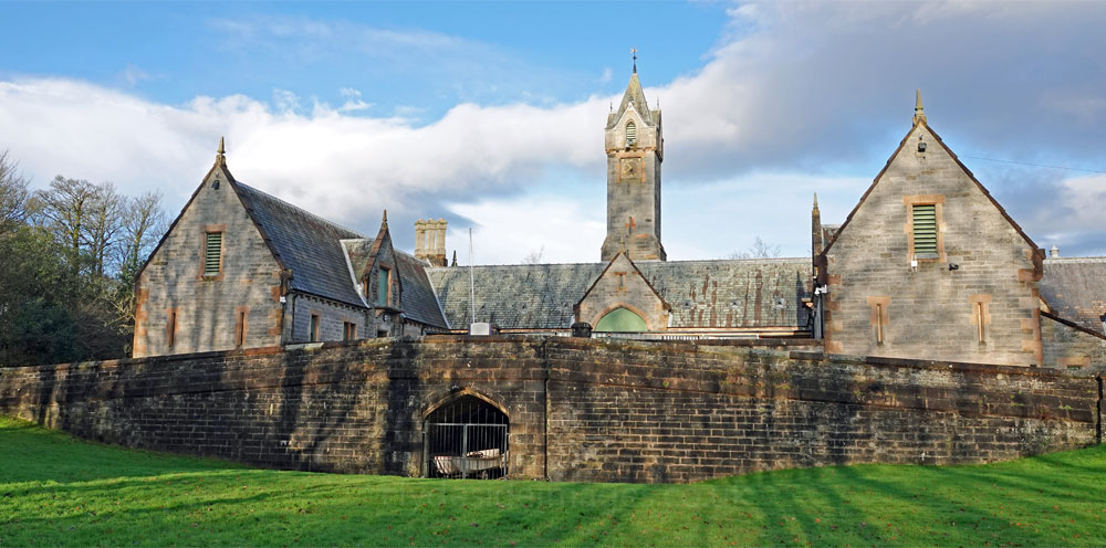
Although the UK is no longer officially at war, members of the British Armed Forces continue to serve their country at various locations across the globe, ensuring that the expert care of Erskine is constantly in demand. On 11 October 2000, to meet the current needs, a £16 Million modern care centre, renamed simply `Erskine` was opened within the existing hospital grounds. Although the present day accommodation is in well-spaced individual units, some of the original estate buildings, including the stable block remain.
The Mar Hall Hotel`s five-star 70-par Earl of Mar Championship Golf Course is pictured below...
(Above image © Steve Moyes 2020 aviation)
|
|
|
In the early 18th century, the Mar Estate passed to Lord Blantyre and in 1828 Major General Robert W. Stuart, the 11th Lord Blantyre (1781-1867), who also designed the British Museum in London, commissioned the present house.
He was a veteran of Wellington`s army and fought with distinction during the Napoleonic Wars. The lavish Gothic-style mansion, designed by Sir Robert Smirke M.A. was completed in 1845. By 1900, however, the house, which had taken 25 years to build, lay derelict. |
|
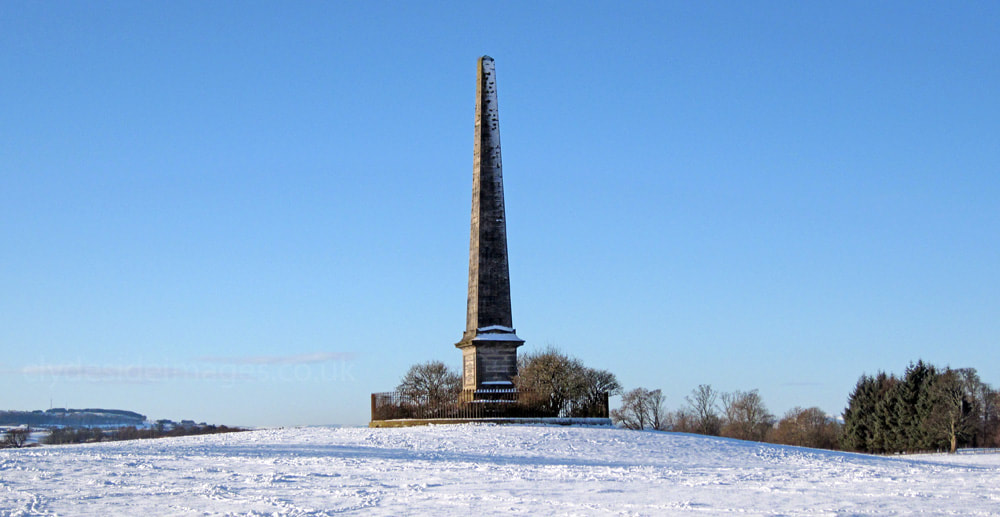
Sadly, Major General Stuart never saw his dream home as he was killed in Brussels in 1830 during an insurrection. His death came as a great shock to the community of Bishopton as he was highly respected. As a tribute this monument was erected to his memory in a field near the village and close to his unfinished project.
|
|
|
|
For those with the relevant skill and experience, as well as access to a sea kayak, an excellent alternative to walking this stretch of the Clyde would be a paddle. Obviously the weather, tides and ships transiting the river would have to be taken into account. Knowing the tide times can be useful and in some cases imperative, depending on the activity you`re embarking on. Also, the larger ships will only come this far upriver around high water. The Admiralty Hydrographic Office provide free tide tables for seven days in advance which can be found on the easytide website.
Most walkers only go as far as the west end of the Mar Hall Golf Course and double-back to the main Boden Boo car park beside the Erskine Ferry slip.
The path, however, continues uphill between the Mar Hall and the Erskine Golf courses then crosses a shallow drainage ditch to enter the mature woodland, now known as Big Wood, which once formed part of the Mar Hall Estate.
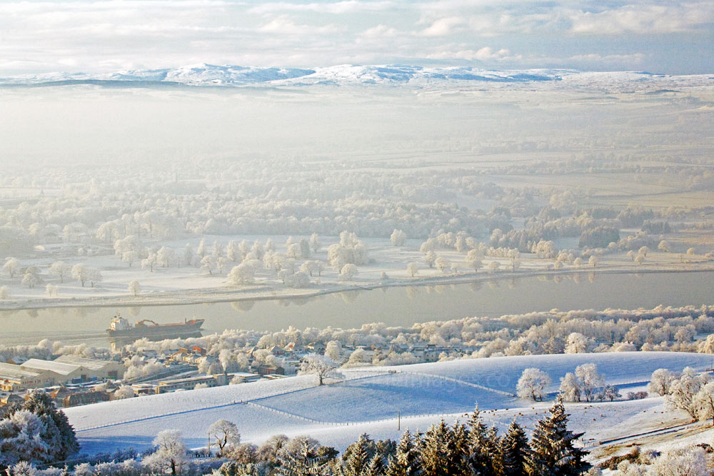
Just beyond the point where the path bears left, you get a view down the Clyde towards Greenock and Dumbarton Rock. The green navigation bollards in the above photo form part of the Lang Dyke, the training wall designed to deepen the central channel of the Clyde which was very shallow at this point. As previously mentioned. before the dyke was brought into use, most of the larger merchant ships had to unload cargoes destined for the city of Glasgow at Port Glasgow, just east of Greenock. The onward transfer of goods by road was not only slower but far less cost effective.
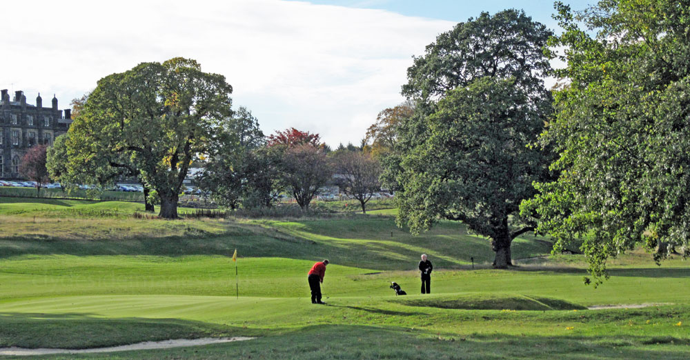
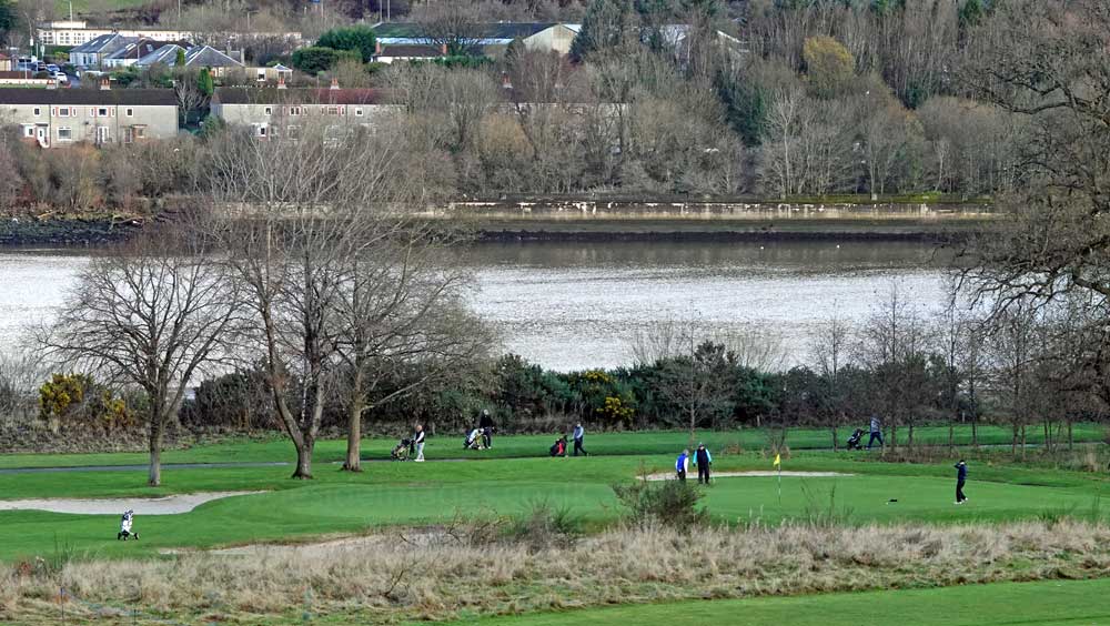
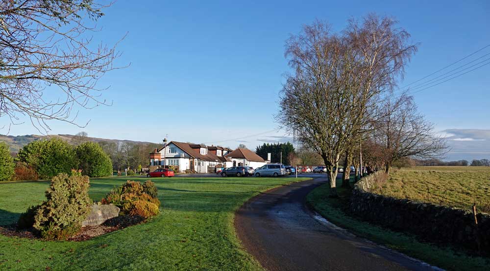
The Erskine Golf Course clubhouse (see below) can`t be seen from the trail but several of its holes can.
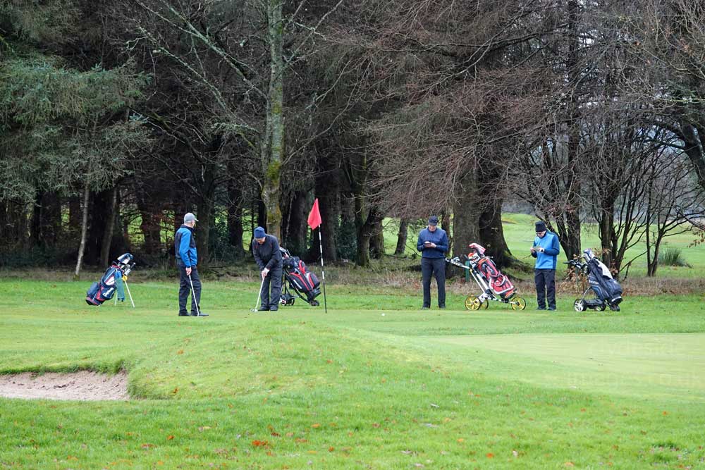
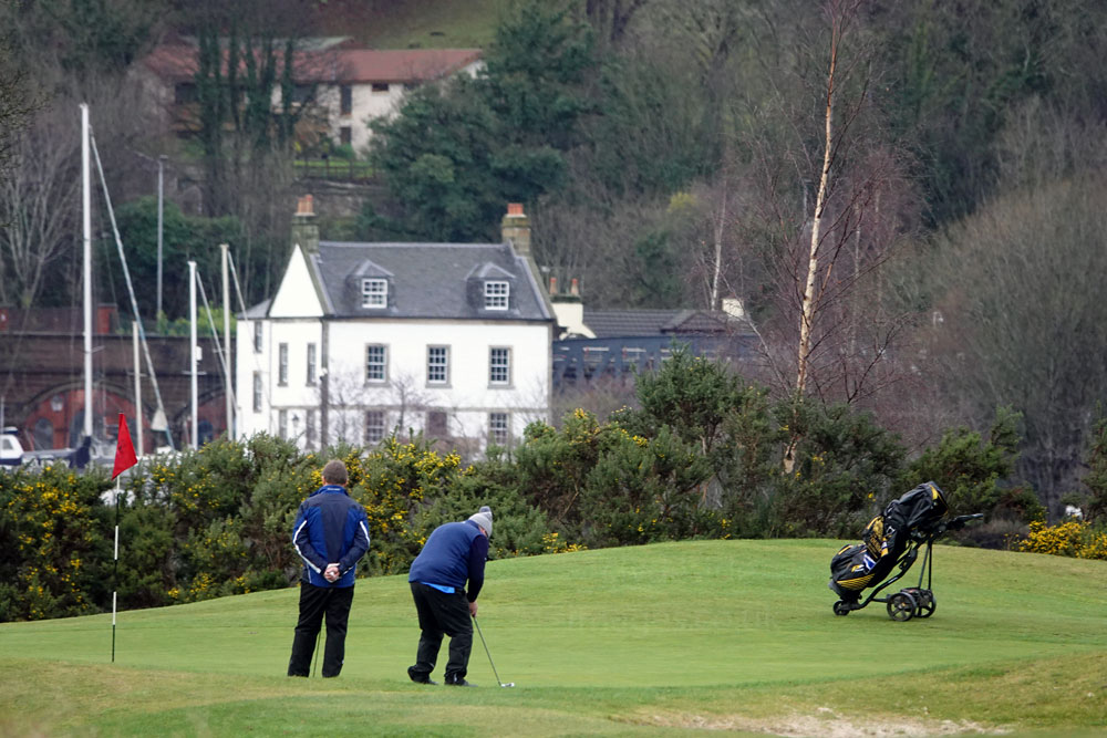
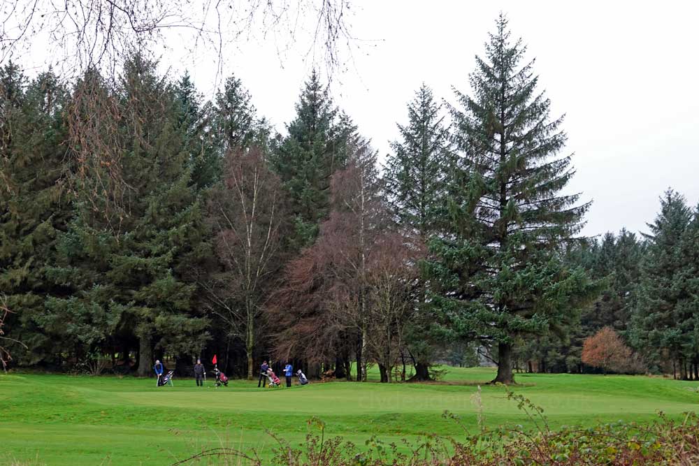
Above: A golfer tees off on the Erskine course. The gate into the grounds of Mar Hall is on the left.
|
|
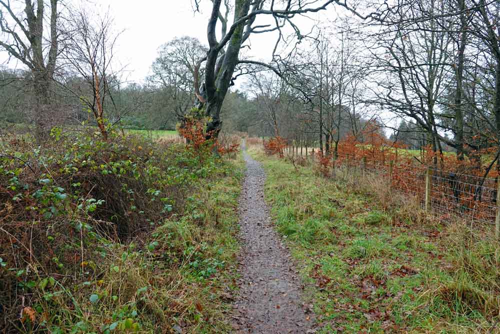
Several trails crisscross the the Mar Hall Woods but its often muddy underfoot and can be more like a quagmire in places after heavy rain.
The entrance to Erskine Golf Club lies at the end of aptly named Golf Road off the B815 Ferry Road, just before Bishopton village.
|

|
Although there`s usually not a lot to see in winter, extensive banks of rhododendron wait to burst into bloom and some of the more open areas are carpeted with bluebells in springtime.
The Return Leg
|
|
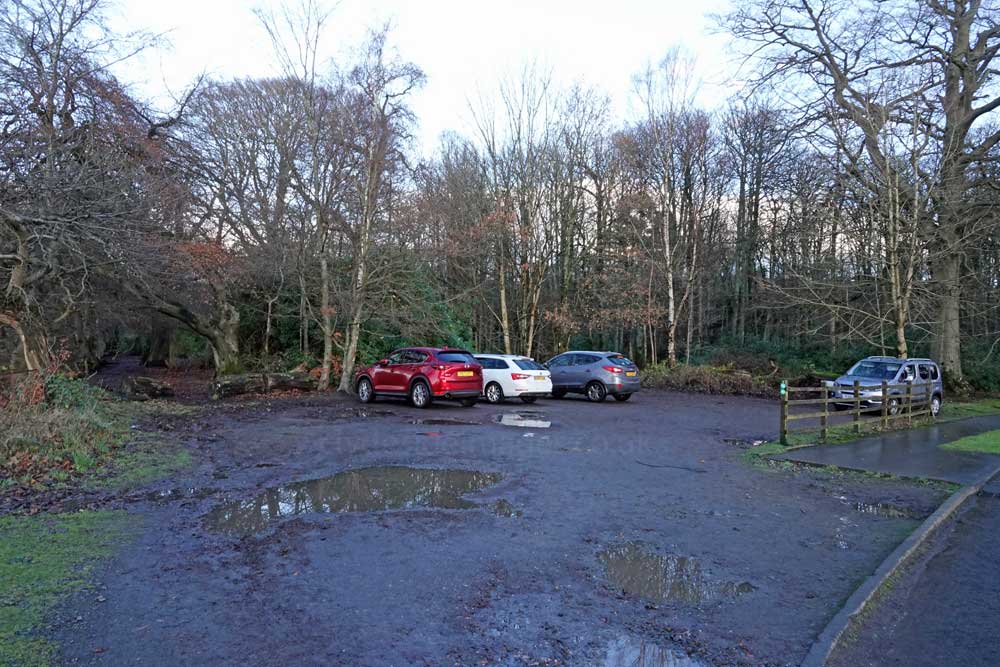
The designated car park for Big Wood (above) is located at the start of the Mar Hall Hotel`s long driveway. Although it`s smaller than most of the other car parks in the area it`s very popular, especially with dog walkers, and fills up quickly. Once out on the main road, you can head east along the B815 to return to the start point, or about turn and retrace your route.
|
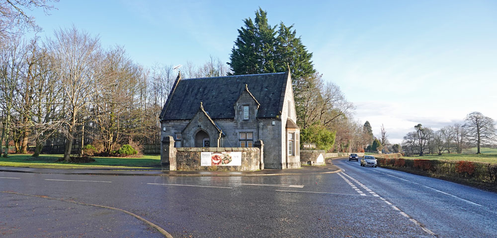
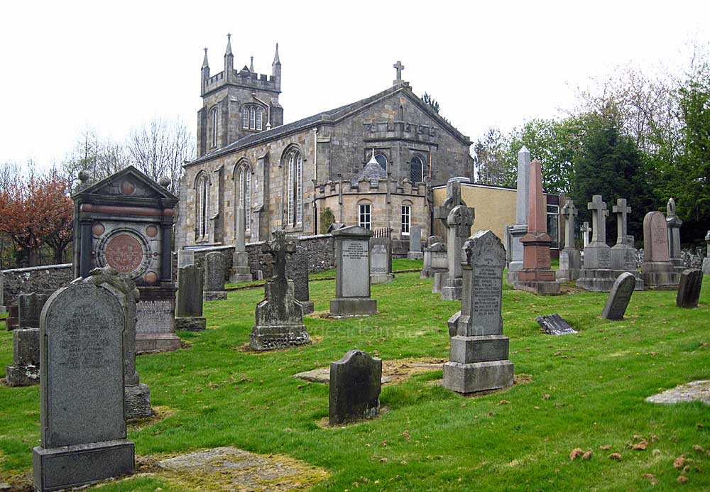
Bishopton Parish Church lies between Bishopton and the old Erskine ferry slipway, just west of the Erskine Bridge. It`s thought that a church, an annex of the Abbey of Paisley, has stood at this location since the 12th century, possibly as the site lay on the main pilgrimage route north to Iona.
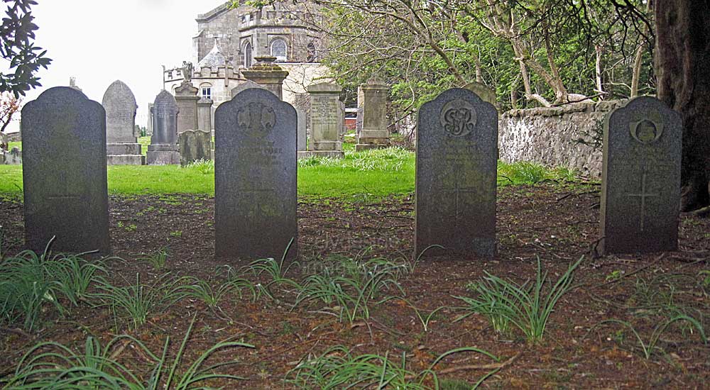
The present building was constructed in 1812 after the first one fell into disrepair and around 1999 Erskine Parish Church was renamed Bishopton Parish Church. The kirkyard contains a number of military headstones, most of which presumably commemorate men who died at nearby Erskine Hospital as the dates, where discernible, show that most passed away after the end of the Great War. Various regiments and branches of the armed services are represented. |
|
|
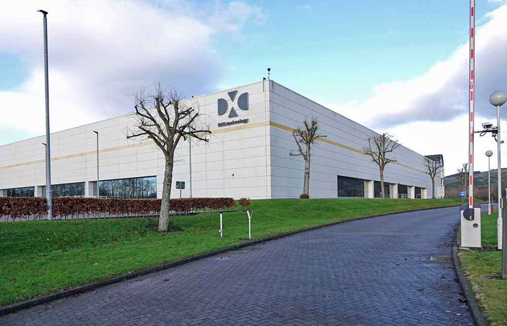
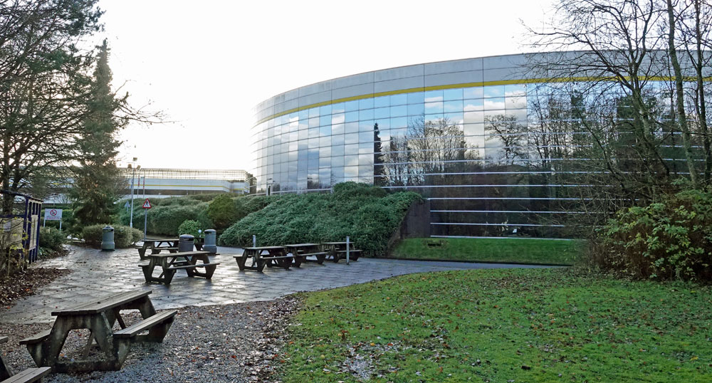
Computer manufacturer Compaq was the major employer in the Bishopton / Erskine area for many years. In 2002, however, the company signed a merger agreement with computing giant Hewlett-Packard for $24.2 billion and gradually most Compaq products were re-branded with the HP nameplate. HP discontinued the Compaq brand name in the United States in 2013. The Renfrewshire HP facility currently employs about 400 people and refurbishes millions of laptops, printers and servers annually, most of which are supplied to customers throughout Europe.
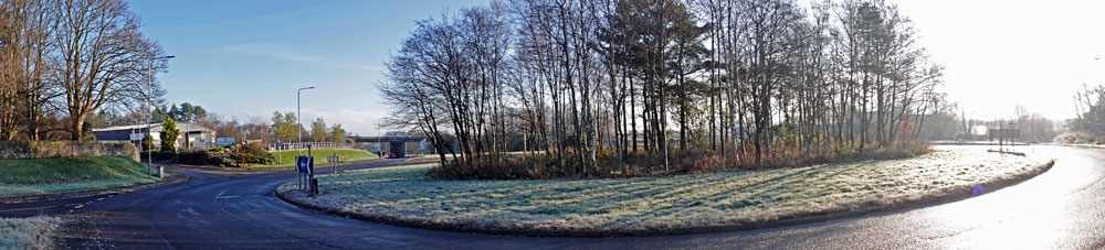
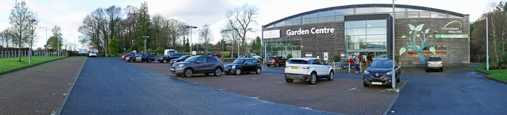
Caulders Garden Centre, nestled between the entrance to Erskine and the west side of the bridge, has a popular restaurant which makes a good place to rest your legs and thaw out during the colder months. Erskine can be found by heading straight down the turnoff road past Caulders` main car park.
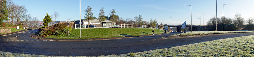
Note there is no pedestrian or vehicular access to the Mar Hall Hotel from here. The only entrance lies to the west near Bishopton as previously described.
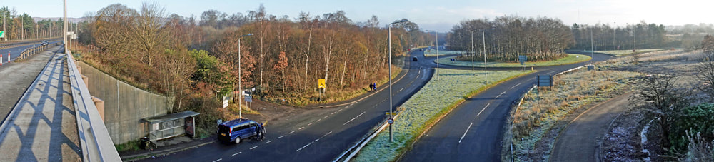
Our walk continues eastward, following the main road under the bridge to the turnoff for the Boden Boo which is just a hundred and fifty metres ahead.
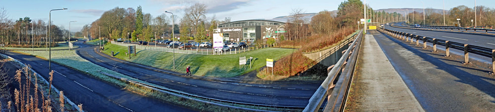
Footpaths lead onto the Erskine bridge for pedestrians and and cyclists, but quite often one side is closed off for essential maintenance.
As you head back through the woods to the walkway and start point, you can think about your next jaunt in Erskine, Inchinnan or Bishopton.