Islands
Skye
Castles and Brochs
*I am in the process of redesigning this section*
Intro
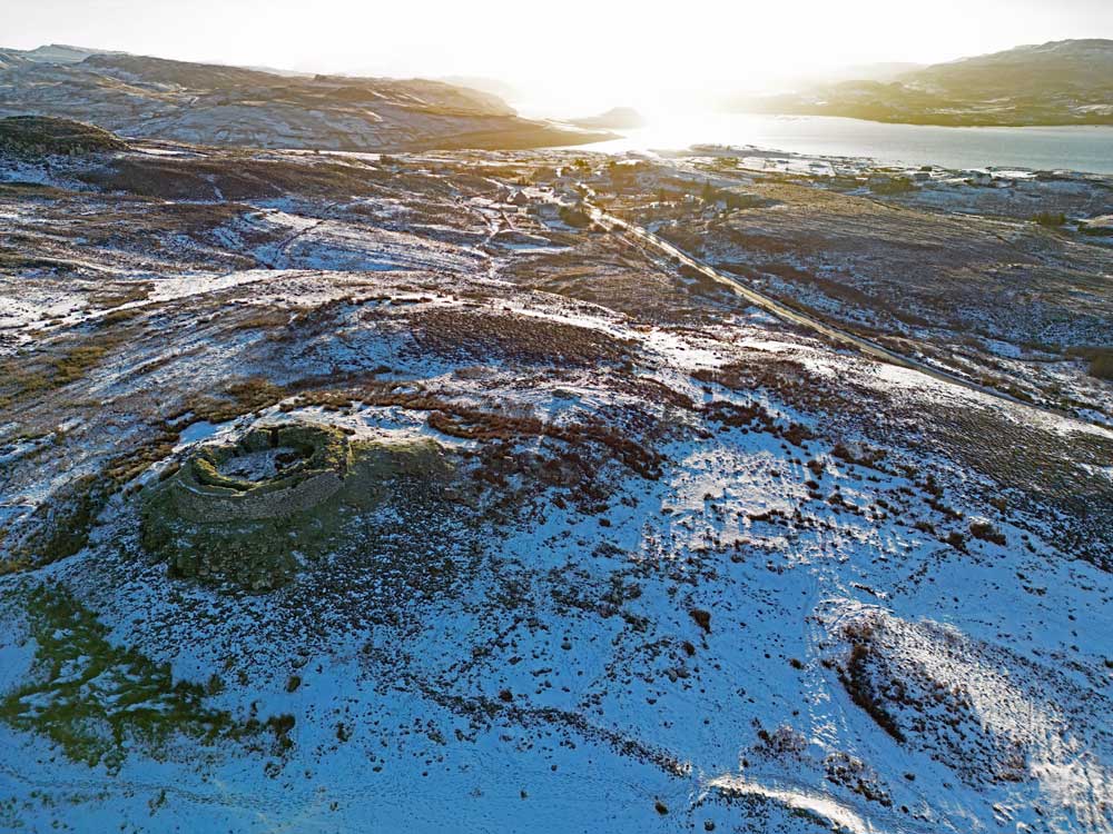
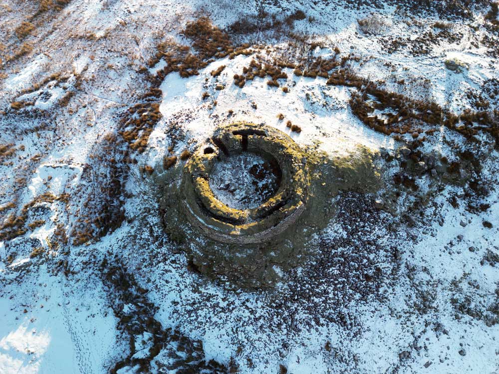
Caisteal Maol (Castle Moil)
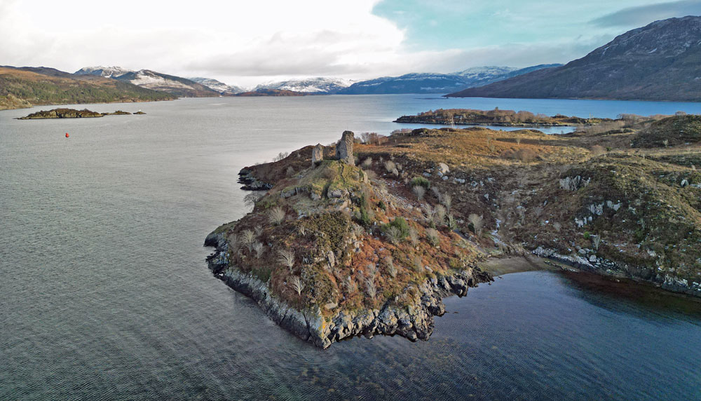
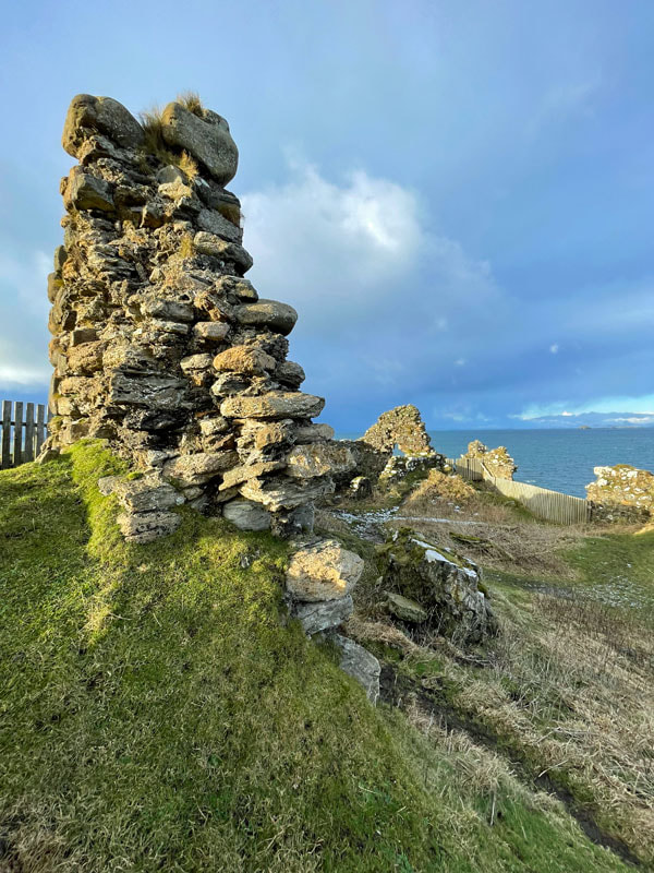
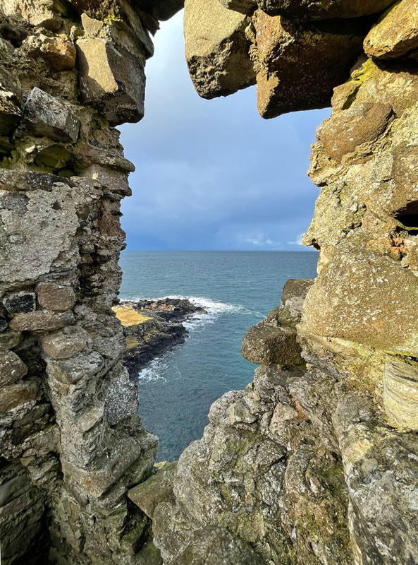
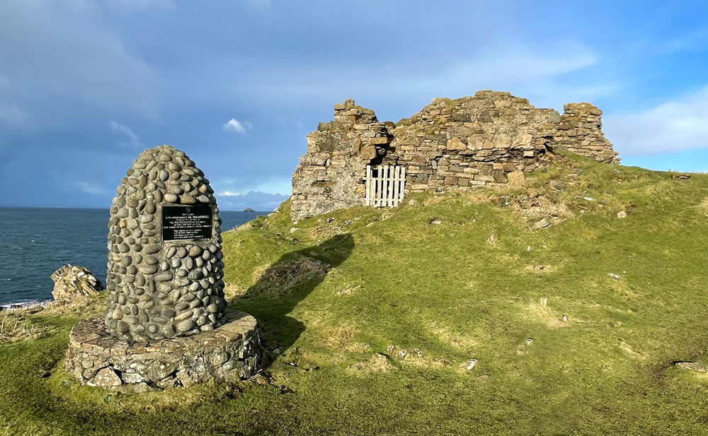
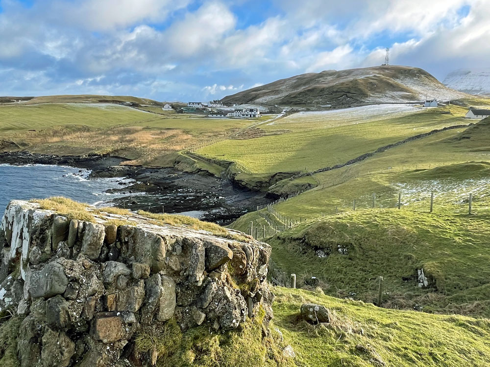
At Kyleakin, the scant ruins of Caisteal Maol (Castle Moil) dominate the harbour entrance and the narrow straits between Skye and the mainland. The structure can be reached by crossing the bridge over the river to South Obbe and following the road along the coast to a large boathouse. (It`s easier to access the castle when the water level is low). As the narrow channel between Kyleakin and the mainland was once such an important, relatively sheltered passage, there has been a stronghold on the site where Caisteal Maol now stands from at least the 10th century.
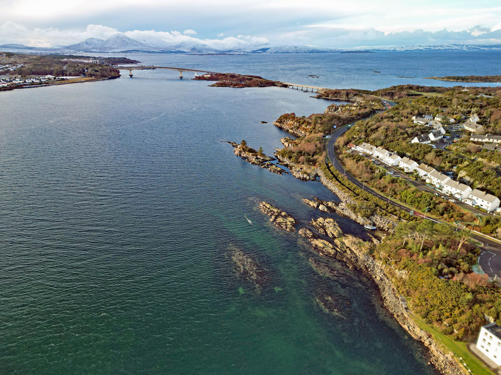
According to legend, the first castle was built by a Norse Princess known as 'Saucy Mary' which doesn't sound very convincing! She married into the local MacKinnon Clan who levied a toll on vessels wishing to transit the straits. The delectable damsel allegedly operated one end of a long chain which blocked access until payment was made. She obviously liked her porridge! A Norse princess, possibly Mary, is said to have been buried under the large cairn on the summit of Beinn na Caillich having reputedly requested this location as her last resting place as it was exposed to the prevailing wind which blew over to Norway. Fortunately the chain tolls, and those on the Skye Bridge centuries later were eventually abolished. There is a good view of the bridge from the war memorial and nearby is a direction marker showing noteworthy hills and other geographical features.
Dun Sgathaich Castle, (also known as Dunscaith)
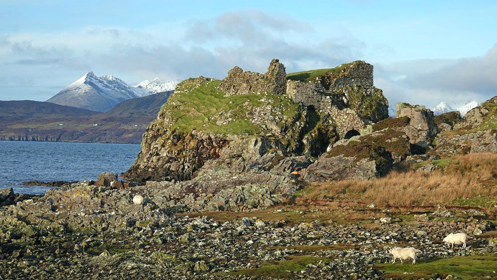
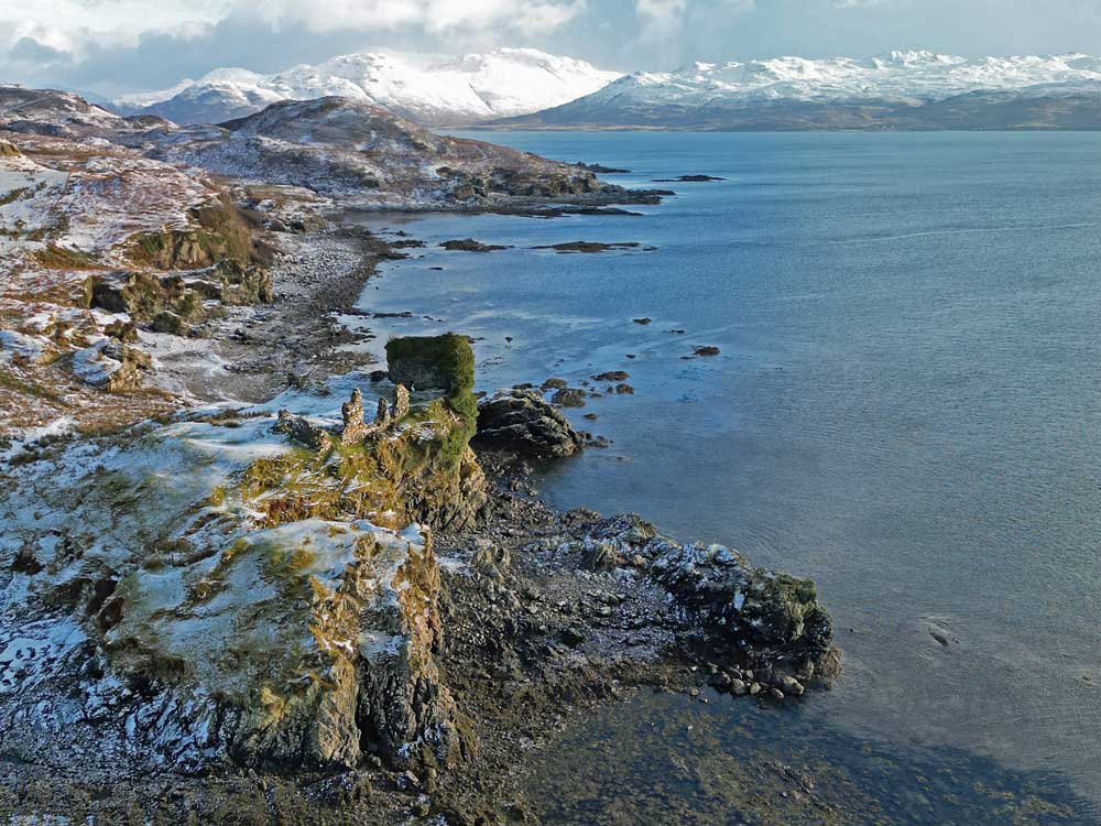
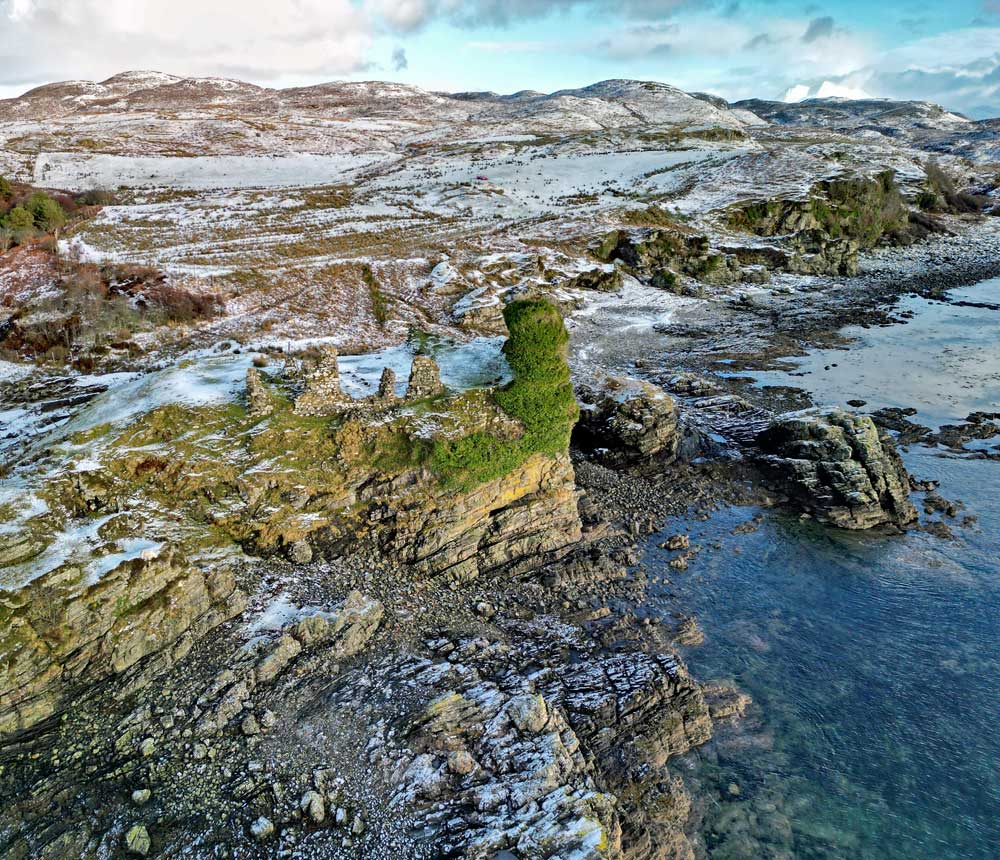
Dun Sgathaich Castle, also known as Dunscaith, (much easier to spell!) stands on the west side of the Isle of Skye`s Sleat Peninsula near Tokavaig, south of Ord. The castle dates from the 14th century and the once substantial stronghold was probably constructed on the site of an earlier castle or dun. The seaward side drops steeply to the bay and access is via a flight of steps and a protected drawbridge but these were later additions, probably from the 16th of 17th centuries. Much of the bridge has crumbled away leaving the structure in a dangerous condition therefore, although access is still possible, it is not recommended.
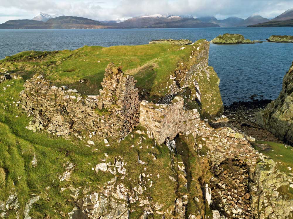
The bay in which the castle stands offers excellent views across the water to the Black Cuillin and it`s easy to see why this site was chosen. The bay, like much of Skye`s coastline, is also a good place for wildlife watching. There are various legends associated with the Dunscaith and it has changed hands several times over the centuries. (The Isle of Rum can be seen in the above shot which was taken at sunset)*.

|
|
|
(Above photo: M Moyes)


Duntulm Castle
Duntulm Castle stands close to Rubha Hunish, the most northerly point on Skye, and during the 17th century it was the seat of the chiefs of Clan MacDonald of Sleat. The hills of Harris lie to the north and it is believed that, in prehistoric times, a broch or dun, known as Dun David, or Dun Dhaibhidh stood here. However, no archaeological evidence has been found to support this.
|
|
The castle was built in the 14th and 15th centuries, when the area was subject to bitter feuds between the rival MacLeod and Macdonald clans. Its defences were improved in the 16th century, and by the early 17th century the MacDonalds had finally gained the upper hand in the area. The castle's importance peaked around 1650, when the fortress was again upgraded with a house built within the wall. Around 1732 the castle was abandoned, when Sir Alexander MacDonald built a new residence, Monkstadt House, 5 miles (8.0 km) to the south, robbing much of the castle's stone as building material. Nowadays, although short, the path to Duntulm Castle can be very muddy. Much of the structure is in a dangerous condition and therefore fenced off.
This cairn at the roadside parking area commemorates the MaCarthurs, hereditary Pipers to the MacDonalds, Lords of the Isles during the 18th century. Their school of Piping was located at nearby Peingown. Another cairn (below) stands above the road on the east side of the peninsula near Flodigarry. It was erected in 2009 on the centenary of land on the Kilmuir Estate being gifted as tenancies to 14 local crofting families.


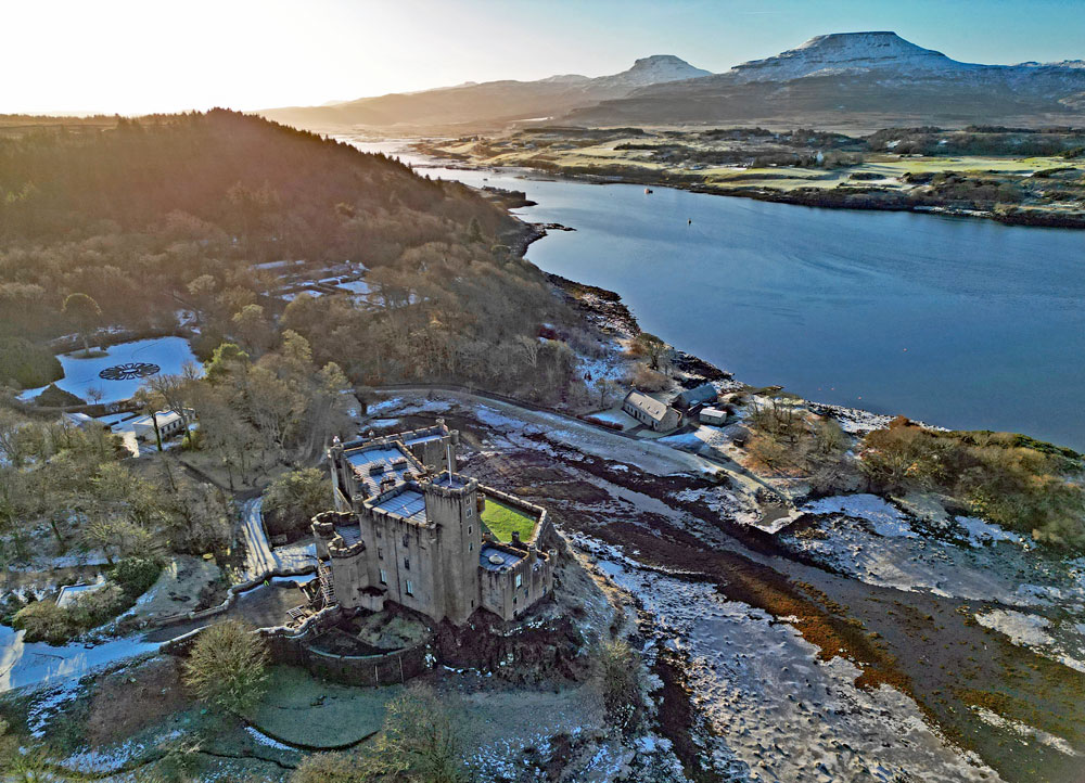
Dunvegan Castle
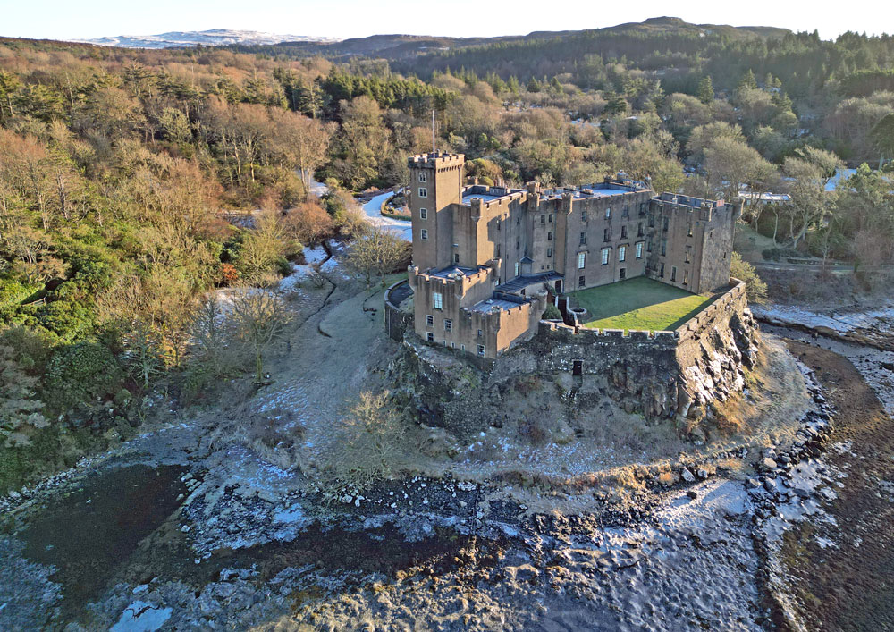
Dunvegan Castle is undoubtedly Skye`s most popular castle with visitors, especially those from overseas. It is the seat of the MacLeod of MacLeod, chief of the Clan MacLeod. The site on which the castle stands was probably fortified from the earliest times, but a fortress was first built here in the 13th century. In the years that followed the original structure was developed piecemeal and in 1800s the whole castle was remodelled in a mock-medieval style. Dunvegan Castle occupies an elevated rock overlooking an inlet on the eastern shore of Loch Dunvegan, a sea loch, and looks at its best around high water.
Above: The view up Loch Dunvegan from the castle.
|
|
The flat-topped MacLeod`s Tables lie to the southwest.

Knock Castle
Knock Castle, also known as Caisteal Chamuis (Camus), is a former MacDonald stronghold located on the east coast of the Isle of Skye's Sleat peninsula. It stands on a steep headland with a ditch cutting off the promontory. Their rivals the MacLeods built the castle but the MacDonalds captured it in the late 15th century along with Dun Sgathaich on the opposite side of the peninsula. The location of Knock Castle was of great strategic importance as it controlled the Sound of Sleat, a relatively sheltered passage between Skye and the mainland, and ownership of the castle passed between the two clans several times in the centuries that followed. The castle was abandoned in the late 17th century and fell into disrepair soon after. Locals took the opportunity to plunder much of its stonework for their own buildings and drystone dykes. It is reputedly haunted by a ghostly `Green Lady`.


Please bear in mind that all my images are subject to copyright. They are not free to use and have been embedded with a digital watermark.
Dun Beag Broch
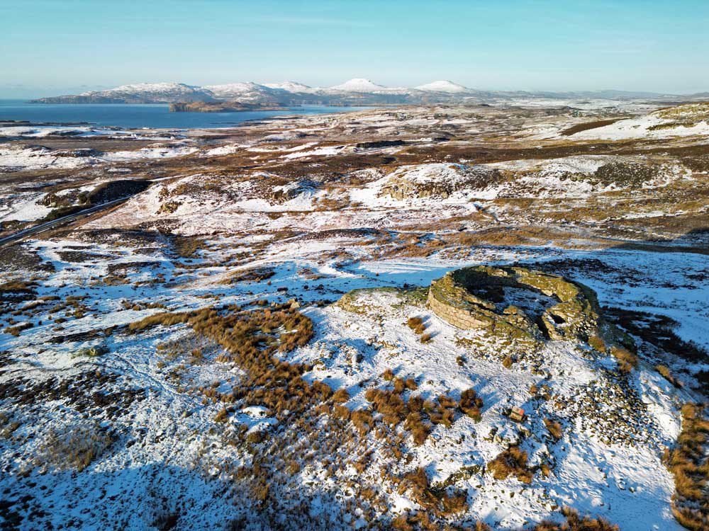
Dun Beag is a fine example of a Hebridean broch. A broch is an Iron Age dry-stane (dry-strone) hollow-walled structure of a type unique to Scotland and numerous examples remain on the mainland as well as in the western and northern isles. Dun Beag is situated on Skye`s west coast, about 8 miles south of Dunvegan, in a commanding position with panoramic views across Loch Bracadale. The flat topped hills of Healabhal Mhor and Healabhal Bheag, known collectively as MacLeod`s Tables, lie in the distance.
|
|
Records show that the broch at Dun Beag was occupied until the 18th century and finds from the site have included pottery, bronze objects, glass beads and coins spanning the reigns of several monarchs. The well-preserved ruins include an entrance passageway, an adjoining cell and stairway.
Dun Beag broch is under the care of Historic Scotland and is open for inspection at all times.
|
Top of Page
|
Skye Main Page
|