A Wildlife Walk along The Erskine Shore
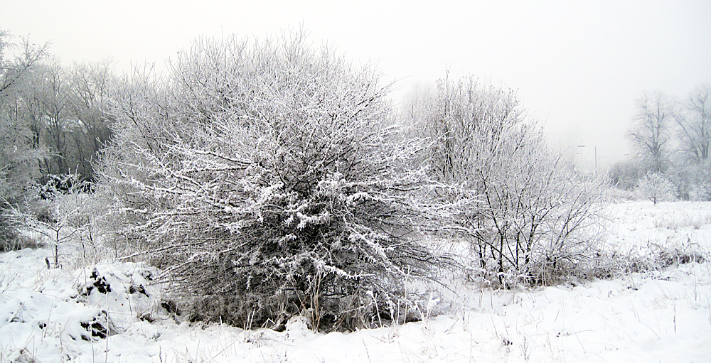
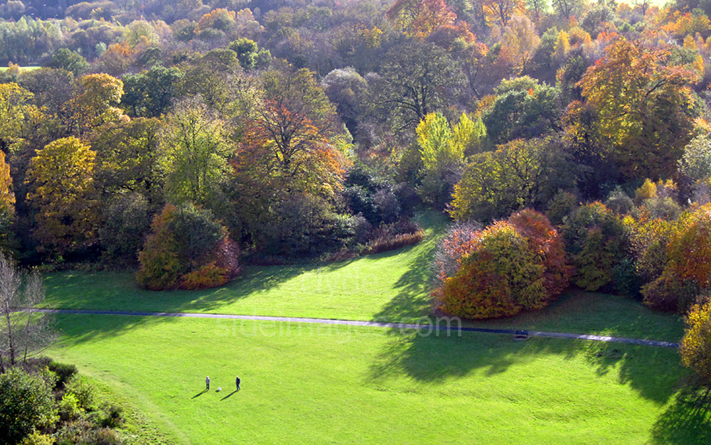
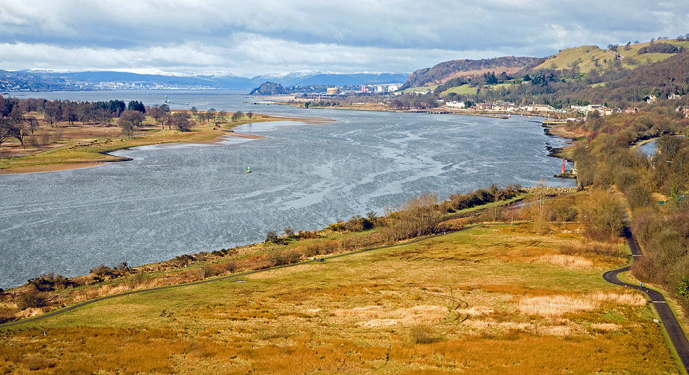
This is effectively an expanded gallery with detailed information on my local wildlife-watching patch which will hopefully be of interest to locals and visitors alike. The area covered is the south bank of the Clyde between the Clyde / Cart confluence and Longhaugh Point approximately 7 kilometres to the west. I`ve also included wildlife shots taken in my garden and a brief look at the Saltings Local Nature Reserve and Bowling Basin, the western terminus of the Forth & Clyde Canal, on the opposite side of the river. Although the north bank is far more developed than the south along this section, the river can still be viewed from various spots in Clydebank, Dalmuir and Old Kilpatrick but the Saltings and canal basin offer the best wildlife watching. I hope to cover these locations later in a separate gallery. The images have been taken over many years and other shots relating to this area can be found in my Stock Photography Archive.
The Clyde has its source high in the Lowther Hills of the Southern Uplands and, at approximately 100 miles long, is the third longest river in Scotland. It flows initially through rural farmland and soon gathers momentum, cutting its way through the heavily-wooded Clyde Gorge and creating the spectacular Falls of Clyde near Lanark. From there, the river flows between Hamilton and Motherwell, passing the flooded meadow of Baron`s Haugh, continues through Blantyre and Bothwell, past Uddingston, through Rutherglen and Dalmarnock and on to the centre of the City itself. The Clyde has always played an important role in the history of Glasgow with shipbuilding one of the main industries. Greenock and Port Glasgow on the Lower Clyde were also major players but the relatively short stretch along the north bank of the river between Clydebank and Dumbarton was also home to famous shipbuilding yards including Beardmore`s, Denny`s and of course John Brown`s.
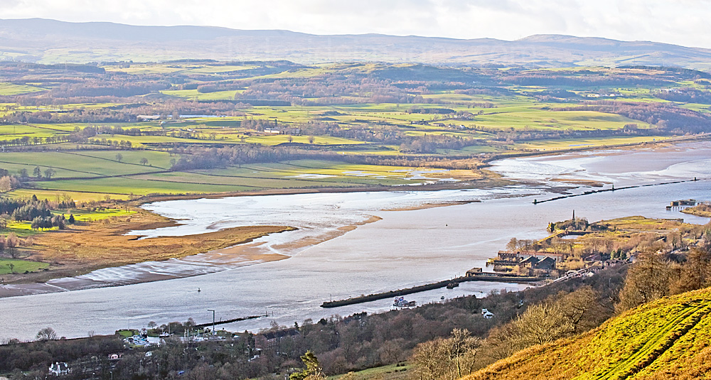
The Clyde / Cart Confluence
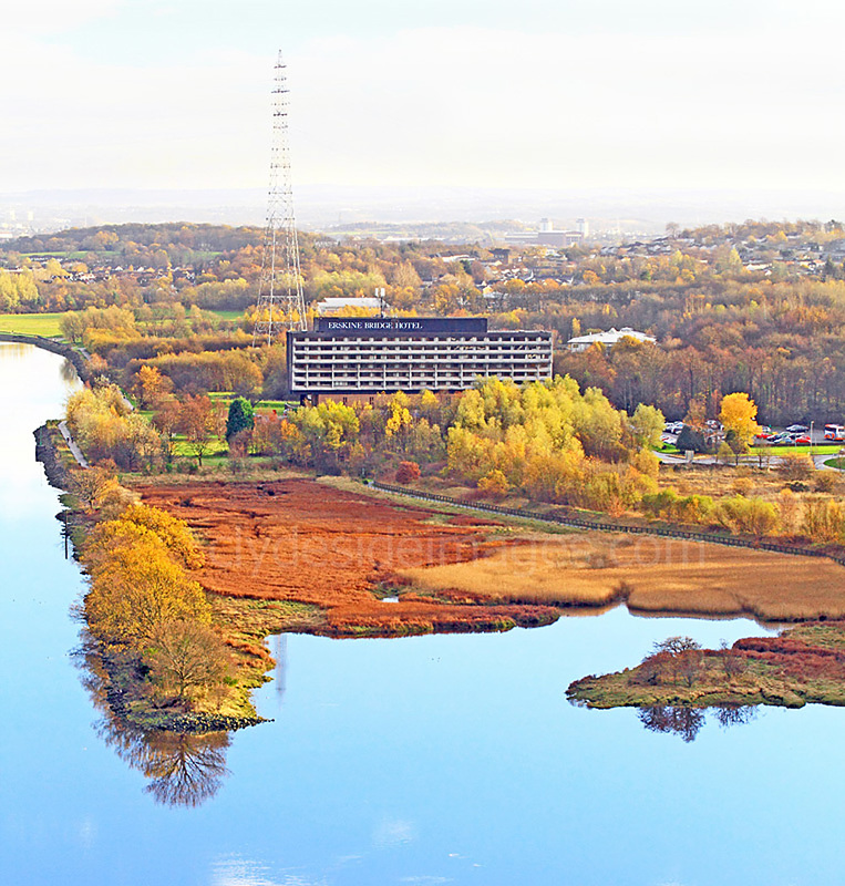
I took the following shot, which shows both sides of the Clyde between the Erskine Bridge and River Cart confluence, from a light aircraft in October 1976. The view incorporates the eastern half of the area featured here. Major housing development has yet to take place at Erskine although an area has been cleared for construction to begin on the Bridgewater Shopping Centre. The Erskine Bridge Hotel is in the centre of the photograph with what was then the Automobile Association (AA) Headquarters nearby.
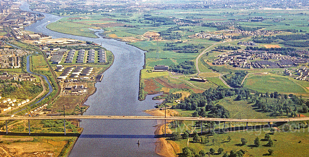
The Cart and Newshot Island are visible top left and the Old Kilpatrick to Dalmuir section of the Forth & Clyde Canal can also be seen. The William Beardmore & Co Shipyard lies just beyond the rectangular sheds. The yard, along with the circular storage tanks of the Mountblow Oil Terminal, have long since been demolished, in the former`s case to make way for the Golden Jubilee Hospital. The Boden Boo woods, very open in comparison to today, and Erskine`s small beach are bottom right.

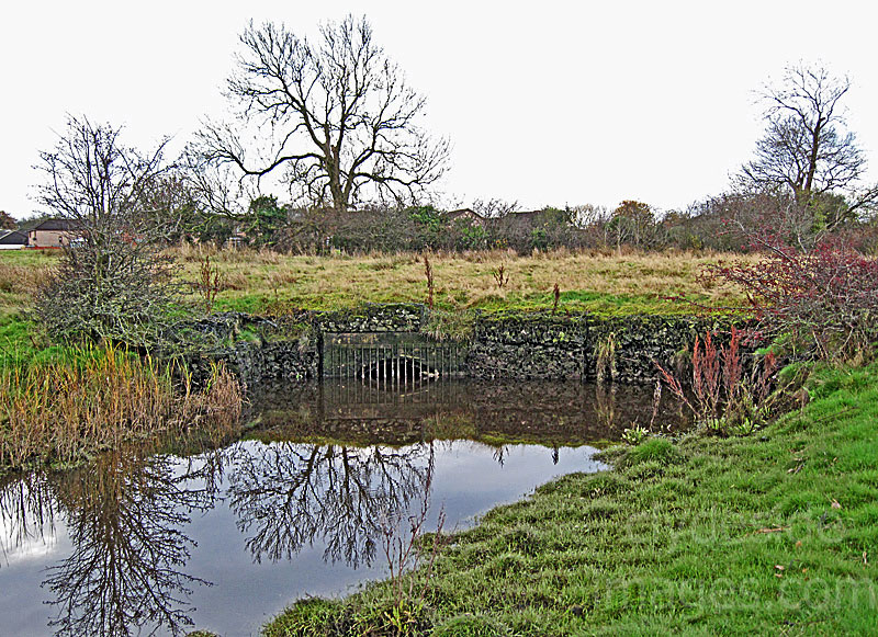
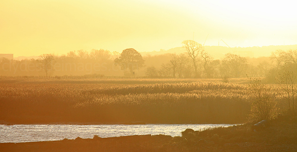
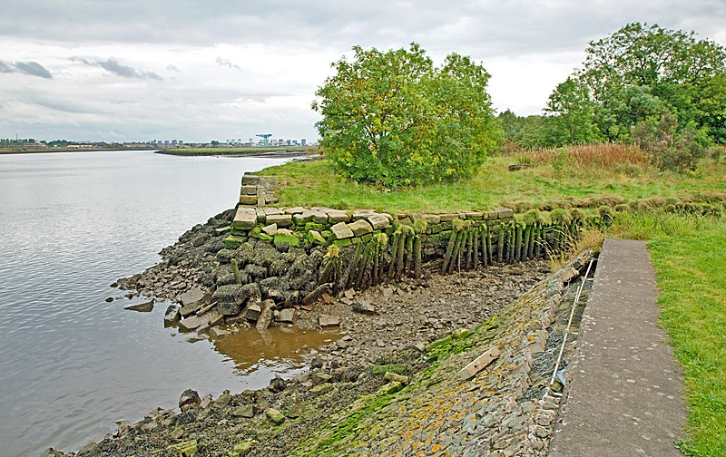
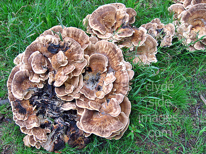
The Black Cart Water, looking west from Barnsford Bridge
|
|
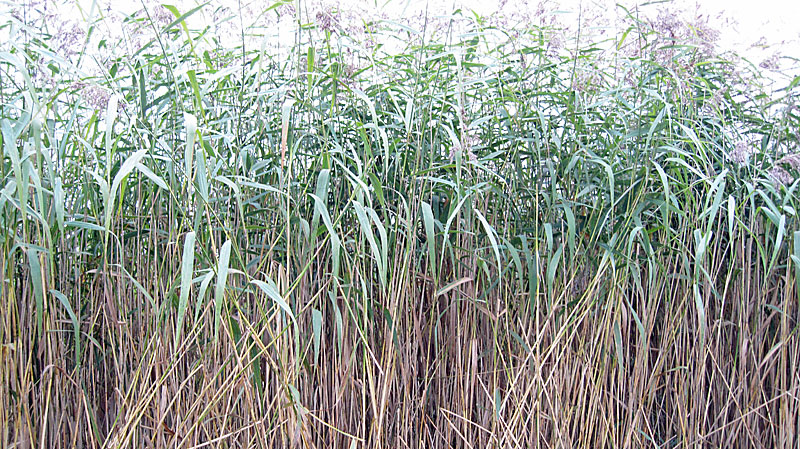
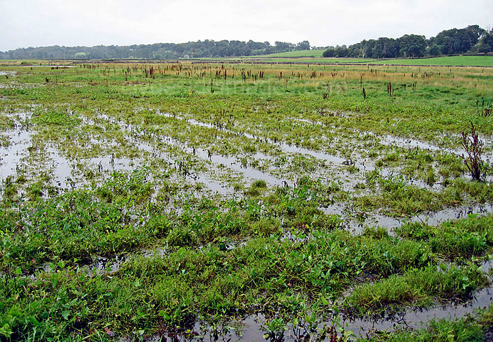
The Black Cart Cart Water drains the water from the northern Renfrewshire wetlands into the Clyde. The section downstream from Linwood passes through rich mixed farmland and contains important wetlands, flood pools, and both riverside and tidal reedbeds.
|
|
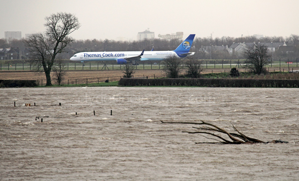
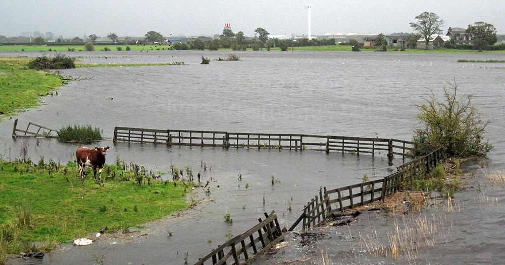
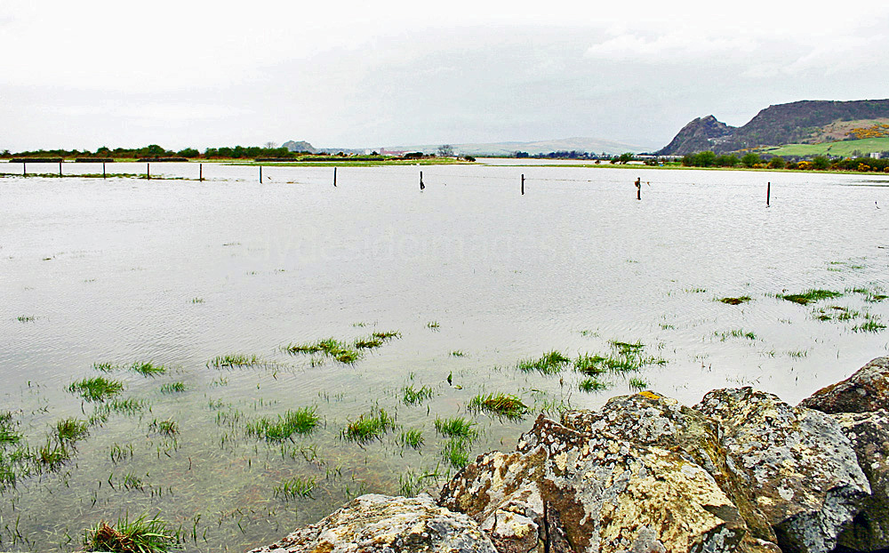
The river often bursts its banks here in spectacular fashion when stormy weather combines with a high spring tide and in extreme cases almost gives the impression that Glasgow Airport is situated on the coast!
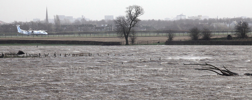
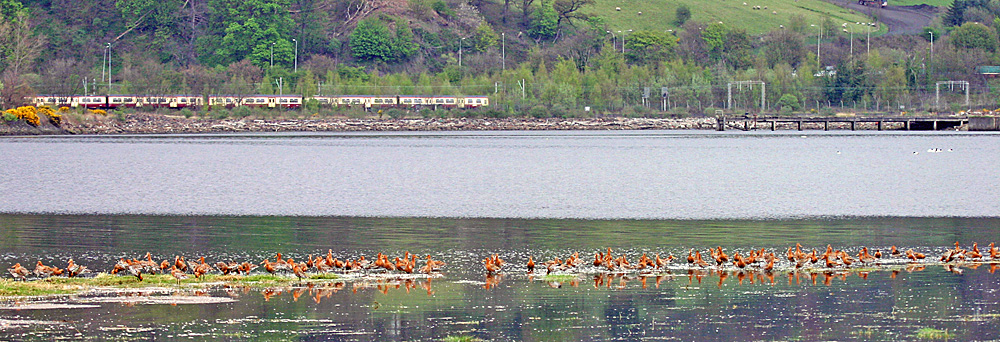
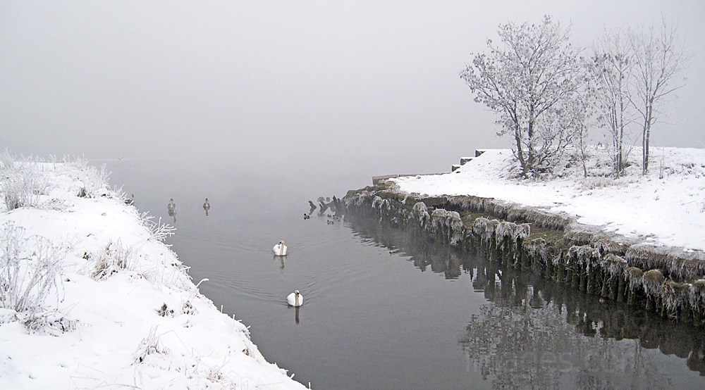
This area is best-known for the wintering flocks of Whooper Swans which roost close to Glasgow Airport between the Barnsford and Inchinnan bridges and feed on the surrounding fields during the day. Very few appear nowadays, however. I only saw a handful last winter but in years gone by numbers would peak at close to 300 birds.
|
The Black Cart and White Cart Waters merge just north of the Inchinnan and Renfrew bridges and the Riverside Walkway to Renfrew and Braehead can be accessed from the A8 here, beside the Normandy Hotel.
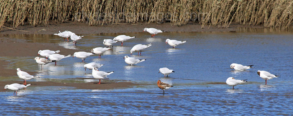
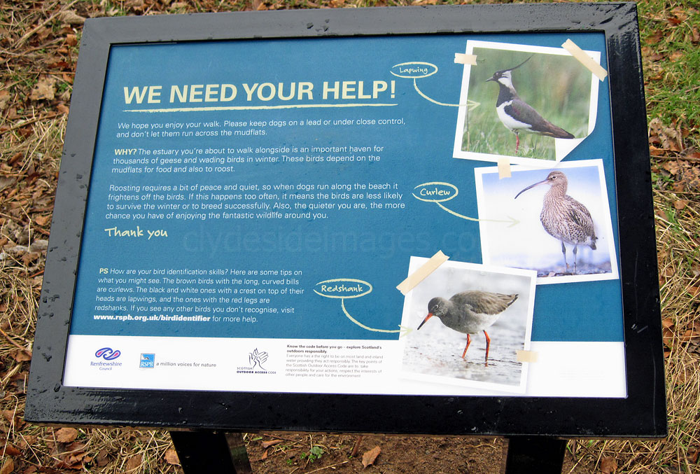
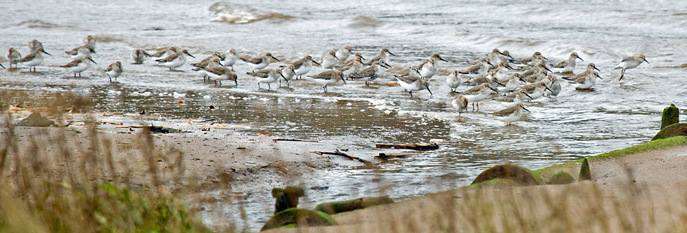
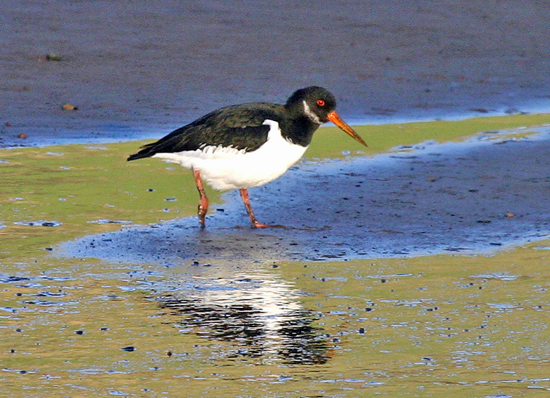
Duck species including Wigeon and Teal and Redshanks and Lapwing are often present and can be found anywhere along the stretch of the Clyde featured here. I`ve spotted a Kingfisher from the Inchinnan stone bridge a couple of times and depending on the time of year some of the Lapwing flocks can reach 100 plus. 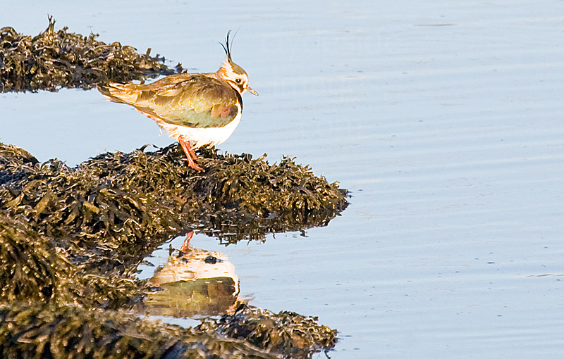
|
|
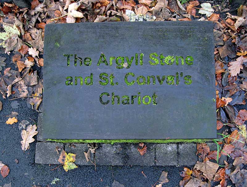
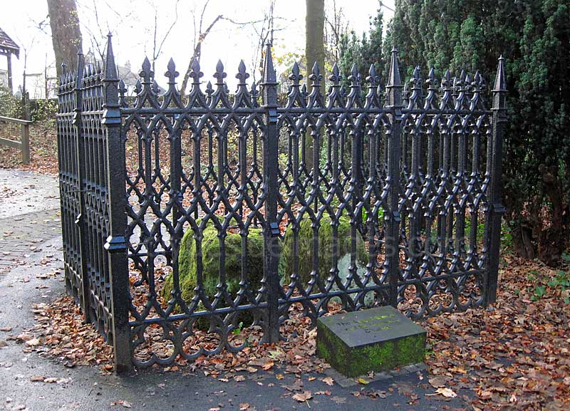
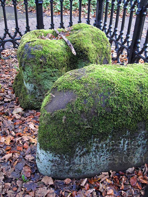
Just east of the Inchinnan bascule bridge, now within the grounds of the Normandy Hotel, are the Argyll Stone and St Conval`s Chariot. One of the moss-covered boulders is the pediment and the other the base of a cross said to have been erected to the memory of St Conval who is thought to be buried at nearby Inchinnan. The stones were moved to their current location, which was part of the Blythswood Estate, sometime prior to 1836 and this cast-iron Gothic ornamental fence was erected to protect them. The location of the remaining parts of the cross has not been established.
|
|
Water from the hollow in the cross-base, St Conval's Chariot, was thought to have healing and medicinal properties and even more bizarrely, the saint is said to have crossed the sea on the stone from Ireland! The pediment, the Argyll Stone, got its name as Archibald Campbell, the 9th Earl of Argyll, supposedly rested here after his capture at Inchinnan on 18 June 1685. At the time of the Monmouth Rebellion against James VII, Argyll was General of the forces which invaded Scotland in support of the failed rebellion, from 17 April 1685. Argyll was later executed in Edinburgh and his remains interred in Greyfriars kirkyard.
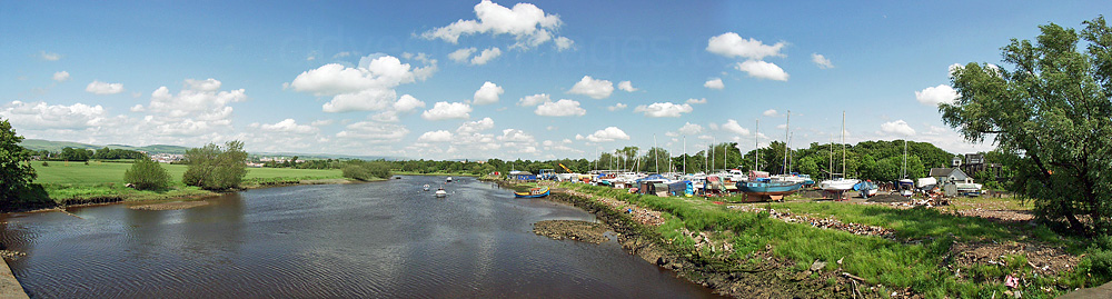
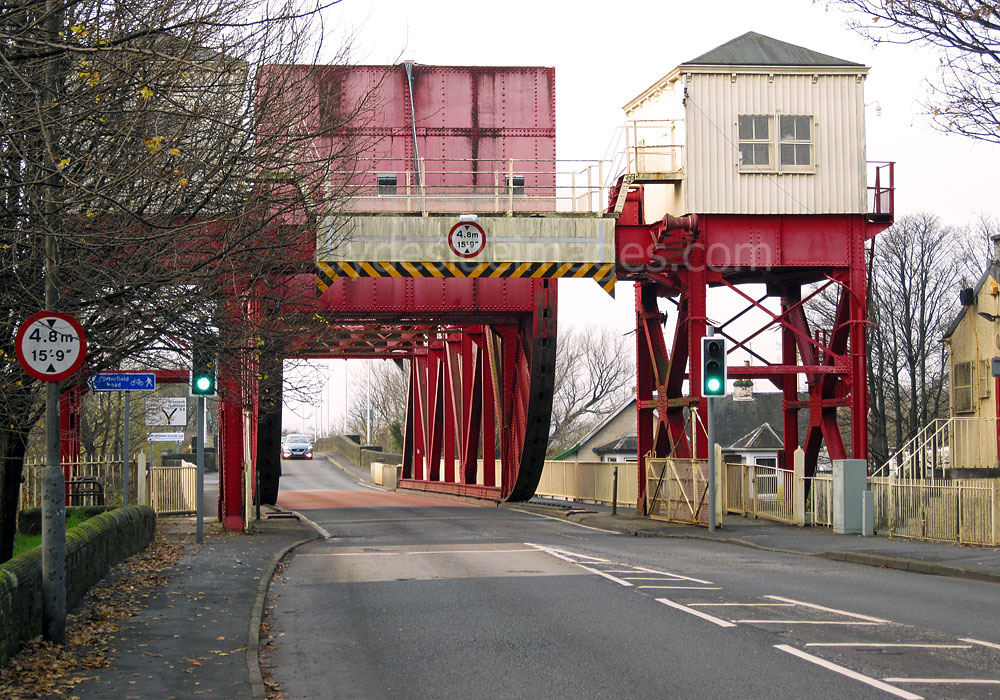
The above view, taken where the `Carts` meet, shows the Inchinnan bascule bridge over the White Cart and the Inchinnan stone bridge spanning the Black Cart. The White Cart and Black Cart Water meet west of Renfrew to form the River Cart. Early travellers crossed here by ford and later by ferry. In 1759 a nine-arch stone bridge was built across both rivers, and in 1786 an adjacent canal with a swing bridge was cut to allow ships to bypass the bridge without lowering their masts. The nine-arch stone bridge was destroyed by flood in 1809 and later replaced by two bridges. The current bascule bridge which dates from 1923 ended the requirement for the swing bridge over the canal.
|
|
The Inchinnan Bascule Bridge at Renfrew, known locally as the `Swing Bridge` is just one of many built by the famous engineering company founded by Sir William Arrol (1839–1913). Arrol was born at Houston in Renfrewshire and despite leaving school at 9 years of age to work in a cotton mill and later as a blacksmith he attended night school where he learned the principles of civil engineering. In 1863 he joined a company in Glasgow that specialised in bridge building and by 1872 he had established his own business in the east end of the city. He expanded it to incorporate the Parkhead Crane Works and in the years that followed, even after Arrol had died, his company built some of the best known bridges in the British Isles. Structures included both Forth Bridges, the Tay Railway Bridge of 1887, Tower Bridge in London, the Middlesborough Transporter Bridge, and bridges over the Humber and River Severn.
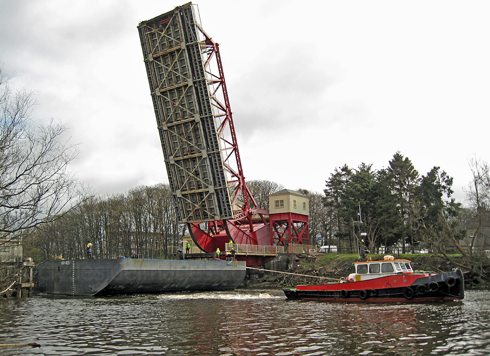
Contrary to popular belief, the bascule bridge still opens occasionally to let river traffic pass, in this case to enable the transportation of a large component from the Doosan Babcock factory.
Contrary to popular belief, the bascule bridge still opens occasionally to let river traffic pass, in this case to enable the transportation of a large component from the Doosan Babcock factory.
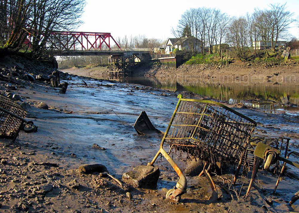
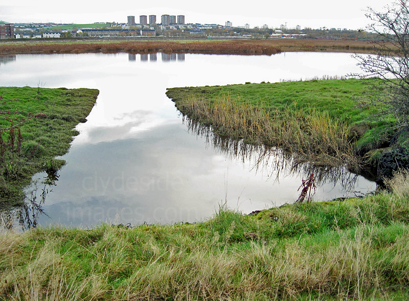
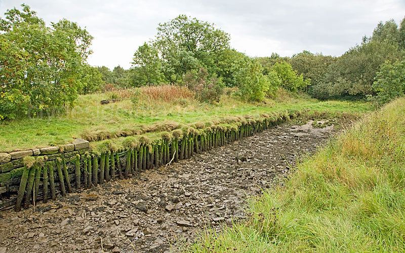
The walkway to Renfrew is on the east side of the Cart and although blocked at present, a short diversion through Renfrew Golf Course is currently in place. There`s no riverside trail on the west side so it`s rough going between the mouth of the Cart and Newshot Island, keeping to the edge of the fields. Much of the riverbank has been badly eroded and is undercut all along this stretch.
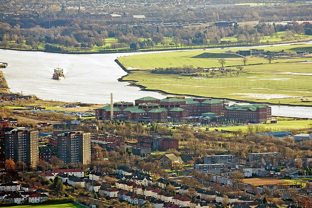
The Golden Jubilee National Hospital, built in 1994 as a private hospital by Health Care International, was first known as the HCI. The initial cost was £180 million but the controversial venture proved unsuccessful in private hands. In 2002, the hospital was purchased for the National Health Service, at a cost of £37.5 million and given its current name.
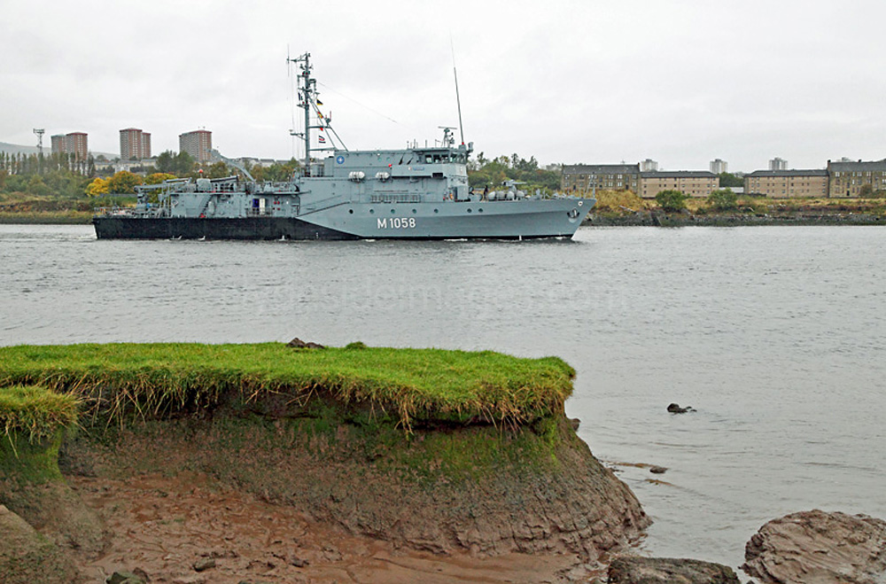
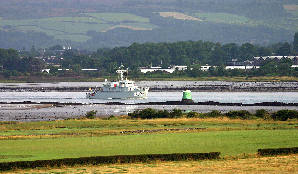
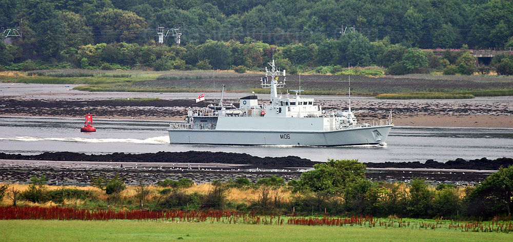
This is an example of the disappearing riverbank with many sections even more deeply undercut. The passing vessel is Joint Warrior participant FGS Fulda (M1058), a Frakenthal Minehunter of the German Navy.
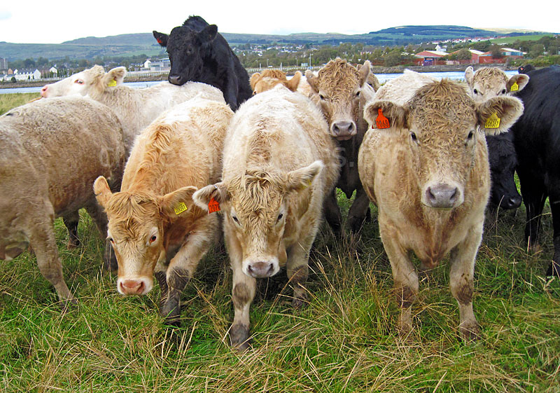
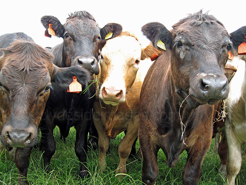
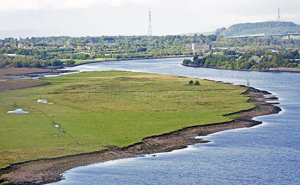
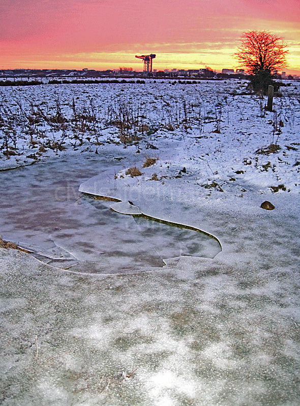
Newshot Island
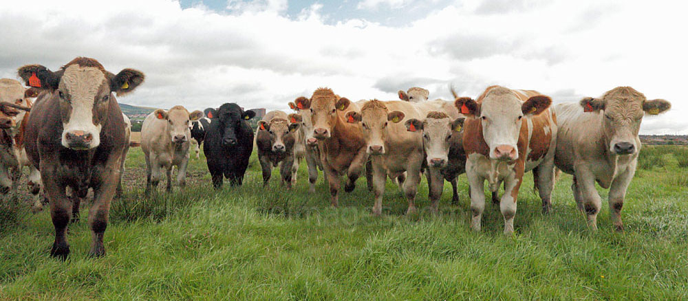
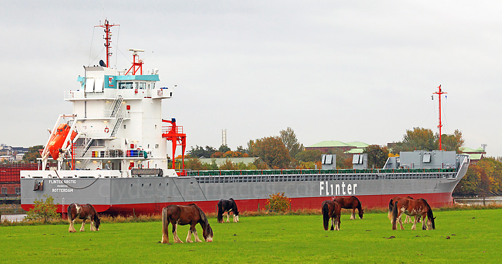
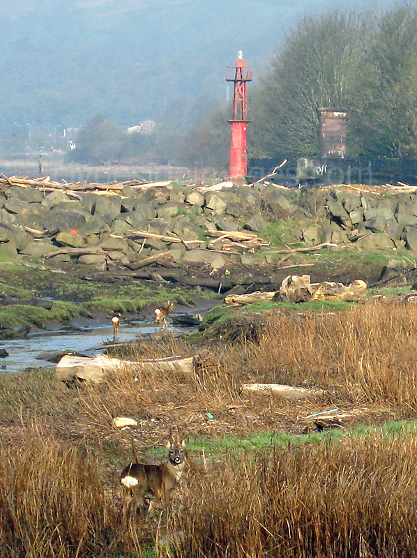
Newshot Island is used to graze cattle and is an excellent but seldom visited area for wildlife-watching. Often when I`ve wandered over the fields, the resident herd of bullocks charge over, possibly suspecting that I`ve got their dinner in my rucksack! They`re difficult to shoo-away and I`ve been surrounded on more than one occasion.
|
|
This view, taken from the Titan Crane, shows the notorious Dalmuir bend, which was prone silting up and often proved problematical for larger vessels transiting the river, especially when visibility was poor. The great Clydebank-built Cunarder Queen Mary grounded temporarily here on her first (and only) traverse of the Clyde on 24th March 1936.
|
|
The Newshot Island stretch contains a variety of remains, ranging from a possible fishing weir across the inner lagoon to a stone jetty and possible loading platforms.
|
|
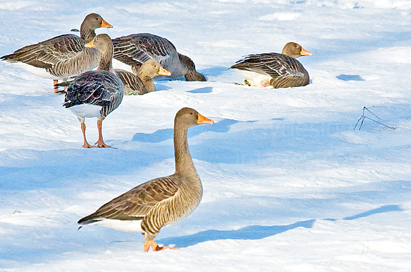
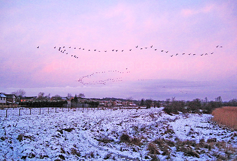
On a clear, crisp winter morning, It`s worth getting into position just before dawn to watch the geese taking off for their feeding grounds against the rising sun. Skylarks are common during the spring and summer months and it`s not unusual to inadvertently flush a Snipe or two from cover while wandering across the fields here. Godwits and Greenshank appear on passage and even an Osprey was seen hunting here many years ago.
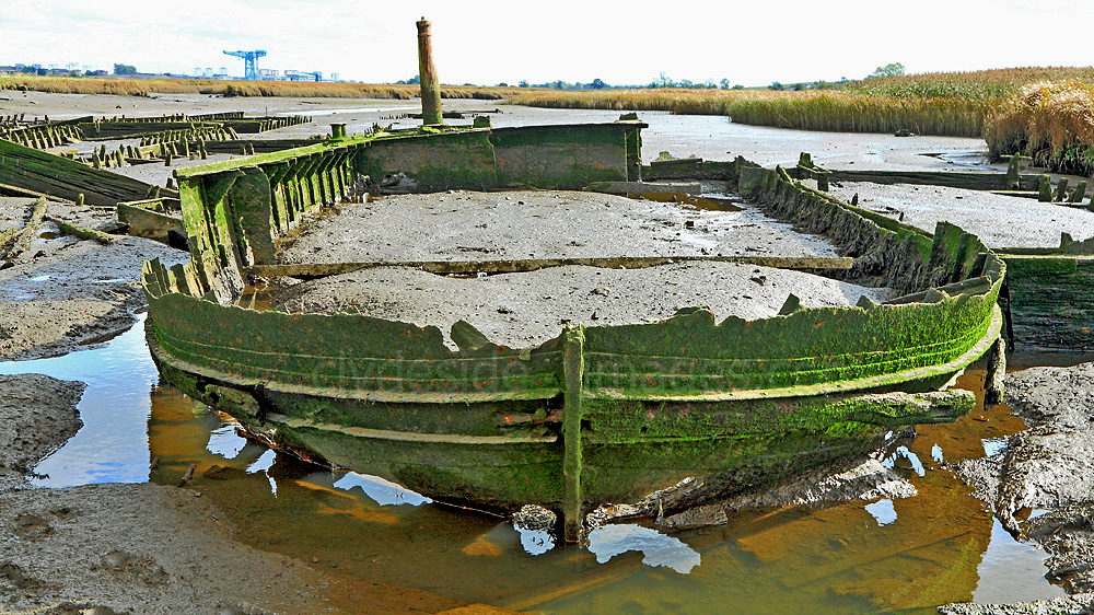
Newshot Island hasn`t been an actual island for many, many decades. In years gone by, when shipping on the Clyde was at its peak, there was a constant battle to keep the riverbed free of silt and sand and the area around Newshot Island was particularly troublesome. During dredging operations, numerous wooden mud punts were filled and towed further downriver to dump the spoil. Many were abandoned and can still be found, scattered along the muddy stretch of riverbank at Newshot alongside several wrecks which were towed here and dumped after they were damaged in a serious fire at Kingston Dock in Glasgow in 1914. The punts, along with the larger vessels, are fully exposed at low tide. In addition to wooden schooners, there`s this steel-hulled craft which experts believe could possibly be the world`s first purpose-built diving-bell boat. The pillar at the stern supported a crane which lowered and raised the necessary equipment.
|
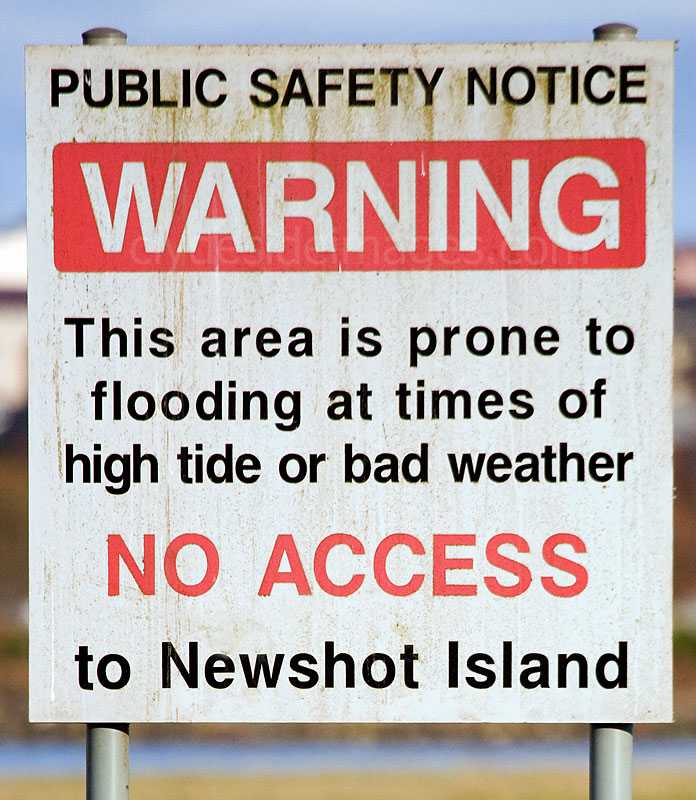
This location can be accessed when the water is very low, but it can be extremely hazardous underfoot with hidden channels and very soft sand and mud, even in fine weather. Warning signs discourage exploration and although I have wandered over the adjacent fields on many occasions, this whole stretch should be avoided during storms or flood conditions, especially around high tide. |
|
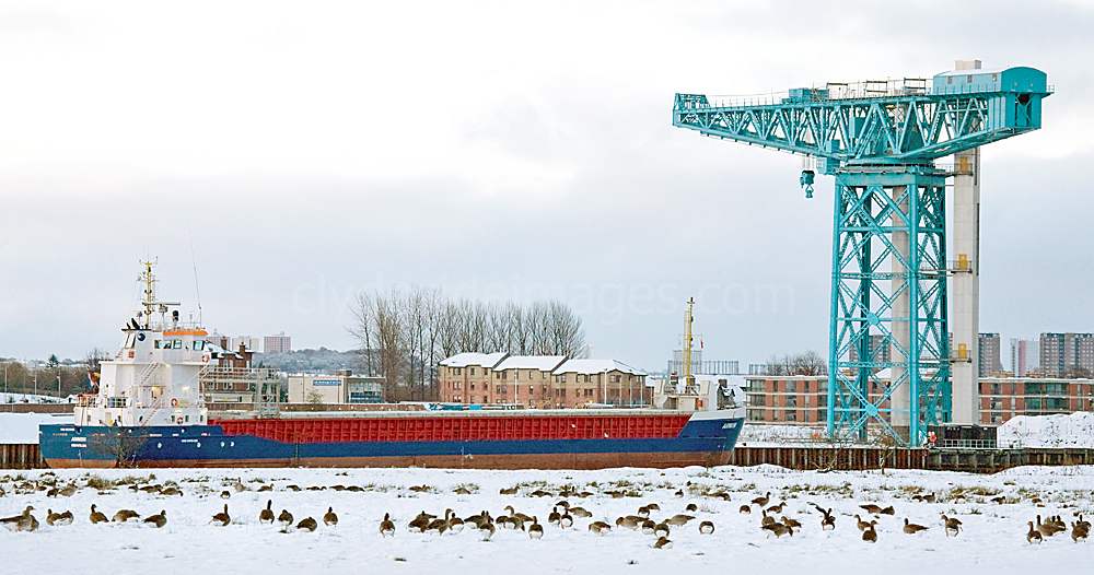
On her way upriver on a cold November morning the Coaster Ammon passes Newshot Island.
|
The fields bordering Newshot Island can be accessed via Newshot Drive, or preferably Hawthorn Avenue to the east. The latter, being closer, is the better option as, although the going can be a bit rough underfoot, it is then possible to walk west, following the tree-line along the southern border of the reedbed before either regaining the road or climbing over the fence into the Newshot Island reserve. At the end of Hawthorn Avenue, there`s a lane which passes an electricity sub-station. The gate beside it opens onto the fields. |
|
|
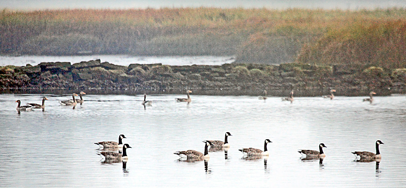
Left: On a misty autumn morning, Greylags are joined by a flock of Canada Geese. The weir is in the background. |
The Newshot Island reed bed from the nature reserve viewpoint.
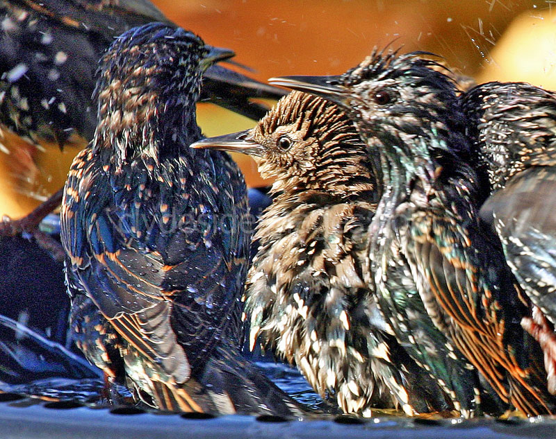
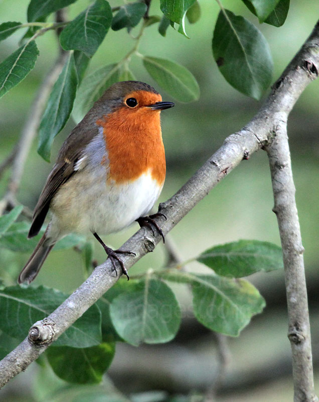
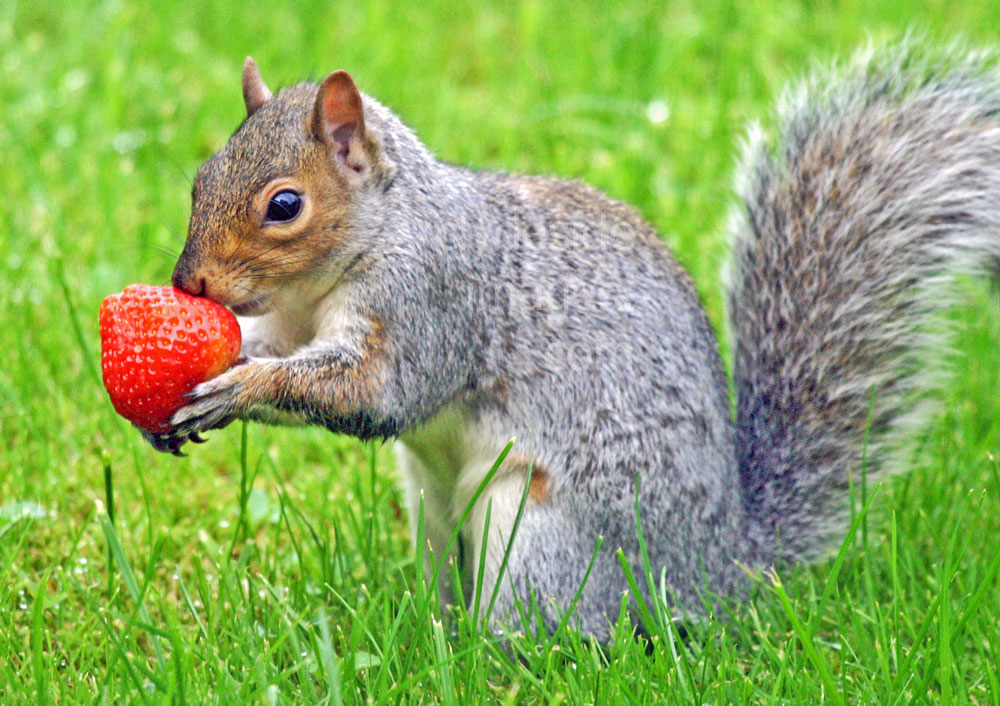
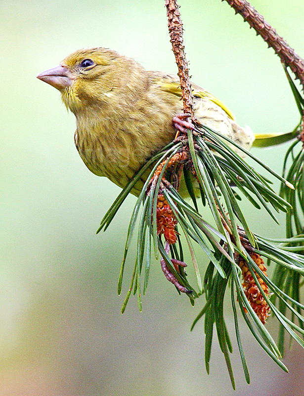
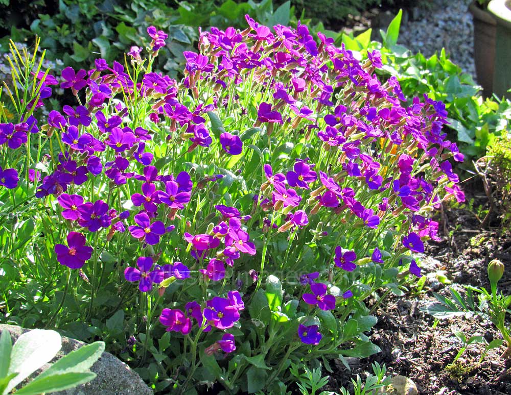
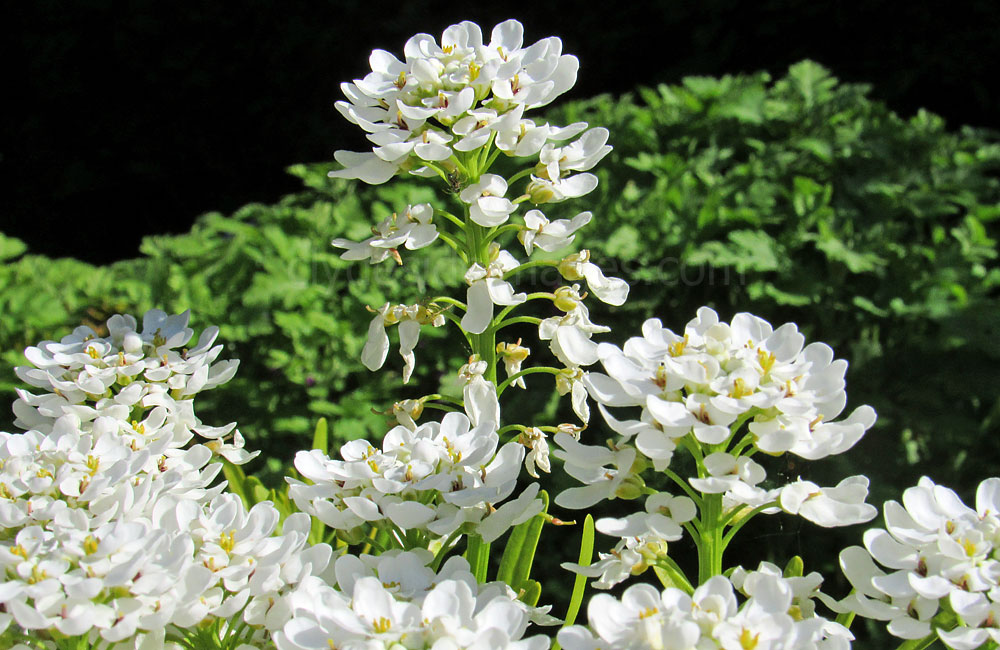
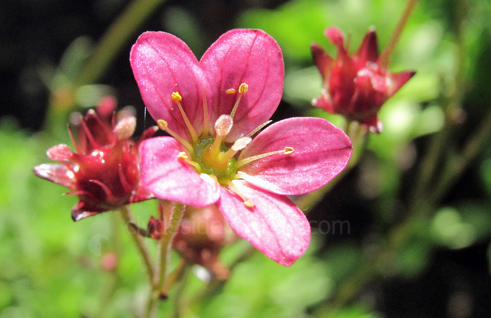
In the Garden
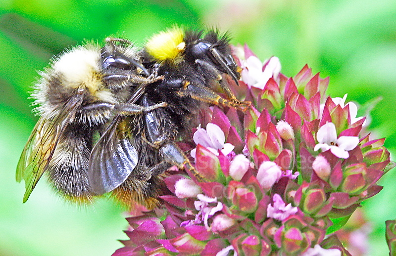
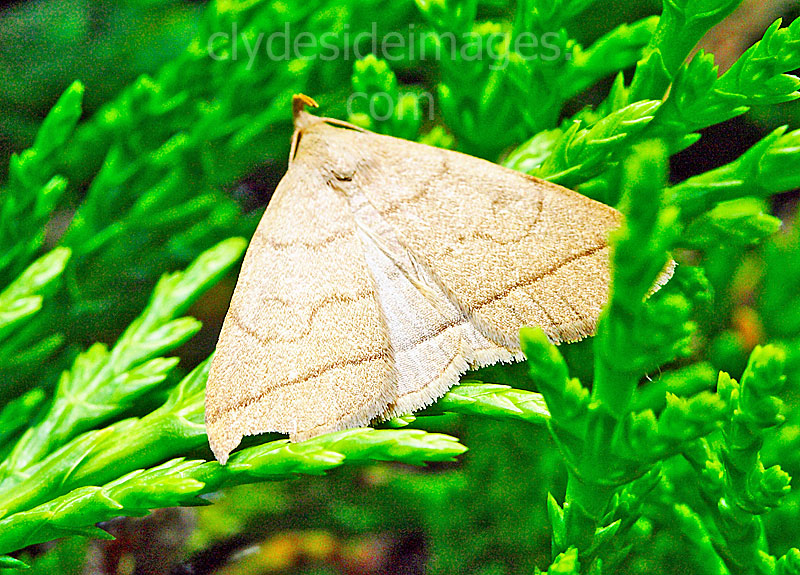
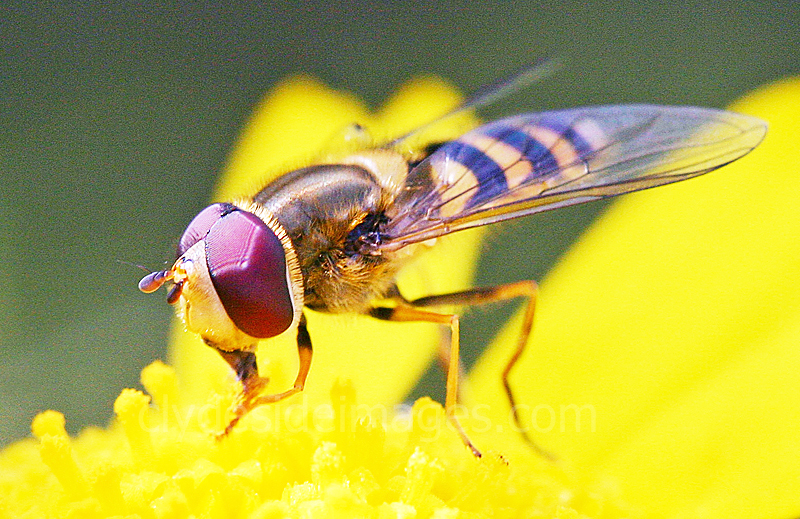
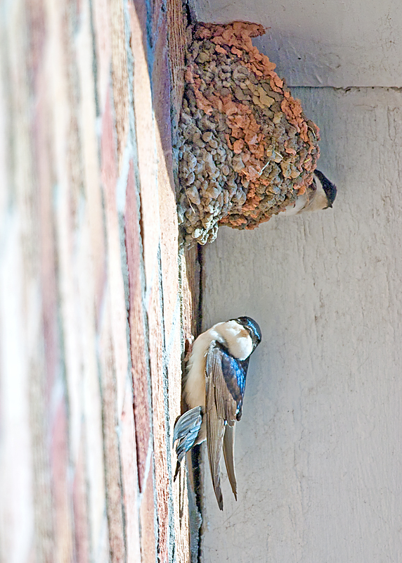
As my house lies only a few hundred metres from the Clyde, and I can see the river from my window, I`ve included a selection of the wildlife I`ve managed to photograph in or around my garden as identical species are just as likely to be encountered in the surrounding area.
|
|
|
|
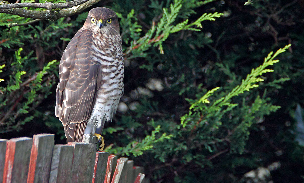
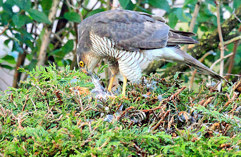
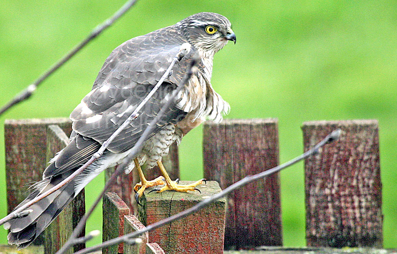
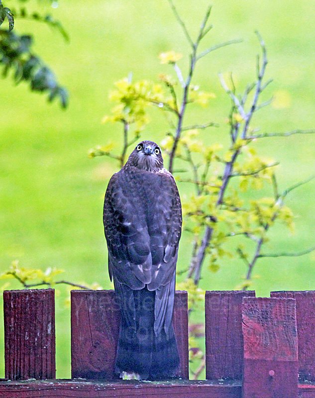
Sparrowhawks in the garden: I`ve also seen these raptors hunting at the Newshot Island nature reserve and down near the Erskine Bridge.
|
|
|
|
|
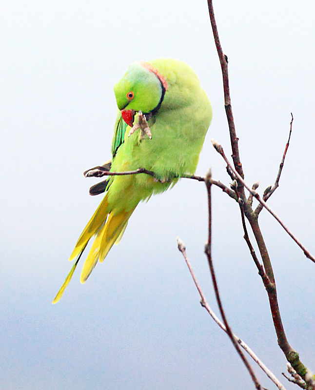
This rare first-time visitor to my garden in mid-December a couple of years back was obviously hoping for some sunshine. The weather had been very wet and unusually mild and the forecast into the following week was much the same. I was aware that a Ring-necked Parakeet had been coming to feeders at the Bishopton end of Erskine, and that there had been another sighting of one at Glasgow`s Victoria Park in Scotstoun, but I was pleasantly surprised to see this guy perched on the rowan tree at the back of my house around midday. Since then, there have been various sightings of individual birds around the west end of Glasgow and Renfrewshire. A serious agricultural pest in Africa and southern Asia, the species` colonisation of Western Europe has been aided by warm winters and abundant bird-table food. British birds are now the most northerly breeding parrot populations in the world. This striking bird happily preened and posed for photographs for around 20 minutes before flying off. Hopefully I`ll see him or her at my feeders again in the not too distant future. |
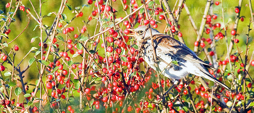
A Fieldfare feasts on autumn berries in the back garden of my house. Redwing also visit during the autumn and winter months.
Newshot Island Local Nature Reserve
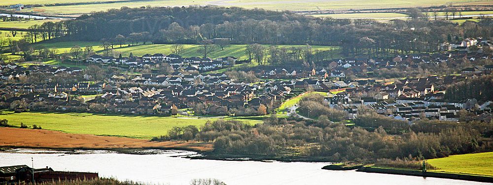
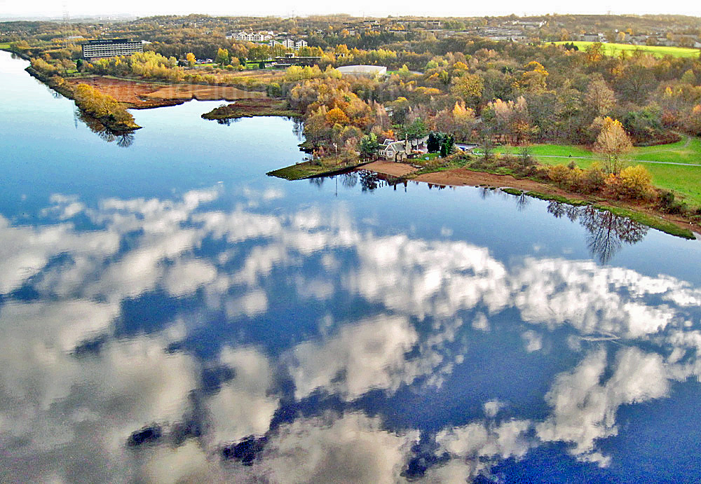
The above shot, taken from the Kilpatrick Hills, shows the west end of the Newshot Island reedbed and the wooded area of the nature reserve, which covers a fairly small area. Park Quay and its navigation light are bottom right with the Inchinnan woods in the background. I`ve seen Roe Deer in the fields in front of the Inchinnan woods on numerous occasions.

A misty dawn at a farm just east of the woods.
|
|
Above: Looking west along Newshot Drive towards the Bridgewater Shopping Centre. One of the main entrances to the nature reserve is on the right, hidden behind the bus shelter. The view on the right shows the path immediately on entering from this location.
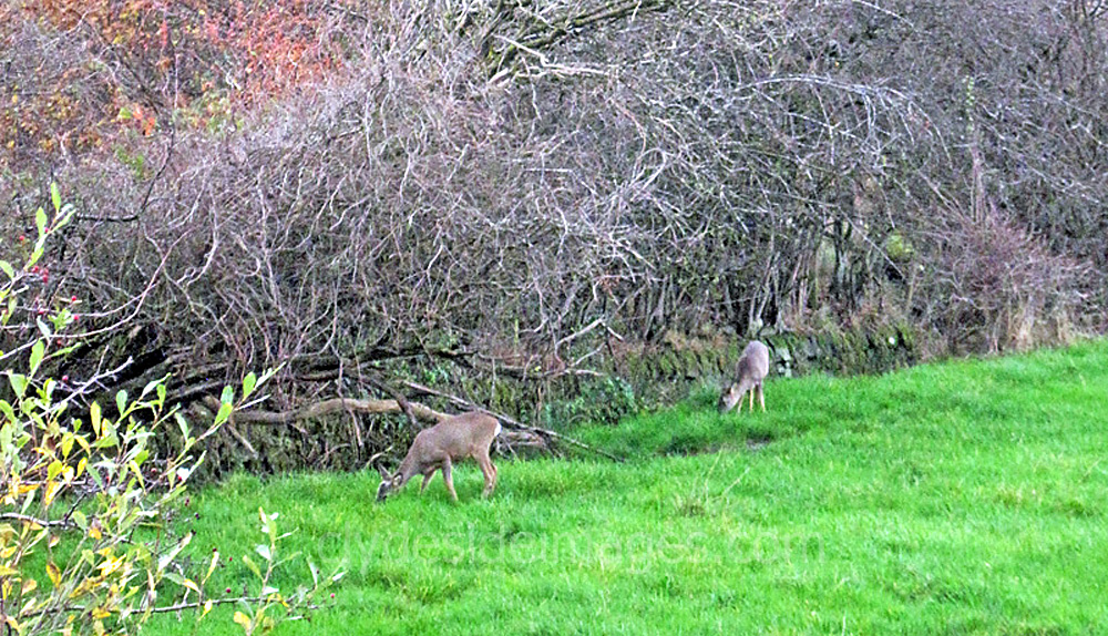
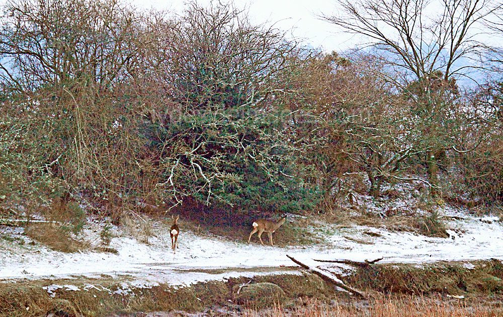
Unfortunately, I only had my digital compact with me when I saw three Roe Deer foraging along the eastern boundary of the reserve on a November morning.
|
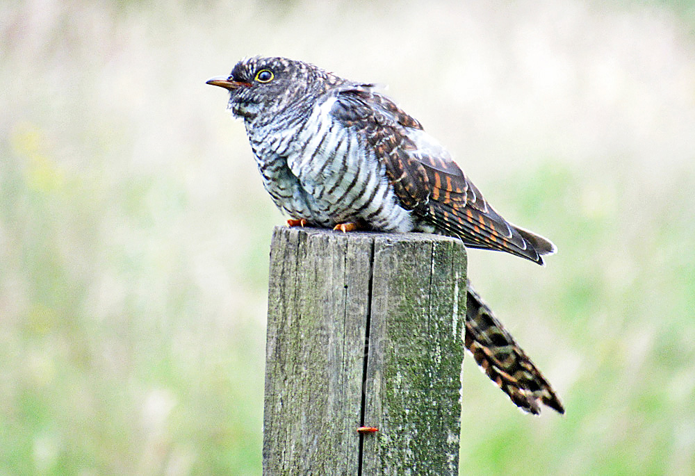
In mid-July, I`d wandered down to Newshot Drive to photograph a passing bulk carrier which had just left the docks at Shieldhall when I noticed this young Cuckoo chick flitting between wooden fenceposts near to where the above shot was taken. It looked as though the bird had only recently fledged as, despite my presence, it didn`t fly very far each time it took to the air. This is the first time I`ve spotted a Cuckoo in this area so I was quite pleased with the shot. |
|
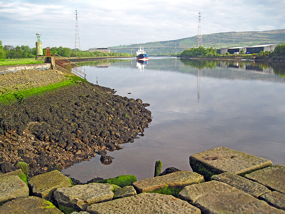
Park Quay
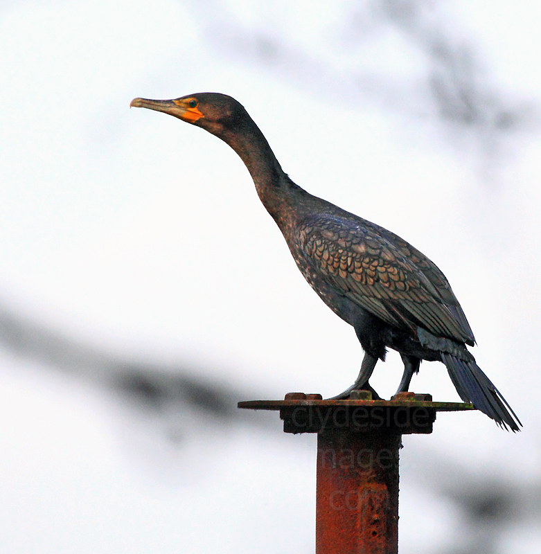
Park Quay, a mainly stone construction, marks the north-western tip of the Newshot Island nature reserve. The quay is fairly well preserved and judging by its proportions, was once an important dock for medium-sized boats. The walkway skirts the west side but the elevated east side is an even better vantage point for photographing passing ships or watching Cormorants and waders fly past, often just above the water. I`ve disturbed a Kingfisher here on several occasions but the wee bird has always darted off before I could focus my camera.
|
|
The east side of the quay is another area to avoid around high water if the river is fast flowing, especially when stormy weather combines with spring tides. Also, in such conditions any passing vessels, even when travelling relatively slowly, can generate a tremendous wash which can lap over onto the high ground.
|
|
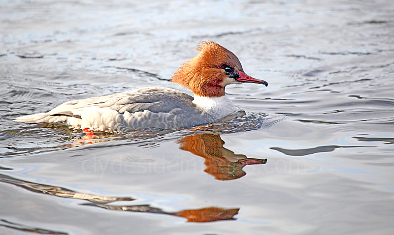
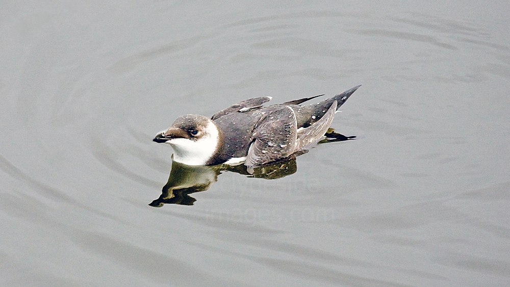
Left: A female Goosander. Red-breasted Mergansers are also seen periodically. I snapped this Razorbill in winter plumage from the walkway at Park Quay on a frosty November morning. It`s very unusual to see this species so far upriver and this was the only time I`ve seen one of these birds along this stretch. They are colonial seabirds that normally only come to land in order to breed so this one may have been injured or exhausted. It certainly looked a bit scraggy!
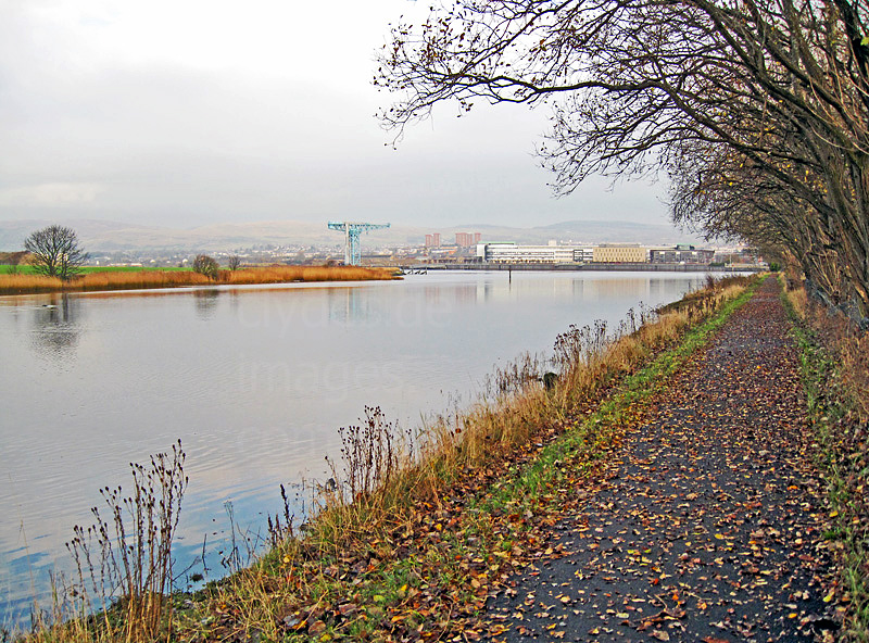
The Clyde Riverside Walkway
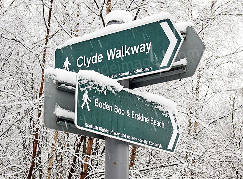
The most easterly section of the Clyde Riverside Walkway at Erskine can be joined from the Newshot Island Local Nature Reserve, or from the purpose-built car park that`s just a short walk downhill from the Bridgwater Shopping Centre. Heading west, the walkway continues past the Erskine Bridge Hotel, contours around the old harbour and follows the southern bank of the river to the Boden Boo woodland. A track continues west from there, passing under the Erskine Bridge.
Above: Looking east along the Riverside Walkway towards Park Quay and the Newshot Island Local Nature Reserve. Pied and Grey Wagtails can usually be found flitting along the embankment here and the field used to keep Clydesdales often becomes a roost for large numbers of gulls and Osytercatchers in stormy weather.
|
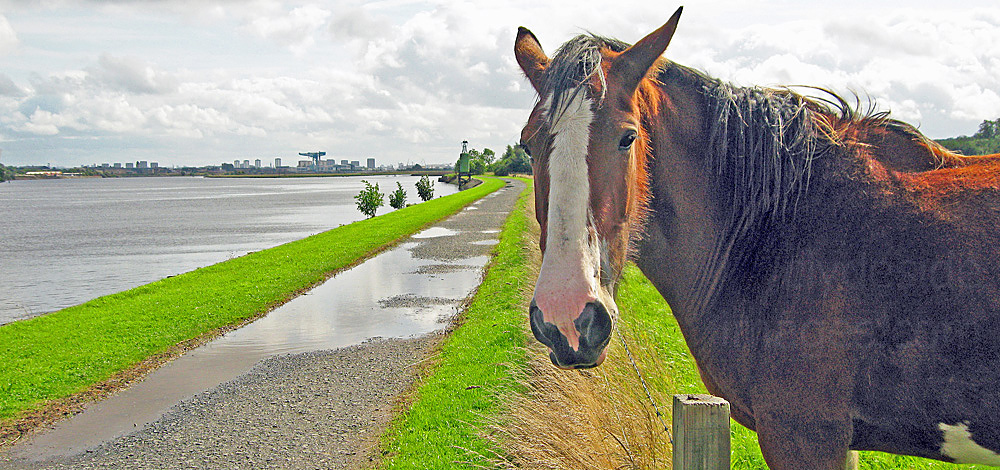
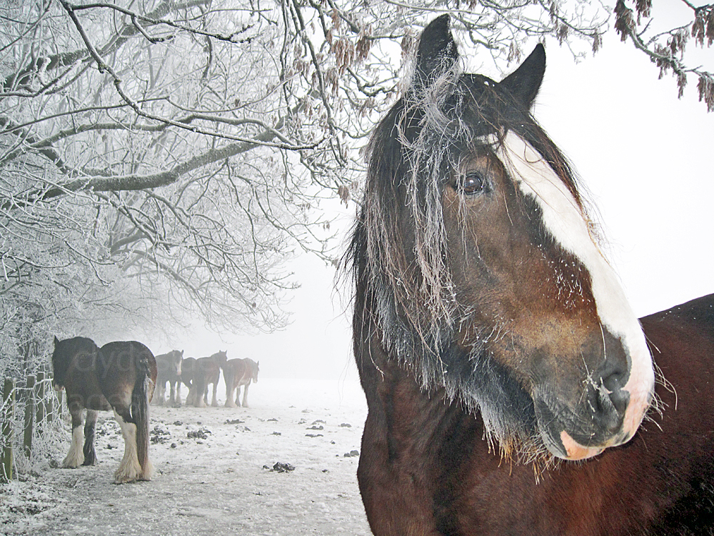
Bordering the walkway, and being so close to the Bridgewater Shopping Centre, this field is passed by hundreds of people every week, many of whom enjoy feeding the horses with apples, carrots and other treats. This proved so popular, especially with kids, that sometimes a short queue formed with carrier bag-laden locals waiting to distribute the goodies. As a result, the farmer had to put up a sign requesting that people stop feeding his animals as they`d become overweight! |
|
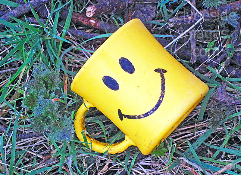
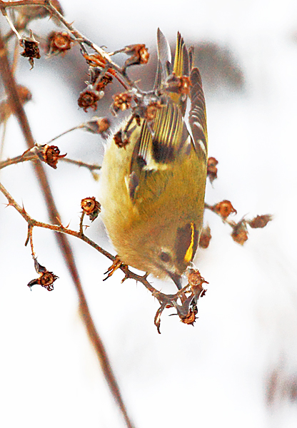
Goldcrest, Britain`s smallest bird, are resident in the area although I`ve only spotted a few over the years. This grainy shot, the best I`ve managed so far, was taken near the Erskine Bridge Hotel. Bullfinches are also resident in the general area. Even if there`s not much to see though - `Don`t Worry - Be Happy!` This discarded mug was lying beside the walkway.
|
|
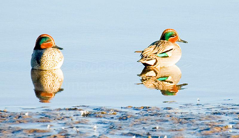
Teal (left), Wigeon and of course Mallard, are the most common duck species on the river. For a while a pair of Little Grebe or `Dabchicks` could found on the water, bobbing around Park Quay.
Over the years, I`ve spotted an occasional seal, either swimming in mid-channel or hauled out on the old ferry slipway. Porpoises and even a whale have made their way further upriver but these have been injured or disorientated animals with little chance of survival. |
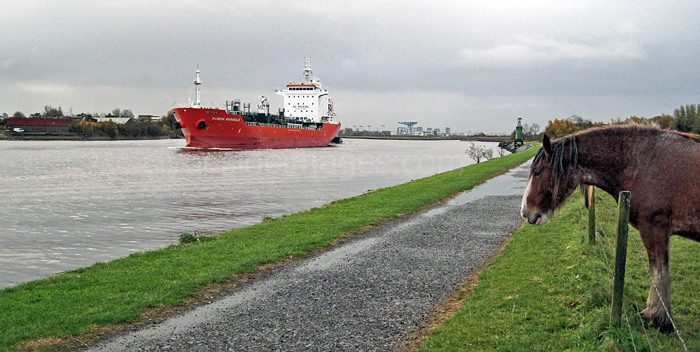
This horse is clearly disappointed as he realises that the crew members on the passing ship are too far away to throw him free carrots!
Erskine Harbour
|
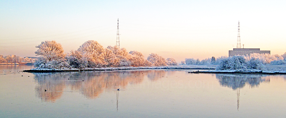
This photo shows the old harbour which has, apart from the area at the harbour mouth, silted up over the years and is now almost totally overgrown with reeds. The line of trees on the left marks the harbour wall and the path on the right shows the extent of the facility which stretched back towards the site of the present-day Erskine Bridge Hotel.
The reed bed attracts waders and waterfowl and Reed Buntings can often be heard singing or spotted clinging precariously to one of the reeds. The harbour wall used to be a regular Heron roost but the birds have not been seen here in numbers for many years, possibly due to increased human disturbance. The hotel, which opened in 1971 at a cost of £1 Million, was first owned by the Esso oil company. The original nine hole pitch and putt golf course in the grounds was converted into a car park many years ago. |
|
|
|
|
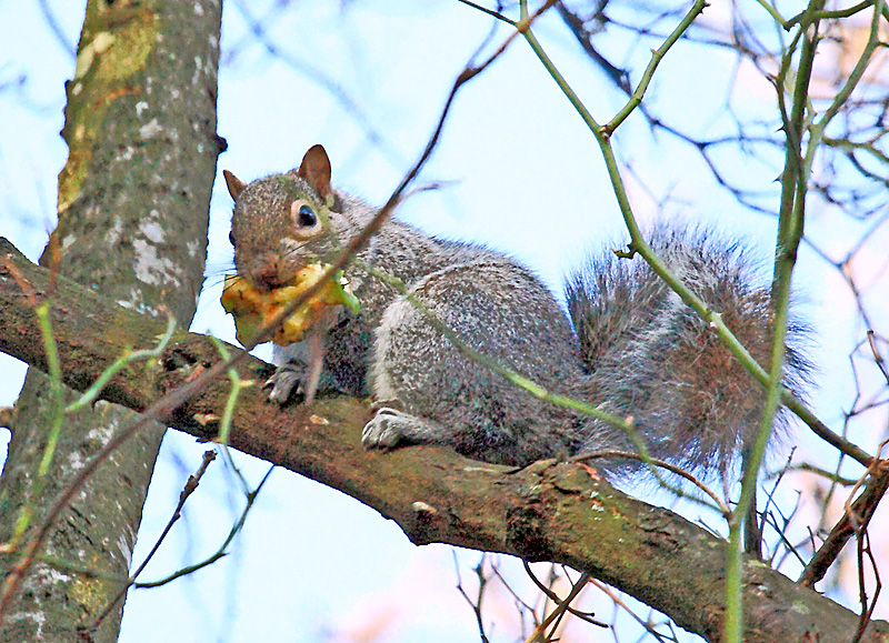
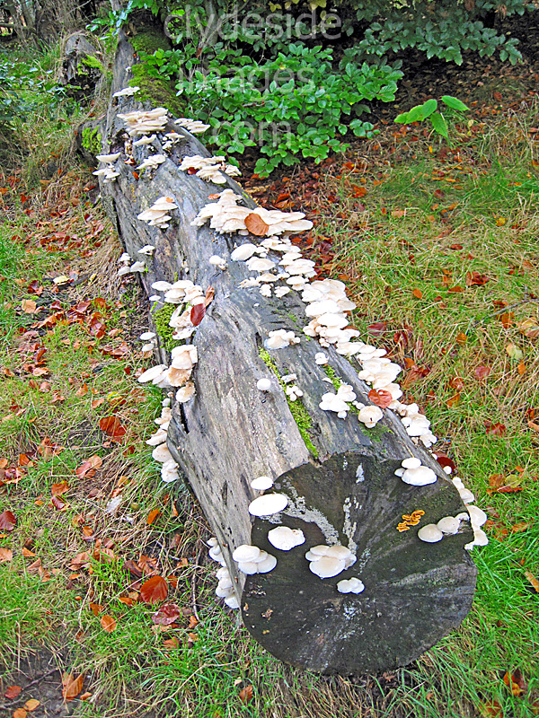
This Grey squirrel had been on a bin raid at the main Boden Boo car park. It`s sizeable drey, made from a mass of twigs, was nearby.
|
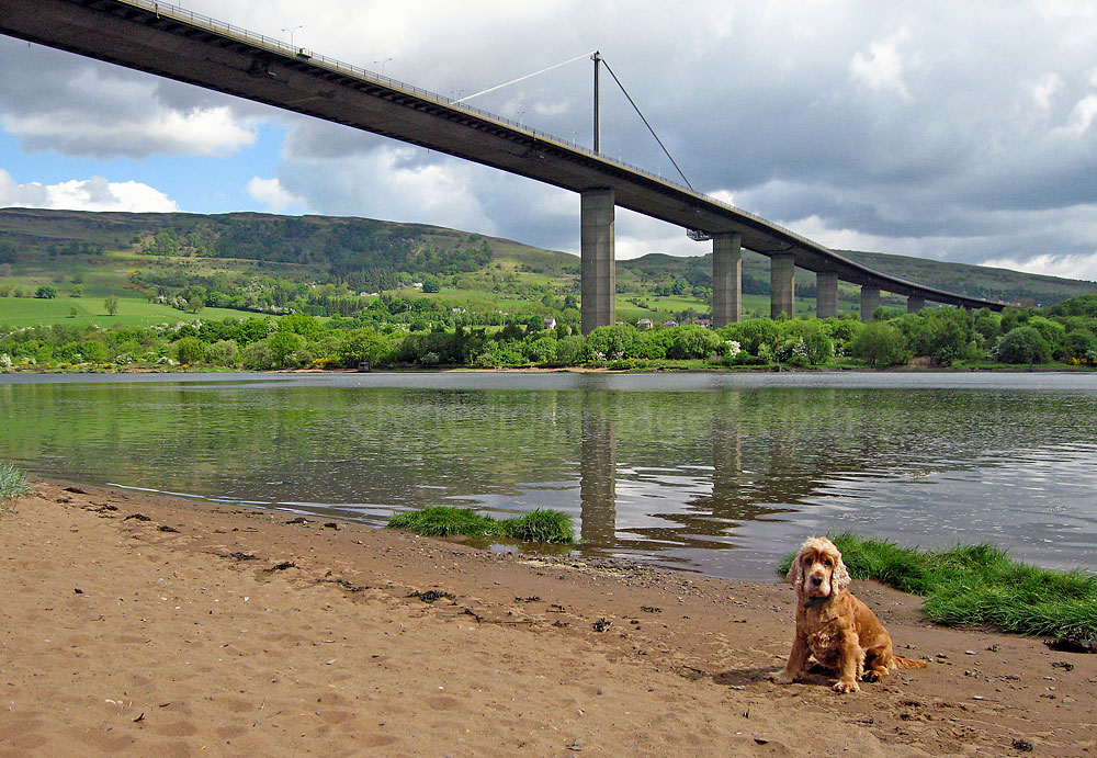
Erskine Beach and the Old Ferry Slipway
There`s no public access to the old Ferry slipway therefore it`s a popular roost with many bird species such as gulls, ducks, Sandpiper, Lapwings, Oystercatcher and usually a Cormorant or two. A pair of Mute Swans have nested annually and I`ve even seen a seal hauled-out here. The small beach can become very busy when the sun appears, especially now that the Forestry Commission have improved the area with picnic benches, more bins, information boards and proper trails through the adjacent woodland.
Boden Boo Community Woodland
|
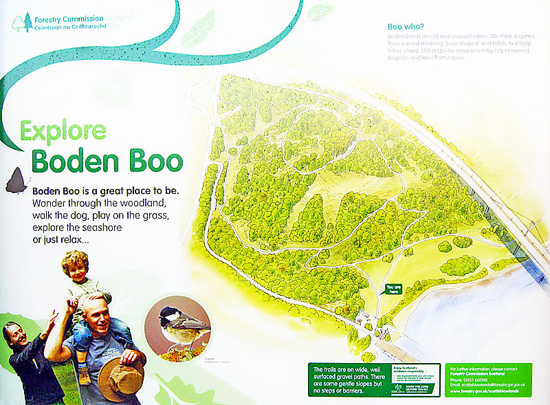
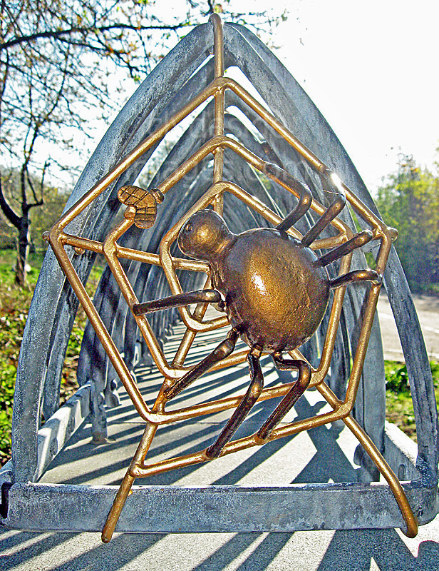
Boden Boo is one of fourteen Commonwealth Woods, designated as part of the legacy of the Commonwealth Games held in Glasgow in 2014. These spaces all provide natural land where visitors can enjoy free events and activities, watch wildlife or just to go for a stroll in the fresh air. The network of green spaces around the city includes a mix of well-established and newly-planted woods, and a new riverside park created out of derelict land opposite the Commonwealth Games Athletes’ Village in Glasgow`s East End. At Erskine, a wildlife dry-stone wall, covered with comical cartoon-like insects, has been built at each of the two Boden Boo car parks. A blog post shows some of the tiny creatures that live on the walls - Click here or on the Spider below to view. |
|
|
|
|
|
|
|
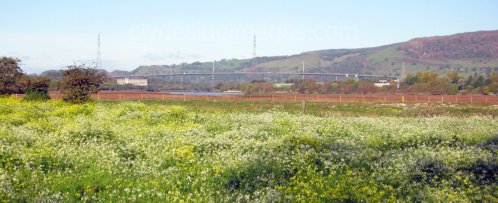
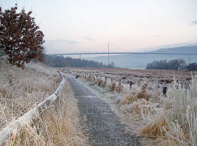
The Erskine Bridge
|
When the Erskine Bridge was officially opened by HRH Princess Anne on 2 July 1971 it became the second major road crossing of the Clyde outwith Glasgow city centre after the Clyde Tunnel which had been in operation since 3 July 1963. Previously, particularly at peak periods, long queues would form at the Renfrew / Yoker and Erskine / Old Kilpatrick ferry crossings.
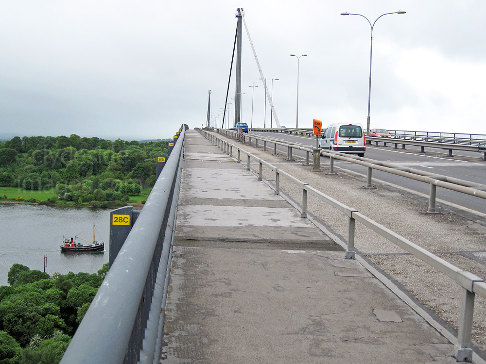
The Erskine Bridge is the only one in Scotland with single cables over central main supports and at the time of construction it was the longest bridge of its type in the world. As well as crossing the Clyde, the bridge also spans the Forth & Clyde Canal and the North Clyde railway line. The total cost of the bridge project including the link roads was £10.5 million. On 4 August 1996, an oil rig called the Texaco Captain collided with the underside of the road deck resulting in the closure of the bridge. The oil rig had been constructed upstream at Clydebank before being towed downriver. Despite painstaking calculations by experts, there had been insufficient clearance for the floating structure to pass underneath, even at the optimum tide-level, and the rig dislodged a chunk of concrete as it scraped through. The bridge reopened to pedestrians and cyclists on 22 August 1996. This was followed by cars and motorcycles on 30 August 1996 and was opened again to all vehicles including heavy goods vehicles on 22 December 1996. Repairs to the bridge cost £3.6 million with a further £700,000 in lost revenue from tolls. |
|
|
The Saltings Local Nature Reserve
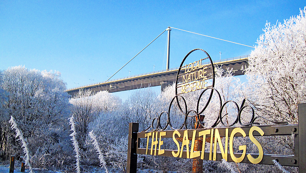
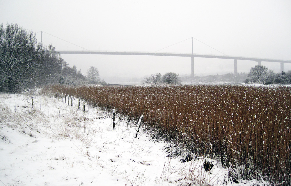
The Saltings Local Nature Reserve, is on the north side of the river at Old Kilpatrick. It lies immediately west of the Erskine Bridge and is bounded by the Clyde and the Forth and Clyde Canal.
|
Prior to the construction of the Erskine Bridge in the late 1960s the Saltings was an area of marshy, poor quality grazing land, which regularly flooded at high tide. To support the foundations of the new bridge, thousands of tons of rubble was dumped there, destroying the fragile habitat but acting as a flood barrier. Over the years additional building debris was added from demolished tenements in Clydebank and Glasgow but fortunately, as is often the case, nature fought back and re-colonised the land, forming rich areas of meadow, woodland and salt marsh. The grassland is home to hundreds of wild orchids and various species of butterflies such as the Peacock and Orange-tip. Common Blue Damselflies and Common Hawk dragonflies, as well as a good variety of birds can also be seen, either on the reserve or feeding along the adjacent shoreline.Roe Deer often wander through the salt marsh at low tide, both here and at Longhaugh Point on the opposite side of the river. The Saltings reserve connects with the Forth & Clyde Canal at several points and the towpath between Old Kilpatrick and the canal`s western terminus at Bowling, is another good place from which to view the local wildlife. As the canal is fairly narrow birds such as herons will usually stay in place as they wait patiently for a fish to swim by, allowing good close-up shots, even with a modest telephoto lens. |
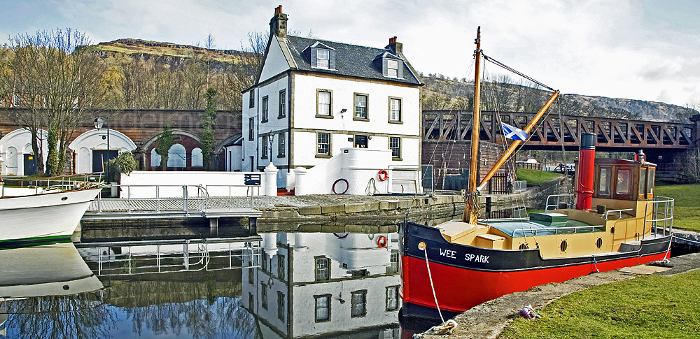
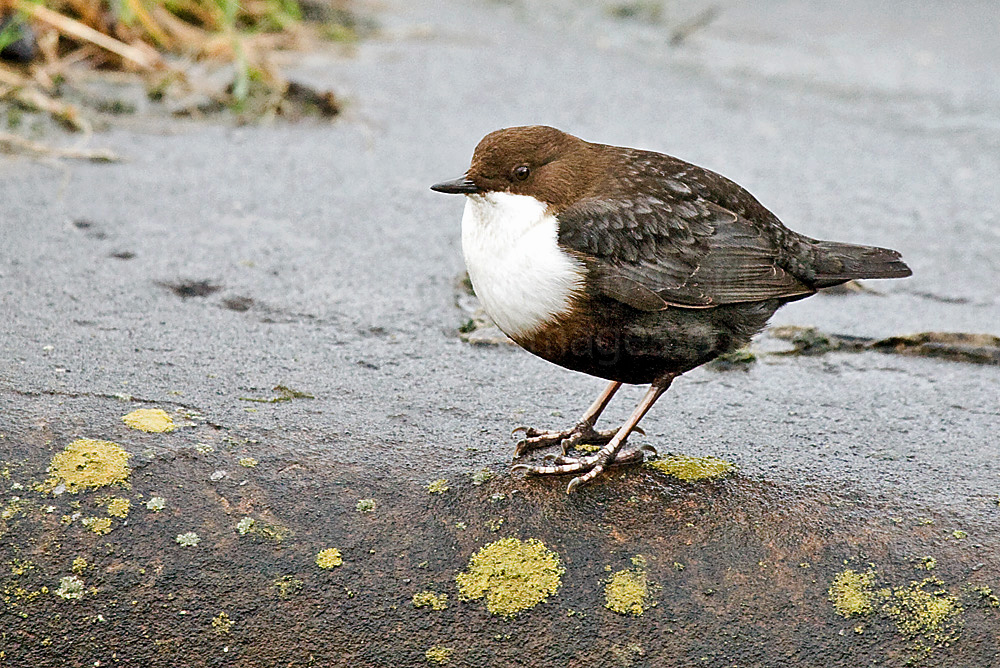
Bowling Basin and the adjacent harbour are visited by a good number of bird species including Dipper, Stonechat and Kestrel, all of which I`ve managed to photograph here.
|
Although the entrance to the inner Firth of Clyde was protected during WW1 and WW2 by an anti-submarine boom which stretched from Cloch Point to Dunoon, seaborne mines laid by German warships and submarines or dropped by aircraft, could easily be carried upstream on an incoming tide and cause serious disruption or catastrophic damage to naval and merchant vessels, all of which were vital for the war effort.
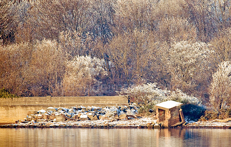
In an effort to protect the huge number of vessels transiting the Clyde, mine-watcher`s lookout posts were built along both banks of the river between Greenock and Glasgow. Most have since been demolished while others have collapsed and slid into the water as a result of bank erosion but several examples remain including this one on the Saltings, just west of the Erskine Bridge. |
|
The shelters, which were likely manned by the Home Guard, or other home defence personnel, are made of brick with a concrete roof and have a foot-high horizontal observation slit facing the river. The rear entrances were often protected by a defensive wall. One post still stands on a promontory at the eastern end of the Greenock Ocean Terminal. It can be seen from the walkway at the back of the town's swimming pool, while another intact example lies at Port Glasgow, near the small black and white lighthouse.
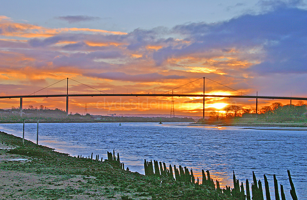
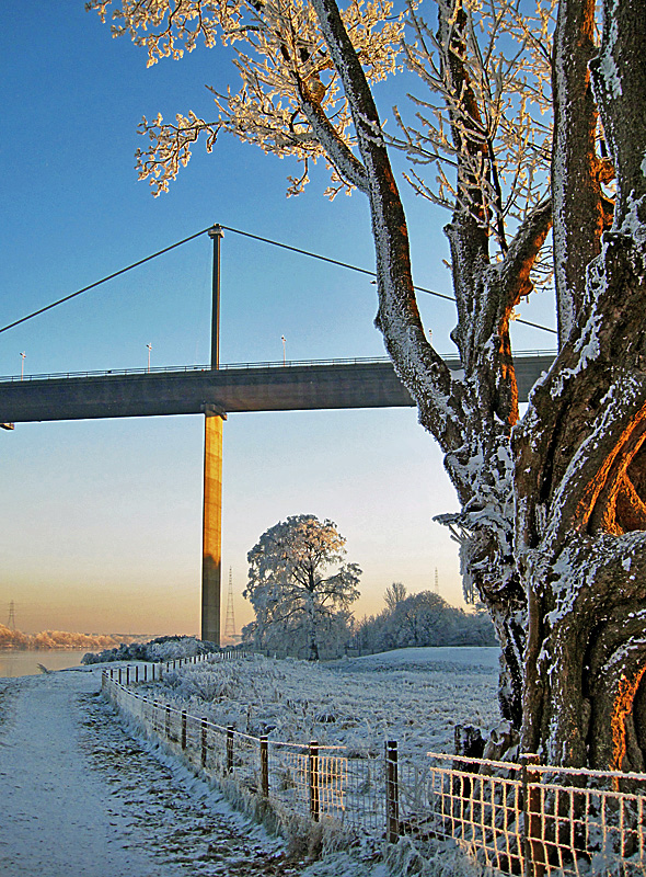
The Erskine Bridge at dawn from Bowling Basin.
Boden Boo to Longhaugh Point
|
Back on the south side of the river, at the edge of the Boden Boo, a track continues west under the Erskine Bridge. The view below was taken before the Mar Hall golf course was built. After it was fenced-off, the rough track was improved which led to an increase in the number of walkers using this stretch, many with dogs, which disturbs the roosting birds.
|
|
A couple of walkers on the path beside the Mar Hall golf course are out on a fine January afternoon enjoying the winter sunshine.
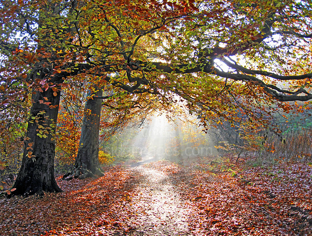
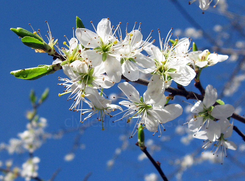
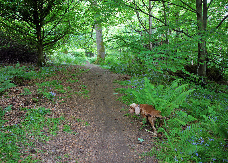
Gorse and various flowers border each side of the path along this stretch, creating a colourful scene during spring and summer.
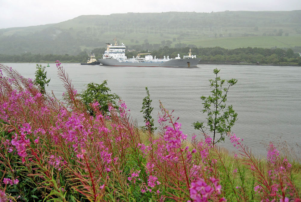
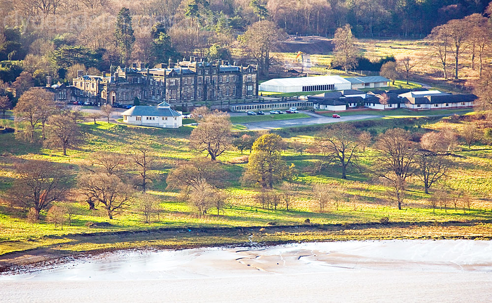
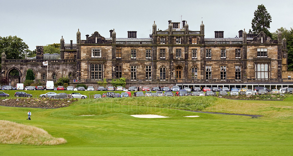
The following photo, of what was the main Erskine Hospital building, was taken before the Mar Hall golf course was created. Founded in 1916, Erskine as it`s now known has provided nursing and medical care for members of the UK`s Armed Forces ever since, helping them to rebuild their lives, usually after suffering horrendous injuries.
In the early 18th century, the Mar Estate passed to Lord Blantyre and in 1828 Major General Robert W Stuart, the 11th Lord Blantyre, commissioned the present house. He was a veteran of Wellington`s army and fought with distinction during the Napoleonic Wars. The lavish Gothic-style mansion, designed by Sir Robert Smirke M.A. (1781-1867), (who also designed the British Museum in London) was finally completed in 1845. Much of the stone used in its construction had been sourced from a quarry on the estate. By 1900, however, the house, which had taken 25 years to build, lay derelict. Sadly, Lord Blantyre never saw his dream home as he was killed in Brussels in 1830 during an insurrection. His death came as a great shock to the community of Bishopton as he was highly respected. As a tribute a monument was erected to his memory in a field near the village and close to his unfinished project. Click here to view a post showing the memorial.
During the First World War, as casualty figures soared, it soon became apparent that the hospitals and medical facilities already in place were unable to care for the vast number of seriously wounded service personnel. In 1916, following a public appeal to raise funds, Erskine House was purchased to become the Princess Louise Hospital for Limbless Sailors and Soldiers.
|
The building, set in such a peaceful countryside location, was ideal for the purpose with pleasant views across the river to the Kilpatrick Hills, a complete contrast to the mayhem, noise and terror of the trenches and other arenas in which the men had fought. Following refurbishment, the facility at Erskine opened in 1916 and became the second largest specialist hospital of its kind in the UK. It is estimated that one in five of the vast number of British military personnel disabled in the Great War received treatment here.
One of the co-founders of the hospital was Sir William Macewen (1848-1924) who became the hospital’s consultant surgeon. Born in Port Bannatyne on the Isle of Bute, Macewen was a pioneer of modern brain surgery and greatly contributed to the development of bone graft techniques. At Erskine he developed a new design of artificial limb, known as the Erskine limb, which greatly improved mobility. He called on the skills of Clydeside shipyard engineers to perfect the design and trained a team of veterans who were resident at the hospital to produce them. Over 600 were eventually fitted to wounded servicemen. Unfortunately the Great War was not, as many thought, the War to end all wars` and just over twenty years later the advent of the Second World War saw even more widespread death and destruction. Numerous other conflicts have followed ever since and members of the British Armed Forces continue to serve their country at various locations across the globe, ensuring that the expert care of Erskine is constantly in demand. On 11 October 2000, to meet the current needs, a £16 Million modern care centre, renamed `Erskine` was opened within the existing hospital grounds. The Earl of Mar Hall Hotel opened in 2004. |
Most dog walkers only go as far as the west end of the Mar Hall Golf Course and double-back to the main Boden Boo car park beside the old Erskine Ferry slip. The path, however, continues uphill between the Mar Hall course and the Erskine Golf Course then crosses a small wooden bridge to enter mature woodland.

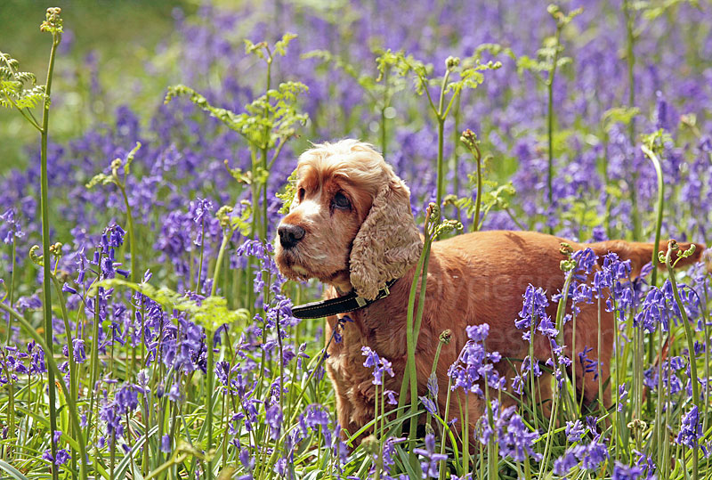
These woods once formed part of the extensive Mar Hall estate and numerous paths were cut during the Victorian era. Trails can be followed either left or right to reach the road near the Compaq computer factory after which a circuit is possible, returning via the main road, or head west toward Bishopton to check out Longhaugh Point. There are a few clearings carpeted with bluebells in spring and early summer.
|
|
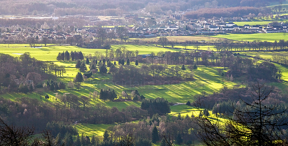
Erskine Golf Course from the Kilpatrick Hills.
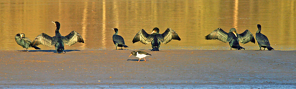
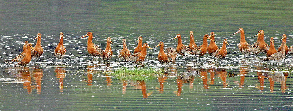
The sands exposed at low tide to the west of Mar Hall are a popular roosting and feeding spot for cormorants, ducks and waders. A flock of Dunlin are pictured below.
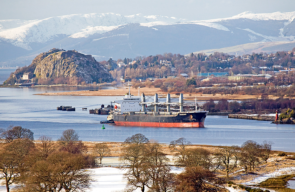
Rather than continue uphill on the path (visible bottom right) between the golf courses, a more direct route to the Point is to stay close to the shore following one of the indistinct natural trails over the marshy ground (below) but this is only feasible in very dry conditions. The above view, taken from the Erskine Bridge, shows the Liberian-registered bulk carrier Anarchos making her way upriver to discharge a cargo of animal feed at Shieldhall. The snow-covered Cowal Hills make a superb backdrop.
This misty view taken from the Loch Humphrey track on the Kilpatrick Braes shows the path between the two golf courses. A fairly new luxury housing development close to the Mar Hall Hotel can be seen on the left.
Longhaugh Point
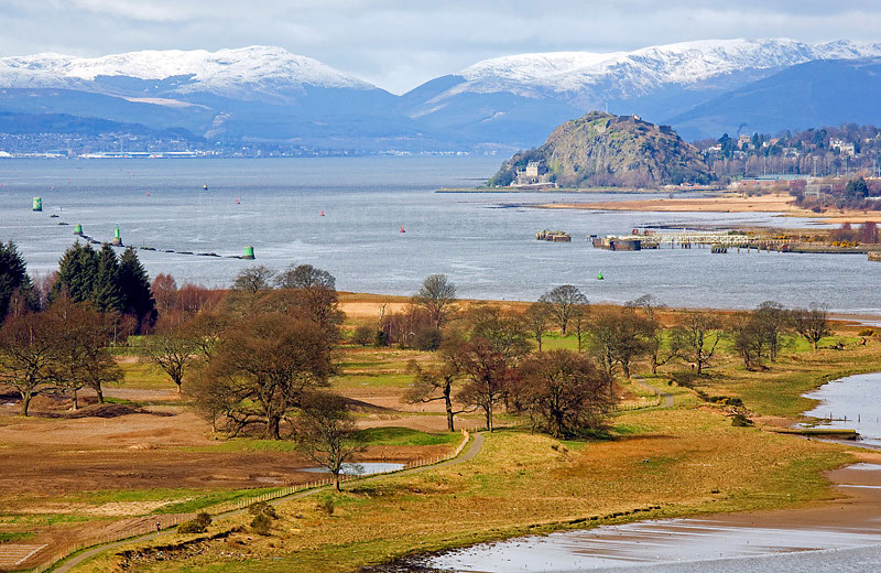
I also took the following shot of Longhaugh Point from the`Humphrey track. The extensive reed bed at the east bay is on the left and the fields, partially flooded after a spring tide, are just left of centre. Bowling Basin and harbour are in the foreground. The monolith , bottom right, stands beside Dunglass Castle and is a memorial to engineer Henry Bell (1767-1830), a celebrated character on Clydeside who pioneered the development of nautical steam power and his vessel, Comet, built at Port Glasgow, operated the first steamboat service on the river in 1812.
The line in mid-channel coming in from the right is the Lang Dyke. This is a long artificial jetty created by the innovative 18th century engineer, John Golborne, to increase the depth of the river and enable vessels to unload their cargoes at the Broomielaw in the centre of Glasgow rather than at Greenock and Port Glasgow. Over the centuries, the Clyde had widened considerably between Dumbarton and Langbank and was too shallow, unless the tides were particularly high, for coasters to negotiate safely, thus restricting trade. Golborne had the riverbed dredged and built various structures including this 800 metre-long wall to restrict the main flow and thus create a passage of deep water. An added bonus was that the river`s tidal action scoured the riverbed and dislodged any loose stones and gravel that gathered there.
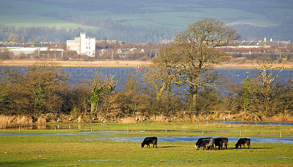
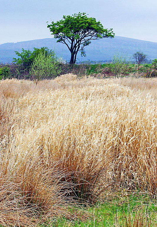
Next, a few views of the fields that are prone to flooding. The first, above, is looking north towards the Clyde. Dumbarton Rock is on the left and Dumbuck Quarry is on the right.
|
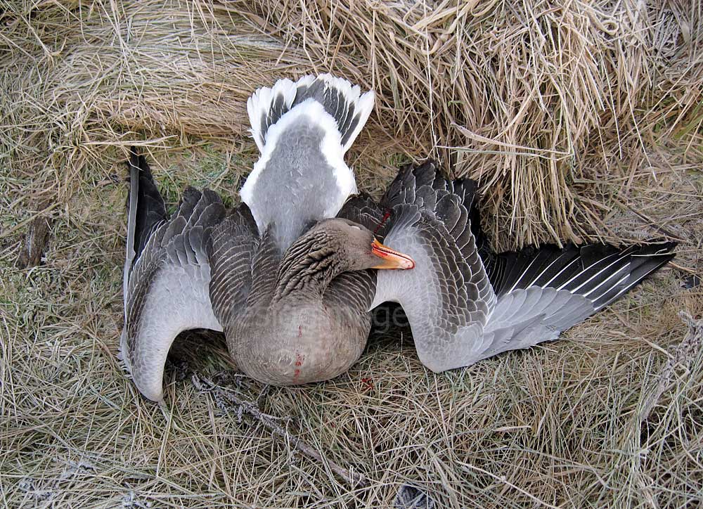
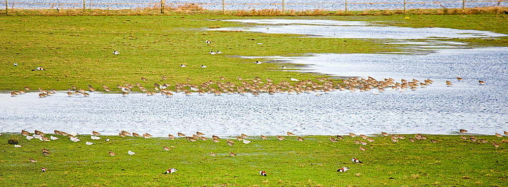
The fields at Longhaugh Point are divided by a series of hedgerows and dry-stone dykes which, along with the embankment to the north and tree-line to the west, can provide cover for anyone trying to get closer to the roosting birds. It should also be borne in mind that wildfowling goes on here occasionally and shooters with shotguns rather than cameras will likely utilise the same spots. I`ve discovered a couple of makeshift hides camouflaged with scrim netting in the undergrowth in a couple of places here so it`s worth carefully scanning the location with binoculars from afar before you venture down to prevent a conflict of interest. This goose lying at the edge of the reed bed awaiting collection was an unfortunate victim of the guns. |
|
Above: Looking southeast from the tree line at the west end of the fields. The right-of-way that leads down to the river follows the grassy slope between the distant trees. This route is often very muddy, even during spells of relatively dry weather.
|
|
Longhaugh Point lies on the south side of the Clyde Estuary, near Bishopton, between Erskine Golf Course and West Ferry. The adjacent fields are divided by dykes and hedgerows and a track, screened by hedges for the most part, runs east to west affording wide but distant views of the lower ground favoured by wading birds and migrating geese.
|
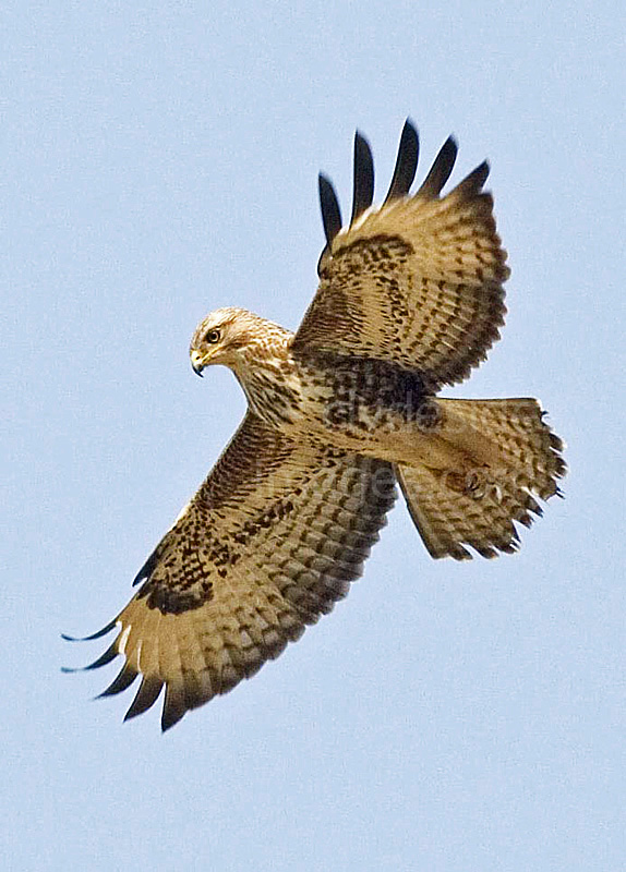
Buzzards are often seen circling over the fields and adjacent marshland. A pair usually nest in the tall trees beside the M8 Motorway.
|
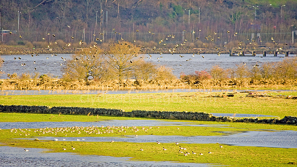
Autumn and winter are the most productive seasons for bird-watching here. Often there isn`t much activity at all but, if you time it right, you might see an impressive gathering of geese and waders. The above shot shows Herons roosting along the tree-line at the west end of the Longhaugh Point fields. I counted a total of 25 birds on one occasion.
One morning, I discovered this strange creature sitting exactly as shown close to the high-water mark. It had likely been left there by the receding tide.
|
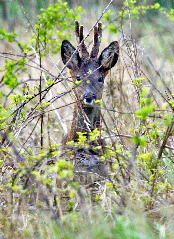
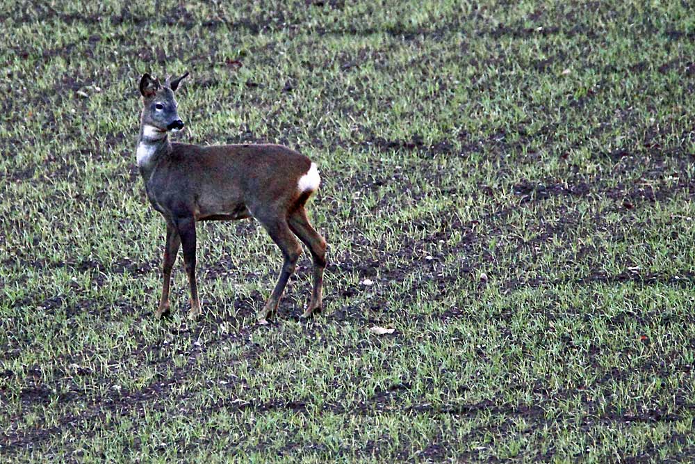
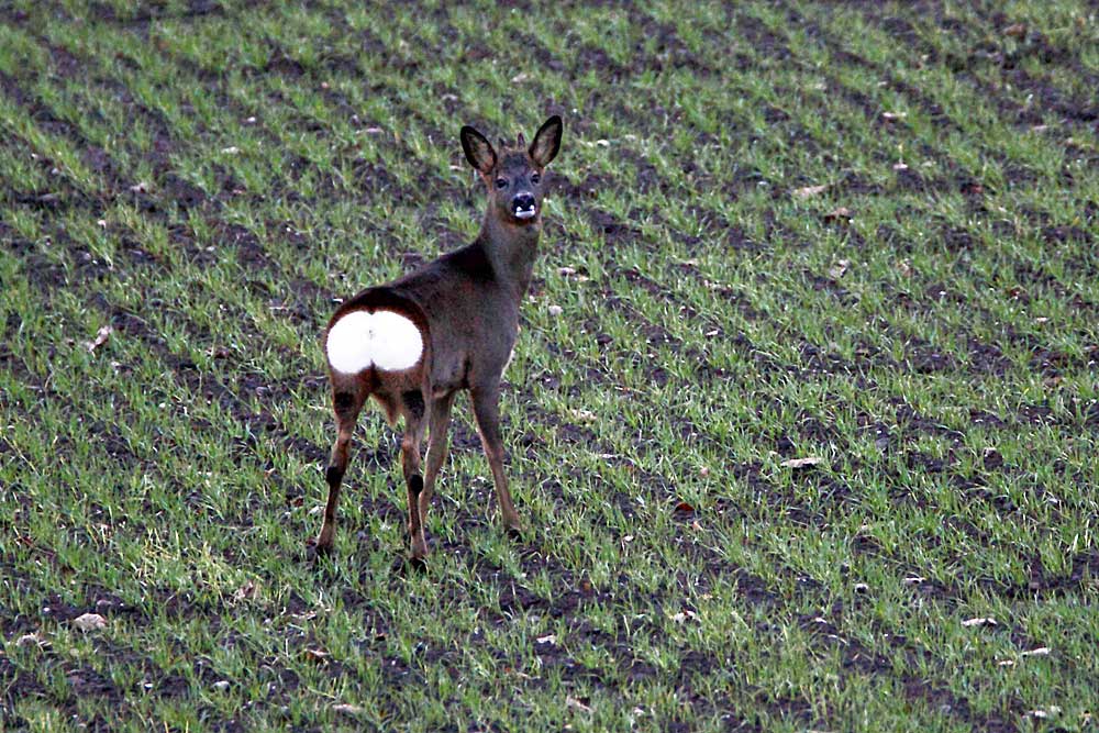
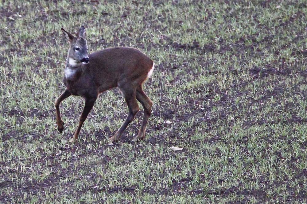
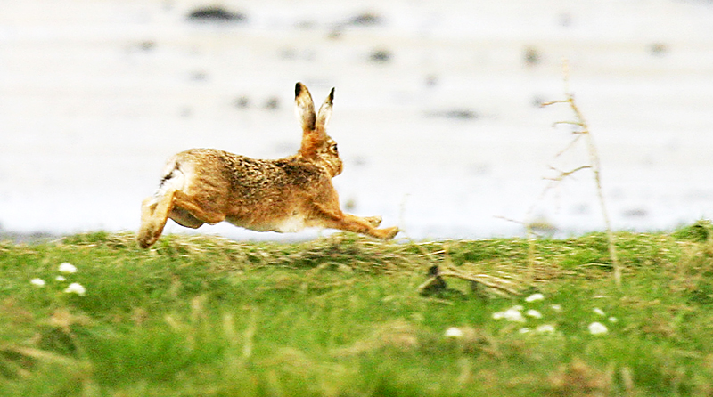
This wary Roe Deer stood still just long enough for me to get a shot before it bounded off across the fields.
|
|

|
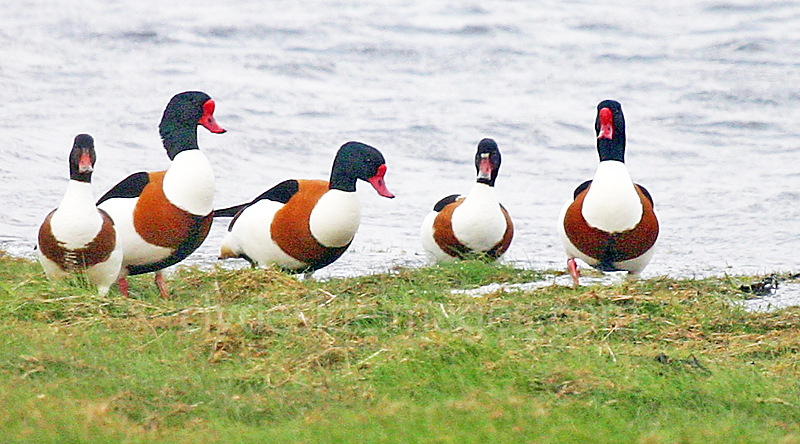
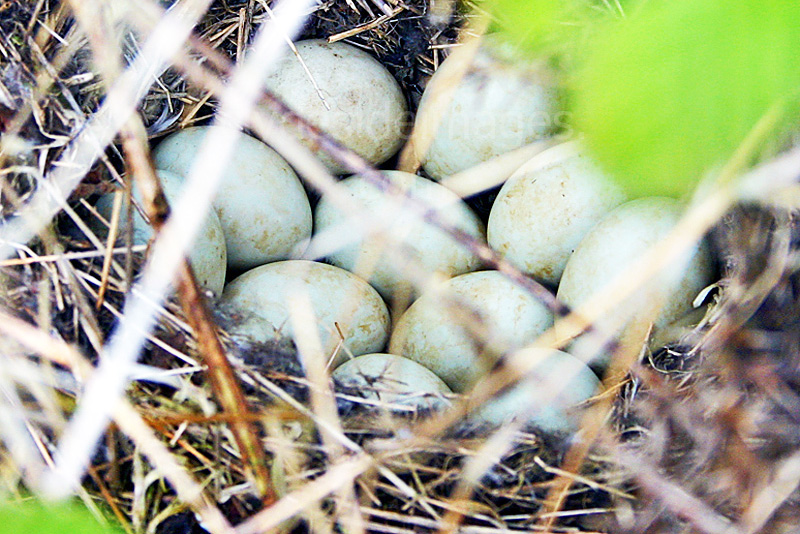
Shelduck used to nest in the scrub and brambles covering the embankment that runs parallel with the river. I think these eggs may belong to this species.
|
|